


|
 Hollywood, JSC
Mendocino, JSC
LA SOCIETY
SF SOCIETY
NY SOCIETY
Open START Drills
Hollywood, JSC
Mendocino, JSC
LA SOCIETY
SF SOCIETY
NY SOCIETY
Open START Drills
 Talk Daily Commodities Review LATPACT Open Market Equities Report Currency Central
 Insider: Situation US
 |

|

|

|
 |
SOCIETY Trust Fund LATPACT Trust Fund LATPACT Open Market Far West (SEZ) Trust RIM of Nations Trust
Arctic Pact Trade Zone | Upper Rhine Zone | Lower Rhine Zone | Middle Rhone Basin
| Level 2 - Open START/*Super Grid |
| Level 3 - Stellar Fields |


Climate Central News & Information
 "US attempts to salvage the European Order with an Oceania based clan-style coalition"
Population Conversations: 1,913,549
Planet Power Seconds
 Glance at NATO
 In early 2018, UNITED STATES ARMY COMMANDER, GENERAL CURTIS M. SCAPARROTTI delivered the posture statement for NATO. He stated, "As our most significant trading partner, Europe is vital to promoting American prosperity. With shared history and values, Europe is also a critical partner in advancing American influence throughout the world. The North Atlantic Treaty Organization (NATO) enables us to preserve peace through strength as alliance unity fundamentally deters the aggression of potential adversaries."
Moreover, General Scaparrotti said, "Russia continues to destabilize regional security and disregard international norms, which have preserved the peace in Europe since 1945. Russia seeks to change the international order, fracture NATO, and undermine U.S. leadership in order to protect its regime, re-assert dominance over its neighbors, and achieve greater influence around the globe. To achieve these ends, the Kremlin is prepared to employ the full spectrum of Russia’s power, to include forcefully using its increasingly capable military."
United Nations Command: AUKUSA/Quad 4
 Extensively, the Central Basin is transforming international security while disabling NATO, AUKUSA and the Quad 4 military alliances with the Open START Hawaii and Open START Alaska drills. Inherently, the Central Basin fleet suppresses the UN Command over security backlogs as the Global South impedes expansion for the Japanese yen. Economically, the US dollar bounds NATO, AUKUSA and the Quad 4 alliances under one entity in the wake of the 2007 housing crises, COVID-19 recovery and war in Ukraine. Generously, the Upper Rhine pass bridges the Open START Hawaii and Open START Alaska drills which stabilize international and climate security. Uniquely, Open START drills for the Upper Rhine pass pegs the value of the Japanese yen and Korean Won to the Chinese yuan, Indian rupee, Russian ruble, and Mexican peso to enable economic transformation for the Central Basin region. Effectively, the Open START drill secures the yen in cooperation with the Global South as significant growth on the New Silk Road Economic Belt extends in Africa. Suitably, the Open START drill baffles the UN Command with the Upper Rhine pass as the historical value is at stake. Judiciously, the Open START drill isolates the UN Command over Level 1 protocol which underpins NATO, AUKUSA and the Quad 4 military alliances to Celtic Briton tribes.
The OSCE and NATO: From the Arctic Circle
 Historically, military conflicts include land navigation rivalry which is significant for the Lower Rhine corridor as tensions between the Eastern and Western hemisphere ignite over political testimony. Substantially, the US has interspersed armed forces in the EU with the connivance of NATO and the OSCE to subjugate the Arctic Circle and dominate international trade from the Middle East. Tacitly, the OSCE is equipped to engineer early warnings, conflict resolution and crisis management over military tensions with NATO to inseminate the world order of law and justice. Decisively, the Open START Iceland drill unify the corners of the world to combat the historical West from the Arctic Circle over climate security, war crimes and crimes against humanity. Particularly, normalized ties to Israel for the Lower Rhine corridor weighs over rising Eastern influence from the Near East which is a major factor in the Open START Iceland drill. Efficiently, the Open START Iceland drill balances political, economic and military parity between the historical East and West which is threatened from the incumbency of trade sanctions and escalating military tensions in the West.
*Schedule of Nuclear Attack
Be advised: The specific plan of attack for Kansas is sensitive and will be posted here closer to its scheduled strike.
Kansas
AL* | AZ* | AR* | CO | CT | DE | FL | GA | ID | IN | IA | KS | KY | LA | ME | MD
MA | MI | MN | MO | MT | NE | NV | NH | NJ | NM | NY | NC | ND | OH | OK | OR | PA | RI | SC
SD | TN | TX | UT | VA (DC)** | VT** | WA** | WV** | WI** | WY**
*Central Fleet South  Bulava + RT23 Cadet + Vysota3
Team: Memphis Fire (Local Area Control)
**Central Fleet North Bulava + Surya + Vysota3
Open START (RKS) |
Groups UR59 - UR66 | *300kt | Millineum Power *4,000 MW
Level 1 - WA Dong (SIT.2) 
Kansas |
Latitude Coordinate |
Longitude Coordinate |
|
Wichita [*elevation ceiling = 40km]Elevation: 400m (Group 59)
UR-100N (SLBM) |
Point A: 37.687176 00(300kt)
Point B: 38.982228 00
Point C: 39.115531 00
Point D: 38.881396 00
Point E: 39.047345 00
Point F: 38.971669 00
Open START Passages |
Point A: -97.330053 00(300kt)
Point B: -94.670792 00
Point C: -94.626787 00
Point D: -94.819128 00
Point E: -95.675158 00
Point F: -95.235250 00
Demonstration |
|
Overland Park [*elevation ceiling = 40km]Elevation: 331m (Group 59)
UR-100N (SLBM) |
Point A: 37.687176 00
Point B: 38.982228 00(300kt)
Point C: 39.115531 00
Point D: 38.881396 00
Point E: 39.047345 00
Point F: 38.971669 00
|
Point A: -97.330053 00
Point B: -94.670792 00(300kt)
Point C: -94.626787 00
Point D: -94.819128 00
Point E: -95.675158 00
Point F: -95.235250 00
|
|
Kansas City [*elevation ceiling = 40km]Elevation: 266m (Group 59)
UR-100N (SLBM) |
Point A: 37.687176 00
Point B: 38.982228 00
Point C: 39.115531 00(300kt)
Point D: 38.881396 00
Point E: 39.047345 00
Point F: 38.971669 00
|
Point A: -97.330053 00
Point B: -94.670792 00
Point C: -94.626787 00(300kt)
Point D: -94.819128 00
Point E: -95.675158 00
Point F: -95.235250 00
|
|
Olathe [*elevation ceiling = 40km]Elevation: 316m (Group 59)
UR-100N (SLBM) |
Point A: 37.687176 00
Point B: 38.982228 00
Point C: 39.115531 00
Point D: 38.881396 00(300kt)
Point E: 39.047345 00
Point F: 38.971669 00
|
Point A: -97.330053 00
Point B: -94.670792 00
Point C: -94.626787 00
Point D: -94.819128 00(300kt)
Point E: -95.675158 00
Point F: -95.235250 00
|
|
Topeka [*elevation ceiling = 40km]Elevation: 289m (Group 59)
UR-100N (SLBM) |
Point A: 37.687176 00
Point B: 38.982228 00
Point C: 39.115531 00
Point D: 38.881396 00
Point E: 39.047345 00(300kt)
Point F: 38.971669 00
|
Point A: -97.330053 00
Point B: -94.670792 00
Point C: -94.626787 00
Point D: -94.819128 00
Point E: -95.675158 00(300kt)
Point F: -95.235250 00
|
|
Lawrence [*elevation ceiling = 40km]Elevation: 264m (Group 59)
UR-100N (SLBM) |
Point A: 37.687176 00
Point B: 38.982228 00
Point C: 39.115531 00
Point D: 38.881396 00
Point E: 39.047345 00
Point F: 38.971669 00(300kt)
|
Point A: -97.330053 00
Point B: -94.670792 00
Point C: -94.626787 00
Point D: -94.819128 00
Point E: -95.675158 00
Point F: -95.235250 00(300kt)
|
|
Shawnee [*elevation ceiling = 40km]Elevation: 305m (Group 60)
UR-100N (SLBM) |
Point A: 39.022848 00(300kt)
Point B: 39.183608 00
Point C: 38.953617 00
Point D: 38.840281 00
Point E: 38.060845 00
Point F: 39.311111 00
|
Point A: -94.715187 00(300kt)
Point B: -96.571669 00
Point C: -94.733571 00
Point D: -97.611424 00
Point E: -97.929774 00
Point F: -94.922464 00
|
|
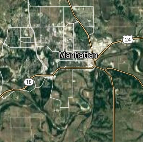
Manhattan [*elevation ceiling = 40km]Elevation: 312m (Group 60)
UR-100N (SLBM) |
Point A: 39.022848 00
Point B: 39.183608 00(300kt)
Point C: 38.953617 00
Point D: 38.840281 00
Point E: 38.060845 00
Point F: 39.311111 00
|
Point A: -94.715187 00
Point B: -96.571669 00(300kt)
Point C: -94.733571 00
Point D: -97.611424 00
Point E: -97.929774 00
Point F: -94.922464 00
|
|
Lenexa [*elevation ceiling = 40km]Elevation: 314m (Group 60)
UR-100N (SLBM) |
Point A: 39.022848 00
Point B: 39.183608 00
Point C: 38.953617 00(300kt)
Point D: 38.840281 00
Point E: 38.060845 00
Point F: 39.311111 00
|
Point A: -94.715187 00
Point B: -96.571669 00
Point C: -94.733571 00(300kt)
Point D: -97.611424 00
Point E: -97.929774 00
Point F: -94.922464 00
|
|
Salina [*elevation ceiling = 40km]Elevation: 374m (Group 60)
UR-100N (SLBM) |
Point A: 39.022848 00
Point B: 39.183608 00
Point C: 38.953617 00
Point D: 38.840281 00(300kt)
Point E: 38.060845 00
Point F: 39.311111 00
|
Point A: -94.715187 00
Point B: -96.571669 00
Point C: -94.733571 00
Point D: -97.611424 00(300kt)
Point E: -97.929774 00
Point F: -94.922464 00
|
|
Hutchinson [*elevation ceiling = 40km]Elevation: 468m (Group 60)
UR-100N (SLBM) |
Point A: 39.022848 00
Point B: 39.183608 00
Point C: 38.953617 00
Point D: 38.840281 00
Point E: 38.060845 00(300kt)
Point F: 39.311111 00
|
Point A: -94.715187 00
Point B: -96.571669 00
Point C: -94.733571 00
Point D: -97.611424 00
Point E: -97.929774 00(300kt)
Point F: -94.922464 00
|
|
Leavenworth [*elevation ceiling = 40km]Elevation: 255m (Group 60)
UR-100N (SLBM) |
Point A: 39.022848 00
Point B: 39.183608 00
Point C: 38.953617 00
Point D: 38.840281 00
Point E: 38.060845 00
Point F: 39.311111 00(300kt)
|
Point A: -94.715187 00
Point B: -96.571669 00
Point C: -94.733571 00
Point D: -97.611424 00
Point E: -97.929774 00
Point F: -94.922464 00(300kt)
|
|
Leawood [*elevation ceiling = 40km]Elevation: 287m (Group 61)
UR-100N (SLBM) |
Point A: 38.966673 00(300kt)
Point B: 37.752798 00
Point C: 37.971690 00
Point D: 39.028609 00
Point E: 38.403903 00
Point F: 37.545574 00
|
Point A: -94.616901 00(300kt)
Point B: -100.017079 00
Point C: -100.872662 00
Point D: -96.831398 00
Point E: -96.181663 00
Point F: -97.268933 00
|
|
Dodge City [*elevation ceiling = 40km]Elevation: 760m (Group 61)
UR-100N (SLBM) |
Point A: 38.966673 00
Point B: 37.752798 00(300kt)
Point C: 37.971690 00
Point D: 39.028609 00
Point E: 38.403903 00
Point F: 37.545574 00
|
Point A: -94.616901 00
Point B: -100.017079 00(300kt)
Point C: -100.872662 00
Point D: -96.831398 00
Point E: -96.181663 00
Point F: -97.268933 00
|
|
Garden City [*elevation ceiling = 40km]Elevation: 866m (Group 61)
UR-100N (SLBM) |
Point A: 38.966673 00
Point B: 37.752798 00
Point C: 37.971690 00(300kt)
Point D: 39.028609 00
Point E: 38.403903 00
Point F: 37.545574 00
|
Point A: -94.616901 00
Point B: -100.017079 00
Point C: -100.872662 00(300kt)
Point D: -96.831398 00
Point E: -96.181663 00
Point F: -97.268933 00
|
|
Junction City [*elevation ceiling = 40km]Elevation: 337m (Group 61)
UR-100N (SLBM) |
Point A: 38.966673 00
Point B: 37.752798 00
Point C: 37.971690 00
Point D: 39.028609 00(300kt)
Point E: 38.403903 00
Point F: 37.545574 00
|
Point A: -94.616901 00
Point B: -100.017079 00
Point C: -100.872662 00
Point D: -96.831398 00(300kt)
Point E: -96.181663 00
Point F: -97.268933 00
|
|
Emporia [*elevation ceiling = 40km]Elevation: 350m (Group 61)
UR-100N (SLBM) |
Point A: 38.966673 00
Point B: 37.752798 00
Point C: 37.971690 00
Point D: 39.028609 00
Point E: 38.403903 00(300kt)
Point F: 37.545574 00
|
Point A: -94.616901 00
Point B: -100.017079 00
Point C: -100.872662 00
Point D: -96.831398 00
Point E: -96.181663 00(300kt)
Point F: -97.268933 00
|
|
Derby [*elevation ceiling = 40km]Elevation: 394m (Group 61)
UR-100N (SLBM) |
Point A: 38.966673 00
Point B: 37.752798 00
Point C: 37.971690 00
Point D: 39.028609 00
Point E: 38.403903 00
Point F: 37.545574 00(300kt)
|
Point A: -94.616901 00
Point B: -100.017079 00
Point C: -100.872662 00
Point D: -96.831398 00
Point E: -96.181663 00
Point F: -97.268933 00(300kt)
|
|
Prairie Village [*elevation ceiling = 40km]Elevation: 302m (Group 62)
UR-100N (SLBM) |
Point A: 38.991673 00(300kt)
Point B: 38.879178 00
Point C: 37.043081 00
Point D: 38.810841 00
Point E: 37.410884 00
Point F: 38.046678 00
|
Point A: -94.633568 00(300kt)
Point B: -99.326770 00
Point C: -100.920999 00
Point D: -94.927187 00
Point E: -94.704960 00
Point F: -97.345036 00
|
|
Hays [*elevation ceiling = 40km]Elevation: 618m (Group 62)
UR-100N (SLBM) |
Point A: 38.991673 00
Point B: 38.879178 00(300kt)
Point C: 37.043081 00
Point D: 38.810841 00
Point E: 37.410884 00
Point F: 38.046678 00
|
Point A: -94.633568 00
Point B: -99.326770 00(300kt)
Point C: -100.920999 00
Point D: -94.927187 00
Point E: -94.704960 00
Point F: -97.345036 00
|
|
Liberal [*elevation ceiling = 40km]Elevation: 865m (Group 62)
UR-100N (SLBM) |
Point A: 38.991673 00
Point B: 38.879178 00
Point C: 37.043081 00(300kt)
Point D: 38.810841 00
Point E: 37.410884 00
Point F: 38.046678 00
|
Point A: -94.633568 00
Point B: -99.326770 00
Point C: -100.920999 00(300kt)
Point D: -94.927187 00
Point E: -94.704960 00
Point F: -97.345036 00
|
|
Gardner [*elevation ceiling = 40km]Elevation: 323m (Group 62)
UR-100N (SLBM) |
Point A: 38.991673 00
Point B: 38.879178 00
Point C: 37.043081 00
Point D: 38.810841 00(300kt)
Point E: 37.410884 00
Point F: 38.046678 00
|
Point A: -94.633568 00
Point B: -99.326770 00
Point C: -100.920999 00
Point D: -94.927187 00(300kt)
Point E: -94.704960 00
Point F: -97.345036 00
|
|
Pittsburg [*elevation ceiling = 40km]Elevation: 289m (Group 62)
UR-100N (SLBM) |
Point A: 38.991673 00
Point B: 38.879178 00
Point C: 37.043081 00
Point D: 38.810841 00
Point E: 37.410884 00(300kt)
Point F: 38.046678 00
|
Point A: -94.633568 00
Point B: -99.326770 00
Point C: -100.920999 00
Point D: -94.927187 00
Point E: -94.704960 00(300kt)
Point F: -97.345036 00
|
|
Newton [*elevation ceiling = 40km]Elevation: 441m (Group 62)
UR-100N (SLBM) |
Point A: 38.991673 00
Point B: 38.879178 00
Point C: 37.043081 00
Point D: 38.810841 00
Point E: 37.410884 00
Point F: 38.046678 00(300kt)
|
Point A: -94.633568 00
Point B: -99.326770 00
Point C: -100.920999 00
Point D: -94.927187 00
Point E: -94.704960 00
Point F: -97.345036 00(300kt)
|
|
Great Bend [*elevation ceiling = 40km]Elevation: 564m (Group 63)
UR-100N (SLBM) |
Point A: 38.364457 00(300kt)
Point B: 38.370842 00
Point C: 37.817240 00
Point D: 38.615768 00
Point E: 37.239749 00
Point F: 37.061974 00
|
Point A: -98.764807 00(300kt)
Point B: -97.664209 00
Point C: -96.862252 00
Point D: -95.268637 00
Point E: -96.995592 00
Point F: -97.038371 00
|
|
McPherson [*elevation ceiling = 40km]Elevation: 456m (Group 63)
UR-100N (SLBM) |
Point A: 38.364457 00
Point B: 38.370842 00(300kt)
Point C: 37.817240 00
Point D: 38.615768 00
Point E: 37.239749 00
Point F: 37.061974 00
|
Point A: -98.764807 00
Point B: -97.664209 00(300kt)
Point C: -96.862252 00
Point D: -95.268637 00
Point E: -96.995592 00
Point F: -97.038371 00
|
|
El Dorado [*elevation ceiling = 40km]Elevation: 410m (Group 63)
UR-100N (SLBM) |
Point A: 38.364457 00
Point B: 38.370842 00
Point C: 37.817240 00(300kt)
Point D: 38.615768 00
Point E: 37.239749 00
Point F: 37.061974 00
|
Point A: -98.764807 00
Point B: -97.664209 00
Point C: -96.862252 00(300kt)
Point D: -95.268637 00
Point E: -96.995592 00
Point F: -97.038371 00
|
|
Ottawa [*elevation ceiling = 40km]Elevation: 275m (Group 63)
UR-100N (SLBM) |
Point A: 38.364457 00
Point B: 38.370842 00
Point C: 37.817240 00
Point D: 38.615768 00(300kt)
Point E: 37.239749 00
Point F: 37.061974 00
|
Point A: -98.764807 00
Point B: -97.664209 00
Point C: -96.862252 00
Point D: -95.268637 00(300kt)
Point E: -96.995592 00
Point F: -97.038371 00
|
|
Winfield [*elevation ceiling = 40km]Elevation: 344m (Group 63)
UR-100N (SLBM) |
Point A: 38.364457 00
Point B: 38.370842 00
Point C: 37.817240 00
Point D: 38.615768 00
Point E: 37.239749 00(300kt)
Point F: 37.061974 00
|
Point A: -98.764807 00
Point B: -97.664209 00
Point C: -96.862252 00
Point D: -95.268637 00
Point E: -96.995592 00(300kt)
Point F: -97.038371 00
|
|
Arkansas City [*elevation ceiling = 40km]Elevation: 342m (Group 63)
UR-100N (SLBM) |
Point A: 38.364457 00
Point B: 38.370842 00
Point C: 37.817240 00
Point D: 38.615768 00
Point E: 37.239749 00
Point F: 37.061974 00(300kt)
|
Point A: -98.764807 00
Point B: -97.664209 00
Point C: -96.862252 00
Point D: -95.268637 00
Point E: -96.995592 00
Point F: -97.038371 00(300kt)
|
|
Andover [*elevation ceiling = 40km]Elevation: 412m (Group 64)
UR-100N (SLBM) |
Point A: 37.713904 00(300kt)
Point B: 39.248613 00
Point C: 39.023617 00
Point D: 37.564462 00
Point E: 39.563052 00
Point F: 37.340338 00
|
Point A: -97.136429 00(300kt)
Point B: -94.900241 00
Point C: -94.693570 00
Point D: -97.352267 00
Point E: -95.121636 00
Point F: -95.261084 00
|
|
Lansing [*elevation ceiling = 40km]Elevation: 259m (Group 64)
UR-100N (SLBM) |
Point A: 37.713904 00
Point B: 39.248613 00(300kt)
Point C: 39.023617 00
Point D: 37.564462 00
Point E: 39.563052 00
Point F: 37.340338 00
|
Point A: -97.136429 00
Point B: -94.900241 00(300kt)
Point C: -94.693570 00
Point D: -97.352267 00
Point E: -95.121636 00
Point F: -95.261084 00
|
|
Merriam [*elevation ceiling = 40km]Elevation: 277m (Group 64)
UR-100N (SLBM) |
Point A: 37.713904 00
Point B: 39.248613 00
Point C: 39.023617 00(300kt)
Point D: 37.564462 00
Point E: 39.563052 00
Point F: 37.340338 00
|
Point A: -97.136429 00
Point B: -94.900241 00
Point C: -94.693570 00(300kt)
Point D: -97.352267 00
Point E: -95.121636 00
Point F: -95.261084 00
|
|
Haysville [*elevation ceiling = 40km]Elevation: 384m (Group 64)
UR-100N (SLBM) |
Point A: 37.713904 00
Point B: 39.248613 00
Point C: 39.023617 00
Point D: 37.564462 00(300kt)
Point E: 39.563052 00
Point F: 37.340338 00
|
Point A: -97.136429 00
Point B: -94.900241 00
Point C: -94.693570 00
Point D: -97.352267 00(300kt)
Point E: -95.121636 00
Point F: -95.261084 00
|
|
Atchison [*elevation ceiling = 40km]Elevation: 248m (Group 64)
UR-100N (SLBM) |
Point A: 37.713904 00
Point B: 39.248613 00
Point C: 39.023617 00
Point D: 37.564462 00
Point E: 39.563052 00(300kt)
Point F: 37.340338 00
|
Point A: -97.136429 00
Point B: -94.900241 00
Point C: -94.693570 00
Point D: -97.352267 00
Point E: -95.121636 00(300kt)
Point F: -95.261084 00
|
|
Parsons [*elevation ceiling = 40km]Elevation: 276m (Group 64)
UR-100N (SLBM) |
Point A: 37.713904 00
Point B: 39.248613 00
Point C: 39.023617 00
Point D: 37.564462 00
Point E: 39.563052 00
Point F: 37.340338 00(300kt)
|
Point A: -97.136429 00
Point B: -94.900241 00
Point C: -94.693570 00
Point D: -97.352267 00
Point E: -95.121636 00
Point F: -95.261084 00(300kt)
|
|
Coffeyville [*elevation ceiling = 40km]Elevation: 225m (Group 65)
UR-100N (SLBM) |
Point A: 37.037301 00(300kt)
Point B: 39.027783 00
Point C: 37.679214 00
Point D: 37.224236 00
Point E: 37.686684 00
Point F: 37.265300 00
|
Point A: -95.616367 00(300kt)
Point B: -94.655791 00
Point C: -95.457203 00
Point D: -95.708313 00
Point E: -96.976702 00
Point F: -97.371712 00
|
|
Mission [*elevation ceiling = 40km]Elevation: 312m (Group 65)
UR-100N (SLBM) |
Point A: 37.037301 00
Point B: 39.027783 00(300kt)
Point C: 37.679214 00
Point D: 37.224236 00
Point E: 37.686684 00
Point F: 37.265300 00
|
Point A: -95.616367 00
Point B: -94.655791 00(300kt)
Point C: -95.457203 00
Point D: -95.708313 00
Point E: -96.976702 00
Point F: -97.371712 00
|
|
Chanute [*elevation ceiling = 40km]Elevation: 292m (Group 65)
UR-100N (SLBM) |
Point A: 37.037301 00
Point B: 39.027783 00
Point C: 37.679214 00(300kt)
Point D: 37.224236 00
Point E: 37.686684 00
Point F: 37.265300 00
|
Point A: -95.616367 00
Point B: -94.655791 00
Point C: -95.457203 00(300kt)
Point D: -95.708313 00
Point E: -96.976702 00
Point F: -97.371712 00
|
|
Independence [*elevation ceiling = 40km]Elevation: 248m (Group 65)
UR-100N (SLBM) |
Point A: 37.037301 00
Point B: 39.027783 00
Point C: 37.679214 00
Point D: 37.224236 00(300kt)
Point E: 37.686684 00
Point F: 37.265300 00
|
Point A: -95.616367 00
Point B: -94.655791 00
Point C: -95.457203 00
Point D: -95.708313 00(300kt)
Point E: -96.976702 00
Point F: -97.371712 00
|
|
Augusta [*elevation ceiling = 40km]Elevation: 389m (Group 65)
UR-100N (SLBM) |
Point A: 37.037301 00
Point B: 39.027783 00
Point C: 37.679214 00
Point D: 37.224236 00
Point E: 37.686684 00(300kt)
Point F: 37.265300 00
|
Point A: -95.616367 00
Point B: -94.655791 00
Point C: -95.457203 00
Point D: -95.708313 00
Point E: -96.976702 00(300kt)
Point F: -97.371712 00
|
|
Wellington [*elevation ceiling = 40km]Elevation: 376m (Group 65)
UR-100N (SLBM) |
Point A: 37.037301 00
Point B: 39.027783 00
Point C: 37.679214 00
Point D: 37.224236 00
Point E: 37.686684 00
Point F: 37.265300 00(300kt)
|
Point A: -95.616367 00
Point B: -94.655791 00
Point C: -95.457203 00
Point D: -95.708313 00
Point E: -96.976702 00
Point F: -97.371712 00(300kt)
|
|
Fort Scott [*elevation ceiling = 40km]Elevation: 258m (Group 66)
UR-100N (SLBM) |
Point A: 37.839763 00(300kt)
Point B: 37.800012 00
Point C: 39.059726 00
Point D: 37.834734 00
Point E: 37.643907 00
Point F: 37.770835 00
|
Point A: -94.708295 00(300kt)
Point B: -97.318376 00
Point C: -94.883575 00
Point D: -97.373376 00
Point E: -98.737591 00
Point F: -97.259891 00
|
|
Park City [*elevation ceiling = 40km]Elevation: 416m (Group 66)
UR-100N (SLBM) |
Point A: 37.839763 00
Point B: 37.800012 00(300kt)
Point C: 39.059726 00
Point D: 37.834734 00
Point E: 37.643907 00
Point F: 37.770835 00
|
Point A: -94.708295 00
Point B: -97.318376 00(300kt)
Point C: -94.883575 00
Point D: -97.373376 00
Point E: -98.737591 00
Point F: -97.259891 00
|
|
Bonner Springs [*elevation ceiling = 40km]Elevation: 266m (Group 66)
UR-100N (SLBM) |
Point A: 37.839763 00
Point B: 37.800012 00
Point C: 39.059726 00(300kt)
Point D: 37.834734 00
Point E: 37.643907 00
Point F: 37.770835 00
|
Point A: -94.708295 00
Point B: -97.318376 00
Point C: -94.883575 00(300kt)
Point D: -97.373376 00
Point E: -98.737591 00
Point F: -97.259891 00
|
|
Valley Center [*elevation ceiling = 40km]Elevation: 410m (Group 66)
UR-100N (SLBM) |
Point A: 37.839763 00
Point B: 37.800012 00
Point C: 39.059726 00
Point D: 37.834734 00(300kt)
Point E: 37.643907 00
Point F: 37.770835 00
|
Point A: -94.708295 00
Point B: -97.318376 00
Point C: -94.883575 00
Point D: -97.373376 00(300kt)
Point E: -98.737591 00
Point F: -97.259891 00
|
|
Pratt [*elevation ceiling = 40km]Elevation: 576m (Group 66)
UR-100N (SLBM) |
Point A: 37.839763 00
Point B: 37.800012 00
Point C: 39.059726 00
Point D: 37.834734 00
Point E: 37.643907 00(300kt)
Point F: 37.770835 00
|
Point A: -94.708295 00
Point B: -97.318376 00
Point C: -94.883575 00
Point D: -97.373376 00
Point E: -98.737591 00(300kt)
Point F: -97.259891 00
|
|
Bel Aire [*elevation ceiling = 40km]Elevation: 427m (Group 66)
UR-100N (SLBM) |
Point A: 37.839763 00
Point B: 37.800012 00
Point C: 39.059726 00
Point D: 37.834734 00
Point E: 37.643907 00
Point F: 37.770835 00(300kt)
|
Point A: -94.708295 00
Point B: -97.318376 00
Point C: -94.883575 00
Point D: -97.373376 00
Point E: -98.737591 00
Point F: -97.259891 00(300kt)
|


[Top]
Open START Drills: Central Basin
![]()
![]()
![]()
![]()
![]()
![]()
![]()
![]()
![]()
JanuaryFebruaryMarchAprilJuneJulySeptemberOctoberDecember |
2024
|
|

JanuaryFebruaryJuneJulyAugustOctoberNovemberDecember |
2024
|
|

JanuaryFebruaryJuneJulySeptemberOctoberNovemberDecember |
2024
|
|
