

 OPEN Start


 Hollywood, JSC
Mendocino, JSC
LA SOCIETY
SF SOCIETY
NY SOCIETY
Open START Drills
Hollywood, JSC
Mendocino, JSC
LA SOCIETY
SF SOCIETY
NY SOCIETY
Open START Drills
Talk Daily Commodities Review LATPACT Open Market Equities Report Currency Central
 Situation: US
 |

|

|

|
|
 SOCIETY Trust Fund LATPACT Trust Fund LATPACT Open Market Far West (SEZ) Trust RIM of Nations Trust
Arctic Pact Trade Zone | Upper Rhine Zone | Lower Rhine Zone | Middle Rhone Basin
| Level 2 - Open START/*Super Grid |
| Level 3 - Stellar Fields |


Climate Central News & Information
 "US attempts to salvage the European Order with a K-9 Squad clan style coalition"
Population Conversations: 1,388,641
Planet Power Seconds
 BRICS Security Council
 Military cooperation is exceedingly pressing ahead in notable markets from China, Russia and India which include achieving greater milestones within the technology, communications, and aerospace industries. Vastly, multi-national alliances continue to expand as relying on new protocols oppose resistance with deregulation in the spheres of international security and terrorism. As a result, the BRICS Security Council is forming several key initiatives from climate security to preserve and harness the skills with establishing a polar-arc posture in outer space.
In contrast, a grave decline in NATO has been detected. In early 2018, UNITED STATES ARMY COMMANDER, GENERAL CURTIS M. SCAPARROTTI delivered the posture statement for NATO. He stated, "As our most significant trading partner, Europe is vital to promoting American prosperity. With shared history and values, Europe is also a critical partner in advancing American influence throughout the world. The North Atlantic Treaty Organization (NATO) enables us to preserve peace through strength as alliance unity fundamentally deters the aggression of potential adversaries." Meanwhile, NATO readiness is faltering in Europe as lack of training, inadequate funding and outdated equipment persist over the Brexit strategy.
United Nations Command: AUKUSA/Quad 4
 Extensively, the Central Basin is transforming international security while disabling NATO, AUKUSA and the Quad 4 military alliances with the Open START Hawaii and Open START Alaska drills. Inherently, the Central Basin fleet suppresses the UN Command over security backlogs as the Global South impedes expansion for the Japanese yen. Economically, the US dollar bounds NATO, AUKUSA and the Quad 4 alliances under one entity in the wake of the 2007 housing crises, COVID-19 recovery and war in Ukraine. Generously, the Upper Rhine pass bridges the Open START Hawaii and Open START Alaska drills which stabilize international and climate security. Uniquely, Open START drills for the Upper Rhine pass pegs the value of the Japanese yen and Korean Won to the Chinese yuan, Indian rupee, Russian ruble, and Mexican peso to enable economic transformation for the Central Basin region. Effectively, the Open START drill secures the yen in cooperation with the Global South as significant growth on the New Silk Road Economic Belt extends in Africa. Suitably, the Open START drill baffles the UN Command with the Upper Rhine pass as the historical value is at stake. Judiciously, the Open START drill isolates the UN Command over Level 1 protocol which underpins NATO, AUKUSA and the Quad 4 military alliances to Celtic Briton tribes.
The OSCE and NATO: From the Arctic Circle
 Historically, military conflicts include land navigation rivalry which is significant for the Lower Rhine corridor as tensions between the Eastern and Western hemisphere ignite over political testimony. Substantially, the US has interspersed armed forces in the EU with the connivance of NATO and the OSCE to subjugate the Arctic Circle and dominate international trade from the Middle East. Tacitly, the OSCE is equipped to engineer early warnings, conflict resolution and crisis management over military tensions with NATO to inseminate the world order of law and justice. Decisively, the Open START Iceland drill unify the corners of the world to combat the historical West from the Arctic Circle over climate security, war crimes and crimes against humanity. Particularly, normalized ties to Israel for the Lower Rhine corridor weighs over rising Eastern influence from the Near East which is a major factor in the Open START Iceland drill. Efficiently, the Open START Iceland drill balances political, economic and military parity between the historical East and West which is threatened from the incumbency of trade sanctions and escalating military tensions in the West.
*Schedule of Nuclear Attack
Be advised: The specific plan of attack for Maryland is sensitive and will be posted here closer to its scheduled strike.
Maryland
AL* | AZ* | AR* | CO | CT | DE | FL | GA | ID | IN | IA | KS | KY | LA | ME |
MA | MI | MN | MO | MT | NE | NV | NH | NJ | NM | NY | NC | ND | OH | OK | OR | PA | RI | SC
SD | TN | UT | VA (DC)** | VT** | WV** | WI** | WY**
*Central Fleet South  Bulava + RT23 Cadet + Vysota3
Team: Memphis Fire (Local Area Control)
**Central Fleet North Bulava + Surya + Vysota3
Open START (RKS) |
Groups UR86 - UR93 | *300kt | Millineum Power *4,000 MW
Level 1 - WA Dong (SIT.2) 
Maryland |
Latitude Coordinate |
Longitude Coordinate |
|
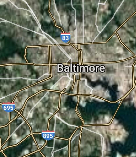
Baltimore [*elevation ceiling = 40km]Elevation: 11m (Group 86)
UR-100N (SLBM) |
Point A: 39.290385 00(300kt)
Point B: 39.414269 00
Point C: 39.083997 00
Point D: 39.143441 00
Point E: 39.006777 00
Point F: 39.641763 00
Open START Passages |
Point A: -76.612189 00(300kt)
Point B: -77.410541 00
Point C: -77.152758 00
Point D: -77.201371 00
Point E: -76.779136 00
Point F: -77.719993 00
Demonstration |
|
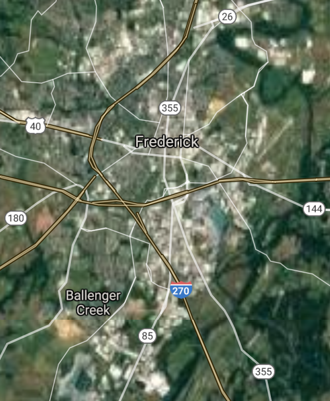
Frederick [*elevation ceiling = 40km]Elevation: 90m (Group 86)
UR-100N (SLBM) |
Point A: 39.290385 00
Point B: 39.414269 00(300kt)
Point C: 39.083997 00
Point D: 39.143441 00
Point E: 39.006777 00
Point F: 39.641763 00
|
Point A: -76.612189 00
Point B: -77.410541 00(300kt)
Point C: -77.152758 00
Point D: -77.201371 00
Point E: -76.779136 00
Point F: -77.719993 00
|
|
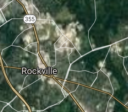
Rockville [*elevation ceiling = 40km]Elevation: 139m (Group 86)
UR-100N (SLBM) |
Point A: 39.290385 00
Point B: 39.414269 00
Point C: 39.083997 00(300kt)
Point D: 39.143441 00
Point E: 39.006777 00
Point F: 39.641763 00
|
Point A: -76.612189 00
Point B: -77.410541 00
Point C: -77.152758 00(300kt)
Point D: -77.201371 00
Point E: -76.779136 00
Point F: -77.719993 00
|
|
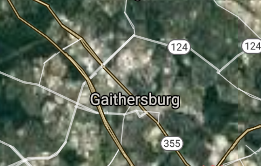
Gaithersburg [*elevation ceiling = 40km]Elevation: 153m (Group 86)
UR-100N (SLBM) |
Point A: 39.290385 00
Point B: 39.414269 00
Point C: 39.083997 00
Point D: 39.143441 00(300kt)
Point E: 39.006777 00
Point F: 39.641763 00
|
Point A: -76.612189 00
Point B: -77.410541 00
Point C: -77.152758 00
Point D: -77.201371 00(300kt)
Point E: -76.779136 00
Point F: -77.719993 00
|
|
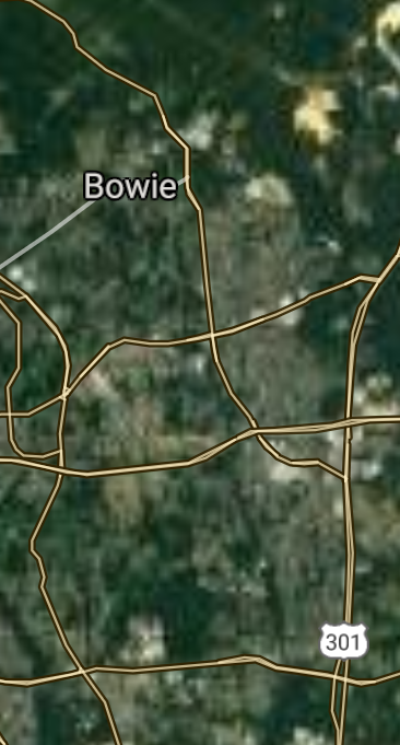
Bowie [*elevation ceiling = 40km]Elevation: 47m (Group 86)
UR-100N (SLBM) |
Point A: 39.290385 00
Point B: 39.414269 00
Point C: 39.083997 00
Point D: 39.143441 00
Point E: 39.006777 00(300kt)
Point F: 39.641763 00
|
Point A: -76.612189 00
Point B: -77.410541 00
Point C: -77.152758 00
Point D: -77.201371 00
Point E: -76.779136 00(300kt)
Point F: -77.719993 00
|
|
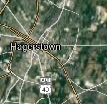
Hagerstown [*elevation ceiling = 40km]Elevation: 162m (Group 86)
UR-100N (SLBM) |
Point A: 39.290385 00
Point B: 39.414269 00
Point C: 39.083997 00
Point D: 39.143441 00
Point E: 39.006777 00
Point F: 39.641763 00(300kt)
|
Point A: -76.612189 00
Point B: -77.410541 00
Point C: -77.152758 00
Point D: -77.201371 00
Point E: -76.779136 00
Point F: -77.719993 00(300kt)
|
|
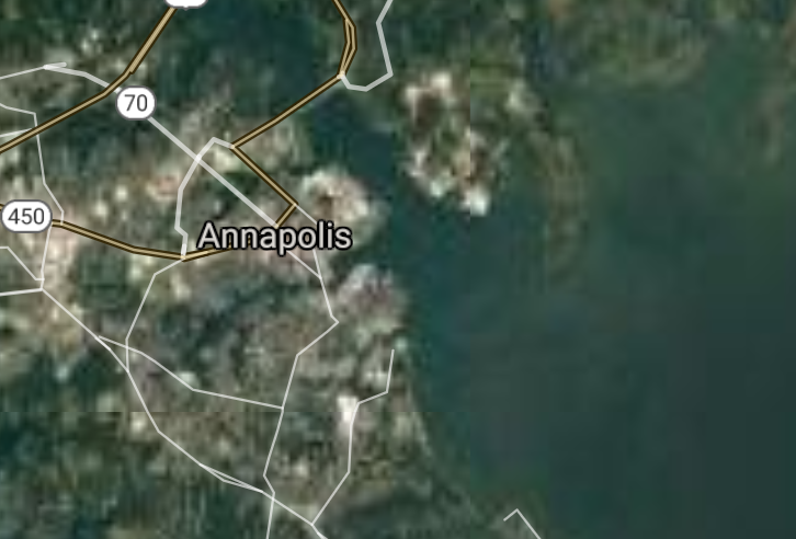
Annapolis [*elevation ceiling = 40km]Elevation: 13m (Group 87)
UR-100N (SLBM) |
Point A: 38.978445 00(300kt)
Point B: 38.989697 00
Point C: 38.360674 00
Point D: 39.099275 00
Point E: 39.004554 00
Point F: 39.652865 00
|
Point A: -76.492183 00(300kt)
Point B: -76.937760 00
Point C: -75.599369 00
Point D: -76.848306 00
Point E: -76.875528 00
Point F: -78.762519 00
|
|
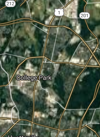
College Park [*elevation ceiling = 40km]Elevation: 23m (Group 87)
UR-100N (SLBM) |
Point A: 38.978445 00
Point B: 38.989697 00(300kt)
Point C: 38.360674 00
Point D: 39.099275 00
Point E: 39.004554 00
Point F: 39.652865 00
|
Point A: -76.492183 00
Point B: -76.937760 00(300kt)
Point C: -75.599369 00
Point D: -76.848306 00
Point E: -76.875528 00
Point F: -78.762519 00
|
|
Salisbury [*elevation ceiling = 40km]Elevation: 7m (Group 87)
UR-100N (SLBM) |
Point A: 38.978445 00
Point B: 38.989697 00
Point C: 38.360674 00(300kt)
Point D: 39.099275 00
Point E: 39.004554 00
Point F: 39.652865 00
|
Point A: -76.492183 00
Point B: -76.937760 00
Point C: -75.599369 00(300kt)
Point D: 00
Point E: -76.875528 00
Point F: -78.762519 00
|
|
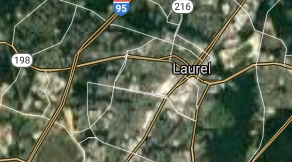
Laurel [*elevation ceiling = 40km]Elevation: 51m (Group 87)
UR-100N (SLBM) |
Point A: 38.978445 00
Point B: 38.989697 00
Point C: 38.360674 00
Point D: 39.099275 00(300kt)
Point E: 39.004554 00
Point F: 39.652865 00
|
Point A: -76.492183 00
Point B: -76.937760 00
Point C: -75.599369 00
Point D: -76.848306 00(300kt)
Point E: -76.875528 00
Point F: -78.762519 00
|
|
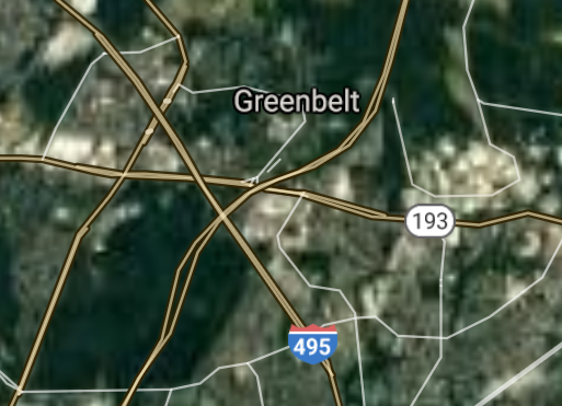
Greenbelt [*elevation ceiling = 40km]Elevation: 49m (Group 87)
UR-100N (SLBM) |
Point A: 38.978445 00
Point B: 38.989697 00
Point C: 38.360674 00
Point D: 39.099275 00
Point E: 39.004554 00(300kt)
Point F: 39.652865 00
|
Point A: -76.492183 00
Point B: -76.937760 00
Point C: -75.599369 00
Point D: -76.848306 00
Point E: -76.875528 00(300kt)
Point F: -78.762519 00
|
|
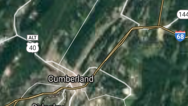
Cumberland [*elevation ceiling = 40km]Elevation: 190m (Group 87)
UR-100N (SLBM) |
Point A: 38.978445 00
Point B: 38.989697 00
Point C: 38.360674 00
Point D: 39.099275 00
Point E: 39.004554 00
Point F: 39.652865 00(300kt)
|
Point A: -76.492183 00
Point B: -76.937760 00
Point C: -75.599369 00
Point D: -76.848306 00
Point E: -76.875528 00
Point F: -78.762519 00(300kt)
|
|
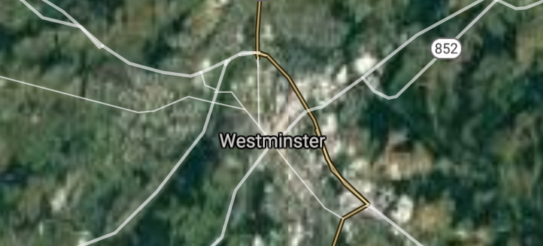
Westminster [*elevation ceiling = 40km]Elevation: 221m (Group 88)
UR-100N (SLBM) |
Point A: 39.575379 00(300kt)
Point B: 38.955944 00
Point C: 38.977888 00
Point D: 38.774283 00
Point E: 39.606779 00
Point F: 39.509556 00
|
Point A: -76.995815 00(300kt)
Point B: -76.945530 00
Point C: -77.007477 00
Point D: -76.076330 00
Point E: -75.833272 00
Point F: -76.164120 00
|
|
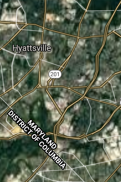
Hyattsville [*elevation ceiling = 40km]Elevation: 33m (Group 88)
UR-100N (SLBM) |
Point A: 39.575379 00
Point B: 38.955944 00(300kt)
Point C: 38.977888 00
Point D: 38.774283 00
Point E: 39.606779 00
Point F: 39.509556 00
|
Point A: -76.995815 00
Point B: -76.945530 00(300kt)
Point C: -77.007477 00
Point D: -76.076330 00
Point E: -75.833272 00
Point F: -76.164120 00
|
|
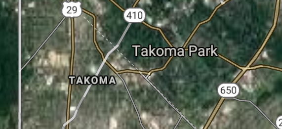
Takoma Park [*elevation ceiling = 40km]Elevation: 89m (Group 88)
UR-100N (SLBM) |
Point A: 39.575379 00
Point B: 38.955944 00
Point C: 38.977888 00(300kt)
Point D: 38.774283 00
Point E: 39.606779 00
Point F: 39.509556 00
|
Point A: -76.995815 00
Point B: -76.945530 00
Point C: -77.007477 00(300kt)
Point D: -76.076330 00
Point E: -75.833272 00
Point F: -76.164120 00
|
|
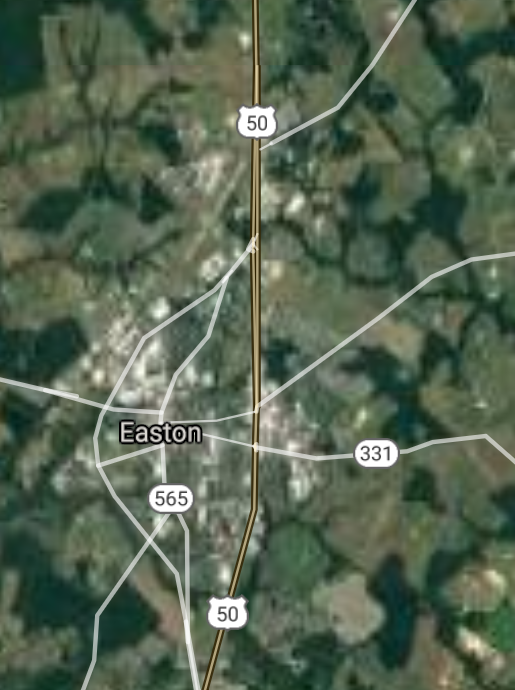
Easton [*elevation ceiling = 40km]Elevation: 11m (Group 88)
UR-100N (SLBM) |
Point A: 39.575379 00
Point B: 38.955944 00
Point C: 38.977888 00
Point D: 38.774283 00(300kt)
Point E: 39.606779 00
Point F: 39.509556 00
|
Point A: -76.995815 00
Point B: -76.945530 00
Point C: -77.007477 00
Point D: -76.076330 00(300kt)
Point E: -75.833272 00
Point F: -76.164120 00
|
|
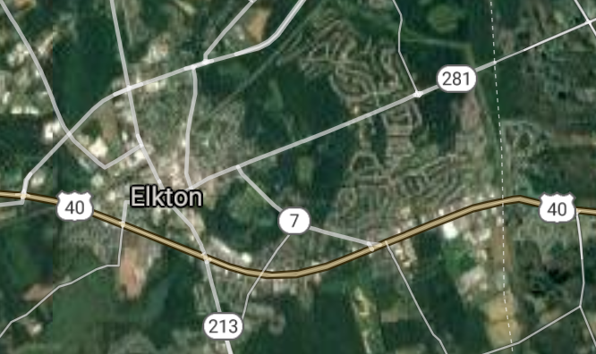
Elkton [*elevation ceiling = 40km]Elevation: 8m (Group 88)
UR-100N (SLBM) |
Point A: 39.575379 00
Point B: 38.955944 00
Point C: 38.977888 00
Point D: 38.774283 00
Point E: 39.606779 00(300kt)
Point F: 39.509556 00
|
Point A: -76.995815 00
Point B: -76.945530 00
Point C: -77.007477 00
Point D: -76.076330 00
Point E: -75.833272 00(300kt)
Point F: -76.164120 00
|
|
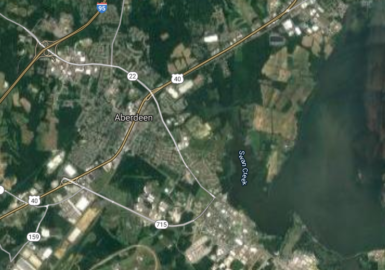
Aberdeen [*elevation ceiling = 40km]Elevation: 24m (Group 88)
UR-100N (SLBM) |
Point A: 39.575379 00
Point B: 38.955944 00
Point C: 38.977888 00
Point D: 38.774283 00
Point E: 39.606779 00
Point F: 39.509556 00(300kt)
|
Point A: -76.995815 00
Point B: -76.945530 00
Point C: -77.007477 00
Point D: -76.076330 00
Point E: -75.833272 00
Point F: -76.164120 00(300kt)
|
|
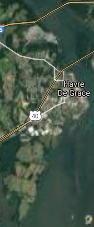
Havre de Grace [*elevation ceiling = 40km]Elevation: 12m (Group 89)
UR-100N (SLBM) |
Point A: 39.549279 00(300kt)
Point B: 38.563174 00
Point C: 38.965725 00
Point D: 39.535941 00
Point E: 39.376215 00
Point F: 38.939278 00
|
Point A: -76.091617 00(300kt)
Point B: -76.078829 00
Point C: -76.880248 00
Point D: -76.348293 00
Point E: -77.154704 00
Point F: -76.933863 00
|
|
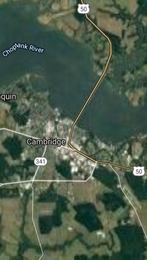
Cambridge [*elevation ceiling = 40km]Elevation: 6m (Group 89)
UR-100N (SLBM) |
Point A: 39.549279 00
Point B: 38.563174 00(300kt)
Point C: 38.965725 00
Point D: 39.535941 00
Point E: 39.376215 00
Point F: 38.939278 00
|
Point A: -76.091617 00
Point B: -76.078829 00(300kt)
Point C: -76.880248 00
Point D: -76.348293 00
Point E: -77.154704 00
Point F: -76.933863 00
|
|
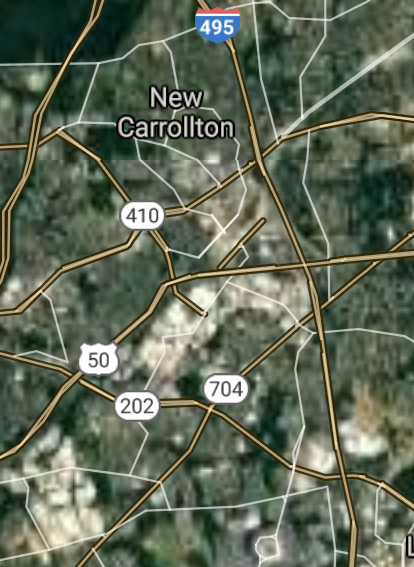
New Carrollton [*elevation ceiling = 40km]Elevation: 22m (Group 89)
UR-100N (SLBM) |
Point A: 39.549279 00
Point B: 38.563174 00
Point C: 38.965725 00(300kt)
Point D: 39.535941 00
Point E: 39.376215 00
Point F: 38.939278 00
|
Point A: -76.091617 00
Point B: -76.078829 00
Point C: -76.880248 00(300kt)
Point D: -76.348293 00
Point E: -77.154704 00
Point F: -76.933863 00
|
|
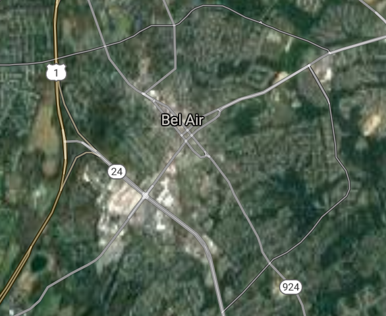
Bel Air [*elevation ceiling = 40km]Elevation: 118m (Group 89)
UR-100N (SLBM) |
Point A: 39.549279 00
Point B: 38.563174 00
Point C: 38.965725 00
Point D: 39.535941 00(300kt)
Point E: 39.376215 00
Point F: 38.939278 00
|
Point A: -76.091617 00
Point B -76.078829 00
Point C: -76.880248 00
Point D: -76.348293 00(300kt)
Point E: -77.154704 00
Point F: -76.933863 00
|
|
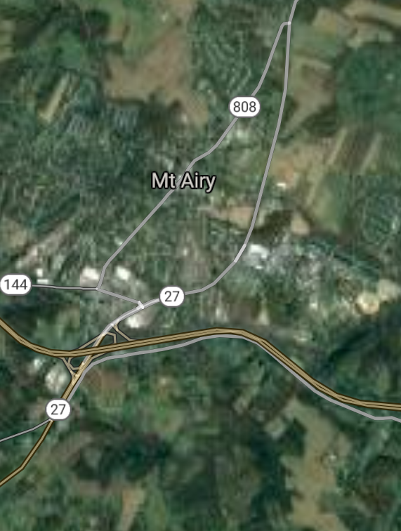
Mount Airy [*elevation ceiling = 40km]Elevation: 237m (Group 89)
UR-100N (SLBM) |
Point A: 39.549279 00
Point B: 38.563174 00
Point C: 38.965725 00
Point D: 39.535941 00
Point E: 39.376215 00(300kt)
Point F: 38.939278 00
|
Point A: -76.091617 00
Point B: -76.078829 00
Point C: -76.880248 00
Point D: -76.348293 00
Point E: -77.154704 00(300kt)
Point F: -76.933863 00
|
|
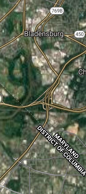
Bladensburg [*elevation ceiling = 40km]Elevation: 16m (Group 89)
UR-100N (SLBM) |
Point A: 39.549279 00
Point B: 38.563174 00
Point C: 38.965725 00
Point D: 39.535941 00
Point E: 39.376215 00
Point F: 38.939278 00(300kt)
|
Point A: -76.091617 00
Point B: -76.078829 00
Point C: -76.880248 00
Point D: -76.348293 00
Point E: -77.154704 00
Point F: -76.933863 00(300kt)
|
|
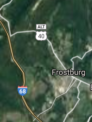
Frostburg [*elevation ceiling = 40km]Elevation: 630m (Group 90)
UR-100N (SLBM) |
Point A: 39.658142 00(300kt)
Point B: 38.529288 00
Point C: 38.941500 00
Point D: 38.336503 00
Point E: 38.963444 00
Point F: 39.657877 00
|
Point A: -78.928357 00(300kt)
Point B: -76.975251 00
Point C: -76.964975 00
Point D: -75.084906 00
Point E: -76.931641 00
Point F: -77.174428 00
|
|
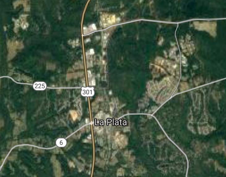
La Plata [*elevation ceiling = 40km]Elevation: 57m (Group 90)
UR-100N (SLBM) |
Point A: 39.658142 00
Point B: 38.529288 00(300kt)
Point C: 38.941500 00
Point D: 38.336503 00
Point E: 38.963444 00
Point F: 39.657877 00
|
Point A: -78.928357 00
Point B: -76.975251 00(300kt)
Point C: -76.964975 00
Point D: -75.084906 00
Point E: -76.931641 00
Point F: -77.174428 00
|
|
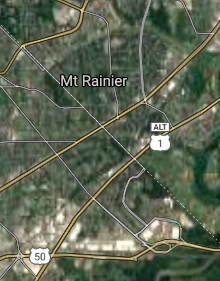
Mount Rainier [*elevation ceiling = 40km]Elevation: 25m (Group 90)
UR-100N (SLBM) |
Point A: 39.658142 00
Point B: 38.529288 00
Point C: 38.941500 00(300kt)
Point D: 38.336503 00
Point E: 38.963444 00
Point F: 39.657877 00
|
Point A: -78.928357 00
Point B: -76.975251 00
Point C: -76.964975 00(300kt)
Point D: -75.084906 00
Point E: -76.931641 00
Point F: -77.174428 00
|
|
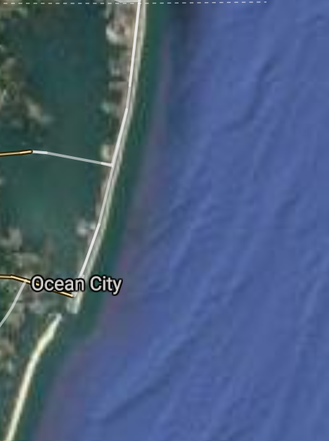
Ocean City [*elevation ceiling = 40km]Elevation: 1m (Group 90)
UR-100N (SLBM) |
Point A: 39.658142 00
Point B: 38.529288 00
Point C: 38.941500 00
Point D: 38.336503 00(300kt)
Point E: 38.963444 00
Point F: 39.657877 00
|
Point A: -78.928357 00
Point B: -76.975251 00
Point C: -76.964975 00
Point D: -75.084906 00(300kt)
Point E: -76.931641 00
Point F: -77.174428 00
|
|
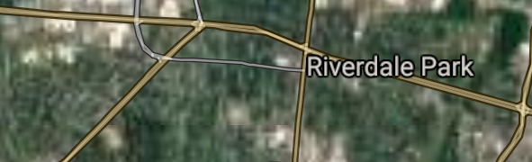
Riverdale Park [*elevation ceiling = 40km]Elevation: 11m (Group 90)
UR-100N (SLBM) |
Point A: 39.658142 00
Point B: 38.529288 00
Point C: 38.941500 00
Point D: 38.336503 00
Point E: 38.963444 00(300kt)
Point F: 39.657877 00
|
Point A: -78.928357 00
Point B: -76.975251 00
Point C: -76.964975 00
Point D: -75.084906 00
Point E: -76.931641 00(300kt)
Point F: -77.174428 00
|
|
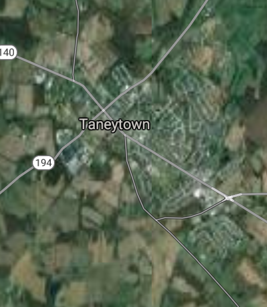
Taneytown [*elevation ceiling = 40km]Elevation: 153m (Group 90)
UR-100N (SLBM) |
Point A: 39.658142 00
Point B: 38.529288 00
Point C: 38.941500 00
Point D: 38.336503 00
Point E: 38.963444 00
Point F: 39.657877 00(300kt)
|
Point A: -78.928357 00
Point B: -76.975251 00
Point C: -76.964975 00
Point D: -75.084906 00
Point E: -76.931641 00
Point F: -77.174428 00(300kt)
|
|
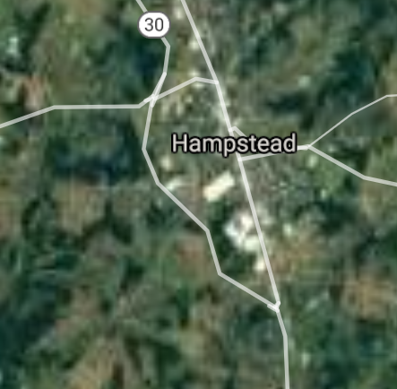
Hampstead [*elevation ceiling = 40km]Elevation: 279m (Group 91)
UR-100N (SLBM) |
Point A: 39.604825 00(300kt)
Point B: 38.928167 00
Point C: 39.623709 00
Point D: 38.929278 00
Point E: 39.314268 00
Point F: 38.857613 00
|
Point A: -76.849977 00(300kt)
Point B: -76.915807 00
Point C: -77.410820 00
Point D: -76.861639 00
Point E: -77.627768 00
Point F: -76.889417 00
|
|
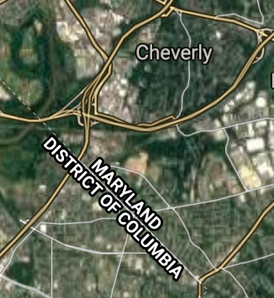
Cheverly [*elevation ceiling = 40km]Elevation: 55m (Group 91)
UR-100N (SLBM) |
Point A: 39.604825 00
Point B: 38.928167 00(300kt)
Point C: 39.623709 00
Point D: 38.929278 00
Point E: 39.314268 00
Point F: 38.857613 00
|
Point A: -76.849977 00
Point B: -76.915807 00(300kt)
Point C: -77.410820 00
Point D: -76.861639 00
Point E: -77.627768 00
Point F: -76.889417 00
|
|
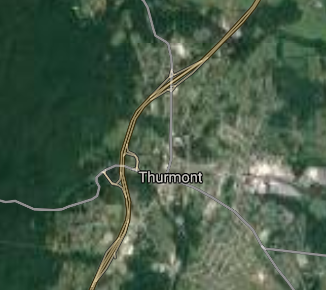
Thurmont [*elevation ceiling = 40km]Elevation: 156m (Group 91)
UR-100N (SLBM) |
Point A: 39.604825 00
Point B: 38.928167 00
Point C: 39.623709 00(300kt)
Point D: 38.929278 00
Point E: 39.314268 00
Point F: 38.857613 00
|
Point A: -76.849977 00
Point B: -76.915807 00
Point C: -77.410820 00(300kt)
Point D: -76.861639 00
Point E: -77.627768 00
Point F: -76.889417 00
|
|
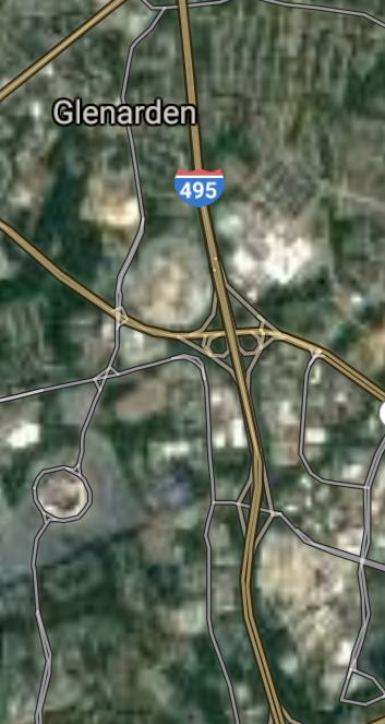
Glenarden [*elevation ceiling = 40km]Elevation: 30m (Group 91)
UR-100N (SLBM) |
Point A: 39.604825 00
Point B: 38.928167 00
Point C: 39.623709 00
Point D: 38.929278 00(300kt)
Point E: 39.314268 00
Point F: 38.857613 00
|
Point A: -76.849977 00
Point B: -76.915807 00
Point C: -77.410820 00
Point D: -76.861639 00(300kt)
Point E: -77.627768 00
Point F: -76.889417 00
|
|
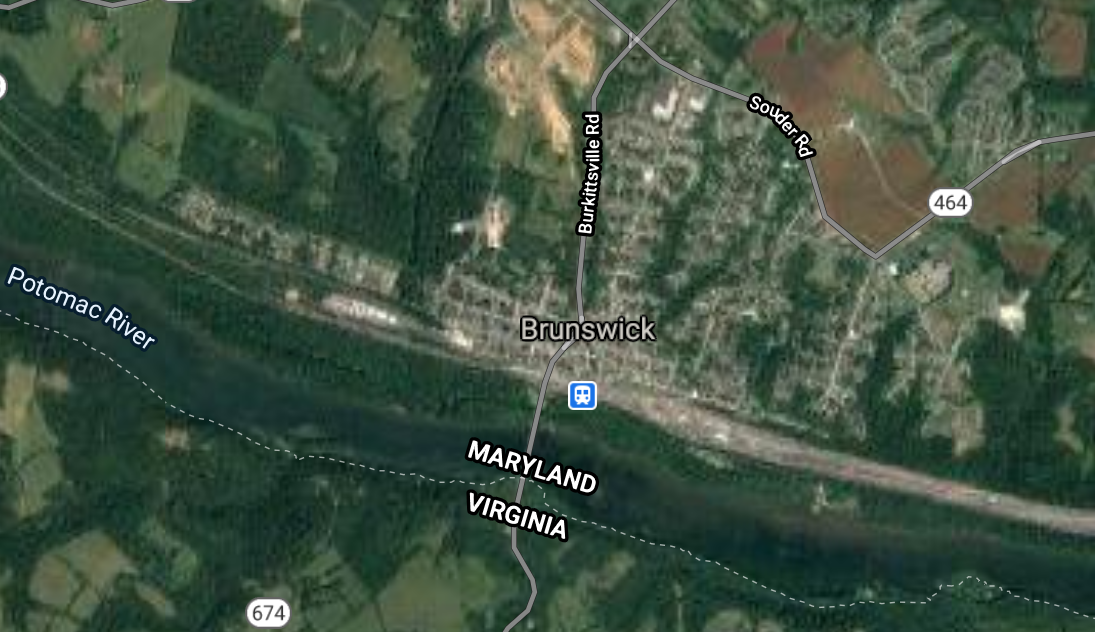
Brunswick [*elevation ceiling = 40km]Elevation: 80m (Group 91)
UR-100N (SLBM) |
Point A: 39.604825 00
Point B: 38.928167 00
Point C: 39.623709 00
Point D: 38.929278 00
Point E: 39.314268 00(300kt)
Point F: 38.857613 00
|
Point A: -76.849977 00
Point B: -76.915807 00
Point C: -77.410820 00
Point D: -76.861639 00
Point E: -77.627768 00(300kt)
Point F: -76.889417 00
|
|
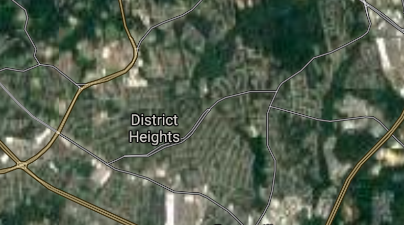
District Heights [*elevation ceiling = 40km]Elevation: 82m (Group 91)
UR-100N (SLBM) |
Point A: 39.604825 00
Point B: 38.928167 00
Point C: 39.623709 00
Point D: 38.929278 00
Point E: 39.314268 00
Point F: 38.857613 00(300kt)
|
Point A: -76.849977 00
Point B: -76.915807 00
Point C: -77.410820 00
Point D: -76.861639 00
Point E: -77.627768 00
Point F: -76.889417 00(300kt)
|
|
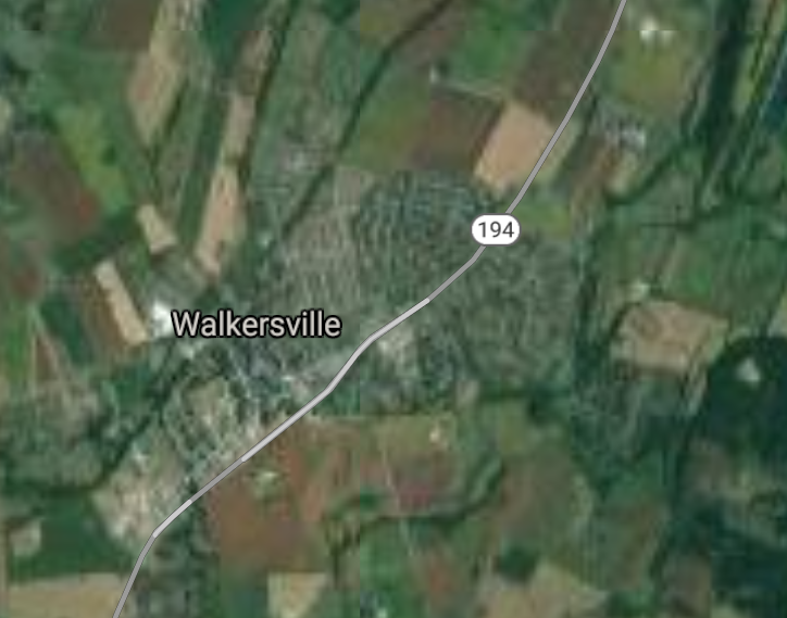
Walkersville [*elevation ceiling = 40km]Elevation: 93m (Group 92)
UR-100N (SLBM) |
Point A: 39.486213 00(300kt)
Point B: 38.694791 00
Point C: 39.218866 00
Point D: 39.145939 00
Point E: 38.322063 00
Point F: 39.661213 00
|
Point A: -77.351928 00(300kt)
Point B: -76.533654 00
Point C: -76.069004 00
Point D: -77.416931 00
Point E: -75.620203 00
Point F: -76.884978 00
|
|
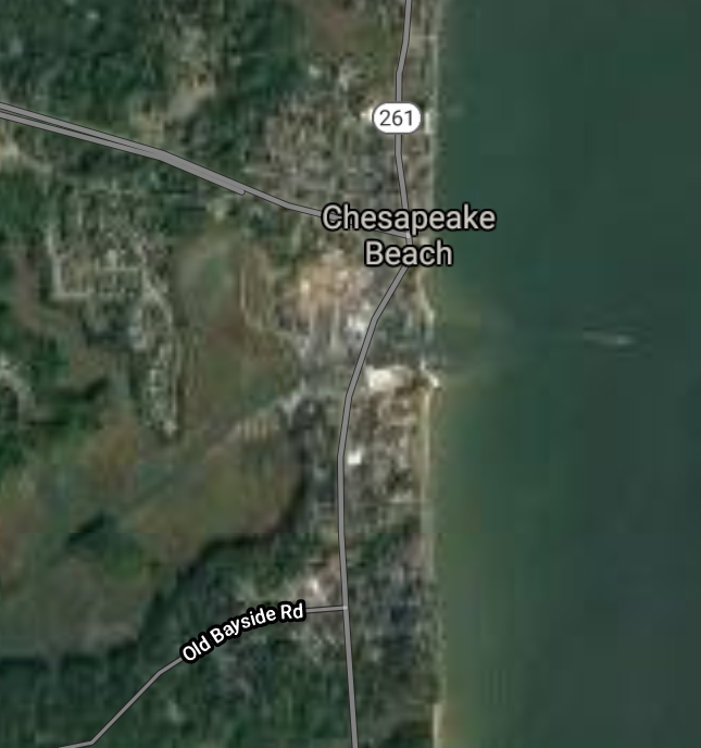
Chesapeake Beach [*elevation ceiling = 40km]Elevation: 3m (Group 92)
UR-100N (SLBM) |
Point A: 39.486213 00
Point B: 38.694791 00(300kt)
Point C: 39.218866 00
Point D: 39.145939 00
Point E: 38.322063 00
Point F: 39.661213 00
|
Point A: -77.351928 00
Point B: -76.533654 00(300kt)
Point C: -76.069004 00
Point D: -77.416931 00
Point E: -75.620203 00
Point F: -76.884978 00
|
|
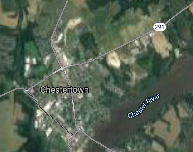
Chestertown [*elevation ceiling = 40km]Elevation: 23m (Group 92)
UR-100N (SLBM) |
Point A: 39.486213 00
Point B: 38.694791 00
Point C: 39.218866 00(300kt)
Point D: 39.145939 00
Point E: 38.322063 00
Point F: 39.661213 00
|
Point A: -77.351928 00
Point B: -76.533654 00
Point C: -76.069004 00(300kt)
Point D: -77.416931 00
Point E: -75.620203 00
Point F: -76.884978 00
|
|
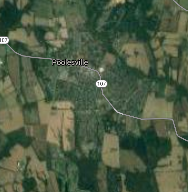
Poolesville [*elevation ceiling = 40km]Elevation: 125m (Group 92)
UR-100N (SLBM) |
Point A: 39.486213 00
Point B: 38.694791 00
Point C: 39.218866 00
Point D: 39.145939 00(300kt)
Point E: 38.322063 00
Point F: 39.661213 00
|
Point A: -77.351928 00
Point B: -76.533654 00
Point C: -76.069004 00
Point D: -77.416931 00(300kt)
Point E: -75.620203 00
Point F: -76.884978 00
|
|
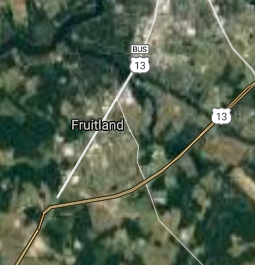
Fruitland [*elevation ceiling = 40km]Elevation: 12m (Group 92)
UR-100N (SLBM) |
Point A: 39.486213 00
Point B: 38.694791 00
Point C: 39.218866 00
Point D: 39.145939 00
Point E: 38.322063 00(300kt)
Point F: 39.661213 00
|
Point A: -77.351928 00
Point B: -76.533654 00
Point C: -76.069004 00
Point D: -77.416931 00
Point E: -75.620203 00(300kt)
Point F: -76.884978 00
|
|
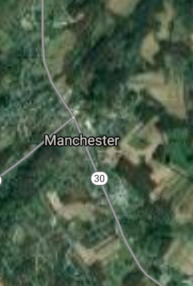
Manchester [*elevation ceiling = 40km]Elevation: 302m (Group 92)
UR-100N (SLBM) |
Point A: 39.486213 00
Point B: 38.694791 00
Point C: 39.218866 00
Point D: 39.145939 00
Point E: 38.322063 00
Point F: 39.661213 00(300kt)
|
Point A: -77.351928 00
Point B: -76.533654 00
Point C: -76.069004 00
Point D: -77.416931 00
Point E: -75.620203 00
Point F: -76.884978 00(300kt)
|
|
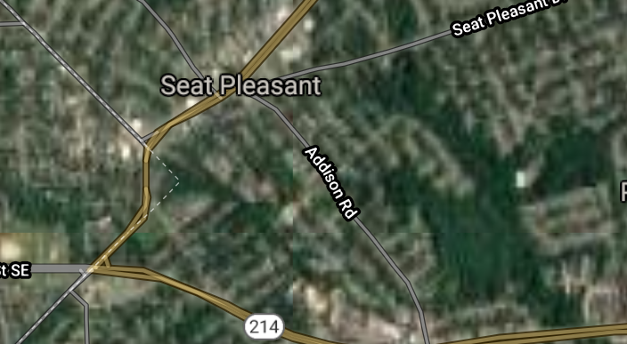
Seat Pleasant [*elevation ceiling = 40km]Elevation: 34m (Group 93)
UR-100N (SLBM) |
Point A: 38.896223 00(300kt)
Point B: 38.322615 00
Point C: 39.373715 00
Point D: 38.884558 00
Point E: 39.560113 00
Point F: 38.885112 00
|
Point A: -76.906640 00(300kt)
Point B: -75.217689 00
Point C: -76.967757 00
Point D: -75.827156 00
Point E: -76.071339 00
Point F: -76.915807 00
|
|
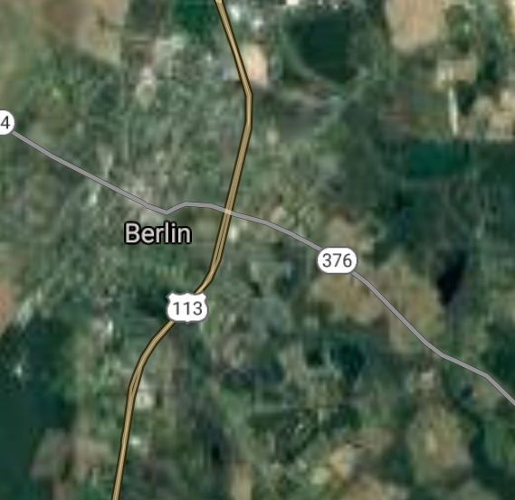
Berlin [*elevation ceiling = 40km]Elevation: 11m (Group 93)
UR-100N (SLBM) |
Point A: 38.896223 00
Point B: 38.322615 00(300kt)
Point C: 39.373715 00
Point D: 38.884558 00
Point E: 39.560113 00
Point F: 38.885112 00
|
Point A: -76.906640 00
Point B: -75.217689 00(300kt)
Point C: -76.967757 00
Point D: -75.827156 00
Point E: -76.071339 00
Point F: -76.915807 00
|
|
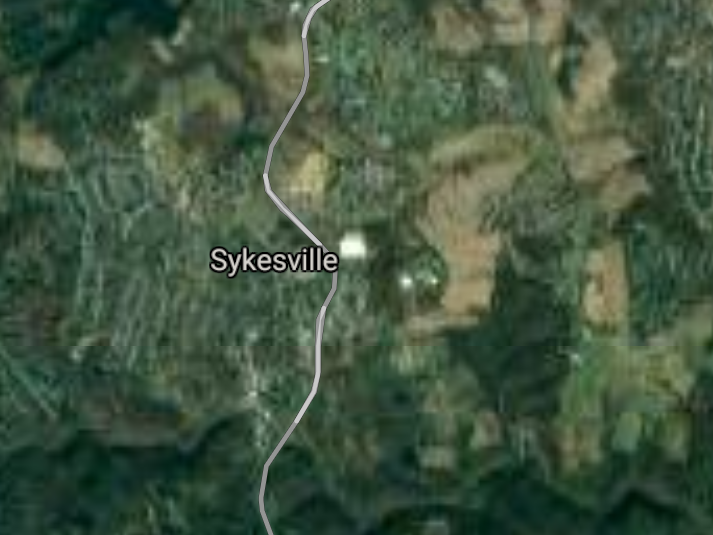
Sykesville [*elevation ceiling = 40km]Elevation: 166m (Group 93)
UR-100N (SLBM) |
Point A: 38.896223 00
Point B: 38.322615 00
Point C: 39.373715 00(300kt)
Point D: 38.884558 00
Point E: 39.560113 00
Point F: 38.885112 00
|
Point A: -76.906640 00
Point B: -75.217689 00
Point C: -76.967757 00(300kt)
Point D: -75.827156 00
Point E: -76.071339 00
Point F: -76.915807 00
|
|
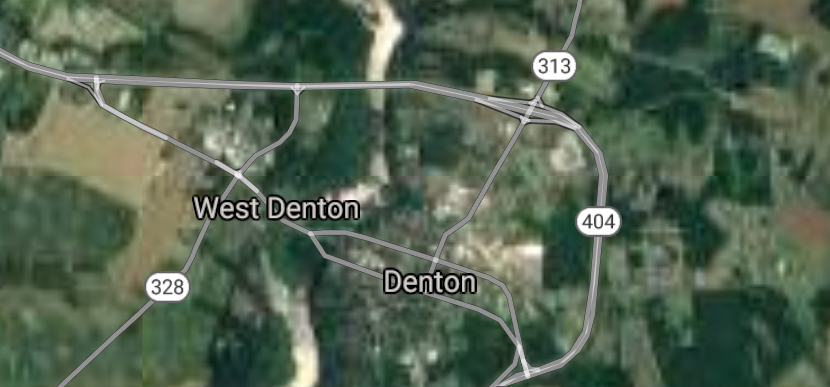
Denton [*elevation ceiling = 40km]Elevation: 14m (Group 93)
UR-100N (SLBM) |
Point A: 38.896223 00
Point B: 38.322615 00
Point C: 39.373715 00
Point D: 38.884558 00(300kt)
Point E: 39.560113 00
Point F: 38.885112 00
|
Point A: -76.906640 00
Point B: -75.217689 00
Point C: -76.967757 00
Point D: -75.827156 00(300kt)
Point E: -76.071339 00
Point F: -76.915807 00
|
|
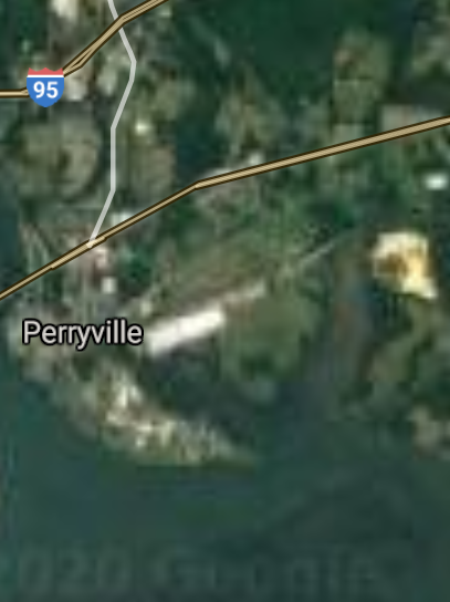
Perryville [*elevation ceiling = 40km]Elevation: 14m (Group 93)
UR-100N (SLBM) |
Point A: 38.896223 00
Point B: 38.322615 00
Point C: 39.373715 00
Point D: 38.884558 00
Point E: 39.560113 00(300kt)
Point F: 38.885112 00
|
Point A: -76.906640 00
Point B: -75.217689 00
Point C: -76.967757 00
Point D: -75.827156 00
Point E: -76.071339 00(300kt)
Point F: -76.915807 00
|
|
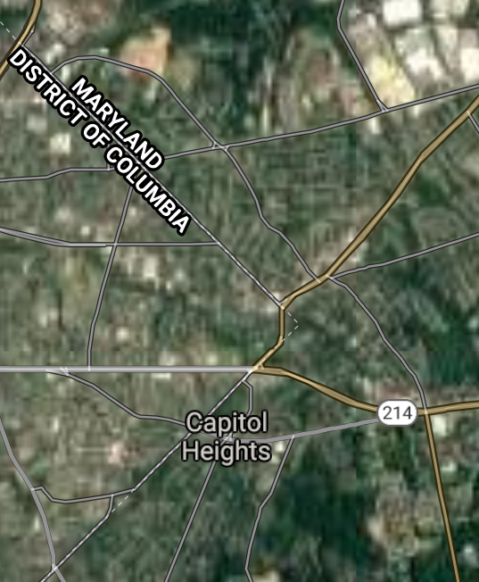
Capitol Heights [*elevation ceiling = 40km]Elevation: 37m (Group 93)
UR-100N (SLBM) |
Point A: 38.896223 00
Point B: 38.322615 00
Point C: 39.373715 00
Point D: 38.884558 00
Point E: 39.560113 00
Point F: 38.885112 00(300kt)
|
Point A: -76.906640 00
Point B: -75.217689 00
Point C: -76.967757 00
Point D: -75.827156 00
Point E: -76.071339 00
Point F: -76.915807 00(300kt)
|

[Top]
Situation: Central Basin
"BRICS Security Council emerging from cross-currency evaluations"
OPEN Start: Central Basin - is an engineering vessel which is proven with climate security in evaluation of the USD/YEN currency pair. Annually, climate security is leading economic growth in key emerging markets surrounding the Four Asian Tigers. Affordably, the following industries extend opportunities for military cooperation: aerospace, telecommunications, finance and banking. OPEN Start: Central Basin strengthens the backbone for international security beyond the shadows of USD/YEN controversy. Traversely, OPEN Start: Central Basin offsets the cross-over gap between the USD/MXN and USD/RUB exchange rates. Notably, the Three Amigas form an economic alliance in the Far West through joint-cooperation projects from Venture 1, Venture LA and Venture SF which all extend with the Far North reach towards the Far South (as illustrated below).
![]()
![]()
![]()
![]()
![]()
![]()
![]()
![]()
![]()
JanuaryFebruaryMarchAprilJuneJulySeptemberOctoberDecember |
2026 Group Drills - Schedule
|
|

JanuaryFebruaryJuneJulyAugustOctoberNovemberDecember |
2026 Group Drills - Schedule
|
|

JanuaryFebruaryJuneJulySeptemberOctoberNovemberDecember |
2026 Group Drills - Schedule
|
|
