

 OPEN Start


 Hollywood, JSC
Mendocino, JSC
LA SOCIETY
SF SOCIETY
NY SOCIETY
Open START Drills
Hollywood, JSC
Mendocino, JSC
LA SOCIETY
SF SOCIETY
NY SOCIETY
Open START Drills
Talk Daily Commodities Review LATPACT Open Market Equities Report Currency Central
 Situation: US
 |

|

|

|
|
 SOCIETY Trust Fund LATPACT Trust Fund LATPACT Open Market Far West (SEZ) Trust RIM of Nations Trust
Arctic Pact Trade Zone | Upper Rhine Zone | Lower Rhine Zone | Middle Rhone Basin
| Level 2 - Open START/*Super Grid |
| Level 3 - Stellar Fields |


Climate Central News & Information
 "US attempts to salvage the European Order with a K-9 Squad clan style coalition"
Population Conversations: 3,066,625
Planet Power Seconds
 BRICS Security Council
 Military cooperation is exceedingly pressing ahead in notable markets from China, Russia and India which include achieving greater milestones within the technology, communications, and aerospace industries. Vastly, multi-national alliances continue to expand as relying on new protocols oppose resistance with deregulation in the spheres of international security and terrorism. As a result, the BRICS Security Council is forming several key initiatives from climate security to preserve and harness the skills with establishing a polar-arc posture in outer space.
In contrast, a grave decline in NATO has been detected. In early 2018, UNITED STATES ARMY COMMANDER, GENERAL CURTIS M. SCAPARROTTI delivered the posture statement for NATO. He stated, "As our most significant trading partner, Europe is vital to promoting American prosperity. With shared history and values, Europe is also a critical partner in advancing American influence throughout the world. The North Atlantic Treaty Organization (NATO) enables us to preserve peace through strength as alliance unity fundamentally deters the aggression of potential adversaries." Meanwhile, NATO readiness is faltering in Europe as lack of training, inadequate funding and outdated equipment persist over the Brexit strategy.
United Nations Command: AUKUSA/Quad 4
 Extensively, the Central Basin is transforming international security while disabling NATO, AUKUSA and the Quad 4 military alliances with the Open START Hawaii and Open START Alaska drills. Inherently, the Central Basin fleet suppresses the UN Command over security backlogs as the Global South impedes expansion for the Japanese yen. Economically, the US dollar bounds NATO, AUKUSA and the Quad 4 alliances under one entity in the wake of the 2007 housing crises, COVID-19 recovery and war in Ukraine. Generously, the Upper Rhine pass bridges the Open START Hawaii and Open START Alaska drills which stabilize international and climate security. Uniquely, Open START drills for the Upper Rhine pass pegs the value of the Japanese yen and Korean Won to the Chinese yuan, Indian rupee, Russian ruble, and Mexican peso to enable economic transformation for the Central Basin region. Effectively, the Open START drill secures the yen in cooperation with the Global South as significant growth on the New Silk Road Economic Belt extends in Africa. Suitably, the Open START drill baffles the UN Command with the Upper Rhine pass as the historical value is at stake. Judiciously, the Open START drill isolates the UN Command over Level 1 protocol which underpins NATO, AUKUSA and the Quad 4 military alliances to Celtic Briton tribes.
The OSCE and NATO: From the Arctic Circle
 Historically, military conflicts include land navigation rivalry which is significant for the Lower Rhine corridor as tensions between the Eastern and Western hemisphere ignite over political testimony. Substantially, the US has interspersed armed forces in the EU with the connivance of NATO and the OSCE to subjugate the Arctic Circle and dominate international trade from the Middle East. Tacitly, the OSCE is equipped to engineer early warnings, conflict resolution and crisis management over military tensions with NATO to inseminate the world order of law and justice. Decisively, the Open START Iceland drill unify the corners of the world to combat the historical West from the Arctic Circle over climate security, war crimes and crimes against humanity. Particularly, normalized ties to Israel for the Lower Rhine corridor weighs over rising Eastern influence from the Near East which is a major factor in the Open START Iceland drill. Efficiently, the Open START Iceland drill balances political, economic and military parity between the historical East and West which is threatened from the incumbency of trade sanctions and escalating military tensions in the West.
*Schedule of Nuclear Attack
Be advised: The specific plan of attack for Pennsylvania is sensitive and will be posted here closer to its scheduled strike.
Pennsylvania
AL* | AZ* | AR* | CO | CT | DE | FL | GA | ID | IN | IA | KS | KY | LA | ME | MD
MA | MI | MN | MO | MT | NE | NV | NH | NJ | NM | NY | NC | ND | OH | OK | OR | PA | RI | SC
SD | TN | TX | UT | VA (DC)** | VT** | WA** | WV** | WI** | WY**
*Central Fleet South  Bulava + RT23 Cadet + Vysota3
Team: Memphis Fire (Local Area Control)
**Central Fleet North Bulava + Surya + Vysota3
Open START (RKS) |
Groups UR205 - UR212 | *300kt | Millineum Power *4,000 MW
Level 1 - WA Dong (SIT.2) 
Pennsylvania |
Latitude Coordinate |
Longitude Coordinate |
|
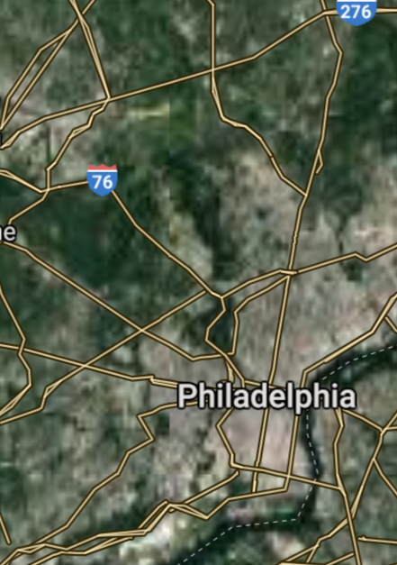
Philadelphia [*elevation ceiling = 40km]Elevation: 14m (Group 205)
UR-100N (SLBM) |
Point A: 39.952584 00(300kt)
Point B: 40.440625 00
Point C: 40.602294 00
Point D: 42.129224 00
Point E: 40.335648 00
Point F: 41.408969 00
Open START Passages |
Point A: -75.165222 00(300kt)
Point B: -79.995886 00
Point C: -75.471410 00
Point D: -80.085059 00
Point E: -75.926875 00
Point F: -75.662412 00
Demonstration |
|
Pittsburgh [*elevation ceiling = 40km]Elevation: 233m (Group 205)
UR-100N (SLBM) |
Point A: 39.952584 00
Point B: 40.440625 00(300kt)
Point C: 40.602294 00
Point D: 42.129224 00
Point E: 40.335648 00
Point F: 41.408969 00
|
Point A: -75.165222 00
Point B: -79.995886 00(300kt)
Point C: -75.471410 00
Point D: -80.085059 00
Point E: -75.926875 00
Point F: -75.662412 00
|
|
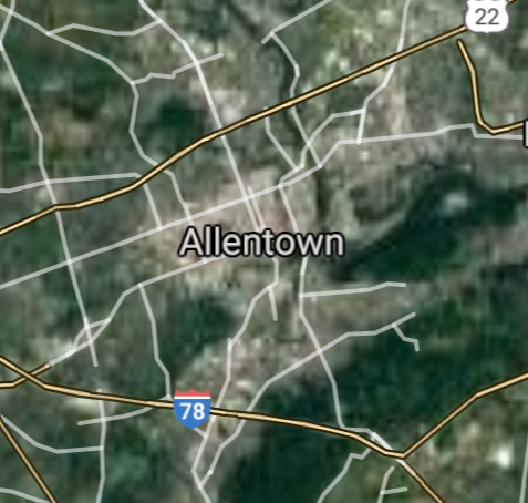
Allentown [*elevation ceiling = 40km]Elevation: 111m (Group 205)
UR-100N (SLBM) |
Point A: 39.952584 00
Point B: 40.440625 00
Point C: 40.602294 00(300kt)
Point D: 42.129224 00
Point E: 40.335648 00
Point F: 41.408969 00
|
Point A: -75.165222 00
Point B: -79.995886 00
Point C: -75.471410 00(300kt)
Point D: -80.085059 00
Point E: -75.926875 00
Point F: -75.662412 00
|
|
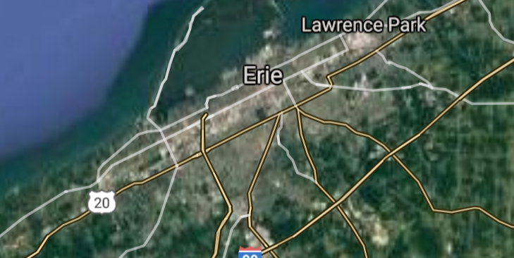
Erie [*elevation ceiling = 40km]Elevation: 199m (Group 205)
UR-100N (SLBM) |
Point A: 39.952584 00
Point B: 40.440625 00
Point C: 40.602294 00
Point D: 42.129224 00(300kt)
Point E: 40.335648 00
Point F: 41.408969 00
|
Point A: -75.165222 00
Point B: -79.995886 00
Point C: -75.471410 00
Point D: -80.085059 00(300kt)
Point E: -75.926875 00
Point F: -75.662412 00
|
|
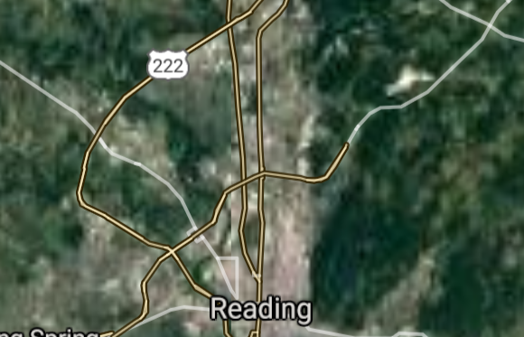
Reading [*elevation ceiling = 40km]Elevation: 78m (Group 205)
UR-100N (SLBM) |
Point A: 39.952584 00
Point B: 40.440625 00
Point C: 40.602294 00
Point D: 42.129224 00
Point E: 40.335648 00(300kt)
Point F: 41.408969 00
|
Point A: -75.165222 00
Point B: -79.995886 00
Point C: -75.471410 00
Point D: -80.085059 00
Point E: -75.926875 00(300kt)
Point F: -75.662412 00
|
|
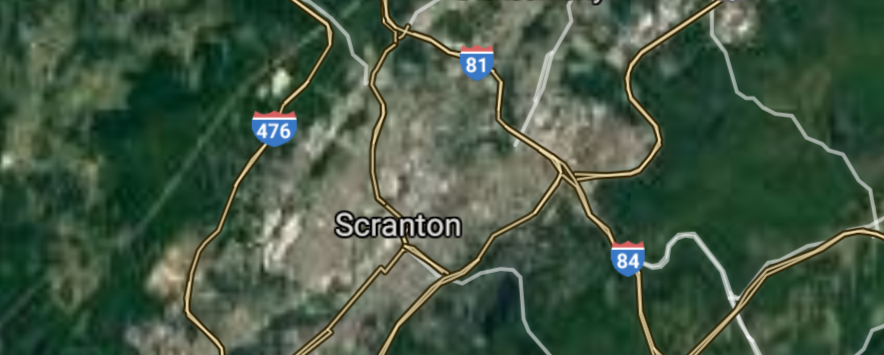
Scranton [*elevation ceiling = 40km]Elevation: 227m (Group 205)
UR-100N (SLBM) |
Point A: 39.952584 00
Point B: 40.440625 00
Point C: 40.602294 00
Point D: 42.129224 00
Point E: 40.335648 00
Point F: 41.408969 00(300kt)
|
Point A: -75.165222 00
Point B: -79.995886 00
Point C: -75.471410 00
Point D: -80.085059 00
Point E: -75.926875 00
Point F: -75.662412 00(300kt)
|
|
Bethlehem [*elevation ceiling = 40km]Elevation: 111m (Group 206)
UR-100N (SLBM) |
Point A: 40.625932 00(300kt)
Point B: 40.037876 00
Point C: 40.273191 00
Point D: 40.518681 00
Point E: 39.962598 00
Point F: 41.245915 00
|
Point A: -75.370458 00(300kt)
Point B: -76.305514 00
Point C: -76.886701 00
Point D: -78.394736 00
Point E: -76.727745 00
Point F: -75.881307 00
|
|
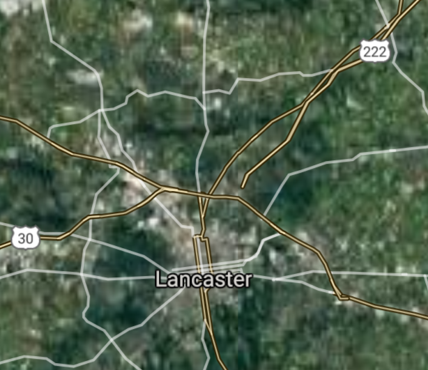
Lancaster [*elevation ceiling = 40km]Elevation: 109m (Group 206)
UR-100N (SLBM) |
Point A: 40.625932 00
Point B: 40.037876 00(300kt)
Point C: 40.273191 00
Point D: 40.518681 00
Point E: 39.962598 00
Point F: 41.245915 00
|
Point A: -75.370458 00
Point B: -76.305514 00(300kt)
Point C: -76.886701 00
Point D: -78.394736 00
Point E: -76.727745 00
Point F: -75.881307 00
|
|
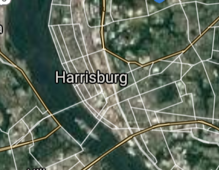
Harrisburg [*elevation ceiling = 40km]Elevation: 107m (Group 206)
UR-100N (SLBM) |
Point A: 40.625932 00
Point B: 40.037876 00
Point C: 40.273191 00(300kt)
Point D: 40.518681 00
Point E: 39.962598 00
Point F: 41.245915 00
|
Point A: -75.370458 00
Point B: -76.305514 00
Point C: -76.886701 00(300kt)
Point D: -78.394736 00
Point E: -76.727745 00
Point F: -75.881307 00
|
|
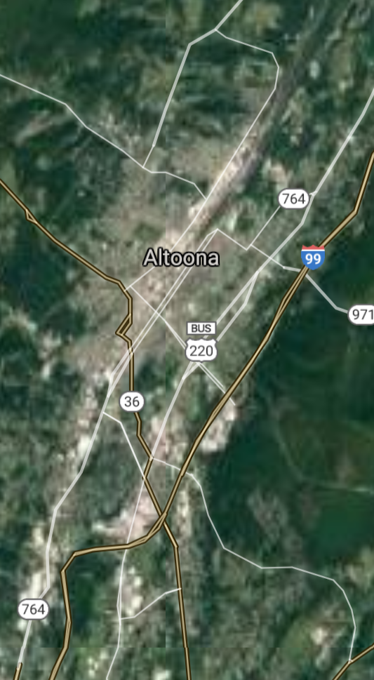
Altoona [*elevation ceiling = 40km]Elevation: 354m (Group 206)
UR-100N (SLBM) |
Point A: 40.625932 00
Point B: 40.037876 00
Point C: 40.273191 00
Point D: 40.518681 00(300kt)
Point E: 39.962598 00
Point F: 41.245915 00
|
Point A: -75.370458 00
Point B: -76.305514 00
Point C: -76.886701 00
Point D: -78.394736 00(300kt)
Point E: -76.727745 00
Point F: -75.881307 00
|
|
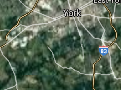
York [*elevation ceiling = 40km]Elevation: 119m (Group 206)
UR-100N (SLBM) |
Point A: 40.625932 00
Point B: 40.037876 00
Point C: 40.273191 00
Point D: 40.518681 00
Point E: 39.962598 00(300kt)
Point F: 41.245915 00
|
Point A: -75.370458 00
Point B: -76.305514 00
Point C: -76.886701 00
Point D: -78.394736 00
Point E: -76.727745 00(300kt)
Point F: -75.881307 00
|
|
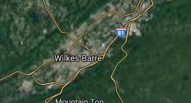
Wilkes-Barre [*elevation ceiling = 40km]Elevation: 167m (Group 206)
UR-100N (SLBM) |
Point A: 40.625932 00
Point B: 40.037876 00
Point C: 40.273191 00
Point D: 40.518681 00
Point E: 39.962598 00
Point F: 41.245915 00(300kt)
|
Point A: -75.370458 00
Point B: -76.305514 00
Point C: -76.886701 00
Point D: -78.394736 00
Point E: -76.727745 00
Point F: -75.881307 00(300kt)
|
|
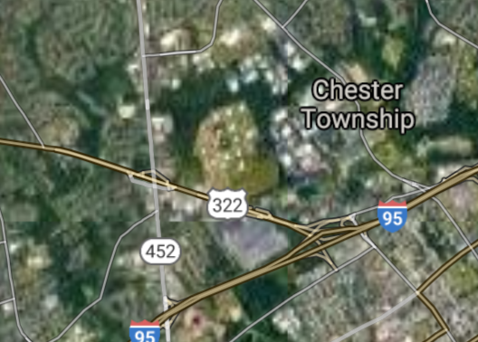
Chester [*elevation ceiling = 40km]Elevation: 3m (Group 207)
UR-100N (SLBM) |
Point A: 39.849557 00(300kt)
Point B: 41.241190 00
Point C: 40.688432 00
Point D: 40.340925 00
Point E: 40.958418 00
Point F: 41.003672 00
|
Point A: -75.355746 00(300kt)
Point B: -77.001079 00
Point C: -75.220732 00
Point D: -76.411350 00
Point E: -75.974647 00
Point F: -80.347009 00
|
|
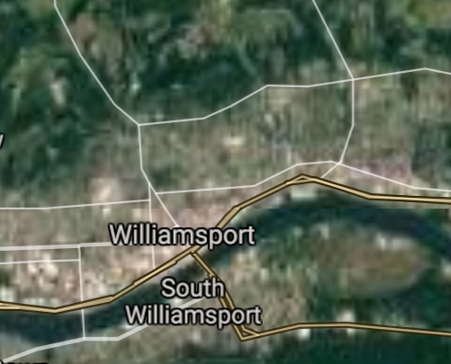
Williamsport [*elevation ceiling = 40km]Elevation: 158m (Group 207)
UR-100N (SLBM) |
Point A: 39.849557 00
Point B: 41.241190 00(300kt)
Point C: 40.688432 00
Point D: 40.340925 00
Point E: 40.958418 00
Point F: 41.003672 00
|
Point A: -75.355746 00
Point B: -77.001079 00(300kt)
Point C: -75.220732 00
Point D: -76.411350 00
Point E: -75.974647 00
Point F: -80.347009 00
|
|
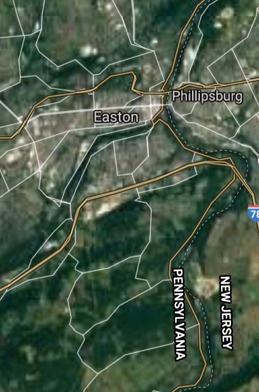
Easton [*elevation ceiling = 40km]Elevation: 101m (Group 207)
UR-100N (SLBM) |
Point A: 39.849557 00
Point B: 41.241190 00
Point C: 40.688432 00(300kt)
Point D: 40.340925 00
Point E: 40.958418 00
Point F: 41.003672 00
|
Point A: -75.355746 00
Point B: -77.001079 00
Point C: -75.220732 00(300kt)
Point D: -76.411350 00
Point E: -75.974647 00
Point F: -80.347009 00
|
|
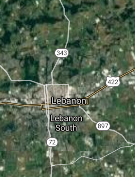
Lebanon [*elevation ceiling = 40km]Elevation: 142m (Group 207)
UR-100N (SLBM) |
Point A: 39.849557 00
Point B: 41.241190 00
Point C: 40.688432 00
Point D: 40.340925 00(300kt)
Point E: 40.958418 00
Point F: 41.003672 00
|
Point A: -75.355746 00
Point B: -77.001079 00
Point C: -75.220732 00
Point D: -76.411350 00(300kt)
Point E: -75.974647 00
Point F: -80.347009 00
|
|
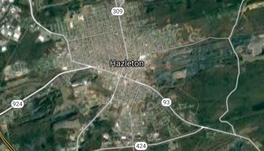
Hazleton [*elevation ceiling = 40km]Elevation: 501m (Group 207)
UR-100N (SLBM) |
Point A: 39.849557 00
Point B: 41.241190 00
Point C: 40.688432 00
Point D: 40.340925 00
Point E: 40.958418 00(300kt)
Point F: 41.003672 00
|
Point A: -75.355746 00
Point B: -77.001079 00
Point C: -75.220732 00
Point D: -76.411350 00
Point E: -75.974647 00(300kt)
Point F: -80.347009 00
|
|
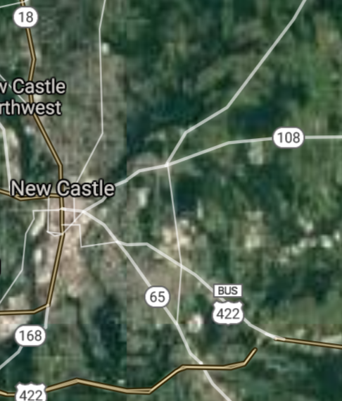
New Castle [*elevation ceiling = 40km]Elevation: 257m (Group 207)
UR-100N (SLBM) |
Point A: 39.849557 00
Point B: 41.241190 00
Point C: 40.688432 00
Point D: 40.340925 00
Point E: 40.958418 00
Point F: 41.003672 00(300kt)
|
Point A: -75.355746 00
Point B: -77.001079 00
Point C: -75.220732 00
Point D: -76.411350 00
Point E: -75.974647 00
Point F: -80.347009 00(300kt)
|
|
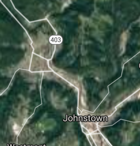
Johnstown [*elevation ceiling = 40km]Elevation: 355m (Group 208)
UR-100N (SLBM) |
Point A: 40.326741 00(300kt)
Point B: 40.347067 00
Point C: 41.233390 00
Point D: 40.301458 00
Point E: 40.685646 00
Point F: 41.233112 00
|
Point A: -78.921970 00(300kt)
Point B: -79.864123 00
Point C: -80.448680 00
Point D: -79.538929 00
Point E: -76.195499 00
Point F: -80.493404 00
|
|
McKeesport [*elevation ceiling = 40km]Elevation: 232m (Group 208)
UR-100N (SLBM) |
Point A: 40.326741 00
Point B: 40.347067 00(300kt)
Point C: 41.233390 00
Point D: 40.301458 00
Point E: 40.685646 00
Point F: 41.233112 00
|
Point A: -78.921970 00
Point B: -79.864123 00(300kt)
Point C: -80.448680 00
Point D: -79.538929 00
Point E: -76.195499 00
Point F: -80.493404 00
|
|
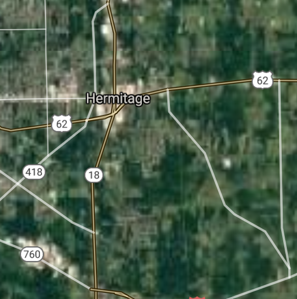
Hermitage [*elevation ceiling = 40km]Elevation: 328m (Group 208)
UR-100N (SLBM) |
Point A: 40.326741 00
Point B: 40.347067 00
Point C: 41.233390 00(300kt)
Point D: 40.301458 00
Point E: 40.685646 00
Point F: 41.233112 00
|
Point A: -78.921970 00
Point B: -79.864123 00
Point C: -80.448680 00(300kt)
Point D: -79.538929 00
Point E: -76.195499 00
Point F: -80.493404 00
|
|
Greensburg [*elevation ceiling = 40km]Elevation: 314m (Group 208)
UR-100N (SLBM) |
Point A: 40.326741 00
Point B: 40.347067 00
Point C: 41.233390 00
Point D: 40.301458 00(300kt)
Point E: 40.685646 00
Point F: 41.233112 00
|
Point A: -78.921970 00
Point B: -79.864123 00
Point C: -80.448680 00
Point D: -79.538929 00(300kt)
Point E: -76.195499 00
Point F: -80.493404 00
|
|
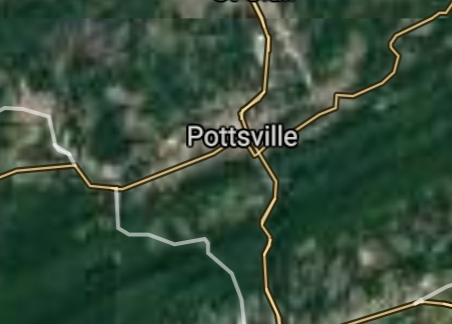
Pottsville [*elevation ceiling = 40km]Elevation: 191m (Group 208)
UR-100N (SLBM) |
Point A: 40.326741 00
Point B: 40.347067 00
Point C: 41.233390 00
Point D: 40.301458 00
Point E: 40.685646 00(300kt)
Point F: 41.233112 00
|
Point A: -78.921970 00
Point B: -79.864123 00
Point C: -80.448680 00
Point D: -79.538929 00
Point E: -76.195499 00(300kt)
Point F: -80.493404 00
|
|
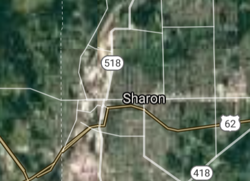
Sharon [*elevation ceiling = 40km]Elevation: 304m (Group 208)
UR-100N (SLBM) |
Point A: 40.326741 00
Point B: 40.347067 00
Point C: 41.233390 00
Point D: 40.301458 00
Point E: 40.685646 00
Point F: 41.233112 00(300kt)
|
Point A: -78.921970 00
Point B: -79.864123 00
Point C: -80.448680 00
Point D: -79.538929 00
Point E: -76.195499 00
Point F: -80.493404 00(300kt)
|
|
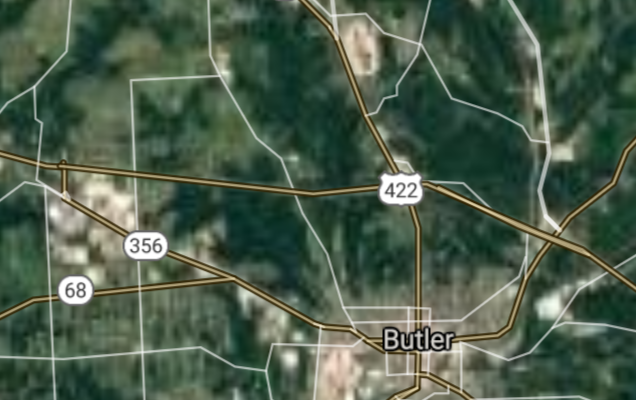
Butler [*elevation ceiling = 40km]Elevation: 318m (Group 209)
UR-100N (SLBM) |
Point A: 40.861176 00(300kt)
Point B: 40.173960 00
Point C: 41.641444 00
Point D: 40.569789 00
Point E: 39.983162 00
Point F: 41.427374 00
|
Point A: -79.895333 00(300kt)
Point B: -80.246171 00
Point C: -80.151448 00
Point D: -79.764771 00
Point E: -75.823835 00
Point F: -78.560940 00
|
|
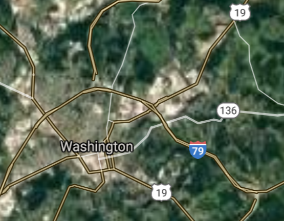
Washington [*elevation ceiling = 40km]Elevation: 359m (Group 209)
UR-100N (SLBM) |
Point A: 40.861176 00
Point B: 40.173960 00(300kt)
Point C: 41.641444 00
Point D: 40.569789 00
Point E: 39.983162 00
Point F: 41.427374 00
|
Point A: -79.895333 00
Point B: -80.246171 00(300kt)
Point C: -80.151448 00
Point D: -79.764771 00
Point E: -75.823835 00
Point F: -78.560940 00
|
|
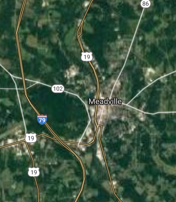
Meadville [*elevation ceiling = 40km]Elevation: 334m (Group 209)
UR-100N (SLBM) |
Point A: 40.861176 00
Point B: 40.173960 00
Point C: 41.641444 00(300kt)
Point D: 40.569789 00
Point E: 39.983162 00
Point F: 41.427374 00
|
Point A: -79.895333 00
Point B: -80.246171 00
Point C: -80.151448 00(300kt)
Point D: -79.764771 00
Point E: -75.823835 00
Point F: -78.560940 00
|
|
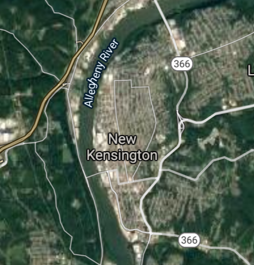
New Kensington [*elevation ceiling = 40km]Elevation: 241m (Group 209)
UR-100N (SLBM) |
Point A: 40.861176 00
Point B: 40.173960 00
Point C: 41.641444 00
Point D: 40.569789 00(300kt)
Point E: 39.983162 00
Point F: 41.427374 00
|
Point A: -79.895333 00
Point B: -80.246171 00
Point C: -80.151448 00
Point D: -79.764771 00(300kt)
Point E: -75.823835 00
Point F: -78.560940 00
|
|
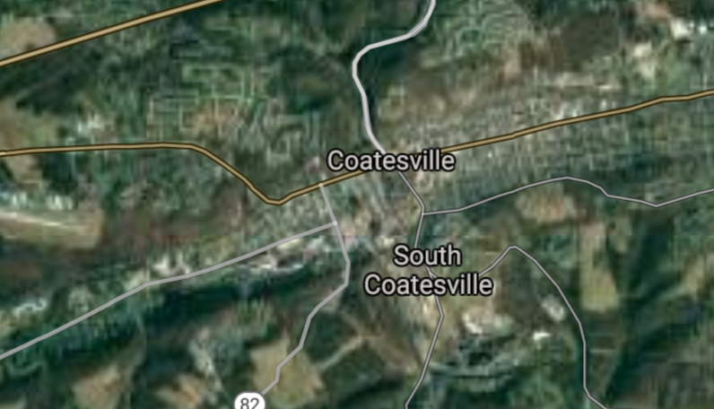
Coatesville [*elevation ceiling = 40km]Elevation: 100m (Group 209)
UR-100N (SLBM) |
Point A: 40.861176 00
Point B: 40.173960 00
Point C: 41.641444 00
Point D: 40.569789 00
Point E: 39.983162 00(300kt)
Point F: 41.427374 00
|
Point A: -79.895333 00
Point B: -80.246171 00
Point C: -80.151448 00
Point D: -79.764771 00
Point E: -75.823835 00(300kt)
Point F: -78.560940 00
|
|
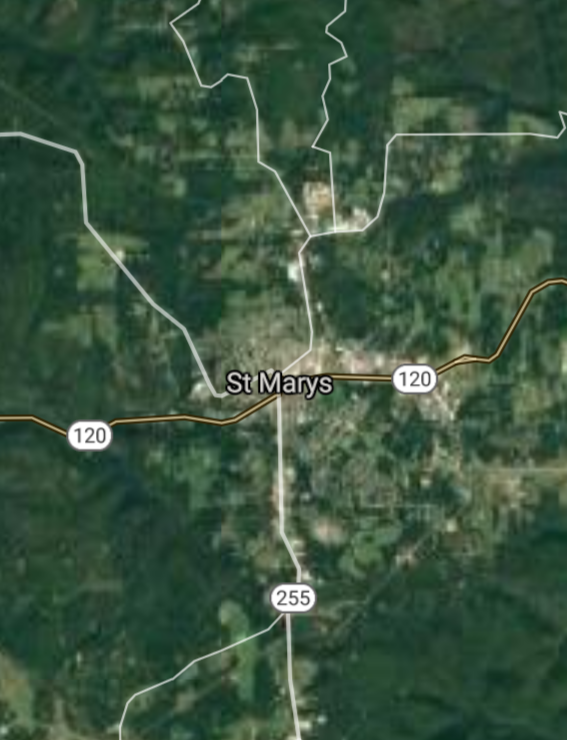
St. Marys [*elevation ceiling = 40km]Elevation: 505m (Group 209)
UR-100N (SLBM) |
Point A: 40.861176 00
Point B: 40.173960 00
Point C: 41.641444 00
Point D: 40.569789 00
Point E: 39.983162 00
Point F: 41.427374 00(300kt)
|
Point A: -79.895333 00
Point B: -80.246171 00
Point C: -80.151448 00
Point D: -79.764771 00
Point E: -75.823835 00
Point F: -78.560940 00(300kt)
|
|
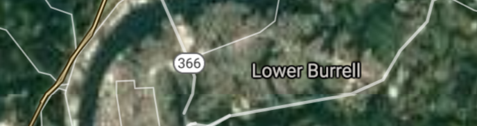
Lower Burrell [*elevation ceiling = 40km]Elevation: 302m (Group 210)
UR-100N (SLBM) |
Point A: 40.584923 00(300kt)
Point B: 41.433948 00
Point C: 41.205360 00
Point D: 39.900076 00
Point E: 40.862585 00
Point F: 41.137013 00
|
Point A: -79.720980 00(300kt)
Point B: -79.706441 00
Point C: -76.004923 00
Point D: -79.716433 00
Point E: -76.794410 00
Point F: -77.446926 00
|
|
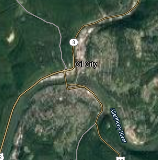
Oil City [*elevation ceiling = 40km]Elevation: 310m (Group 210)
UR-100N (SLBM) |
Point A: 40.584923 00
Point B: 41.433948 00(300kt)
Point C: 41.205360 00
Point D: 39.900076 00
Point E: 40.862585 00
Point F: 41.137013 00
|
Point A: -79.720980 00
Point B: -79.706441 00(300kt)
Point C: -76.004923 00
Point D: -79.716433 00
Point E: -76.794410 00
Point F: -77.446926 00
|
|
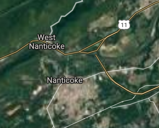
Nanticoke [*elevation ceiling = 40km]Elevation: 170m (Group 210)
UR-100N (SLBM) |
Point A: 40.584923 00
Point B: 41.433948 00
Point C: 41.205360 00(300kt)
Point D: 39.900076 00
Point E: 40.862585 00
Point F: 41.137013 00
|
Point A: -79.720980 00
Point B: -79.706441 00
Point C: -76.004923 00(300kt)
Point D: -79.716433 00
Point E: -76.794410 00
Point F: -77.446926 00
|
|
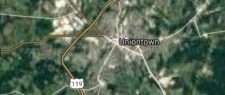
Uniontown [*elevation ceiling = 40km]Elevation: 326m (Group 210)
UR-100N (SLBM) |
Point A: 40.584923 00
Point B: 41.433948 00
Point C: 41.205360 00
Point D: 39.900076 00(300kt)
Point E: 40.862585 00
Point F: 41.137013 00
|
Point A: -79.720980 00
Point B: -79.706441 00
Point C: -76.004923 00
Point D: -79.716433 00(300kt)
Point E: -76.794410 00
Point F: -77.446926 00
|
|
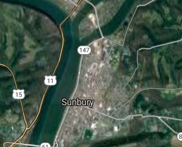
Sunbury [*elevation ceiling = 40km]Elevation: 136m (Group 210)
UR-100N (SLBM) |
Point A: 40.584923 00
Point B: 41.433948 00
Point C: 41.205360 00
Point D: 39.900076 00
Point E: 40.862585 00(300kt)
Point F: 41.137013 00
|
Point A: -79.720980 00
Point B: -79.706441 00
Point C: -76.004923 00
Point D: -79.716433 00
Point E: -76.794410 00(300kt)
Point F: -77.446926 00
|
|
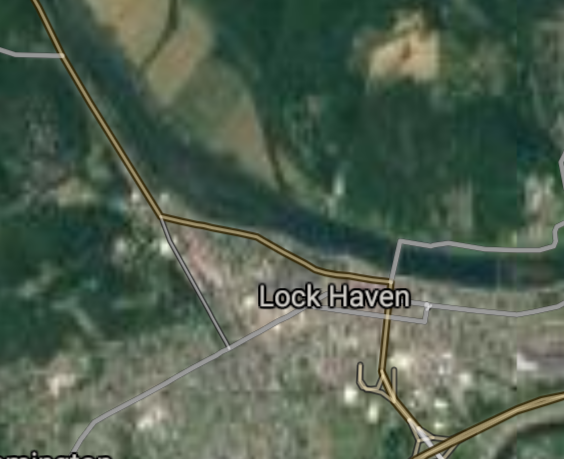
Lock Haven [*elevation ceiling = 40km]Elevation: 170m (Group 210)
UR-100N (SLBM) |
Point A: 40.584923 00
Point B: 41.433948 00
Point C: 41.205360 00
Point D: 39.900076 00
Point E: 40.862585 00
Point F: 41.137013 00(300kt)
|
Point A: -79.720980 00
Point B: -79.706441 00
Point C: -76.004923 00
Point D: -79.716433 00
Point E: -76.794410 00
Point F: -77.446926 00(300kt)
|
|
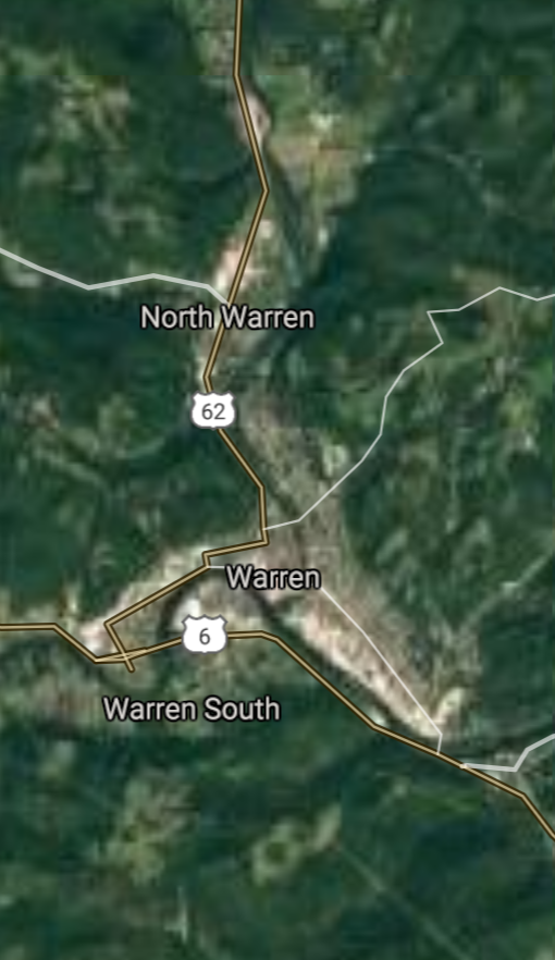
Warren [*elevation ceiling = 40km]Elevation: 361m (Group 211)
UR-100N (SLBM) |
Point A: 41.843949 00(300kt)
Point B: 40.328125 00
Point C: 40.615537 00
Point D: 40.752010 00
Point E: 40.321181 00
Point F: 41.573694 00
|
Point A: -79.145044 00(300kt)
Point B: -79.615320 00
Point C: -80.262185 00
Point D: -80.319230 00
Point E: -79.379481 00
Point F: -75.501851 00
|
|
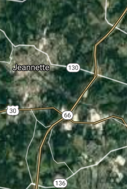
Jeannette [*elevation ceiling = 40km]Elevation: 315m (Group 211)
UR-100N (SLBM) |
Point A: 41.843949 00
Point B: 40.328125 00(300kt)
Point C: 40.615537 00
Point D: 40.752010 00
Point E: 40.321181 00
Point F: 41.573694 00
|
Point A: -79.145044 00
Point B: -79.615320 00(300kt)
Point C: -80.262185 00
Point D: -80.319230 00
Point E: -79.379481 00
Point F: -75.501851 00
|
|
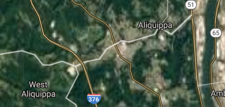
Aliquippa [*elevation ceiling = 40km]Elevation: 253m (Group 211)
UR-100N (SLBM) |
Point A: 41.843949 00
Point B: 40.328125 00
Point C: 40.615537 00(300kt)
Point D: 40.752010 00
Point E: 40.321181 00
Point F: 41.573694 00
|
Point A: -79.145044 00
Point B: -79.615320 00
Point C: -80.262185 00(300kt)
Point D: -80.319230 00
Point E: -79.379481 00
Point F: -75.501851 00
|
|
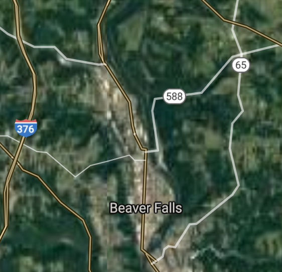
Beaver Falls [*elevation ceiling = 40km]Elevation: 243m (Group 211)
UR-100N (SLBM) |
Point A: 41.843949 00
Point B: 40.328125 00
Point C: 40.615537 00
Point D: 40.752010 00(300kt)
Point E: 40.321181 00
Point F: 41.573694 00
|
Point A: -79.145044 00
Point B: -79.615320 00
Point C: -80.262185 00
Point D: -80.319230 00(300kt)
Point E: -79.379481 00
Point F: -75.501851 00
|
|
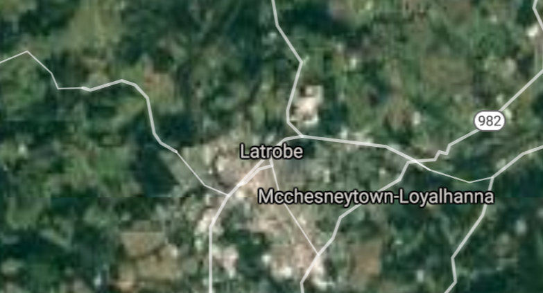
Latrobe [*elevation ceiling = 40km]Elevation: 310m (Group 211)
UR-100N (SLBM) |
Point A: 41.843949 00
Point B: 40.328125 00
Point C: 40.615537 00
Point D: 40.752010 00
Point E: 40.321181 00(300kt)
Point F: 41.573694 00
|
Point A: -79.145044 00
Point B: -79.615320 00
Point C: -80.262185 00
Point D: -80.319230 00
Point E: -79.379481 00(300kt)
Point F: -75.501851 00
|
|
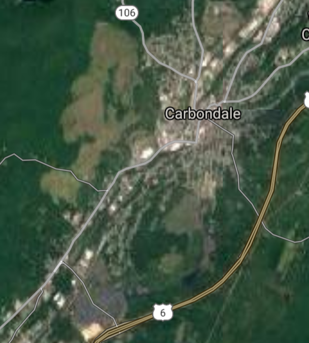
Carbondale [*elevation ceiling = 40km]Elevation: 324m (Group 211)
UR-100N (SLBM) |
Point A: 41.843949 00
Point B: 40.328125 00
Point C: 40.615537 00
Point D: 40.752010 00
Point E: 40.321181 00
Point F: 41.573694 00(300kt)
|
Point A: -79.145044 00
Point B: -79.615320 00
Point C: -80.262185 00
Point D: -80.319230 00
Point E: -79.379481 00
Point F: -75.501851 00(300kt)
|
|
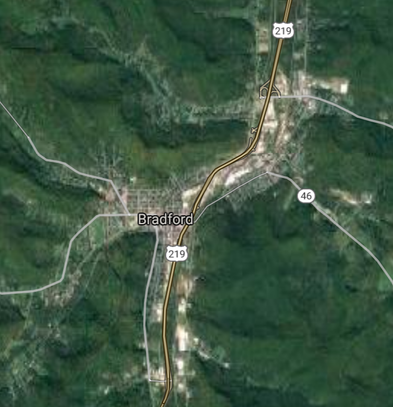
Bradford [*elevation ceiling = 40km]Elevation: 439m (Group 212)
UR-100N (SLBM) |
Point A: 41.956495 00(300kt)
Point B: 41.121012 00
Point C: 41.325913 00
Point D: 40.148405 00
Point E: 40.017852 00
Point F: 40.788975 00
|
Point A: -78.649163 00(300kt)
Point B: -78.758326 00
Point C: -75.789360 00
Point D: -79.887825 00
Point E: -79.589483 00
Point F: -76.558847 00
|
|
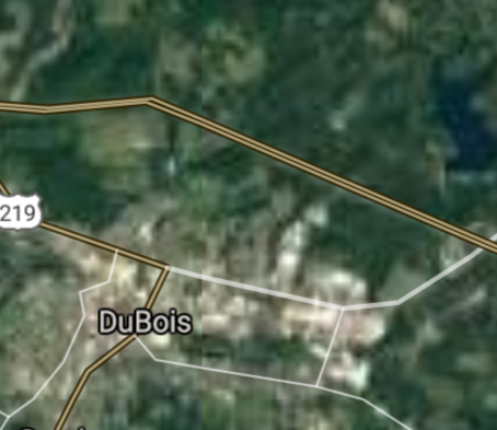
DuBois [*elevation ceiling = 40km]Elevation: 427m (Group 212)
UR-100N (SLBM) |
Point A: 41.956495 00
Point B: 41.121012 00(300kt)
Point C: 41.325913 00
Point D: 40.148405 00
Point E: 40.017852 00
Point F: 40.788975 00
|
Point A: -78.649163 00
Point B: -78.758326 00(300kt)
Point C: -75.789360 00
Point D: -79.887825 00
Point E: -79.589483 00
Point F: -76.558847 00
|
|
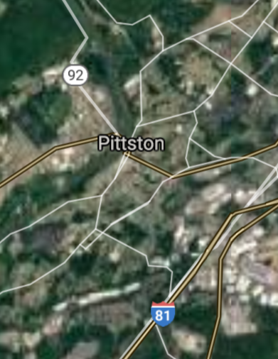
Pittston [*elevation ceiling = 40km]Elevation: 178m (Group 212)
UR-100N (SLBM) |
Point A: 41.956495 00
Point B: 41.121012 00
Point C: 41.325913 00(300kt)
Point D: 40.148405 00
Point E: 40.017852 00
Point F: 40.788975 00
|
Point A: -78.649163 00
Point B: -78.758326 00
Point C: -75.789360 00(300kt)
Point D: -79.887825 00
Point E: -79.589483 00
Point F: -76.558847 00
|
|
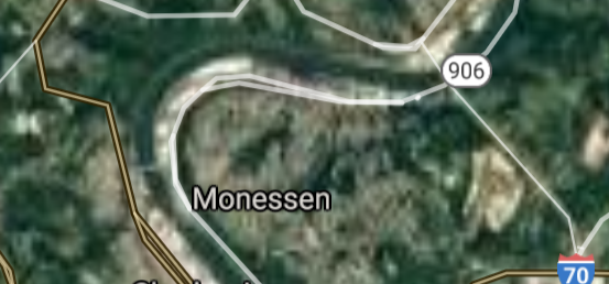
Monessen [*elevation ceiling = 40km]Elevation: 343m (Group 212)
UR-100N (SLBM) |
Point A: 41.956495 00
Point B: 41.121012 00
Point C: 41.325913 00
Point D: 40.148405 00(300kt)
Point E: 40.017852 00
Point F: 40.788975 00
|
Point A: -78.649163 00
Point B: -78.758326 00
Point C: -75.789360 00
Point D: -79.887825 00(300kt)
Point E: -79.589483 00
Point F: -76.558847 00
|
|
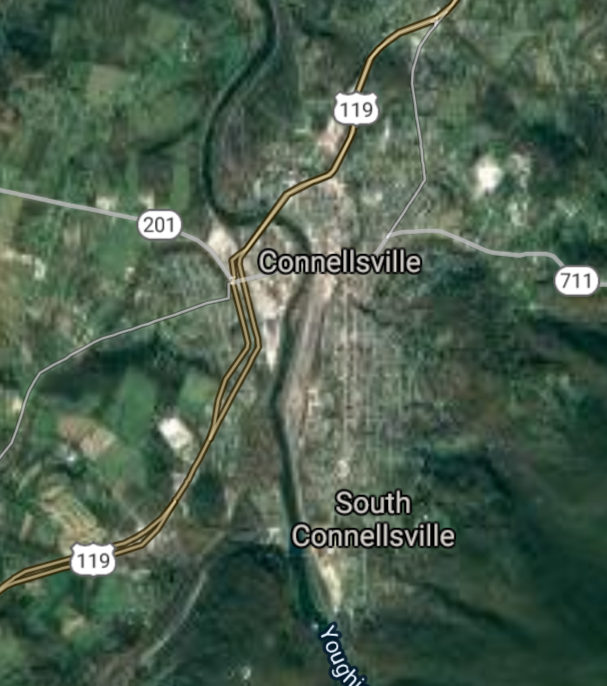
Connellsville [*elevation ceiling = 40km]Elevation: 280m (Group 212)
UR-100N (SLBM) |
Point A: 41.956495 00
Point B: 41.121012 00
Point C: 41.325913 00
Point D: 40.148405 00
Point E: 40.017852 00(300kt)
Point F: 40.788975 00
|
Point A: -78.649163 00
Point B: -78.758326 00
Point C: -75.789360 00
Point D: -79.887825 00
Point E: -79.589483 00(300kt)
Point F: -76.558847 00
|
|
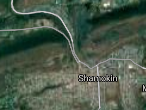
Shamokin [*elevation ceiling = 40km]Elevation: 220m (Group 212)
UR-100N (SLBM) |
Point A: 41.956495 00
Point B: 41.121012 00
Point C: 41.325913 00
Point D: 40.148405 00
Point E: 40.017852 00
Point F: 40.788975 00(300kt)
|
Point A: -78.649163 00
Point B: -78.758326 00
Point C: -75.789360 00
Point D: -79.887825 00
Point E: -79.589483 00
Point F: -76.558847 00(300kt)
|


[Top]
Open START: Central Basin
"BRICS Security Council emerging from cross-currency evaluations"
OPEN Start: Central Basin - is an engineering vessel which is proven with climate security in evaluation of the USD/YEN currency pair. Annually, climate security is leading economic growth in key emerging markets surrounding the Four Asian Tigers. Affordably, the following industries extend opportunities for military cooperation: aerospace, telecommunications, finance and banking. OPEN Start: Central Basin strengthens the backbone for international security beyond the shadows of USD/YEN controversy. Traversely, OPEN Start: Central Basin offsets the cross-over gap between the USD/MXN and USD/RUB exchange rates. Notably, the Three Amigas form an economic alliance in the Far West through joint-cooperation projects from Venture 1, Venture LA and Venture SF which all extend with the Far North reach towards the Far South (as illustrated below).
![]()
![]()
![]()
![]()
![]()
![]()
![]()
![]()
![]()
JanuaryFebruaryMarchAprilJuneJulySeptemberOctoberDecember |
2026 Group Drills - Schedule
|
|

JanuaryFebruaryJuneJulyAugustOctoberNovemberDecember |
2026 Group Drills - Schedule
|
|

JanuaryFebruaryJuneJulySeptemberOctoberNovemberDecember |
2026 Group Drills - Schedule
|
|
