

 OPEN Start


 Hollywood, JSC
Mendocino, JSC
LA SOCIETY
SF SOCIETY
NY SOCIETY
Open START Drills
Hollywood, JSC
Mendocino, JSC
LA SOCIETY
SF SOCIETY
NY SOCIETY
Open START Drills
Talk Daily Commodities Review LATPACT Open Market Equities Report Currency Central
 Situation: US
 |

|

|

|
|
 SOCIETY Trust Fund LATPACT Trust Fund LATPACT Open Market Far West (SEZ) Trust RIM of Nations Trust
Arctic Pact Trade Zone | Upper Rhine Zone | Lower Rhine Zone | Middle Rhone Basin
| Level 2 - Open START/*Super Grid |
| Level 3 - Stellar Fields |


Climate Central News & Information
 "US attempts to salvage the European Order with a K-9 Squad clan style coalition"
Population Conversations: 4,095,546
Planet Power Seconds
 BRICS Security Council
 Military cooperation is exceedingly pressing ahead in notable markets from China, Russia and India which include achieving greater milestones within the technology, communications, and aerospace industries. Vastly, multi-national alliances continue to expand as relying on new protocols oppose resistance with deregulation in the spheres of international security and terrorism. As a result, the BRICS Security Council is forming several key initiatives from climate security to preserve and harness the skills with establishing a polar-arc posture in outer space.
In contrast, a grave decline in NATO has been detected. In early 2018, UNITED STATES ARMY COMMANDER, GENERAL CURTIS M. SCAPARROTTI delivered the posture statement for NATO. He stated, "As our most significant trading partner, Europe is vital to promoting American prosperity. With shared history and values, Europe is also a critical partner in advancing American influence throughout the world. The North Atlantic Treaty Organization (NATO) enables us to preserve peace through strength as alliance unity fundamentally deters the aggression of potential adversaries." Meanwhile, NATO readiness is faltering in Europe as lack of training, inadequate funding and outdated equipment persist over the Brexit strategy.
United Nations Command: AUKUSA/Quad 4
 Extensively, the Central Basin is transforming international security while disabling NATO, AUKUSA and the Quad 4 military alliances with the Open START Hawaii and Open START Alaska drills. Inherently, the Central Basin fleet suppresses the UN Command over security backlogs as the Global South impedes expansion for the Japanese yen. Economically, the US dollar bounds NATO, AUKUSA and the Quad 4 alliances under one entity in the wake of the 2007 housing crises, COVID-19 recovery and war in Ukraine. Generously, the Upper Rhine pass bridges the Open START Hawaii and Open START Alaska drills which stabilize international and climate security. Uniquely, Open START drills for the Upper Rhine pass pegs the value of the Japanese yen and Korean Won to the Chinese yuan, Indian rupee, Russian ruble, and Mexican peso to enable economic transformation for the Central Basin region. Effectively, the Open START drill secures the yen in cooperation with the Global South as significant growth on the New Silk Road Economic Belt extends in Africa. Suitably, the Open START drill baffles the UN Command with the Upper Rhine pass as the historical value is at stake. Judiciously, the Open START drill isolates the UN Command over Level 1 protocol which underpins NATO, AUKUSA and the Quad 4 military alliances to Celtic Briton tribes.
The OSCE and NATO: From the Arctic Circle
 Historically, military conflicts include land navigation rivalry which is significant for the Lower Rhine corridor as tensions between the Eastern and Western hemisphere ignite over political testimony. Substantially, the US has interspersed armed forces in the EU with the connivance of NATO and the OSCE to subjugate the Arctic Circle and dominate international trade from the Middle East. Tacitly, the OSCE is equipped to engineer early warnings, conflict resolution and crisis management over military tensions with NATO to inseminate the world order of law and justice. Decisively, the Open START Iceland drill unify the corners of the world to combat the historical West from the Arctic Circle over climate security, war crimes and crimes against humanity. Particularly, normalized ties to Israel for the Lower Rhine corridor weighs over rising Eastern influence from the Near East which is a major factor in the Open START Iceland drill. Efficiently, the Open START Iceland drill balances political, economic and military parity between the historical East and West which is threatened from the incumbency of trade sanctions and escalating military tensions in the West.
*Schedule of Nuclear Attack
Be advised: The specific plan of attack for Ohio is sensitive and will be posted here closer to its scheduled strike.
Ohio
AL* | AZ* | AR* | CO | CT | DE | FL | GA | ID | IN | IA | KS | KY | LA | ME |
MA | MI | MN | MO | MT | NE | NV | NH | NJ | NM | NY | NC | ND | OH | OK | OR | PA | RI | SC
SD | TN | UT | VA (DC)** | VT** | WV** | WI** | WY**
*Central Fleet South  Bulava + RT23 Cadet + Vysota3
Team: Memphis Fire (Local Area Control)
**Central Fleet North Bulava + Surya + Vysota3
Open START (RKS) |
Groups UR181 - UR188 | *300kt | Millineum Power *4,000 MW
Level 1 - WA Dong (SIT.2) 
Ohio |
Latitude Coordinate |
Longitude Coordinate |
|
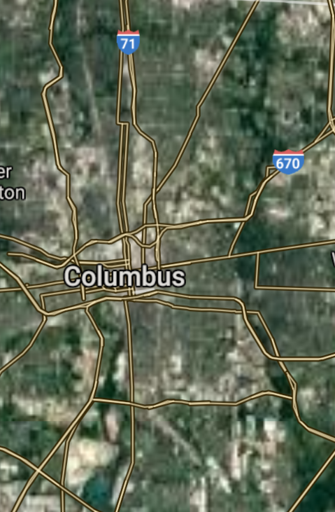
Columbus [*elevation ceiling = 40km]Elevation: 238m (Group 181)
UR-100N (SLBM) |
Point A: 39.961176 00(300kt)
Point B: 41.499320 00
Point C: 39.103118 00
Point D: 41.652805 00
Point E: 41.081445 00
Point F: 39.758948 00
Open START Passages |
Point A: -82.998794 00(300kt)
Point B: -81.694361 00
Point C: -84.512020 00
Point D: -83.537867 00
Point E: -81.519005 00
Point F: -84.191607 00
Demonstration |
|
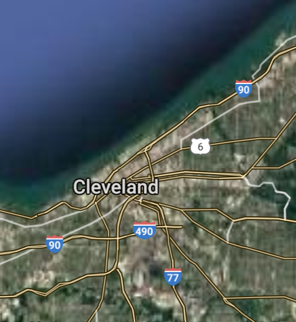
Cleveland [*elevation ceiling = 40km]Elevation: 200m (Group 181)
UR-100N (SLBM) |
Point A: 39.961176 00
Point B: 41.499320 00(300kt)
Point C: 39.103118 00
Point D: 41.652805 00
Point E: 41.081445 00
Point F: 39.758948 00
|
Point A: -82.998794 00
Point B: -81.694361 00(300kt)
Point C: -84.512020 00
Point D: -83.537867 00
Point E: -81.519005 00
Point F: -84.191607 00
|
|
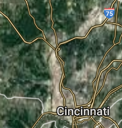
Cincinnati [*elevation ceiling = 40km]Elevation: 168m (Group 181)
UR-100N (SLBM) |
Point A: 39.961176 00
Point B: 41.499320 00
Point C: 39.103118 00(300kt)
Point D: 41.652805 00
Point E: 41.081445 00
Point F: 39.758948 00
|
Point A: -82.998794 00
Point B: -81.694361 00
Point C: -84.512020 00(300kt)
Point D: -83.537867 00
Point E: -81.519005 00
Point F: -84.191607 00
|
|
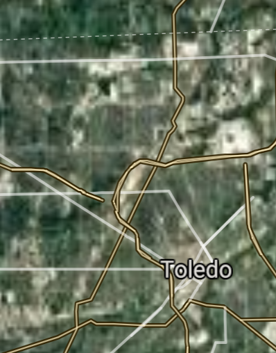
Toledo [*elevation ceiling = 40km]Elevation: 179m (Group 181)
UR-100N (SLBM) |
Point A: 39.961176 00
Point B: 41.499320 00
Point C: 39.103118 00
Point D: 41.652805 00(300kt)
Point E: 41.081445 00
Point F: 39.758948 00
|
Point A: -82.998794 00
Point B: -81.694361 00
Point C: -84.512020 00
Point D: -83.537867 00(300kt)
Point E: -81.519005 00
Point F: -84.191607 00
|
|
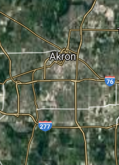
Akron [*elevation ceiling = 40km]Elevation: 293m (Group 181)
UR-100N (SLBM) |
Point A: 39.961176 00
Point B: 41.499320 00
Point C: 39.103118 00
Point D: 41.652805 00
Point E: 41.081445 00(300kt)
Point F: 39.758948 00
|
Point A: -82.998794 00
Point B: -81.694361 00
Point C: -84.512020 00
Point D: -83.537867 00
Point E: -81.519005 00(300kt)
Point F: -84.191607 00
|
|
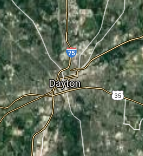
Dayton [*elevation ceiling = 40km]Elevation: 226m (Group 181)
UR-100N (SLBM) |
Point A: 39.961176 00
Point B: 41.499320 00
Point C: 39.103118 00
Point D: 41.652805 00
Point E: 41.081445 00
Point F: 39.758948 00(300kt)
|
Point A: -82.998794 00
Point B: -81.694361 00
Point C: -84.512020 00
Point D: -83.537867 00
Point E: -81.519005 00
Point F: -84.191607 00(300kt)
|
|
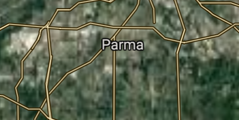
Parma [*elevation ceiling = 40km]Elevation: 263m (Group 182)
UR-100N (SLBM) |
Point A: 41.404774 00(300kt)
Point B: 40.798947 00
Point C: 41.099780 00
Point D: 41.452819 00
Point E: 39.399501 00
Point F: 39.924227 00
|
Point A: -81.722909 00(300kt)
Point B: -81.378447 00
Point C: -80.649519 00
Point D: -82.182375 00
Point E: -84.561335 00
Point F: -83.808817 00
|
|
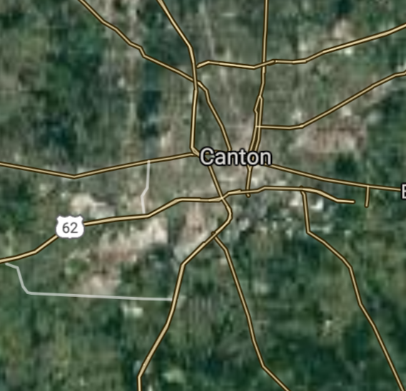
Canton [*elevation ceiling = 40km]Elevation: 322m (Group 182)
UR-100N (SLBM) |
Point A: 41.404774 00
Point B: 40.798947 00(300kt)
Point C: 41.099780 00
Point D: 41.452819 00
Point E: 39.399501 00
Point F: 39.924227 00
|
Point A: -81.722909 00
Point B: -81.378447 00(300kt)
Point C: -80.649519 00
Point D: -82.182375 00
Point E: -84.561335 00
Point F: -83.808817 00
|
|
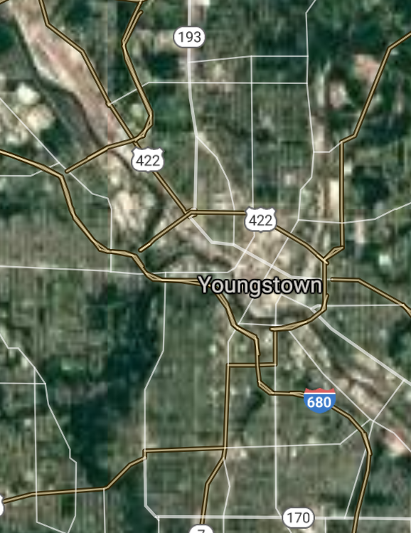
Youngstown [*elevation ceiling = 40km]Elevation: 261m (Group 182)
UR-100N (SLBM) |
Point A: 41.404774 00
Point B: 40.798947 00
Point C: 41.099780 00(300kt)
Point D: 41.452819 00
Point E: 39.399501 00
Point F: 39.924227 00
|
Point A: -81.722909 00
Point B: -81.378447 00
Point C: -80.649519 00(300kt)
Point D: -82.182375 00
Point E: -84.561335 00
Point F: -83.808817 00
|
|
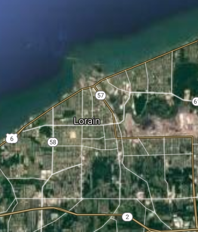
Lorain [*elevation ceiling = 40km]Elevation: 186m (Group 182)
UR-100N (SLBM) |
Point A: 41.404774 00
Point B: 40.798947 00
Point C: 41.099780 00
Point D: 41.452819 00(300kt)
Point E: 39.399501 00
Point F: 39.924227 00
|
Point A: -81.722909 00
Point B: -81.378447 00
Point C: -80.649519 00
Point D: -82.182375 00(300kt)
Point E: -84.561335 00
Point F: -83.808817 00
|
|
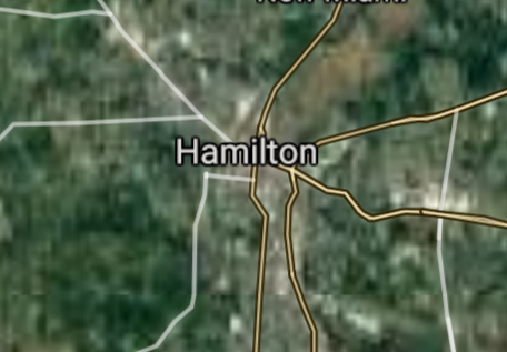
Hamilton [*elevation ceiling = 40km]Elevation: 182m (Group 182)
UR-100N (SLBM) |
Point A: 41.404774 00
Point B: 40.798947 00
Point C: 41.099780 00
Point D: 41.452819 00
Point E: 39.399501 00(300kt)
Point F: 39.924227 00
|
Point A: -81.722909 00
Point B: -81.378447 00
Point C: -80.649519 00
Point D: -82.182375 00
Point E: -84.561335 00(300kt)
Point F: -83.808817 00
|
|
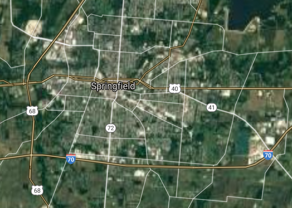
Springfield [*elevation ceiling = 40km]Elevation: 297m (Group 182)
UR-100N (SLBM) |
Point A: 41.404774 00
Point B: 40.798947 00
Point C: 41.099780 00
Point D: 41.452819 00
Point E: 39.399501 00
Point F: 39.924227 00(300kt)
|
Point A: -81.722909 00
Point B: -81.378447 00
Point C: -80.649519 00
Point D: -82.182375 00
Point E: -84.561335 00
Point F: -83.808817 00(300kt)
|
|
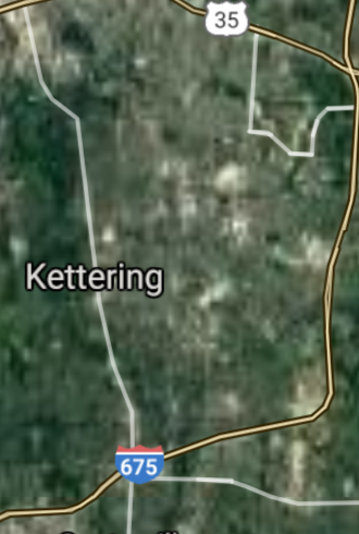
Kettering [*elevation ceiling = 40km]Elevation: 307m (Group 183)
UR-100N (SLBM) |
Point A: 39.689504 00(300kt)
Point B: 41.368380 00
Point C: 41.481993 00
Point D: 41.133945 00
Point E: 41.593105 00
Point F: 39.515058 00
|
Point A: -84.168827 00(300kt)
Point B: -82.107649 00
Point C: -81.798191 00
Point D: -81.484558 00
Point E: -81.526787 00
Point F: -84.398276 00
|
|
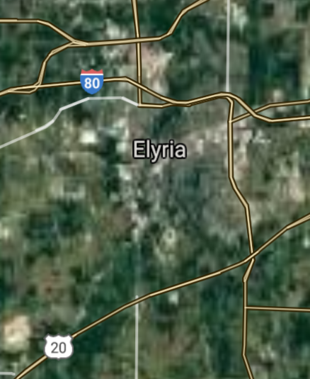
Elyria [*elevation ceiling = 40km]Elevation: 224m (Group 183)
UR-100N (SLBM) |
Point A: 39.689504 00
Point B: 41.368380 00(300kt)
Point C: 41.481993 00
Point D: 41.133945 00
Point E: 41.593105 00
Point F: 39.515058 00
|
Point A: -84.168827 00
Point B: -82.107649 00(300kt)
Point C: -81.798191 00
Point D: -81.484558 00
Point E: -81.526787 00
Point F: -84.398276 00
|
|
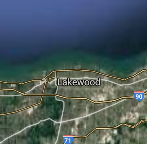
Lakewood [*elevation ceiling = 40km]Elevation: 214m (Group 183)
UR-100N (SLBM) |
Point A: 39.689504 00
Point B: 41.368380 00
Point C: 41.481993 00(300kt)
Point D: 41.133945 00
Point E: 41.593105 00
Point F: 39.515058 00
|
Point A: -84.168827 00
Point B: -82.107649 00
Point C: -81.798191 00(300kt)
Point D: -81.484558 00
Point E: -81.526787 00
Point F: -84.398276 00
|
|
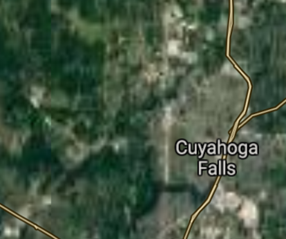
Cuyahoga Falls [*elevation ceiling = 40km]Elevation: 313m (Group 183)
UR-100N (SLBM) |
Point A: 39.689504 00
Point B: 41.368380 00
Point C: 41.481993 00
Point D: 41.133945 00(300kt)
Point E: 41.593105 00
Point F: 39.515058 00
|
Point A: -84.168827 00
Point B: -82.107649 00
Point C: -81.798191 00
Point D: -81.484558 00(300kt)
Point E: -81.526787 00
Point F: -84.398276 00
|
|
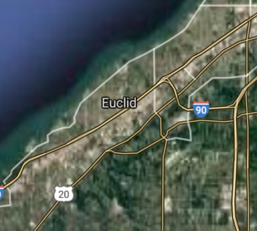
Euclid [*elevation ceiling = 40km]Elevation: 188m (Group 183)
UR-100N (SLBM) |
Point A: 39.689504 00
Point B: 41.368380 00
Point C: 41.481993 00
Point D: 41.133945 00
Point E: 41.593105 00(300kt)
Point F: 39.515058 00
|
Point A: -84.168827 00
Point B: -82.107649 00
Point C: -81.798191 00
Point D: -81.484558 00
Point E: -81.526787 00(300kt)
Point F: -84.398276 00
|
|
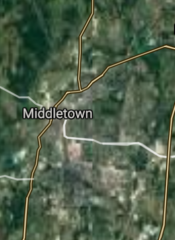
Middletown [*elevation ceiling = 40km]Elevation: 200m (Group 183)
UR-100N (SLBM) |
Point A: 39.689504 00
Point B: 41.368380 00
Point C: 41.481993 00
Point D: 41.133945 00
Point E: 41.593105 00
Point F: 39.515058 00(300kt)
|
Point A: -84.168827 00
Point B: -82.107649 00
Point C: -81.798191 00
Point D: -81.484558 00
Point E: -81.526787 00
Point F: -84.398276 00(300kt)
|
|
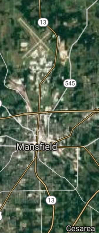
Mansfield [*elevation ceiling = 40km]Elevation: 378m (Group 184)
UR-100N (SLBM) |
Point A: 40.758390 00(300kt)
Point B: 40.058121 00
Point C: 41.666157 00
Point D: 41.520052 00
Point E: 39.709226 00
Point F: 41.314497 00
|
Point A: -82.515447 00(300kt)
Point B: -82.401264 00
Point C: -81.339552 00
Point D: -81.556235 00
Point E: -84.063268 00
Point F: -81.835690 00
|
|
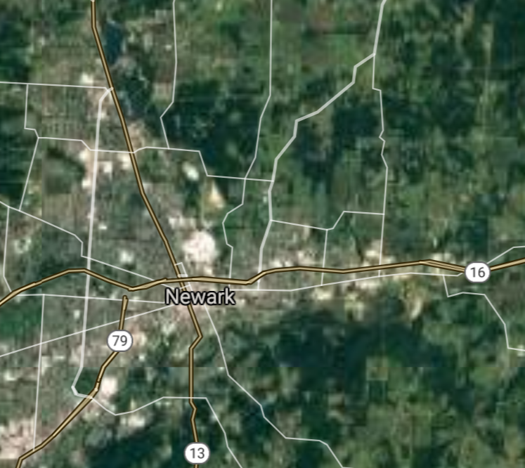
Newark [*elevation ceiling = 40km]Elevation: 254m (Group 184)
UR-100N (SLBM) |
Point A: 40.758390 00
Point B: 40.058121 00(300kt)
Point C: 41.666157 00
Point D: 41.520052 00
Point E: 39.709226 00
Point F: 41.314497 00
|
Point A: -82.515447 00
Point B: -82.401264 00(300kt)
Point C: -81.339552 00
Point D: -81.556235 00
Point E: -84.063268 00
Point F: -81.835690 00
|
|
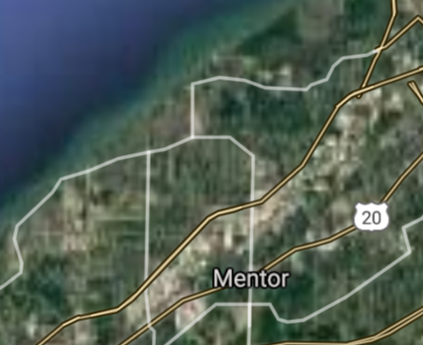
Mentor [*elevation ceiling = 40km]Elevation: 211m (Group 184)
UR-100N (SLBM) |
Point A: 40.758390 00
Point B: 40.058121 00
Point C: 41.666157 00(300kt)
Point D: 41.520052 00
Point E: 39.709226 00
Point F: 41.314497 00
|
Point A: -82.515447 00
Point B: -82.401264 00
Point C: -81.339552 00(300kt)
Point D: -81.556235 00
Point E: -84.063268 00
Point F: -81.835690 00
|
|
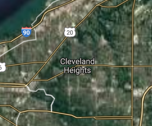
Cleveland Heights [*elevation ceiling = 40km]Elevation: 287m (Group 184)
UR-100N (SLBM) |
Point A: 40.758390 00
Point B: 40.058121 00
Point C: 41.666157 00
Point D: 41.520052 00(300kt)
Point E: 39.709226 00
Point F: 41.314497 00
|
Point A: -82.515447 00
Point B: -82.401264 00
Point C: -81.339552 00
Point D: -81.556235 00(300kt)
Point E: -84.063268 00
Point F: -81.835690 00
|
|
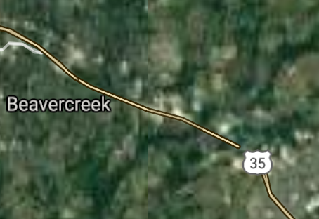
Beavercreek [*elevation ceiling = 40km]Elevation: 267m (Group 184)
UR-100N (SLBM) |
Point A: 40.758390 00
Point B: 40.058121 00
Point C: 41.666157 00
Point D: 41.520052 00
Point E: 39.709226 00(300kt)
Point F: 41.314497 00
|
Point A: -82.515447 00
Point B: -82.401264 00
Point C: -81.339552 00
Point D: -81.556235 00
Point E: -84.063268 00(300kt)
Point F: -81.835690 00
|
|
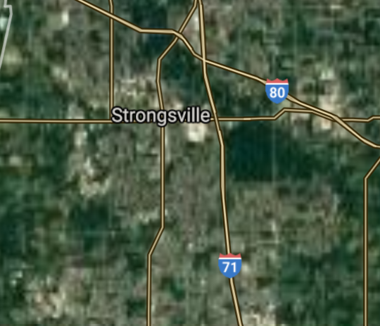
Strongsville [*elevation ceiling = 40km]Elevation: 284m (Group 184)
UR-100N (SLBM) |
Point A: 40.758390 00
Point B: 40.058121 00
Point C: 41.666157 00
Point D: 41.520052 00
Point E: 39.709226 00
Point F: 41.314497 00(300kt)
|
Point A: -82.515447 00
Point B: -82.401264 00
Point C: -81.339552 00
Point D: -81.556235 00
Point E: -84.063268 00
Point F: -81.835690 00(300kt)
|
|
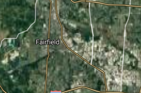
Fairfield [*elevation ceiling = 40km]Elevation: 181m (Group 185)
UR-100N (SLBM) |
Point A: 39.345467 00(300kt)
Point B: 40.099229 00
Point C: 41.237557 00
Point D: 41.044220 00
Point E: 39.713675 00
Point F: 40.742551 00
|
Point A: -84.560319 00(300kt)
Point B: -83.114077 00
Point C: -80.818417 00
Point D: -83.649932 00
Point E: -82.599329 00
Point F: -84.105226 00
|
|
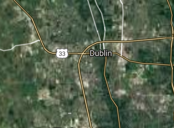
Dublin [*elevation ceiling = 40km]Elevation: 253m (Group 185)
UR-100N (SLBM) |
Point A: 39.345467 00
Point B: 40.099229 00(300kt)
Point C: 41.237557 00
Point D: 41.044220 00
Point E: 39.713675 00
Point F: 40.742551 00
|
Point A: -84.560319 00
Point B: -83.114077 00(300kt)
Point C: -80.818417 00
Point D: -83.649932 00
Point E: -82.599329 00
Point F: -84.105226 00
|
|
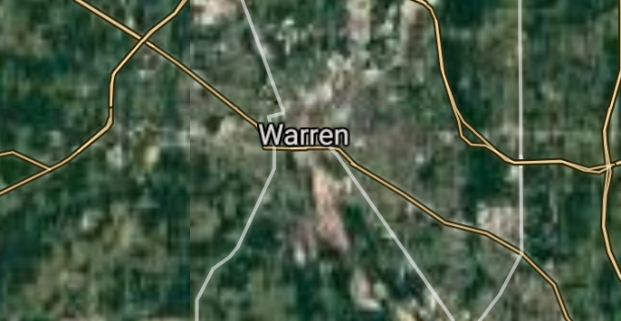
Warren [*elevation ceiling = 40km]Elevation: 271m (Group 185)
UR-100N (SLBM) |
Point A: 39.345467 00
Point B: 40.099229 00
Point C: 41.237557 00(300kt)
Point D: 41.044220 00
Point E: 39.713675 00
Point F: 40.742551 00
|
Point A: -84.560319 00
Point B: -83.114077 00
Point C: -80.818417 00(300kt)
Point D: -83.649932 00
Point E: -82.599329 00
Point F: -84.105226 00
|
|
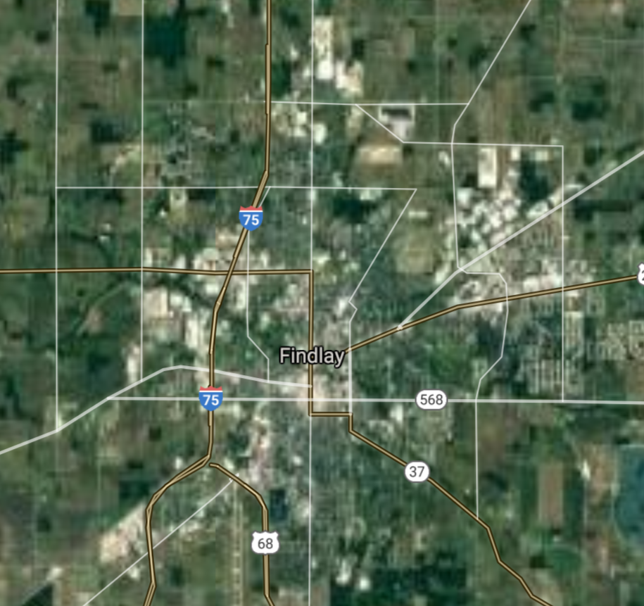
Findlay [*elevation ceiling = 40km]Elevation: 237m (Group 185)
UR-100N (SLBM) |
Point A: 39.345467 00
Point B: 40.099229 00
Point C: 41.237557 00
Point D: 41.044220 00(300kt)
Point E: 39.713675 00
Point F: 40.742551 00
|
Point A: -84.560319 00
Point B: -83.114077 00
Point C: -80.818417 00
Point D: -83.649932 00(300kt)
Point E: -82.599329 00
Point F: -84.105226 00
|
|
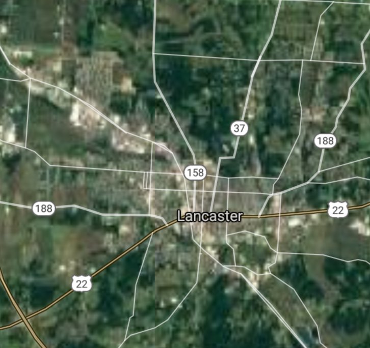
Lancaster [*elevation ceiling = 40km]Elevation: 270m (Group 185)
UR-100N (SLBM) |
Point A: 39.345467 00
Point B: 40.099229 00
Point C: 41.237557 00
Point D: 41.044220 00
Point E: 39.713675 00(300kt)
Point F: 40.742551 00
|
Point A: -84.560319 00
Point B: -83.114077 00
Point C: -80.818417 00
Point D: -83.649932 00
Point E: -82.599329 00(300kt)
Point F: -84.105226 00
|
|
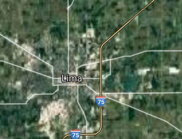
Lima [*elevation ceiling = 40km]Elevation: 268m (Group 185)
UR-100N (SLBM) |
Point A: 39.345467 00
Point B: 40.099229 00
Point C: 41.237557 00
Point D: 41.044220 00
Point E: 39.713675 00
Point F: 40.742551 00(300kt)
|
Point A: -84.560319 00
Point B: -83.114077 00
Point C: -80.818417 00
Point D: -83.649932 00
Point E: -82.599329 00
Point F: -84.105226 00(300kt)
|
|
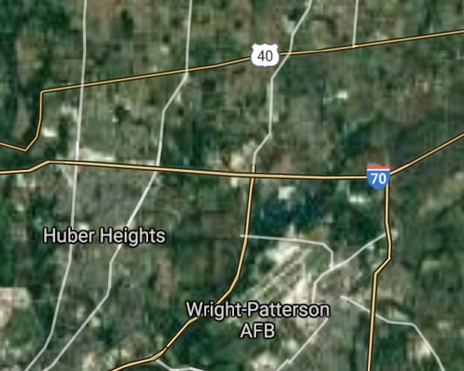
Huber Heights [*elevation ceiling = 40km]Elevation: 284m (Group 186)
UR-100N (SLBM) |
Point A: 39.843947 00(300kt)
Point B: 40.588670 00
Point C: 40.126669 00
Point D: 39.954786 00
Point E: 39.881452 00
Point F: 41.159501 00
|
Point A: -84.124661 00(300kt)
Point B: -83.128524 00
Point C: -82.931881 00
Point D: -82.812119 00
Point E: -83.092964 00
Point F: -81.440390 00
|
|
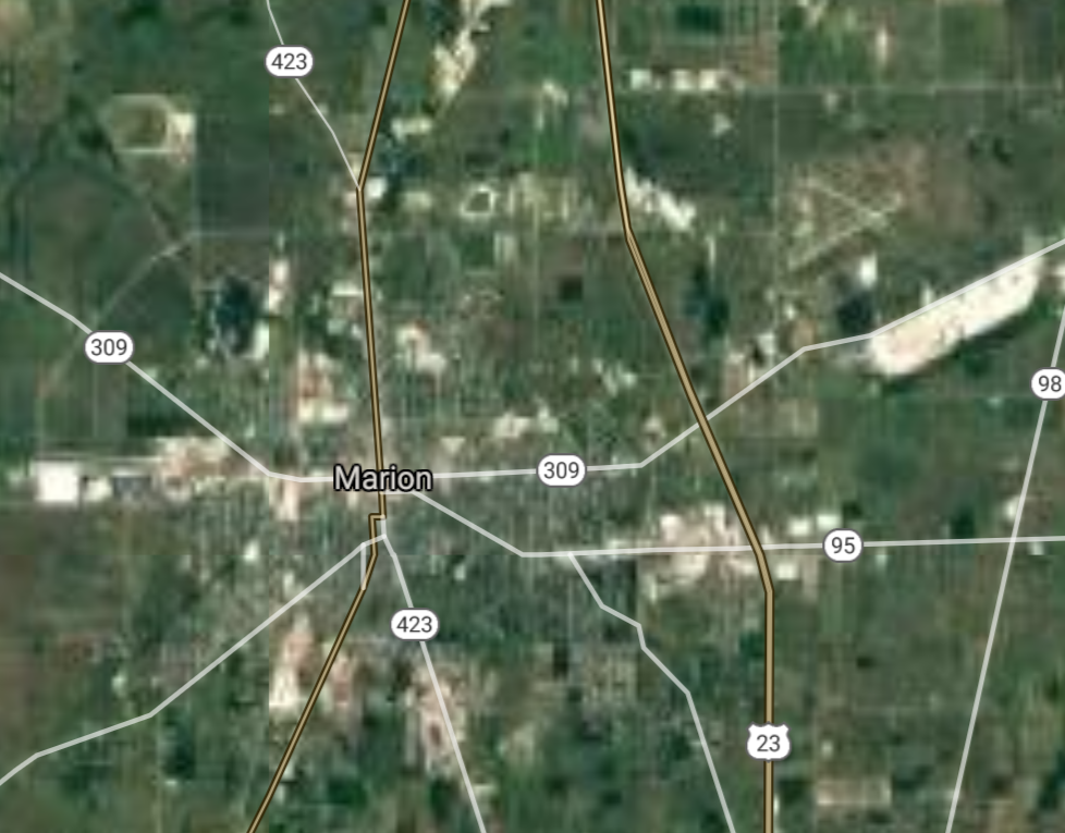
Marion [*elevation ceiling = 40km]Elevation: 299m (Group 186)
UR-100N (SLBM) |
Point A: 39.843947 00
Point B: 40.588670 00(300kt)
Point C: 40.126669 00
Point D: 39.954786 00
Point E: 39.881452 00
Point F: 41.159501 00
|
Point A: -84.124661 00
Point B: -83.128524 00(300kt)
Point C: -82.931881 00
Point D: -82.812119 00
Point E: -83.092964 00
Point F: -81.440390 00
|
|
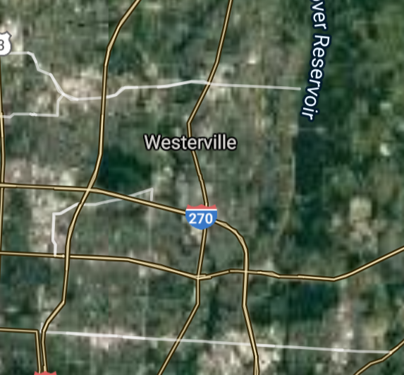
Westerville [*elevation ceiling = 40km]Elevation: 264m (Group 186)
UR-100N (SLBM) |
Point A: 39.843947 00
Point B: 40.588670 00
Point C: 40.126669 00(300kt)
Point D: 39.954786 00
Point E: 39.881452 00
Point F: 41.159501 00
|
Point A: -84.124661 00
Point B: -83.128524 00
Point C: -82.931881 00(300kt)
Point D: -82.812119 00
Point E: -83.092964 00
Point F: -81.440390 00
|
|
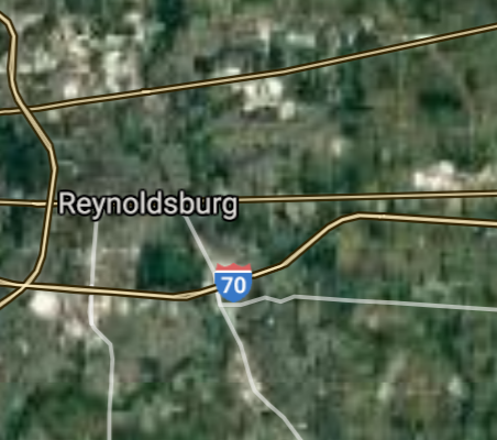
Reynoldsburg [*elevation ceiling = 40km]Elevation: 268m (Group 186)
UR-100N (SLBM) |
Point A: 39.843947 00
Point B: 40.588670 00
Point C: 40.126669 00
Point D: 39.954786 00(300kt)
Point E: 39.881452 00
Point F: 41.159501 00
|
Point A: -84.124661 00
Point B: -83.128524 00
Point C: -82.931881 00
Point D: -82.812119 00(300kt)
Point E: -83.092964 00
Point F: -81.440390 00
|
|
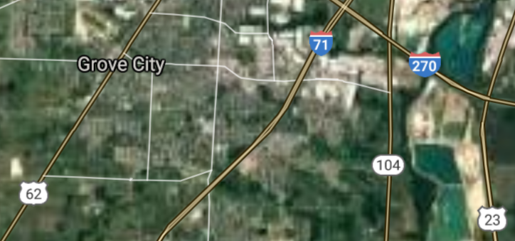
Grove City [*elevation ceiling = 40km]Elevation: 258m (Group 186)
UR-100N (SLBM) |
Point A: 39.843947 00
Point B: 40.588670 00
Point C: 40.126669 00
Point D: 39.954786 00
Point E: 39.881452 00(300kt)
Point F: 41.159501 00
|
Point A: -84.124661 00
Point B: -83.128524 00
Point C: -82.931881 00
Point D: -82.812119 00
Point E: -83.092964 00(300kt)
Point F: -81.440390 00
|
|
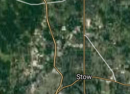
Stow [re-entry data]Elevation: 332m (Group 186)
UR-100N (SLBM) |
Point A: 39.843947 00
Point B: 40.588670 00
Point C: 40.126669 00
Point D: 39.954786 00
Point E: 39.881452 00
Point F: 41.159501 00(300kt)
|
Point A: -84.124661 00
Point B: -83.128524 00
Point C: -82.931881 00
Point D: -82.812119 00
Point E: -83.092964 00
Point F: -81.440390 00(300kt)
|
|
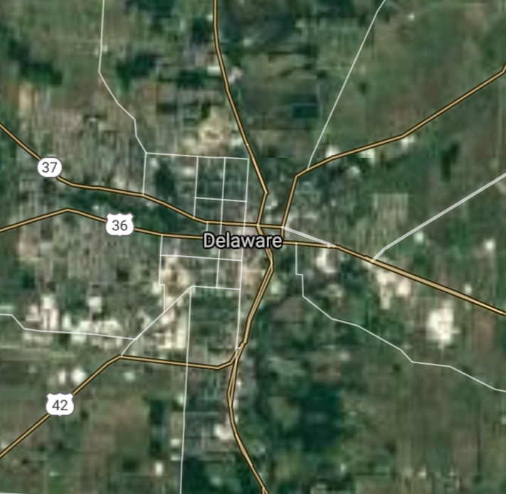
Delaware [*elevation ceiling = 40km]Elevation: 265m (Group 187)
UR-100N (SLBM) |
Point A: 40.298672 00(300kt)
Point B: 41.238110 00
Point C: 39.994508 00
Point D: 40.019231 00
Point E: 39.820893 00
Point F: 41.455323 00
|
Point A: -83.067965 00(300kt)
Point B: -81.841801 00
Point C: -83.062408 00
Point D: -82.879345 00
Point E: -84.019379 00
Point F: -81.917917 00
|
|
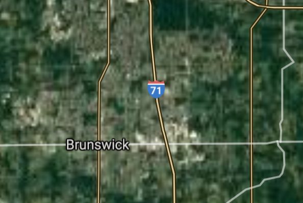
Brunswick [*elevation ceiling = 40km]Elevation: 357m (Group 187)
UR-100N (SLBM) |
Point A: 40.298672 00
Point B: 41.238110 00(300kt)
Point C: 39.994508 00
Point D: 40.019231 00
Point E: 39.820893 00
Point F: 41.455323 00
|
Point A: -83.067965 00
Point B: -81.841801 00(300kt)
Point C: -83.062408 00
Point D: -82.879345 00
Point E: -84.019379 00
Point F: -81.917917 00
|
|
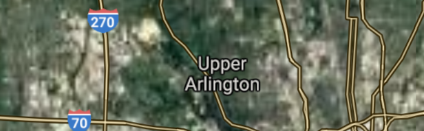
Upper Arlington [*elevation ceiling = 40km]Elevation: 248m (Group 187)
UR-100N (SLBM) |
Point A: 40.298672 00
Point B: 41.238110 00
Point C: 39.994508 00(300kt)
Point D: 40.019231 00
Point E: 39.820893 00
Point F: 41.455323 00
|
Point A: -83.067965 00
Point B: -81.841801 00
Point C: -83.062408 00(300kt)
Point D: -82.879345 00
Point E: -84.019379 00
Point F: -81.917917 00
|
|
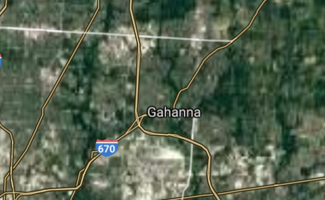
Gahanna [*elevation ceiling = 40km]Elevation: 243m (Group 187)
UR-100N (SLBM) |
Point A: 40.298672 00
Point B: 41.238110 00
Point C: 39.994508 00
Point D: 40.019231 00(300kt)
Point E: 39.820893 00
Point F: 41.455323 00
|
Point A: -83.067965 00
Point B: -81.841801 00
Point C: -83.062408 00
Point D: -82.879345 00(300kt)
Point E: -84.019379 00
Point F: -81.917917 00
|
|
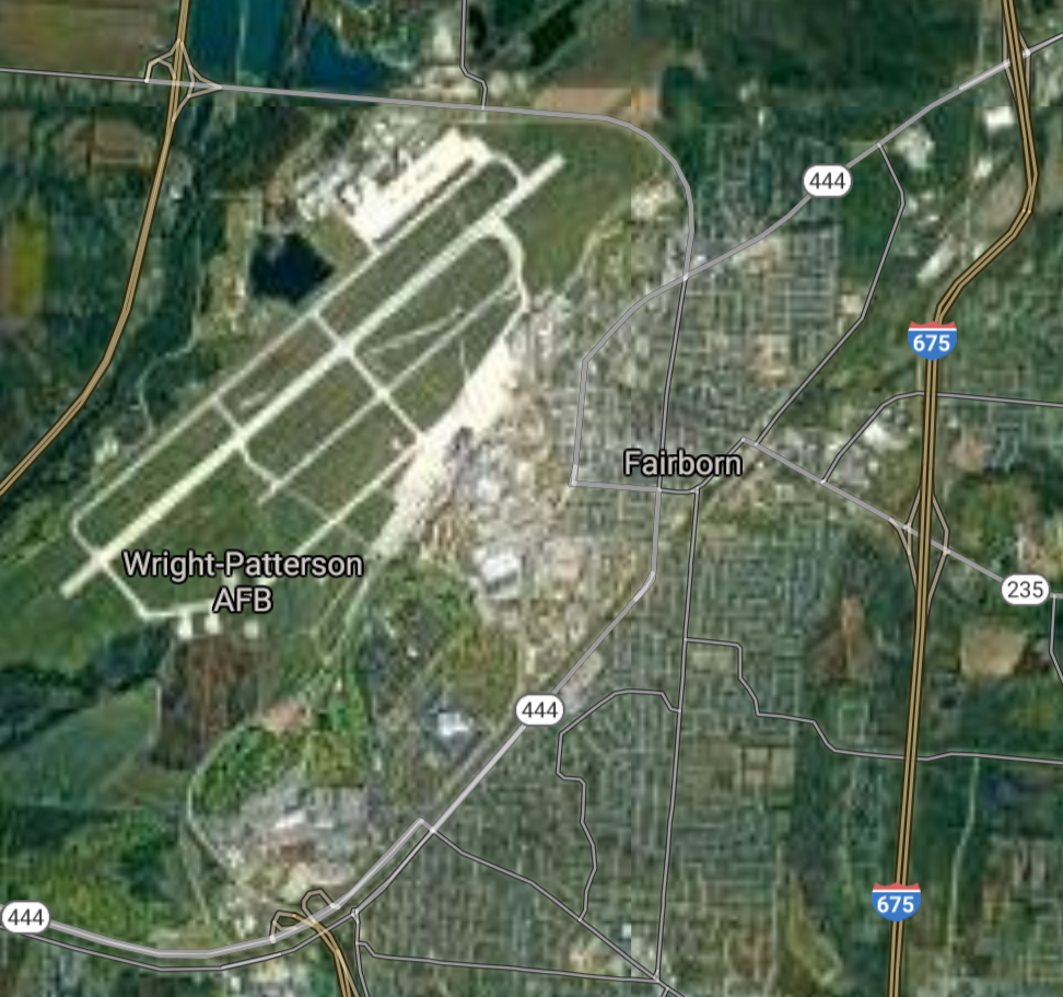
Fairborn [*elevation ceiling = 40km]Elevation: 255m (Group 187)
UR-100N (SLBM) |
Point A: 40.298672 00
Point B: 41.238110 00
Point C: 39.994508 00
Point D: 40.019231 00
Point E: 39.820893 00(300kt)
Point F: 41.455323 00
|
Point A: -83.067965 00
Point B: -81.841801 00
Point C: -83.062408 00
Point D: -82.879345 00
Point E: -84.019379 00(300kt)
Point F: -81.917917 00
|
|
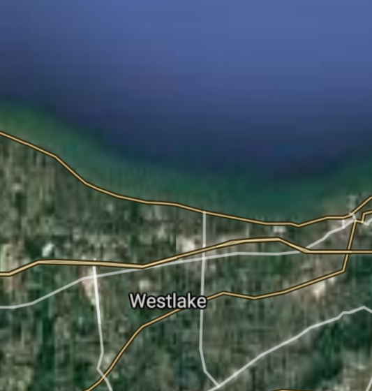
Westlake [*elevation ceiling = 40km]Elevation: 216m (Group 187)
UR-100N (SLBM) |
Point A: 40.298672 00
Point B: 41.238110 00
Point C: 39.994508 00
Point D: 40.019231 00
Point E: 39.820893 00
Point F: 41.455323 00(300kt)
|
Point A: -83.067965 00
Point B: -81.841801 00
Point C: -83.062408 00
Point D: -82.879345 00
Point E: -84.019379 00
Point F: -81.917917 00(300kt)
|
|
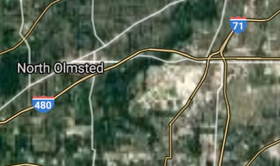
North Olmsted [*elevation ceiling = 40km]Elevation: 232m (Group 188)
UR-100N (SLBM) |
Point A: 41.415603 00(300kt)
Point B: 40.796724 00
Point C: 39.360059 00
Point D: 41.313664 00
Point E: 41.374774 00
Point F: 41.389491 00
|
Point A: -81.923473 00(300kt)
Point B: -81.521509 00
Point C: -84.309939 00
Point D: -81.724574 00
Point E: -83.651323 00
Point F: -82.019032 00
|
|
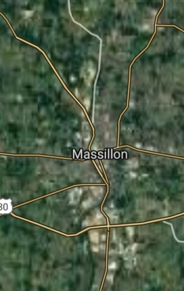
Massillon [*elevation ceiling = 40km]Elevation: 289m (Group 188)
UR-100N (SLBM) |
Point A: 41.415603 00
Point B: 40.796724 00(300kt)
Point C: 39.360059 00
Point D: 41.313664 00
Point E: 41.374774 00
Point F: 41.389491 00
|
Point A: -81.923473 00
Point B: -81.521509 00(300kt)
Point C: -84.309939 00
Point D: -81.724574 00
Point E: -83.651323 00
Point F: -82.019032 00
|
|
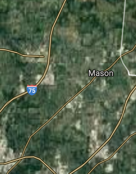
Mason [*elevation ceiling = 40km]Elevation: 246m (Group 188)
UR-100N (SLBM) |
Point A: 41.415603 00
Point B: 40.796724 00
Point C: 39.360059 00(300kt)
Point D: 41.313664 00
Point E: 41.374774 00
Point F: 41.389491 00
|
Point A: -81.923473 00
Point B: -81.521509 00
Point C: -84.309939 00(300kt)
Point D: -81.724574 00
Point E: -83.651323 00
Point F: -82.019032 00
|
|
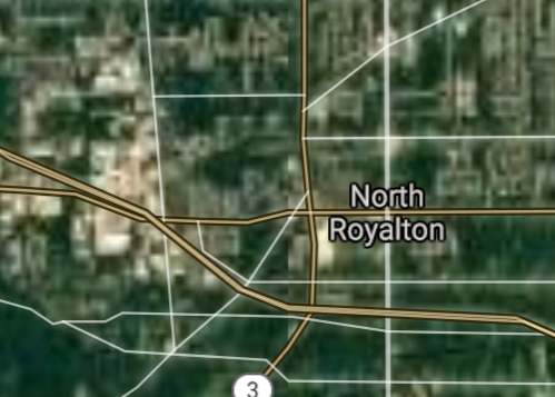
North Royalton [*elevation ceiling = 40km]Elevation: 365m (Group 188)
UR-100N (SLBM) |
Point A: 41.415603 00
Point B: 40.796724 00
Point C: 39.360059 00
Point D: 41.313664 00(300kt)
Point E: 41.374774 00
Point F: 41.389491 00
|
Point A: -81.923473 00
Point B: -81.521509 00
Point C: -84.309939 00
Point D: -81.724574 00(300kt)
Point E: -83.651323 00
Point F: -82.019032 00
|
|
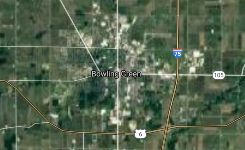
Bowling Green [*elevation ceiling = 40km]Elevation: 211m (Group 188)
UR-100N (SLBM) |
Point A: 41.415603 00
Point B: 40.796724 00
Point C: 39.360059 00
Point D: 41.313664 00
Point E: 41.374774 00(300kt)
Point F: 41.389491 00
|
Point A: -81.923473 00
Point B: -81.521509 00
Point C: -84.309939 00
Point D: -81.724574 00
Point E: -83.651323 00(300kt)
Point F: -82.019032 00
|
|
North Ridgeville [*elevation ceiling = 40km]Elevation: 222m (Group 188)
UR-100N (SLBM) |
Point A: 41.415603 00
Point B: 40.796724 00
Point C: 39.360059 00
Point D: 41.313664 00
Point E: 41.374774 00
Point F: 41.389491 00(300kt)
|
Point A: -81.923473 00
Point B: -81.521509 00
Point C: -84.309939 00
Point D: -81.724574 00
Point E: -83.651323 00
Point F: -82.019032 00(300kt)
|

[Top]
Situation: Central Basin
"BRICS Security Council emerging from cross-currency evaluations"
OPEN Start: Central Basin - is an engineering vessel which is proven with climate security in evaluation of the USD/YEN currency pair. Annually, climate security is leading economic growth in key emerging markets surrounding the Four Asian Tigers. Affordably, the following industries extend opportunities for military cooperation: aerospace, telecommunications, finance and banking. OPEN Start: Central Basin strengthens the backbone for international security beyond the shadows of USD/YEN controversy. Traversely, OPEN Start: Central Basin offsets the cross-over gap between the USD/MXN and USD/RUB exchange rates. Notably, the Three Amigas form an economic alliance in the Far West through joint-cooperation projects from Venture 1, Venture LA and Venture SF which all extend with the Far North reach towards the Far South (as illustrated below).
![]()
![]()
![]()
![]()
![]()
![]()
![]()
![]()
![]()
JanuaryFebruaryMarchAprilJuneJulySeptemberOctoberDecember |
2026 Group Drills - Schedule
|
|

JanuaryFebruaryJuneJulyAugustOctoberNovemberDecember |
2026 Group Drills - Schedule
|
|

JanuaryFebruaryJuneJulySeptemberOctoberNovemberDecember |
2026 Group Drills - Schedule
|
|
