

 OPEN Start


 Hollywood, JSC
Mendocino, JSC
LA SOCIETY
SF SOCIETY
NY SOCIETY
Open START Drills
Hollywood, JSC
Mendocino, JSC
LA SOCIETY
SF SOCIETY
NY SOCIETY
Open START Drills
Talk Daily Commodities Review LATPACT Open Market Equities Report Currency Central
 Situation: US
 |

|

|

|
|
 SOCIETY Trust Fund LATPACT Trust Fund LATPACT Open Market Far West (SEZ) Trust RIM of Nations Trust
Arctic Pact Trade Zone | Upper Rhine Zone | Lower Rhine Zone | Middle Rhone Basin
| Level 2 - Open START/*Super Grid |
| Level 3 - Stellar Fields |


Climate Central News & Information
 "US attempts to salvage the European Order with a K-9 Squad clan style coalition"
Population Conversations: 528,079
Planet Power Seconds
 BRICS Security Council
 Military cooperation is exceedingly pressing ahead in notable markets from China, Russia and India which include achieving greater milestones within the technology, communications, and aerospace industries. Vastly, multi-national alliances continue to expand as relying on new protocols oppose resistance with deregulation in the spheres of international security and terrorism. As a result, the BRICS Security Council is forming several key initiatives from climate security to preserve and harness the skills with establishing a polar-arc posture in outer space.
In contrast, a grave decline in NATO has been detected. In early 2018, UNITED STATES ARMY COMMANDER, GENERAL CURTIS M. SCAPARROTTI delivered the posture statement for NATO. He stated, "As our most significant trading partner, Europe is vital to promoting American prosperity. With shared history and values, Europe is also a critical partner in advancing American influence throughout the world. The North Atlantic Treaty Organization (NATO) enables us to preserve peace through strength as alliance unity fundamentally deters the aggression of potential adversaries." Meanwhile, NATO readiness is faltering in Europe as lack of training, inadequate funding and outdated equipment persist over the Brexit strategy.
United Nations Command: AUKUSA/Quad 4
 Extensively, the Central Basin is transforming international security while disabling NATO, AUKUSA and the Quad 4 military alliances with the Open START Hawaii and Open START Alaska drills. Inherently, the Central Basin fleet suppresses the UN Command over security backlogs as the Global South impedes expansion for the Japanese yen. Economically, the US dollar bounds NATO, AUKUSA and the Quad 4 alliances under one entity in the wake of the 2007 housing crises, COVID-19 recovery and war in Ukraine. Generously, the Upper Rhine pass bridges the Open START Hawaii and Open START Alaska drills which stabilize international and climate security. Uniquely, Open START drills for the Upper Rhine pass pegs the value of the Japanese yen and Korean Won to the Chinese yuan, Indian rupee, Russian ruble, and Mexican peso to enable economic transformation for the Central Basin region. Effectively, the Open START drill secures the yen in cooperation with the Global South as significant growth on the New Silk Road Economic Belt extends in Africa. Suitably, the Open START drill baffles the UN Command with the Upper Rhine pass as the historical value is at stake. Judiciously, the Open START drill isolates the UN Command over Level 1 protocol which underpins NATO, AUKUSA and the Quad 4 military alliances to Celtic Briton tribes.
The OSCE and NATO: From the Arctic Circle
 Historically, military conflicts include land navigation rivalry which is significant for the Lower Rhine corridor as tensions between the Eastern and Western hemisphere ignite over political testimony. Substantially, the US has interspersed armed forces in the EU with the connivance of NATO and the OSCE to subjugate the Arctic Circle and dominate international trade from the Middle East. Tacitly, the OSCE is equipped to engineer early warnings, conflict resolution and crisis management over military tensions with NATO to inseminate the world order of law and justice. Decisively, the Open START Iceland drill unify the corners of the world to combat the historical West from the Arctic Circle over climate security, war crimes and crimes against humanity. Particularly, normalized ties to Israel for the Lower Rhine corridor weighs over rising Eastern influence from the Near East which is a major factor in the Open START Iceland drill. Efficiently, the Open START Iceland drill balances political, economic and military parity between the historical East and West which is threatened from the incumbency of trade sanctions and escalating military tensions in the West.
*Schedule of Nuclear Attack
Be advised: The specific plan of attack for South Dakota is sensitive and will be posted here closer to its scheduled strike.
South Dakota
AL* | AZ* | AR* | CO | CT | DE | FL | GA | ID | IN | IA | KS | KY | LA | ME |
MA | MI | MN | MO | MT | NE | NV | NH | NJ | NM | NY | NC | ND | OH | OK | OR | PA | RI | SC
SD | TN | UT | VA (DC)** | VT** | WV** | WI** | WY**
*Central Fleet South  Bulava + RT23 Cadet + Vysota3
Team: Memphis Fire (Local Area Control)
**Central Fleet North Bulava + Surya + Vysota3
Open START (RKS) |
Groups UR227 - UR234 | *300kt | Millineum Power *4,000 MW
Level 1 - WA Dong (SIT.2) 
South Dakota |
Latitude Coordinate |
Longitude Coordinate |
|
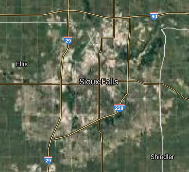
Sioux Falls [*elevation ceiling = 40km]Elevation: 431m (Group 227)
UR-100N (SLBM) |
Point A: 43.547303 00(300kt)
Point B: 44.080543 00
Point C: 45.464699 00
Point D: 44.311357 00
Point E: 44.899409 00
Point F: 43.709428 00
Open START Passages |
Point A: -96.728333 00(300kt)
Point B: -103.231015 00
Point C: -98.486483 00
Point D: -96.798388 00
Point E: -97.115073 00
Point F: -98.029799 00
Demonstration |
|
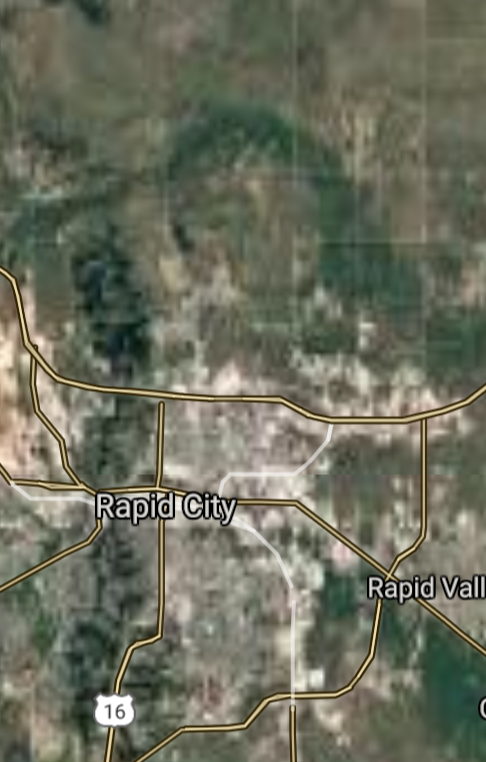
Rapid City [*elevation ceiling = 40km]Elevation: 988m (Group 227)
UR-100N (SLBM) |
Point A: 43.547303 00
Point B: 44.080543 00(300kt)
Point C: 45.464699 00
Point D: 44.311357 00
Point E: 44.899409 00
Point F: 43.709428 00
|
Point A: -96.728333 00
Point B: -103.231015 00(300kt)
Point C: -98.486483 00
Point D: -96.798388 00
Point E: -97.115073 00
Point F: -98.029799 00
|
|
Aberdeen [*elevation ceiling = 40km]Elevation: 399m (Group 227)
UR-100N (SLBM) |
Point A: 43.547303 00
Point B: 44.080543 00
Point C: 45.464699 00(300kt)
Point D: 44.311357 00
Point E: 44.899409 00
Point F: 43.709428 00
|
Point A: -96.728333 00
Point B: -103.231015 00
Point C: -98.486483 00(300kt)
Point D: -96.798388 00
Point E: -97.115073 00
Point F: -98.029799 00
|
|
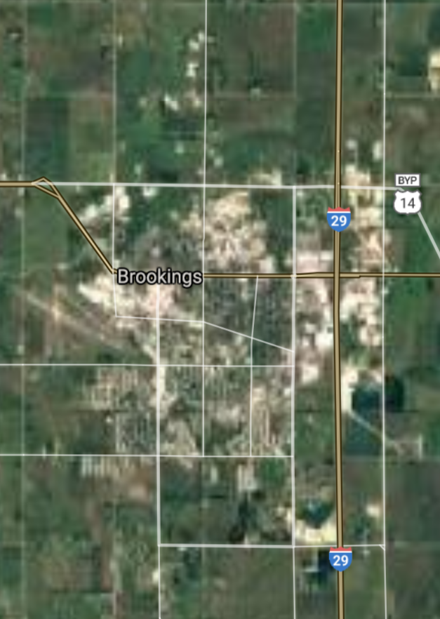
Brookings [*elevation ceiling = 40km]Elevation: 494m (Group 227)
UR-100N (SLBM) |
Point A: 43.547303 00
Point B: 44.080543 00
Point C: 45.464699 00
Point D: 44.311357 00(300kt)
Point E: 44.899409 00
Point F: 43.709428 00
|
Point A: -96.728333 00
Point B: -103.231015 00
Point C: -98.486483 00
Point D: -96.798388 00(300kt)
Point E: -97.115073 00
Point F: -98.029799 00
|
|
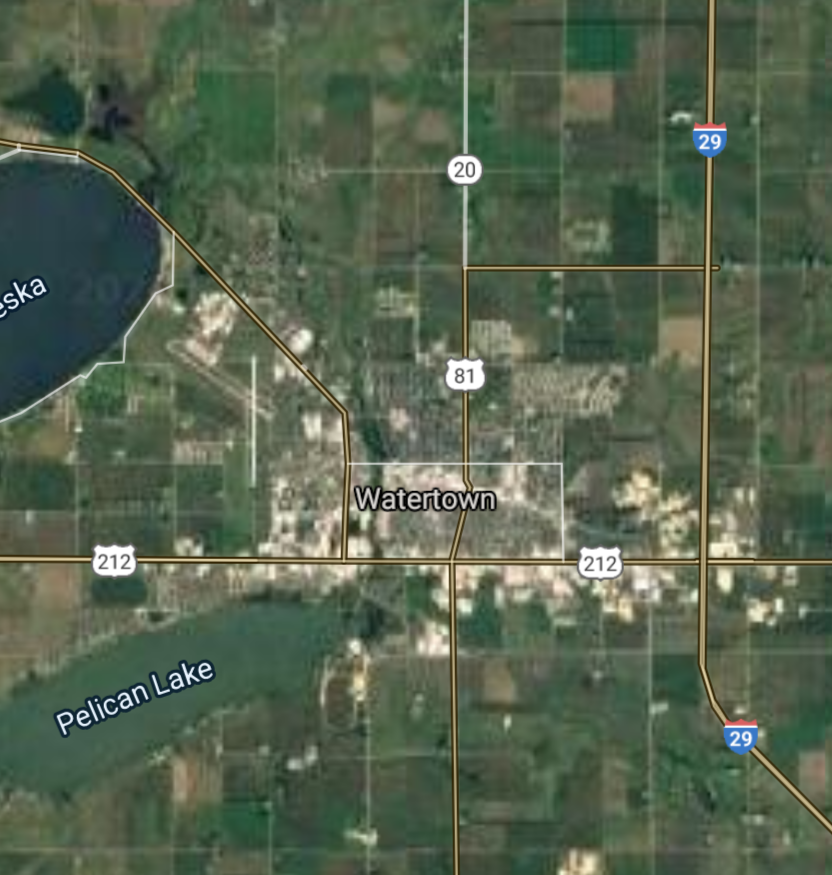
Watertown [*elevation ceiling = 40km]Elevation: 529m (Group 227)
UR-100N (SLBM) |
Point A: 43.547303 00
Point B: 44.080543 00
Point C: 45.464699 00
Point D: 44.311357 00
Point E: 44.899409 00(300kt)
Point F: 43.709428 00
|
Point A: -96.728333 00
Point B: -103.231015 00
Point C: -98.486483 00
Point D: -96.798388 00
Point E: -97.115073 00(300kt)
Point F: -98.029799 00
|
|
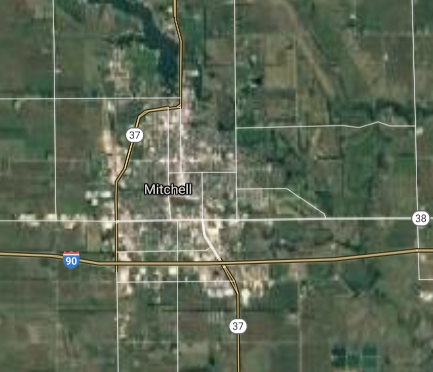
Mitchell [*elevation ceiling = 40km]Elevation: 401m (Group 227)
UR-100N (SLBM) |
Point A: 43.547303 00
Point B: 44.080543 00
Point C: 45.464699 00
Point D: 44.311357 00
Point E: 44.899409 00
Point F: 43.709428 00(300kt)
|
Point A: -96.728333 00
Point B: -103.231015 00
Point C: -98.486483 00
Point D: -96.798388 00
Point E: -97.115073 00
Point F: -98.029799 00(300kt)
|
|
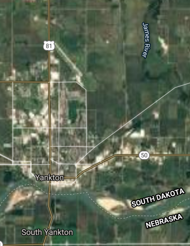
Yankton [*elevation ceiling = 40km]Elevation: 369m (Group 228)
UR-100N (SLBM) |
Point A: 42.871109 00(300kt)
Point B: 44.366788 00
Point C: 44.363317 00
Point D: 44.490817 00
Point E: 42.779442 00
Point F: 43.594696 00
|
Point A: -97.397281 00(300kt)
Point B: -100.353752 00
Point C: -98.214257 00
Point D: -103.859370 00
Point E: -96.929210 00
Point F: -96.571990 00
|
|
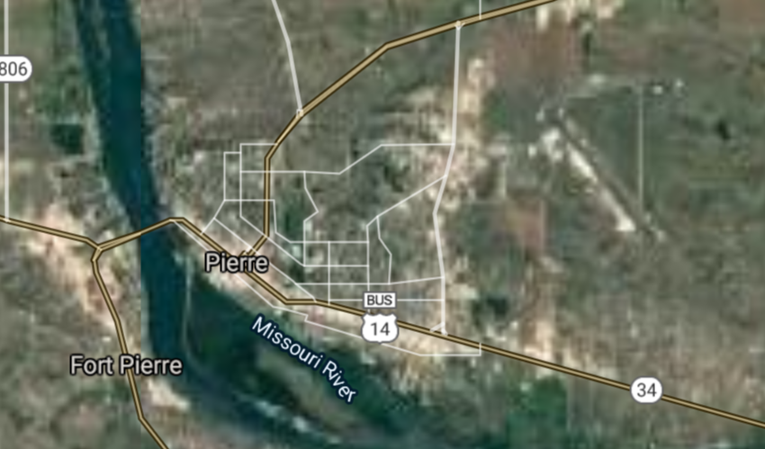
Pierre [*elevation ceiling = 40km]Elevation: 437m (Group 228)
UR-100N (SLBM) |
Point A: 42.871109 00
Point B: 44.366788 00(300kt)
Point C: 44.363317 00
Point D: 44.490817 00
Point E: 42.779442 00
Point F: 43.594696 00
|
Point A: -97.397281 00
Point B: -100.353752 00(300kt)
Point C: -98.214257 00
Point D: -103.859370 00
Point E: -96.929210 00
Point F: -96.571990 00
|
|
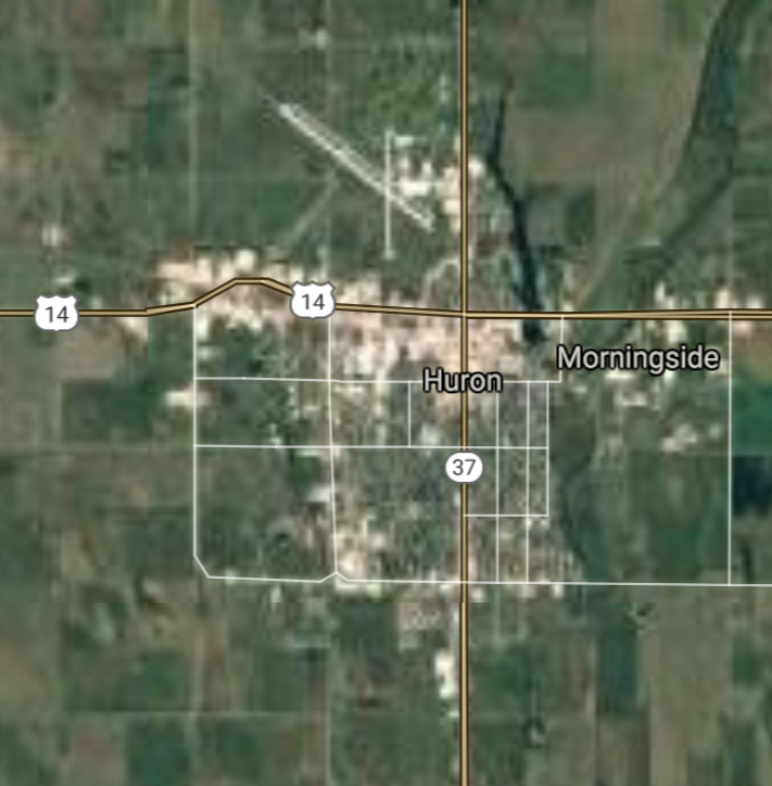
Huron [*elevation ceiling = 40km]Elevation: 390m (Group 228)
UR-100N (SLBM) |
Point A: 42.871109 00
Point B: 44.366788 00
Point C: 44.363317 00(300kt)
Point D: 44.490817 00
Point E: 42.779442 00
Point F: 43.594696 00
|
Point A: -97.397281 00
Point B: -100.353752 00
Point C: -98.214257 00(300kt)
Point D: -103.859370 00
Point E: -96.929210 00
Point F: -96.571990 00
|
|
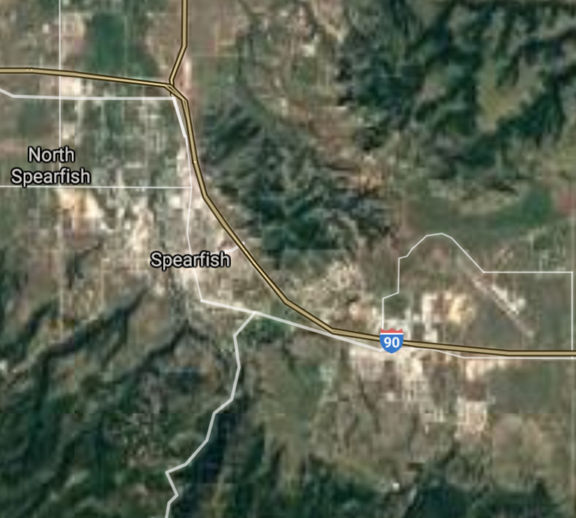
Spearfish [*elevation ceiling = 40km]Elevation: 1111m (Group 228)
UR-100N (SLBM) |
Point A: 42.871109 00
Point B: 44.366788 00
Point C: 44.363317 00
Point D: 44.490817 00(300kt)
Point E: 42.779442 00
Point F: 43.594696 00
|
Point A: -97.397281 00
Point B: -100.353752 00
Point C: -98.214257 00
Point D: -103.859370 00(300kt)
Point E: -96.929210 00
Point F: -96.571990 00
|
|
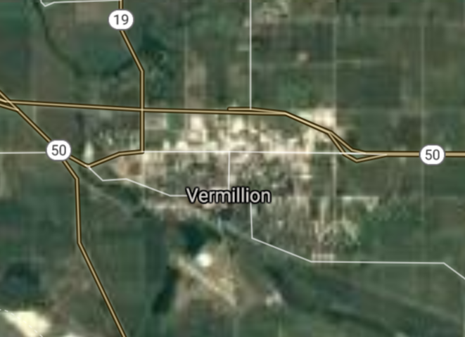
Vermillion [*elevation ceiling = 40km]Elevation: 372m (Group 228)
UR-100N (SLBM) |
Point A: 42.871109 00
Point B: 44.366788 00
Point C: 44.363317 00
Point D: 44.490817 00
Point E: 42.779442 00(300kt)
Point F: 43.594696 00
|
Point A: -97.397281 00
Point B: -100.353752 00
Point C: -98.214257 00
Point D: -103.859370 00
Point E: -96.929210 00(300kt)
Point F: -96.571990 00
|
|
Brandon [*elevation ceiling = 40km]Elevation: 412m (Group 228)
UR-100N (SLBM) |
Point A: 42.871109 00
Point B: 44.366788 00
Point C: 44.363317 00
Point D: 44.490817 00
Point E: 42.779442 00
Point F: 43.594696 00(300kt)
|
Point A: -97.397281 00
Point B: -100.353752 00
Point C: -98.214257 00
Point D: -103.859370 00
Point E: -96.929210 00
Point F: -96.571990 00(300kt)
|
|
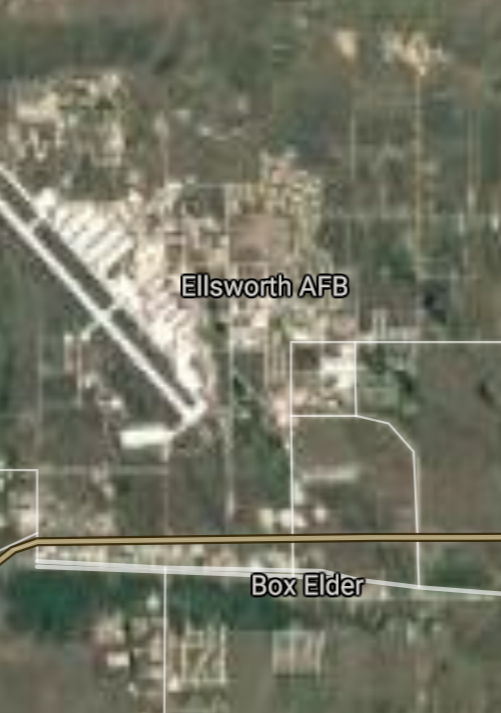
Box Elder [*elevation ceiling = 40km]Elevation: 923m (Group 229)
UR-100N (SLBM) |
Point A: 44.112488 00(300kt)
Point B: 44.006085 00
Point C: 44.409707 00
Point D: 43.431366 00
Point E: 44.671373 00
Point F: 43.446367 00
|
Point A: -103.068232 00(300kt)
Point B: -97.113950 00
Point C: -103.509079 00
Point D: -96.697270 00
Point E: -103.852148 00
Point F: -96.835885 00
|
|
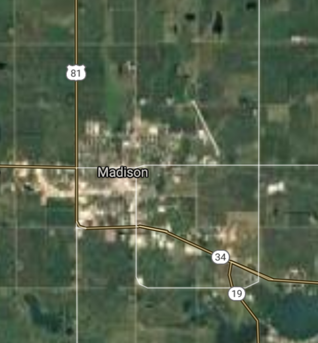
Madison [*elevation ceiling = 40km]Elevation: 511m (Group 229)
UR-100N (SLBM) |
Point A: 44.112488 00
Point B: 44.006085 00(300kt)
Point C: 44.409707 00
Point D: 43.431366 00
Point E: 44.671373 00
Point F: 43.446367 00
|
Point A: -103.068232 00
Point B: -97.113950 00(300kt)
Point C: -103.509079 00
Point D: -96.697270 00
Point E: -103.852148 00
Point F: -96.835885 00
|
|
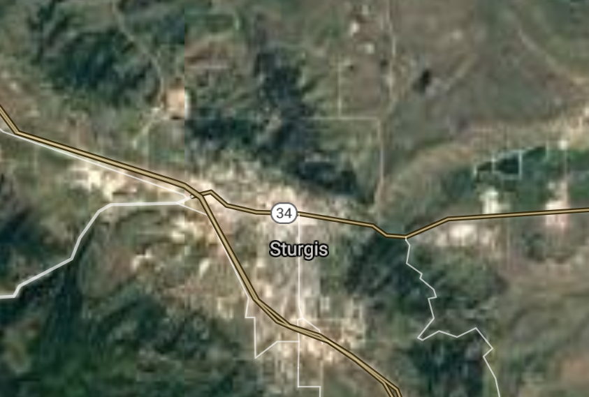
Sturgis [*elevation ceiling = 40km]Elevation: 1044m (Group 229)
UR-100N (SLBM) |
Point A: 44.112488 00
Point B: 44.006085 00
Point C: 44.409707 00(300kt)
Point D: 43.431366 00
Point E: 44.671373 00
Point F: 43.446367 00
|
Point A: -103.068232 00
Point B: -97.113950 00
Point C: -103.509079 00(300kt)
Point D: -96.697270 00
Point E: -103.852148 00
Point F: -96.835885 00
|
|
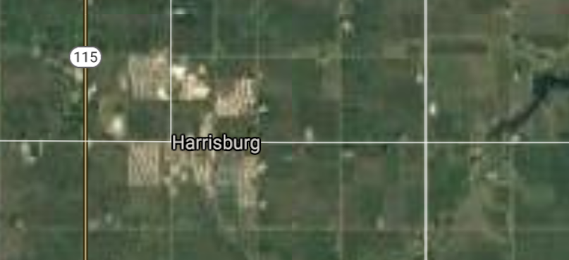
Harrisburg [*elevation ceiling = 40km]Elevation: 435m (Group 229)
UR-100N (SLBM) |
Point A: 44.112488 00
Point B: 44.006085 00
Point C: 44.409707 00
Point D: 43.431366 00(300kt)
Point E: 44.671373 00
Point F: 43.446367 00
|
Point A: -103.068232 00
Point B: -97.113950 00
Point C: -103.509079 00
Point D: -96.697270 00(300kt)
Point E: -103.852148 00
Point F: -96.835885 00
|
|
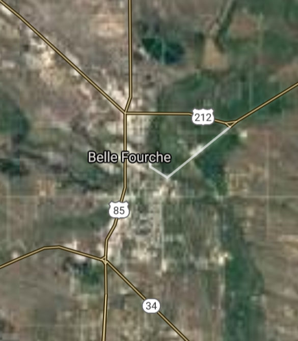
Belle Fourche [*elevation ceiling = 40km]Elevation: 921m (Group 229)
UR-100N (SLBM) |
Point A: 44.112488 00
Point B: 44.006085 00
Point C: 44.409707 00
Point D: 43.431366 00
Point E: 44.671373 00(300kt)
Point F: 43.446367 00
|
Point A: -103.068232 00
Point B: -97.113950 00
Point C: -103.509079 00
Point D: -96.697270 00
Point E: -103.852148 00(300kt)
Point F: -96.835885 00
|
|
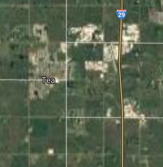
Tea [*elevation ceiling = 40km]Elevation: 453m (Group 229)
UR-100N (SLBM) |
Point A: 44.112488 00
Point B: 44.006085 00
Point C: 44.409707 00
Point D: 43.431366 00
Point E: 44.671373 00
Point F: 43.446367 00(300kt)
|
Point A: -103.068232 00
Point B: -97.113950 00
Point C: -103.509079 00
Point D: -96.697270 00
Point E: -103.852148 00
Point F: -96.835885 00(300kt)
|
|
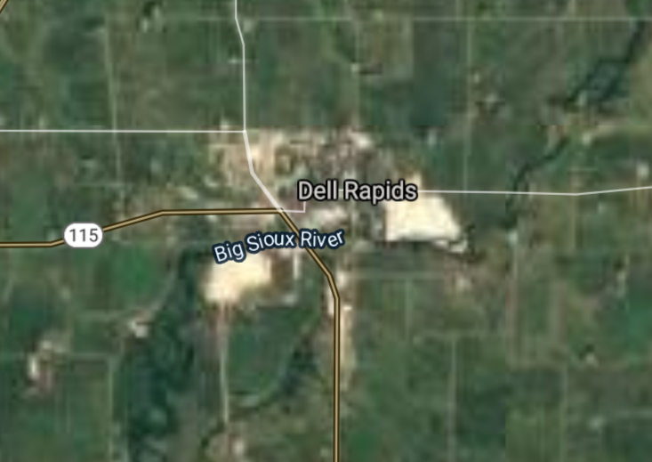
Dell Rapids [*elevation ceiling = 40km]Elevation: 459m (Group 230)
UR-100N (SLBM) |
Point A: 43.826084 00(300kt)
Point B: 45.537216 00
Point C: 43.431646 00
Point D: 43.300815 00
Point E: 43.623032 00
Point F: 45.215012 00
|
Point A: -96.706161 00(300kt)
Point B: -100.427913 00
Point C: -103.474362 00
Point D: -96.592820 00
Point E: -96.942555 00
Point F: -96.633849 00
|
|
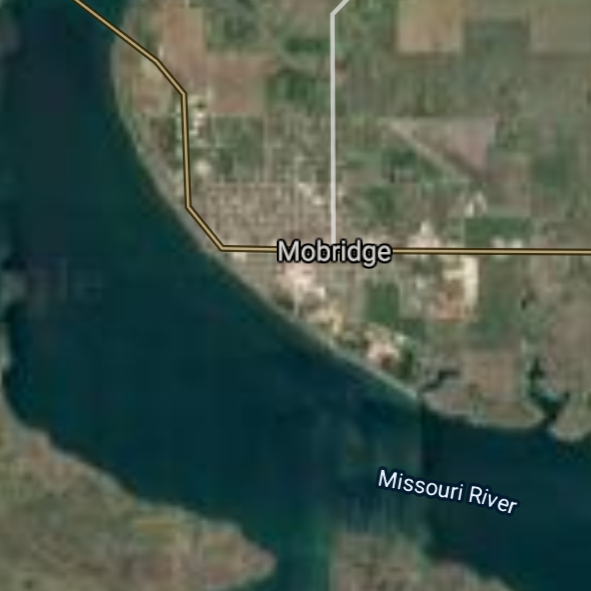
Mobridge [*elevation ceiling = 40km]Elevation: 506m (Group 230)
UR-100N (SLBM) |
Point A: 43.826084 00
Point B: 45.537216 00(300kt)
Point C: 43.431646 00
Point D: 43.300815 00
Point E: 43.623032 00
Point F: 45.215012 00
|
Point A: -96.706161 00
Point B: -100.427913 00(300kt)
Point C: -103.474362 00
Point D: -96.592820 00
Point E: -96.942555 00
Point F: -96.633849 00
|
|
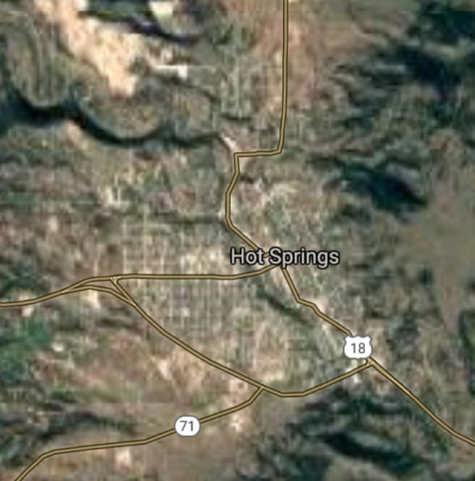
Hot Springs [*elevation ceiling = 40km]Elevation: 1050m (Group 230)
UR-100N (SLBM) |
Point A: 43.826084 00
Point B: 45.537216 00
Point C: 43.431646 00(300kt)
Point D: 43.300815 00
Point E: 43.623032 00
Point F: 45.215012 00
|
Point A: -96.706161 00
Point B: -100.427913 00
Point C: -103.474362 00(300kt)
Point D: -96.592820 00
Point E: -96.942555 00
Point F: -96.633849 00
|
|
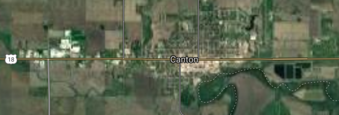
Canton [*elevation ceiling = 40km]Elevation: 387m (Group 230)
UR-100N (SLBM) |
Point A: 43.826084 00
Point B: 45.537216 00
Point C: 43.431646 00
Point D: 43.300815 00(300kt)
Point E: 43.623032 00
Point F: 45.215012 00
|
Point A: -96.706161 00
Point B: -100.427913 00
Point C: -103.474362 00
Point D: -96.592820 00(300kt)
Point E: -96.942555 00
Point F: -96.633849 00
|
|
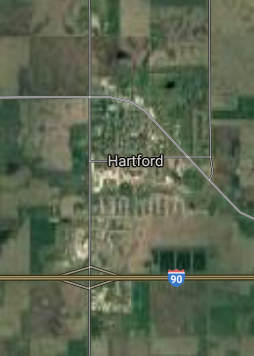
Hartford [*elevation ceiling = 40km]Elevation: 479m (Group 230)
UR-100N (SLBM) |
Point A: 43.826084 00
Point B: 45.537216 00
Point C: 43.431646 00
Point D: 43.300815 00
Point E: 43.623032 00(300kt)
Point F: 45.215012 00
|
Point A: -96.706161 00
Point B: -100.427913 00
Point C: -103.474362 00
Point D: -96.592820 00
Point E: -96.942555 00(300kt)
Point F: -96.633849 00
|
|
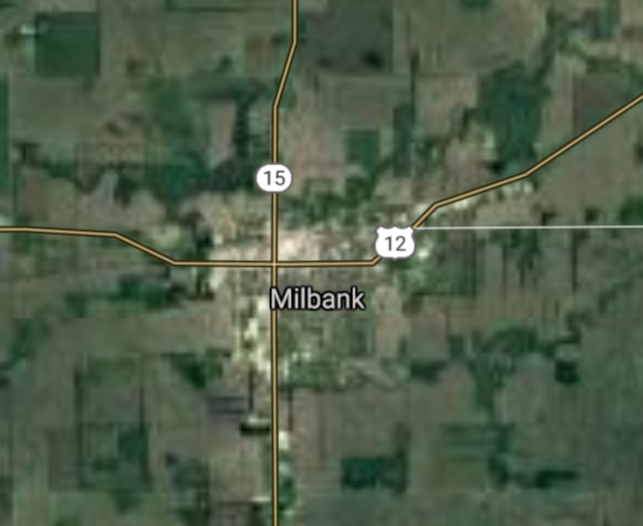
Milbank [*elevation ceiling = 40km]Elevation: 350m (Group 230)
UR-100N (SLBM) |
Point A: 43.826084 00
Point B: 45.537216 00
Point C: 43.431646 00
Point D: 43.300815 00
Point E: 43.623032 00
Point F: 45.215012 00(300kt)
|
Point A: -96.706161 00
Point B: -100.427913 00
Point C: -103.474362 00
Point D: -96.592820 00
Point E: -96.942555 00
Point F: -96.633849 00(300kt)
|
|
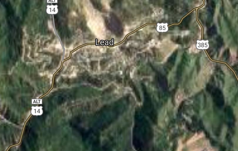
Lead [*elevation ceiling = 40km]Elevation: 1586m (Group 231)
UR-100N (SLBM) |
Point A: 44.352207 00(300kt)
Point B: 43.376667 00
Point C: 42.527217 00
Point D: 44.189978 00
Point E: 45.664682 00
Point F: 43.810828 00
|
Point A: -103.765198 00(300kt)
Point B: -99.859007 00
Point C: -96.483086 00
Point D: -103.343840 00
Point E: -97.049805 00
Point F: -99.330656 00
|
|
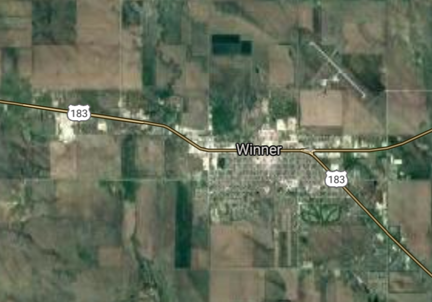
Winner [*elevation ceiling = 40km]Elevation: 600m (Group 231)
UR-100N (SLBM) |
Point A: 44.352207 00
Point B: 43.376667 00(300kt)
Point C: 42.527217 00
Point D: 44.189978 00
Point E: 45.664682 00
Point F: 43.810828 00
|
Point A: -103.765198 00
Point B: -99.859007 00(300kt)
Point C: -96.483086 00
Point D: -103.343840 00
Point E: -97.049805 00
Point F: -99.330656 00
|
|
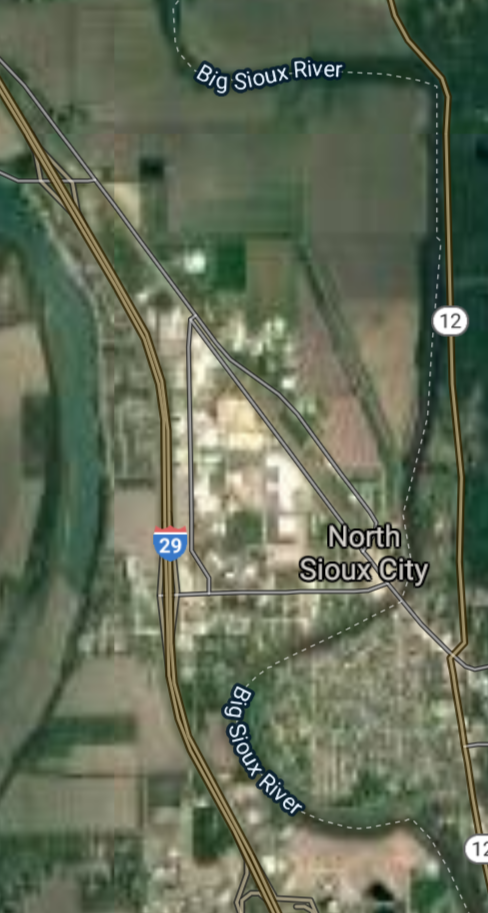
North Sioux City [*elevation ceiling = 40km]Elevation: 336m (Group 231)
UR-100N (SLBM) |
Point A: 44.352207 00
Point B: 43.376667 00
Point C: 42.527217 00(300kt)
Point D: 44.189978 00
Point E: 45.664682 00
Point F: 43.810828 00
|
Point A: -103.765198 00
Point B: -99.859007 00
Point C: -96.483086 00(300kt)
Point D: -103.343840 00
Point E: -97.049805 00
Point F: -99.330656 00
|
|
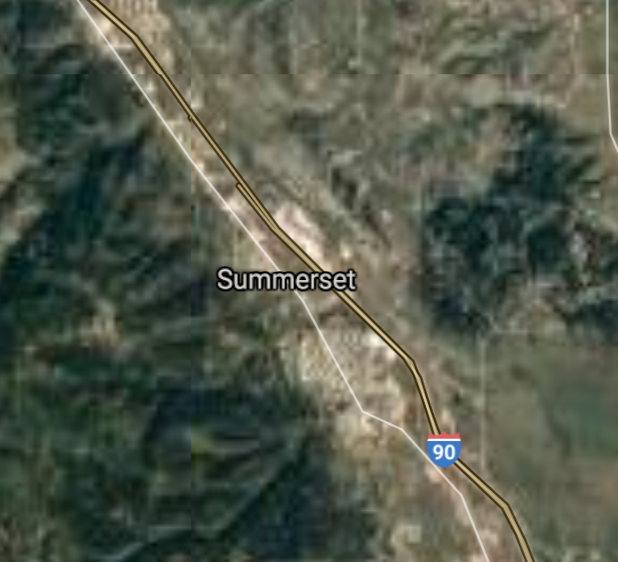
Summerset [*elevation ceiling = 40km]Elevation: 1110m (Group 231)
UR-100N (SLBM) |
Point A: 44.352207 00
Point B: 43.376667 00
Point C: 42.527217 00
Point D: 44.189978 00(300kt)
Point E: 45.664682 00
Point F: 43.810828 00
|
Point A: -103.765198 00
Point B: -99.859007 00
Point C: -96.483086 00
Point D: -103.343840 00(300kt)
Point E: -97.049805 00
Point F: -99.330656 00
|
|
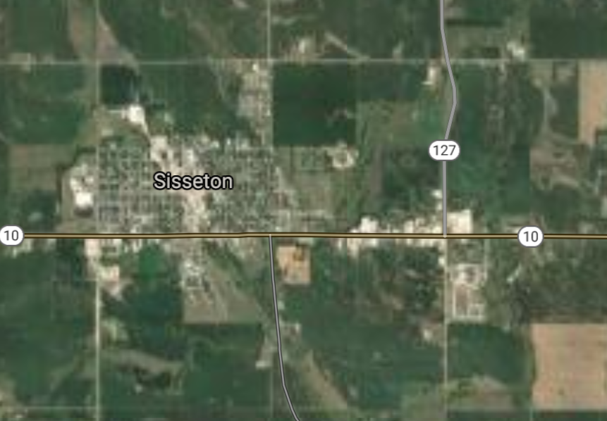
Sisseton [*elevation ceiling = 40km]Elevation: 372m (Group 231)
UR-100N (SLBM) |
Point A: 44.352207 00
Point B: 43.376667 00
Point C: 42.527217 00
Point D: 44.189978 00
Point E: 45.664682 00(300kt)
Point F: 43.810828 00
|
Point A: -103.765198 00
Point B: -99.859007 00
Point C: -96.483086 00
Point D: -103.343840 00
Point E: -97.049805 00(300kt)
Point F: -99.330656 00
|
|
Chamberlain [*elevation ceiling = 40km]Elevation: 429m (Group 231)
UR-100N (SLBM) |
Point A: 44.352207 00
Point B: 43.376667 00
Point C: 42.527217 00
Point D: 44.189978 00
Point E: 45.664682 00
Point F: 43.810828 00(300kt)
|
Point A: -103.765198 00
Point B: -99.859007 00
Point C: -96.483086 00
Point D: -103.343840 00
Point E: -97.049805 00
Point F: -99.330656 00(300kt)
|
|
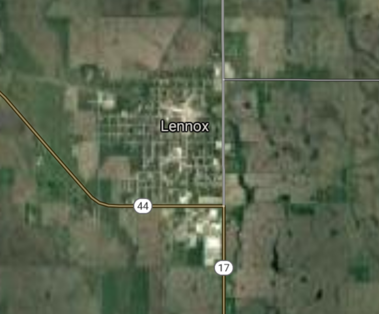
Lennox [*elevation ceiling = 40km]Elevation: 410m (Group 232)
UR-100N (SLBM) |
Point A: 43.354148 00(300kt)
Point B: 44.049415 00
Point C: 44.875810 00
Point D: 44.353593 00
Point E: 43.080545 00
Point F: 42.854166 00
|
Point A: -96.891995 00(300kt)
Point B: -96.595324 00
Point C: -98.518706 00
Point D: -100.373745 00
Point E: -96.773655 00
Point F: -97.897291 00
|
|
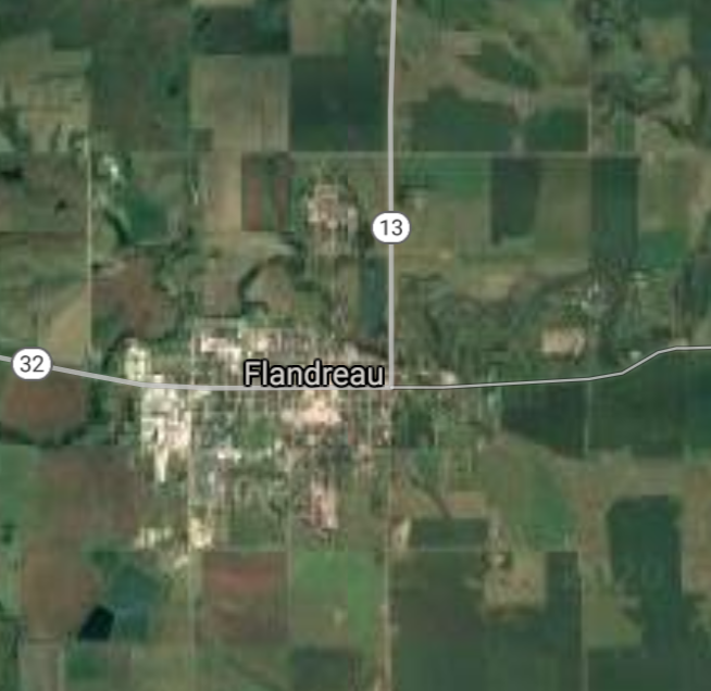
Flandreau [*elevation ceiling = 40km]Elevation: 476m (Group 232)
UR-100N (SLBM) |
Point A: 43.354148 00
Point B: 44.049415 00(300kt)
Point C: 44.875810 00
Point D: 44.353593 00
Point E: 43.080545 00
Point F: 42.854166 00
|
Point A: -96.891995 00
Point B: -96.595324 00(300kt)
Point C: -98.518706 00
Point D: -100.373745 00
Point E: -96.773655 00
Point F: -97.897291 00
|
|
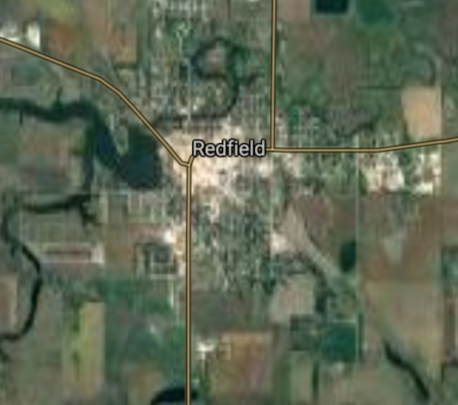
Redfield [*elevation ceiling = 40km]Elevation: 397m (Group 232)
UR-100N (SLBM) |
Point A: 43.354148 00
Point B: 44.049415 00
Point C: 44.875810 00(300kt)
Point D: 44.353593 00
Point E: 43.080545 00
Point F: 42.854166 00
|
Point A: -96.891995 00
Point B: -96.595324 00
Point C: -98.518706 00(300kt)
Point D: -100.373745 00
Point E: -96.773655 00
Point F: -97.897291 00
|
|
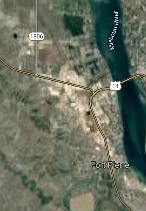
Fort Pierre [*elevation ceiling = 40km]Elevation: 438m (Group 232)
UR-100N (SLBM) |
Point A: 43.354148 00
Point B: 44.049415 00
Point C: 44.875810 00
Point D: 44.353593 00(300kt)
Point E: 43.080545 00
Point F: 42.854166 00
|
Point A: -96.891995 00
Point B: -96.595324 00
Point C: -98.518706 00
Point D: -100.373745 00(300kt)
Point E: -96.773655 00
Point F: -97.897291 00
|
|
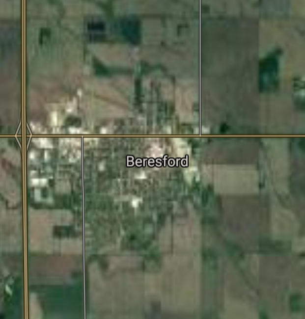
Beresford [*elevation ceiling = 40km]Elevation: 458m (Group 232)
UR-100N (SLBM) |
Point A: 43.354148 00
Point B: 44.049415 00
Point C: 44.875810 00
Point D: 44.353593 00
Point E: 43.080545 00(300kt)
Point F: 42.854166 00
|
Point A: -96.891995 00
Point B: -96.595324 00
Point C: -98.518706 00
Point D: -100.373745 00
Point E: -96.773655 00(300kt)
Point F: -97.897291 00
|
|
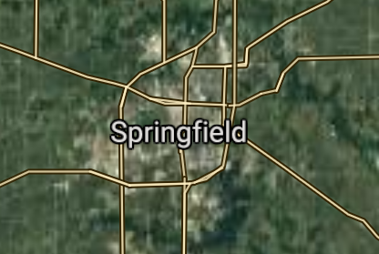
Springfield [*elevation ceiling = 40km]Elevation: 395m (Group 232)
UR-100N (SLBM) |
Point A: 43.354148 00
Point B: 44.049415 00
Point C: 44.875810 00
Point D: 44.353593 00
Point E: 43.080545 00
Point F: 42.854166 00(300kt)
|
Point A: -96.891995 00
Point B: -96.595324 00
Point C: -98.518706 00
Point D: -100.373745 00
Point E: -96.773655 00
Point F: -97.897291 00(300kt)
|
|
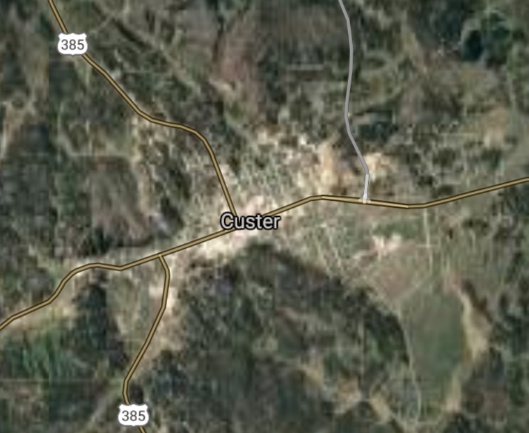
Custer [*elevation ceiling = 40km]Elevation: 1620m (Group 233)
UR-100N (SLBM) |
Point A: 43.766651 00(300kt)
Point B: 44.323580 00
Point C: 42.683330 00
Point D: 45.332180 00
Point E: 43.079716 00
Point F: 45.447459 00
|
Point A: -103.598806 00(300kt)
Point B: -96.926448 00
Point C: -96.683648 00
Point D: -97.520089 00
Point E: -98.293134 00
Point F: -98.098709 00
|
|
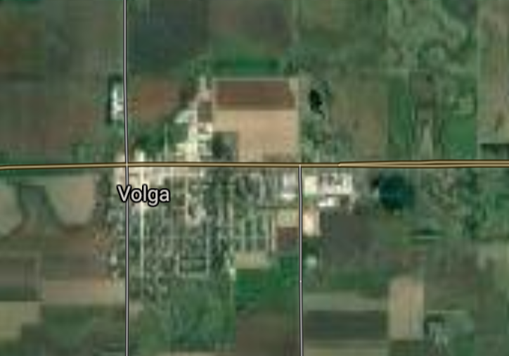
Volga [*elevation ceiling = 40km]Elevation: 499m (Group 233)
UR-100N (SLBM) |
Point A: 43.766651 00
Point B: 44.323580 00(300kt)
Point C: 42.683330 00
Point D: 45.332180 00
Point E: 43.079716 00
Point F: 45.447459 00
|
Point A: -103.598806 00
Point B: -96.926448 00(300kt)
Point C: -96.683648 00
Point D: -97.520089 00
Point E: -98.293134 00
Point F: -98.098709 00
|
|
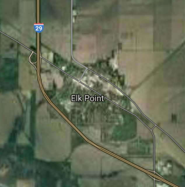
Elk Point [*elevation ceiling = 40km]Elevation: 343m (Group 233)
UR-100N (SLBM) |
Point A: 43.766651 00
Point B: 44.323580 00
Point C: 42.683330 00(300kt)
Point D: 45.332180 00
Point E: 43.079716 00
Point F: 45.447459 00
|
Point A: -103.598806 00
Point B: -96.926448 00
Point C: -96.683648 00(300kt)
Point D: -97.520089 00
Point E: -98.293134 00
Point F: -98.098709 00
|
|
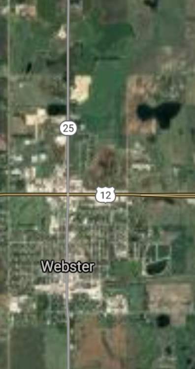
Webster [*elevation ceiling = 40km]Elevation: 566m (Group 233)
UR-100N (SLBM) |
Point A: 43.766651 00
Point B: 44.323580 00
Point C: 42.683330 00
Point D: 45.332180 00(300kt)
Point E: 43.079716 00
Point F: 45.447459 00
|
Point A: -103.598806 00
Point B: -96.926448 00
Point C: -96.683648 00
Point D: -97.520089 00(300kt)
Point E: -98.293134 00
Point F: -98.098709 00
|
|
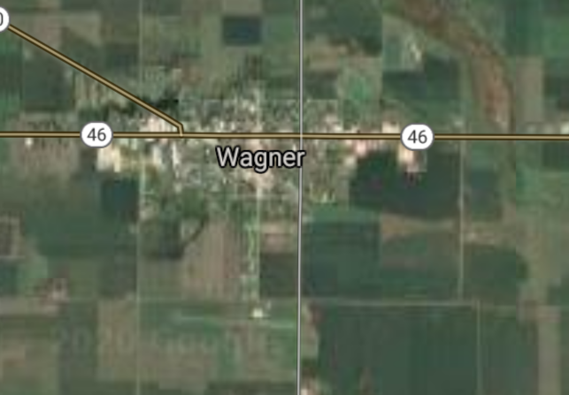
Wagner [*elevation ceiling = 40km]Elevation: 440m (Group 233)
UR-100N (SLBM) |
Point A: 43.766651 00
Point B: 44.323580 00
Point C: 42.683330 00
Point D: 45.332180 00
Point E: 43.079716 00(300kt)
Point F: 45.447459 00
|
Point A: -103.598806 00
Point B: -96.926448 00
Point C: -96.683648 00
Point D: -97.520089 00
Point E: -98.293134 00(300kt)
Point F: -98.098709 00
|
|
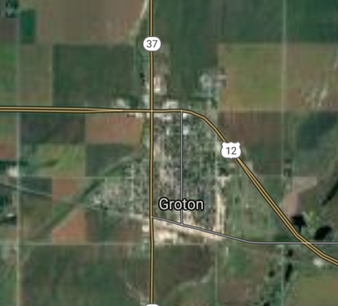
Groton [*elevation ceiling = 40km]Elevation: 397m (Group 233)
UR-100N (SLBM) |
Point A: 43.766651 00
Point B: 44.323580 00
Point C: 42.683330 00
Point D: 45.332180 00
Point E: 43.079716 00
Point F: 45.447459 00(300kt)
|
Point A: -103.598806 00
Point B: -96.926448 00
Point C: -96.683648 00
Point D: -97.520089 00
Point E: -98.293134 00
Point F: -98.098709 00(300kt)
|
|
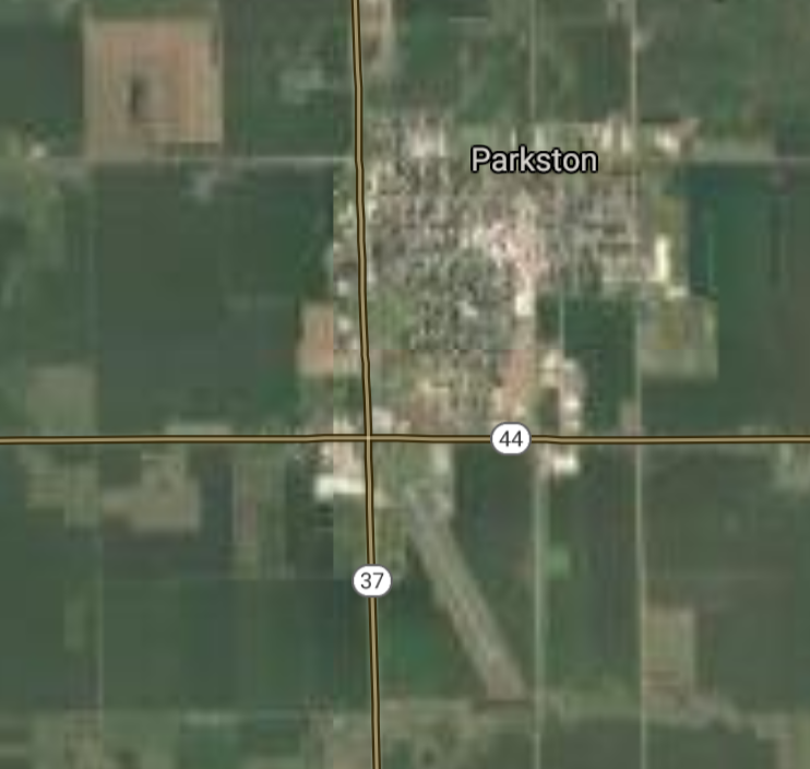
Parkston [*elevation ceiling = 40km]Elevation: 425m (Group 234)
UR-100N (SLBM) |
Point A: 43.398876 00(300kt)
Point B: 44.518315 00
Point C: 44.988654 00
Point D: 43.664698 00
Point E: 44.376651 00
Point F: 43.352487 00
|
Point A: -97.983683 00(300kt)
Point B: -98.988434 00
Point C: -101.222481 00
Point D: -96.810803 00
Point E: -103.729642 00
Point F: -97.437286 00
|
|
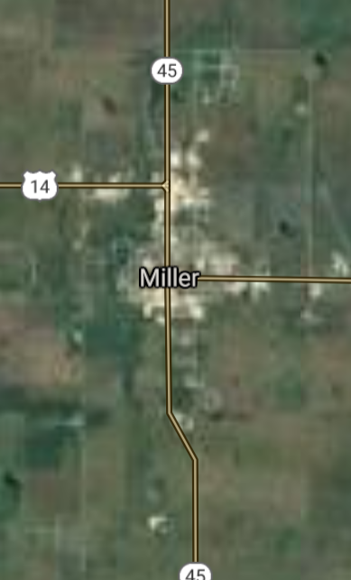
Miller [*elevation ceiling = 40km]Elevation: 480m (Group 234)
UR-100N (SLBM) |
Point A: 43.398876 00
Point B: 44.518315 00(300kt)
Point C: 44.988654 00
Point D: 43.664698 00
Point E: 44.376651 00
Point F: 43.352487 00
|
Point A: -97.983683 00
Point B: -98.988434 00(300kt)
Point C: -101.222481 00
Point D: -96.810803 00
Point E: -103.729642 00
Point F: -97.437286 00
|
|
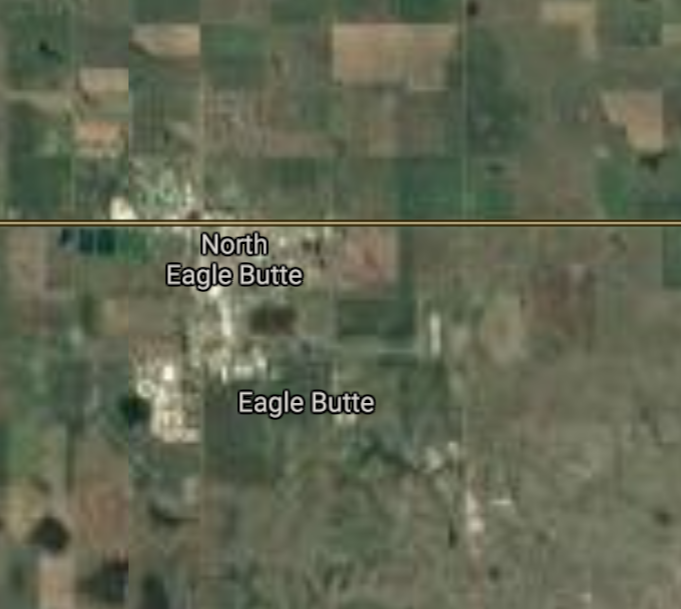
Eagle Butte [*elevation ceiling = 40km]Elevation: 738m (Group 234)
UR-100N (SLBM) |
Point A: 43.398876 00
Point B: 44.518315 00
Point C: 44.988654 00(300kt)
Point D: 43.664698 00
Point E: 44.376651 00
Point F: 43.352487 00
|
Point A: -97.983683 00
Point B: -98.988434 00
Point C: -101.222481 00(300kt)
Point D: -96.810803 00
Point E: -103.729642 00
Point F: -97.437286 00
|
|
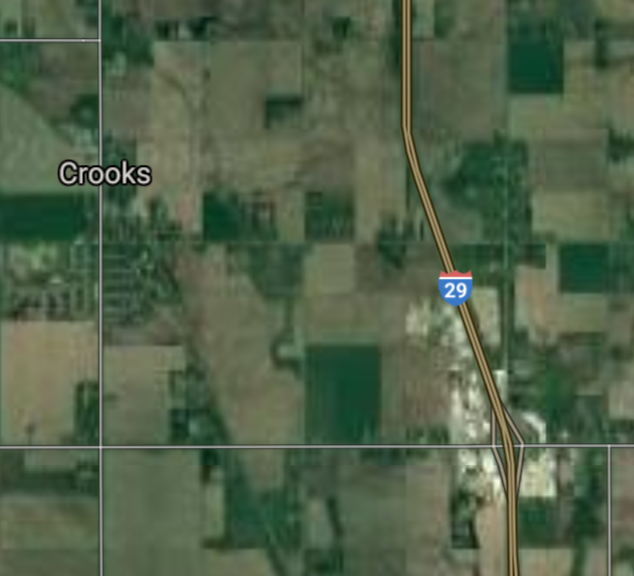
Crooks [*elevation ceiling = 40km]Elevation: 485m (Group 234)
UR-100N (SLBM) |
Point A: 43.398876 00
Point B: 44.518315 00
Point C: 44.988654 00
Point D: 43.664698 00(300kt)
Point E: 44.376651 00
Point F: 43.352487 00
|
Point A: -97.983683 00
Point B: -98.988434 00
Point C: -101.222481 00
Point D: -96.810803 00(300kt)
Point E: -103.729642 00
Point F: -97.437286 00
|
|
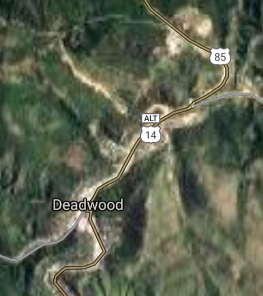
Deadwood [*elevation ceiling = 40km]Elevation: 1383m (Group 234)
UR-100N (SLBM) |
Point A: 43.398876 00
Point B: 44.518315 00
Point C: 44.988654 00
Point D: 43.664698 00
Point E: 44.376651 00(300kt)
Point F: 43.352487 00
|
Point A: -97.983683 00
Point B: -98.988434 00
Point C: -101.222481 00
Point D: -96.810803 00
Point E: -103.729642 00(300kt)
Point F: -97.437286 00
|
|
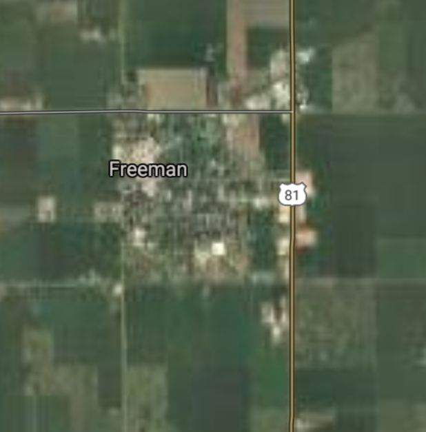
Freeman [*elevation ceiling = 40km]Elevation: 462m (Group 234)
UR-100N (SLBM) |
Point A: 43.398876 00
Point B: 44.518315 00
Point C: 44.988654 00
Point D: 43.664698 00
Point E: 44.376651 00
Point F: 43.352487 00(300kt)
|
Point A: -97.983683 00
Point B: -98.988434 00
Point C: -101.222481 00
Point D: -96.810803 00
Point E: -103.729642 00
Point F: -97.437286 00(300kt)
|


[Top]
Situation: Central Basin
"BRICS Security Council emerging from cross-currency evaluations"
OPEN Start: Central Basin - is an engineering vessel which is proven with climate security in evaluation of the USD/YEN currency pair. Annually, climate security is leading economic growth in key emerging markets surrounding the Four Asian Tigers. Affordably, the following industries extend opportunities for military cooperation: aerospace, telecommunications, finance and banking. OPEN Start: Central Basin strengthens the backbone for international security beyond the shadows of USD/YEN controversy. Traversely, OPEN Start: Central Basin offsets the cross-over gap between the USD/MXN and USD/RUB exchange rates. Notably, the Three Amigas form an economic alliance in the Far West through joint-cooperation projects from Venture 1, Venture LA and Venture SF which all extend with the Far North reach towards the Far South (as illustrated below).
![]()
![]()
![]()
![]()
![]()
![]()
![]()
![]()
![]()
JanuaryFebruaryMarchAprilJuneJulySeptemberOctoberDecember |
2026 Group Drills - Schedule
|
|

JanuaryFebruaryJuneJulyAugustOctoberNovemberDecember |
2026 Group Drills - Schedule
|
|

JanuaryFebruaryJuneJulySeptemberOctoberNovemberDecember |
2026 Group Drills - Schedule
|
|
