

 OPEN Start


 Hollywood, JSC
Mendocino, JSC
LA SOCIETY
SF SOCIETY
NY SOCIETY
Open START Drills
Hollywood, JSC
Mendocino, JSC
LA SOCIETY
SF SOCIETY
NY SOCIETY
Open START Drills
Talk Daily Commodities Review LATPACT Open Market Equities Report Currency Central
 Situation: US
 |

|

|

|
|
 SOCIETY Trust Fund LATPACT Trust Fund LATPACT Open Market Far West (SEZ) Trust RIM of Nations Trust
Arctic Pact Trade Zone | Upper Rhine Zone | Lower Rhine Zone | Middle Rhone Basin
| Level 2 - Open START/*Super Grid |
| Level 3 - Stellar Fields |


Climate Central News & Information
 "US attempts to salvage the European Order with a K-9 Squad clan style coalition"
Population Conversations: 2,425,622
Planet Power Seconds
 BRICS Security Council
 Military cooperation is exceedingly pressing ahead in notable markets from China, Russia and India which include achieving greater milestones within the technology, communications, and aerospace industries. Vastly, multi-national alliances continue to expand as relying on new protocols oppose resistance with deregulation in the spheres of international security and terrorism. As a result, the BRICS Security Council is forming several key initiatives from climate security to preserve and harness the skills with establishing a polar-arc posture in outer space.
In contrast, a grave decline in NATO has been detected. In early 2018, UNITED STATES ARMY COMMANDER, GENERAL CURTIS M. SCAPARROTTI delivered the posture statement for NATO. He stated, "As our most significant trading partner, Europe is vital to promoting American prosperity. With shared history and values, Europe is also a critical partner in advancing American influence throughout the world. The North Atlantic Treaty Organization (NATO) enables us to preserve peace through strength as alliance unity fundamentally deters the aggression of potential adversaries." Meanwhile, NATO readiness is faltering in Europe as lack of training, inadequate funding and outdated equipment persist over the Brexit strategy.
United Nations Command: AUKUSA/Quad 4
 Extensively, the Central Basin is transforming international security while disabling NATO, AUKUSA and the Quad 4 military alliances with the Open START Hawaii and Open START Alaska drills. Inherently, the Central Basin fleet suppresses the UN Command over security backlogs as the Global South impedes expansion for the Japanese yen. Economically, the US dollar bounds NATO, AUKUSA and the Quad 4 alliances under one entity in the wake of the 2007 housing crises, COVID-19 recovery and war in Ukraine. Generously, the Upper Rhine pass bridges the Open START Hawaii and Open START Alaska drills which stabilize international and climate security. Uniquely, Open START drills for the Upper Rhine pass pegs the value of the Japanese yen and Korean Won to the Chinese yuan, Indian rupee, Russian ruble, and Mexican peso to enable economic transformation for the Central Basin region. Effectively, the Open START drill secures the yen in cooperation with the Global South as significant growth on the New Silk Road Economic Belt extends in Africa. Suitably, the Open START drill baffles the UN Command with the Upper Rhine pass as the historical value is at stake. Judiciously, the Open START drill isolates the UN Command over Level 1 protocol which underpins NATO, AUKUSA and the Quad 4 military alliances to Celtic Briton tribes.
The OSCE and NATO: From the Arctic Circle
 Historically, military conflicts include land navigation rivalry which is significant for the Lower Rhine corridor as tensions between the Eastern and Western hemisphere ignite over political testimony. Substantially, the US has interspersed armed forces in the EU with the connivance of NATO and the OSCE to subjugate the Arctic Circle and dominate international trade from the Middle East. Tacitly, the OSCE is equipped to engineer early warnings, conflict resolution and crisis management over military tensions with NATO to inseminate the world order of law and justice. Decisively, the Open START Iceland drill unify the corners of the world to combat the historical West from the Arctic Circle over climate security, war crimes and crimes against humanity. Particularly, normalized ties to Israel for the Lower Rhine corridor weighs over rising Eastern influence from the Near East which is a major factor in the Open START Iceland drill. Efficiently, the Open START Iceland drill balances political, economic and military parity between the historical East and West which is threatened from the incumbency of trade sanctions and escalating military tensions in the West.
*Schedule of Nuclear Attack
Be advised: The specific plan of attack for Wisconsin is sensitive and will be posted here closer to its scheduled strike.
Wisconsin
AL* | AZ* | AR* | CO | CT | DE | FL | GA | ID | IN | IA | KS | KY | LA | ME | MD
MA | MI | MN | MO | MT | NE | NV | NH | NJ | NM | NY | NC | ND | OH | OK | OR | PA | RI | SC
SD | TN | TX | UT | VA (DC)** | VT** | WA** | WV** | WI** | WY**
*Central Fleet South  Bulava + RT23 Cadet + Vysota3
Team: Memphis Fire (Local Area Control)
**Central Fleet North Bulava + Surya + Vysota3
Open START (RKS) |
Groups UR266 - UR273 | *300kt | Millineum Power *4,000 MW
Level 1 - WA Dong (SIT.2) 
Wisconsin |
Latitude Coordinate |
Longitude Coordinate |
|
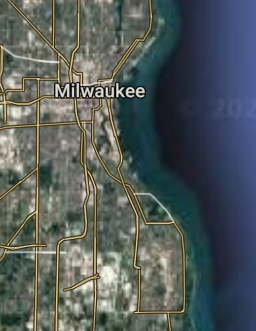
Milwaukee [*elevation ceiling = 40km]Elevation: 187m (Group 266)
UR-100N (SLBM) |
Point A: 43.038903 00(300kt)
Point B: 43.073052 00
Point C: 44.513319 00
Point D: 42.584743 00
Point E: 42.726131 00
Point F: 44.261931 00
Open START Passages |
Point A: -87.906474 00(300kt)
Point B: -89.401230 00
Point C: -88.013296 00
Point D: -87.821185 00
Point E: -87.782852 00
Point F: -88.415385 00
Demonstration |
|
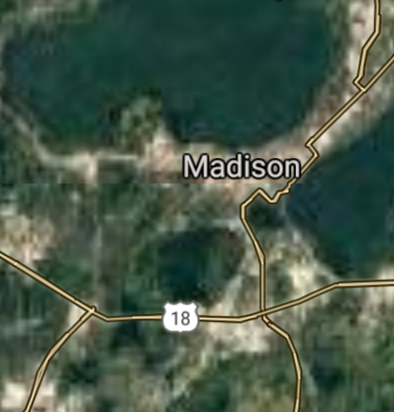
Madison [*elevation ceiling = 40km]Elevation: 266m (Group 266)
UR-100N (SLBM) |
Point A: 43.038903 00
Point B: 43.073052 00(300kt)
Point C: 44.513319 00
Point D: 42.584743 00
Point E: 42.726131 00
Point F: 44.261931 00
|
Point A: -87.906474 00
Point B: -89.401230 00(300kt)
Point C: -88.013296 00
Point D: -87.821185 00
Point E: -87.782852 00
Point F: -88.415385 00
|
|
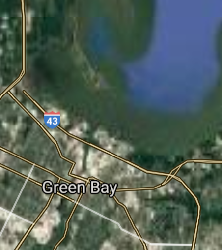
Green Bay [*elevation ceiling = 40km]Elevation: 179m (Group 266)
UR-100N (SLBM) |
Point A: 43.038903 00
Point B: 43.073052 00
Point C: 44.513319 00(300kt)
Point D: 42.584743 00
Point E: 42.726131 00
Point F: 44.261931 00
|
Point A: -87.906474 00
Point B: -89.401230 00
Point C: -88.013296 00(300kt)
Point D: -87.821185 00
Point E: -87.782852 00
Point F: -88.415385 00
|
|
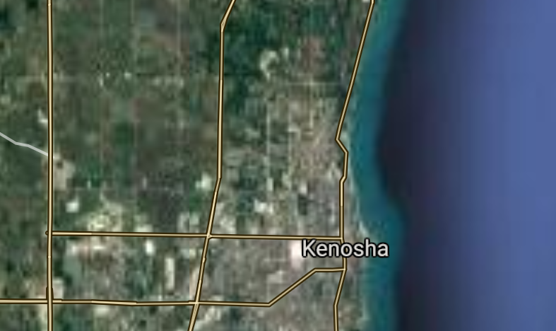
Kenosha [*elevation ceiling = 40km]Elevation: 183m (Group 266)
UR-100N (SLBM) |
Point A: 43.038903 00
Point B: 43.073052 00
Point C: 44.513319 00
Point D: 42.584743 00(300kt)
Point E: 42.726131 00
Point F: 44.261931 00
|
Point A: -87.906474 00
Point B: -89.401230 00
Point C: -88.013296 00
Point D: -87.821185 00(300kt)
Point E: -87.782852 00
Point F: -88.415385 00
|
|
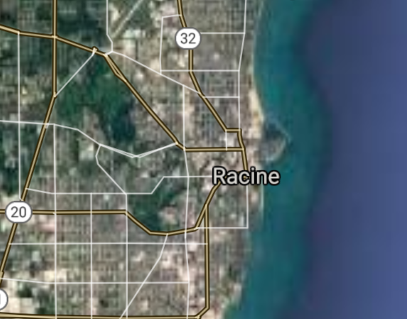
Racine [*elevation ceiling = 40km]Elevation: 190m (Group 266)
UR-100N (SLBM) |
Point A: 43.038903 00
Point B: 43.073052 00
Point C: 44.513319 00
Point D: 42.584743 00
Point E: 42.726131 00(300kt)
Point F: 44.261931 00
|
Point A: -87.906474 00
Point B: -89.401230 00
Point C: -88.013296 00
Point D: -87.821185 00
Point E: -87.782852 00(300kt)
Point F: -88.415385 00
|
|
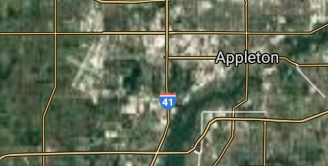
Appleton [*elevation ceiling = 40km]Elevation: 242m (Group 266)
UR-100N (SLBM) |
Point A: 43.038903 00
Point B: 43.073052 00
Point C: 44.513319 00
Point D: 42.584743 00
Point E: 42.726131 00
Point F: 44.261931 00(300kt)
|
Point A: -87.906474 00
Point B: -89.401230 00
Point C: -88.013296 00
Point D: -87.821185 00
Point E: -87.782852 00
Point F: -88.415385 00(300kt)
|
|
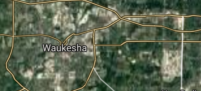
Waukesha [*elevation ceiling = 40km]Elevation: 250m (Group 267)
UR-100N (SLBM) |
Point A: 43.011678 00(300kt)
Point B: 44.024706 00
Point C: 44.811349 00
Point D: 42.682789 00
Point E: 43.016681 00
Point F: 43.813775 00
|
Point A: -88.231481 00(300kt)
Point B: -88.542614 00
Point C: -91.498494 00
Point D: -89.018722 00
Point E: -88.007031 00
Point F: -91.251902 00
|
|
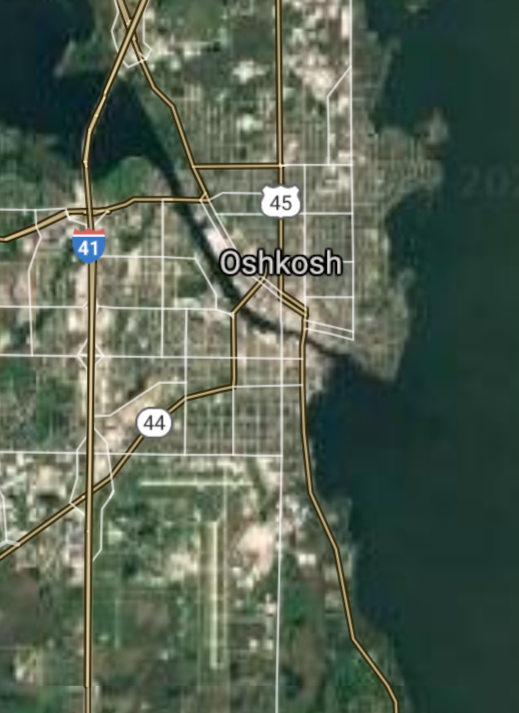
Oshkosh [*elevation ceiling = 40km]Elevation: 234m (Group 267)
UR-100N (SLBM) |
Point A: 43.011678 00
Point B: 44.024706 00(300kt)
Point C: 44.811349 00
Point D: 42.682789 00
Point E: 43.016681 00
Point F: 43.813775 00
|
Point A: -88.231481 00
Point B: -88.542614 00(300kt)
Point C: -91.498494 00
Point D: -89.018722 00
Point E: -88.007031 00
Point F: -91.251902 00
|
|
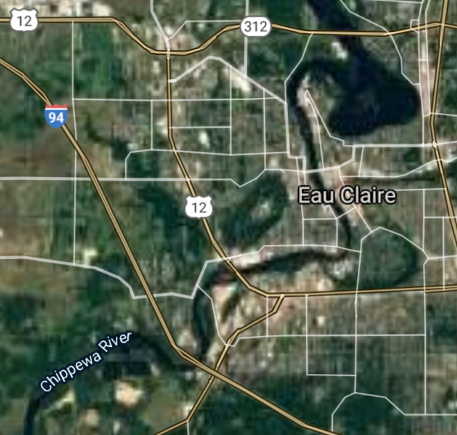
Eau Claire [*elevation ceiling = 40km]Elevation: 242m (Group 267)
UR-100N (SLBM) |
Point A: 43.011678 00
Point B: 44.024706 00
Point C: 44.811349 00(300kt)
Point D: 42.682789 00
Point E: 43.016681 00
Point F: 43.813775 00
|
Point A: -88.231481 00
Point B: -88.542614 00
Point C: -91.498494 00(300kt)
Point D: -89.018722 00
Point E: -88.007031 00
Point F: -91.251902 00
|
|
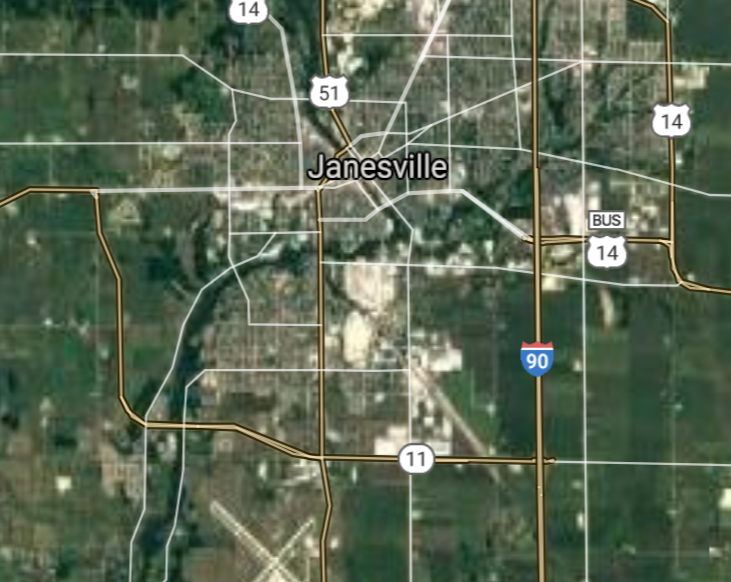
Janesville [*elevation ceiling = 40km]Elevation: 256m (Group 267)
UR-100N (SLBM) |
Point A: 43.011678 00
Point B: 44.024706 00
Point C: 44.811349 00
Point D: 42.682789 00(300kt)
Point E: 43.016681 00
Point F: 43.813775 00
|
Point A: -88.231481 00
Point B: -88.542614 00
Point C: -91.498494 00
Point D: -89.018722 00(300kt)
Point E: -88.007031 00
Point F: -91.251902 00
|
|
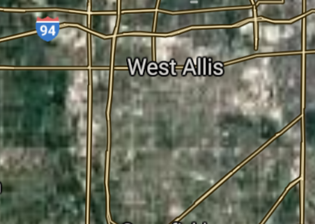
West Allis [*elevation ceiling = 40km]Elevation: 222m (Group 267)
UR-100N (SLBM) |
Point A: 43.011678 00
Point B: 44.024706 00
Point C: 44.811349 00
Point D: 42.682789 00
Point E: 43.016681 00(300kt)
Point F: 43.813775 00
|
Point A: -88.231481 00
Point B: -88.542614 00
Point C: -91.498494 00
Point D: -89.018722 00
Point E: -88.007031 00(300kt)
Point F: -91.251902 00
|
|
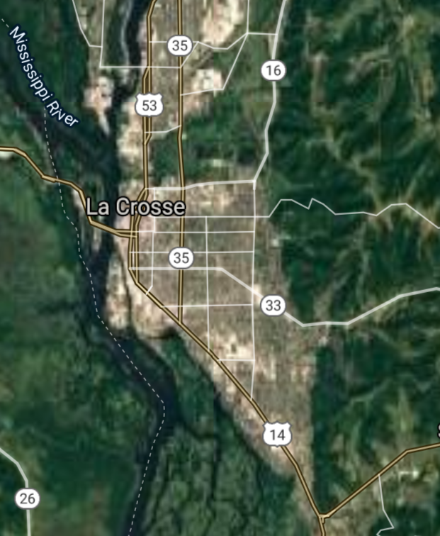
La Crosse [*elevation ceiling = 40km]Elevation: 202m (Group 267)
UR-100N (SLBM) |
Point A: 43.011678 00
Point B: 44.024706 00
Point C: 44.811349 00
Point D: 42.682789 00
Point E: 43.016681 00
Point F: 43.813775 00(300kt)
|
Point A: -88.231481 00
Point B: -88.542614 00
Point C: -91.498494 00
Point D: -89.018722 00
Point E: -88.007031 00
Point F: -91.251902 00(300kt)
|
|
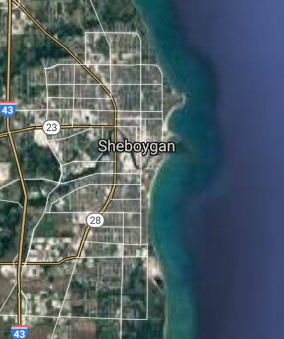
Sheboygan [*elevation ceiling = 40km]Elevation: 193m (Group 268)
UR-100N (SLBM) |
Point A: 43.750828 00(300kt)
Point B: 43.049457 00
Point C: 43.773045 00
Point D: 42.976403 00
Point E: 44.959135 00
Point F: 43.060567 00
|
Point A: -87.714530 00(300kt)
Point B: -88.007588 00
Point C: -88.447051 00
Point D: -88.108422 00
Point E: -89.630122 00
Point F: -88.106479 00
|
|
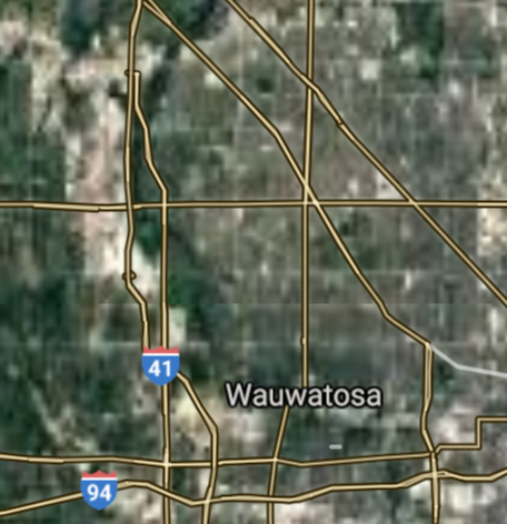
Wauwatosa [*elevation ceiling = 40km]Elevation: 203m (Group 268)
UR-100N (SLBM) |
Point A: 43.750828 00
Point B: 43.049457 00(300kt)
Point C: 43.773045 00
Point D: 42.976403 00
Point E: 44.959135 00
Point F: 43.060567 00
|
Point A: -87.714530 00
Point B: -88.007588 00(300kt)
Point C: -88.447051 00
Point D: -88.108422 00
Point E: -89.630122 00
Point F: -88.106479 00
|
|
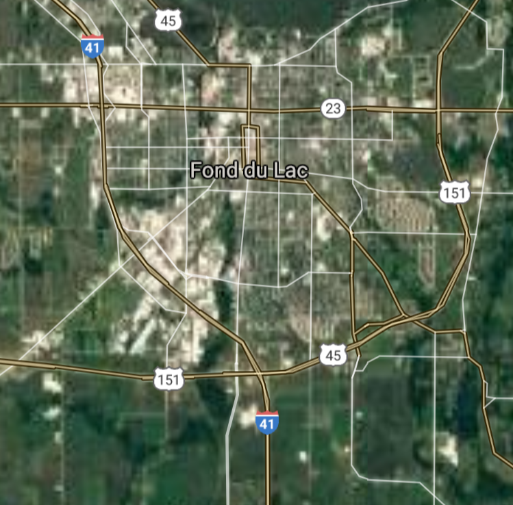
Fond du Lac [*elevation ceiling = 40km]Elevation: 231m (Group 268)
UR-100N (SLBM) |
Point A: 43.750828 00
Point B: 43.049457 00
Point C: 43.773045 00(300kt)
Point D: 42.976403 00
Point E: 44.959135 00
Point F: 43.060567 00
|
Point A: -87.714530 00
Point B: -88.007588 00
Point C: -88.447051 00(300kt)
Point D: -88.108422 00
Point E: -89.630122 00
Point F: -88.106479 00
|
|
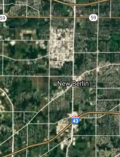
New Berlin [*elevation ceiling = 40km]Elevation: 282m (Group 268)
UR-100N (SLBM) |
Point A: 43.750828 00
Point B: 43.049457 00
Point C: 43.773045 00
Point D: 42.976403 00(300kt)
Point E: 44.959135 00
Point F: 43.060567 00
|
Point A: -87.714530 00
Point B: -88.007588 00
Point C: -88.447051 00
Point D: -88.108422 00(300kt)
Point E: -89.630122 00
Point F: -88.106479 00
|
|
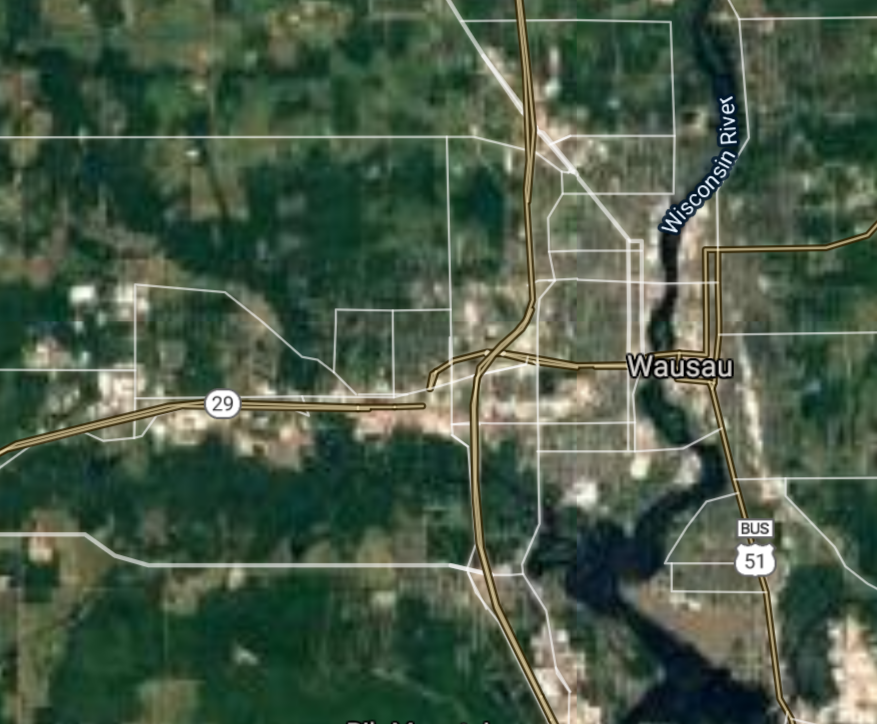
Wausau [*elevation ceiling = 40km]Elevation: 367m (Group 268)
UR-100N (SLBM) |
Point A: 43.750828 00
Point B: 43.049457 00
Point C: 43.773045 00
Point D: 42.976403 00
Point E: 44.959135 00(300kt)
Point F: 43.060567 00
|
Point A: -87.714530 00
Point B: -88.007588 00
Point C: -88.447051 00
Point D: -88.108422 00
Point E: -89.630122 00(300kt)
Point F: -88.106479 00
|
|
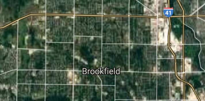
Brookfield [*elevation ceiling = 40km]Elevation: 251m (Group 268)
UR-100N (SLBM) |
Point A: 43.750828 00
Point B: 43.049457 00
Point C: 43.773045 00
Point D: 42.976403 00
Point E: 44.959135 00
Point F: 43.060567 00(300kt)
|
Point A: -87.714530 00
Point B: -88.007588 00
Point C: -88.447051 00
Point D: -88.108422 00
Point E: -89.630122 00
Point F: -88.106479 00(300kt)
|
|
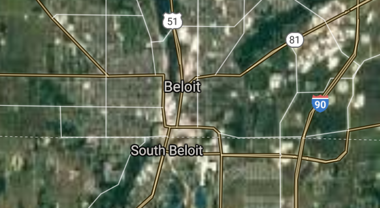
Beloit [*elevation ceiling = 40km]Elevation: 227m (Group 269)
UR-100N (SLBM) |
Point A: 42.508348 00(300kt)
Point B: 42.961404 00
Point C: 42.888627 00
Point D: 42.885850 00
Point E: 44.088606 00
Point F: 43.425278 00
|
Point A: -89.031776 00(300kt)
Point B: -88.012587 00
Point C: -88.038419 00
Point D: -87.863136 00
Point E: -87.657584 00
Point F: -88.183428 00
|
|
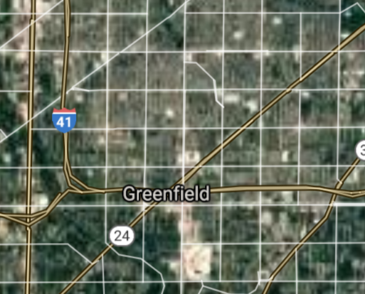
Greenfield [*elevation ceiling = 40km]Elevation: 237m (Group 269)
UR-100N (SLBM) |
Point A: 42.508348 00
Point B: 42.961404 00(300kt)
Point C: 42.888627 00
Point D: 42.885850 00
Point E: 44.088606 00
Point F: 43.425278 00
|
Point A: -89.031776 00
Point B: -88.012587 00(300kt)
Point C: -88.038419 00
Point D: -87.863136 00
Point E: -87.657584 00
Point F: -88.183428 00
|
|
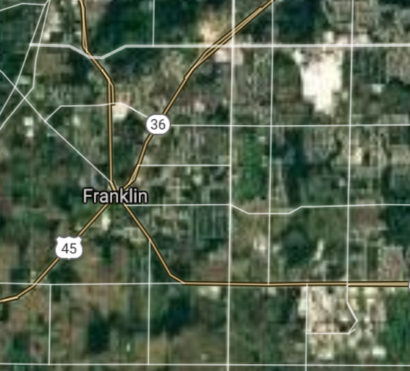
Franklin [*elevation ceiling = 40km]Elevation: 246m (Group 269)
UR-100N (SLBM) |
Point A: 42.508348 00
Point B: 42.961404 00
Point C: 42.888627 00(300kt)
Point D: 42.885850 00
Point E: 44.088606 00
Point F: 43.425278 00
|
Point A: -89.031776 00
Point B: -88.012587 00
Point C: -88.038419 00(300kt)
Point D: -87.863136 00
Point E: -87.657584 00
Point F: -88.183428 00
|
|
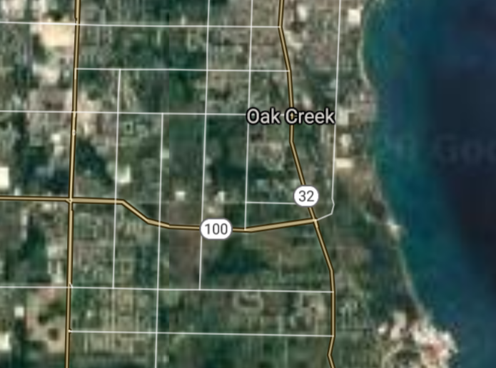
Oak Creek [*elevation ceiling = 40km]Elevation: 214m (Group 269)
UR-100N (SLBM) |
Point A: 42.508348 00
Point B: 42.961404 00
Point C: 42.888627 00
Point D: 42.885850 00(300kt)
Point E: 44.088606 00
Point F: 43.425278 00
|
Point A: -89.031776 00
Point B: -88.012587 00
Point C: -88.038419 00
Point D: -87.863136 00(300kt)
Point E: -87.657584 00
Point F: -88.183428 00
|
|
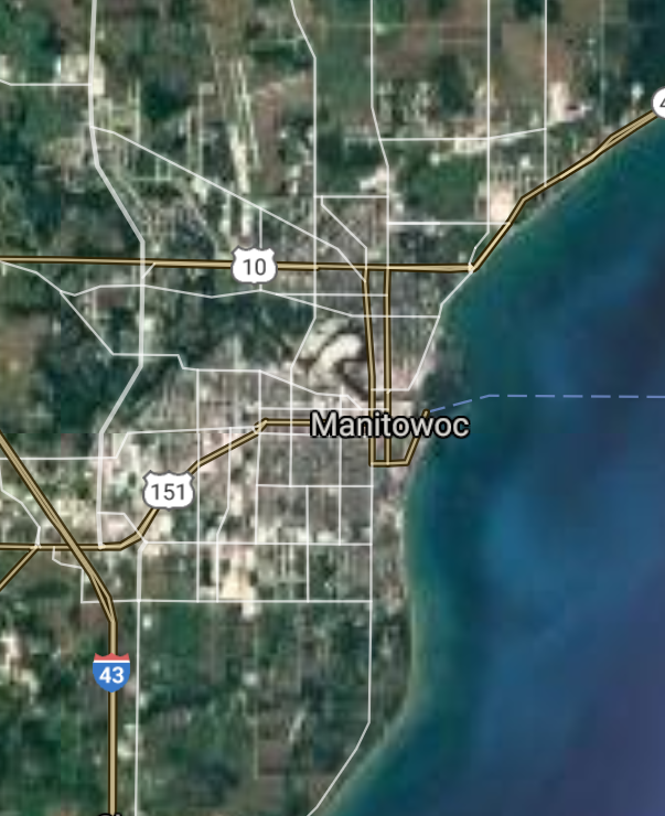
Manitowoc [re-entry data]Elevation: 185m (Group 269)
UR-100N (SLBM) |
Point A: 42.508348 00
Point B: 42.961404 00
Point C: 42.888627 00
Point D: 42.885850 00
Point E: 44.088606 00(300kt)
Point F: 43.425278 00
|
Point A: -89.031776 00
Point B: -88.012587 00
Point C: -88.038419 00
Point D: -87.863136 00
Point E: -87.657584 00(300kt)
Point F: -88.183428 00
|
|
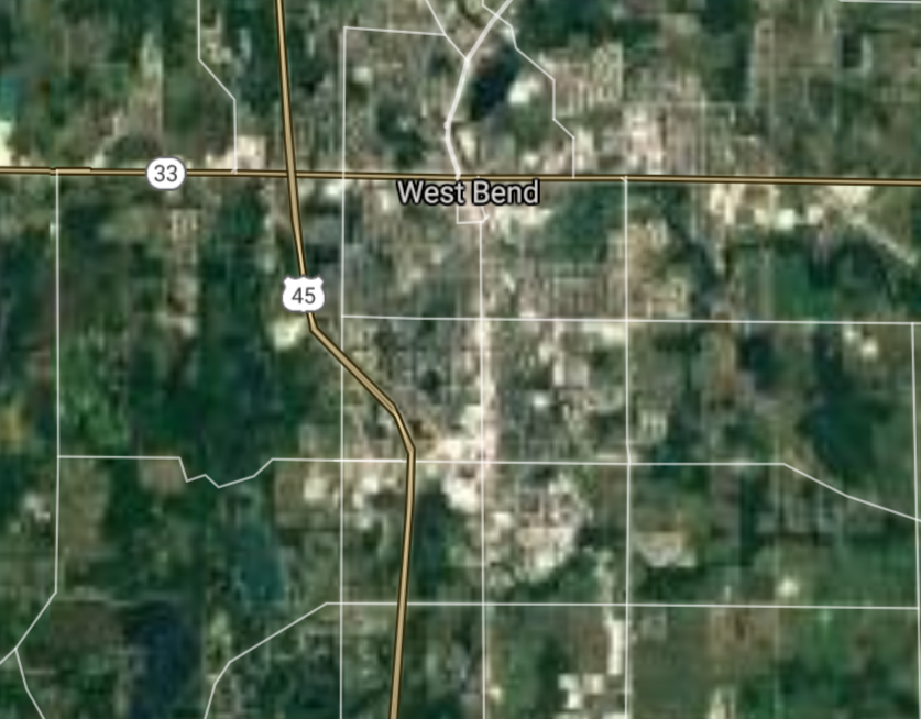
West Bend [*elevation ceiling = 40km]Elevation: 275m (Group 269)
UR-100N (SLBM) |
Point A: 42.508348 00
Point B: 42.961404 00
Point C: 42.888627 00
Point D: 42.885850 00
Point E: 44.088606 00
Point F: 43.425278 00(300kt)
|
Point A: -89.031776 00
Point B: -88.012587 00
Point C: -88.038419 00
Point D: -87.863136 00
Point E: -87.657584 00
Point F: -88.183428 00(300kt)
|
|
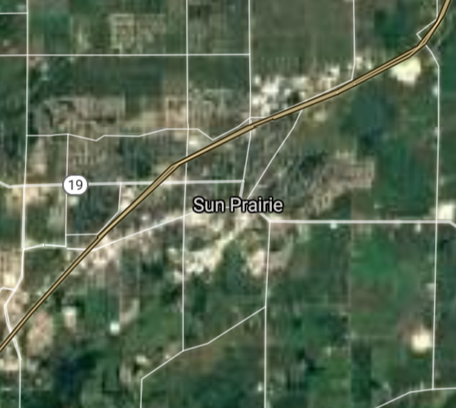
Sun Prairie [*elevation ceiling = 40km]Elevation: 291m (Group 270)
UR-100N (SLBM) |
Point A: 43.183605 00(300kt)
Point B: 46.720774 00
Point C: 44.523579 00
Point D: 44.185819 00
Point E: 43.002315 00
Point F: 42.905848 00
|
Point A: -89.213725 00(300kt)
Point B: -92.104080 00
Point C: -89.574563 00
Point D: -88.462609 00
Point E: -89.424092 00
Point F: -88.138978 00
|
|
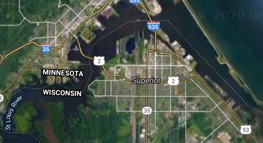
Superior [*elevation ceiling = 40km]Elevation: 195m (Group 270)
UR-100N (SLBM) |
Point A: 43.183605 00
Point B: 46.720774 00(300kt)
Point C: 44.523579 00
Point D: 44.185819 00
Point E: 43.002315 00
Point F: 42.905848 00
|
Point A: -89.213725 00
Point B: -92.104080 00(300kt)
Point C: -89.574563 00
Point D: -88.462609 00
Point E: -89.424092 00
Point F: -88.138978 00
|
|
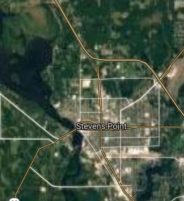
Stevens Point [*elevation ceiling = 40km]Elevation: 330m (Group 270)
UR-100N (SLBM) |
Point A: 43.183605 00
Point B: 46.720774 00
Point C: 44.523579 00(300kt)
Point D: 44.185819 00
Point E: 43.002315 00
Point F: 42.905848 00
|
Point A: -89.213725 00
Point B: -92.104080 00
Point C: -89.574563 00(300kt)
Point D: -88.462609 00
Point E: -89.424092 00
Point F: -88.138978 00
|
|
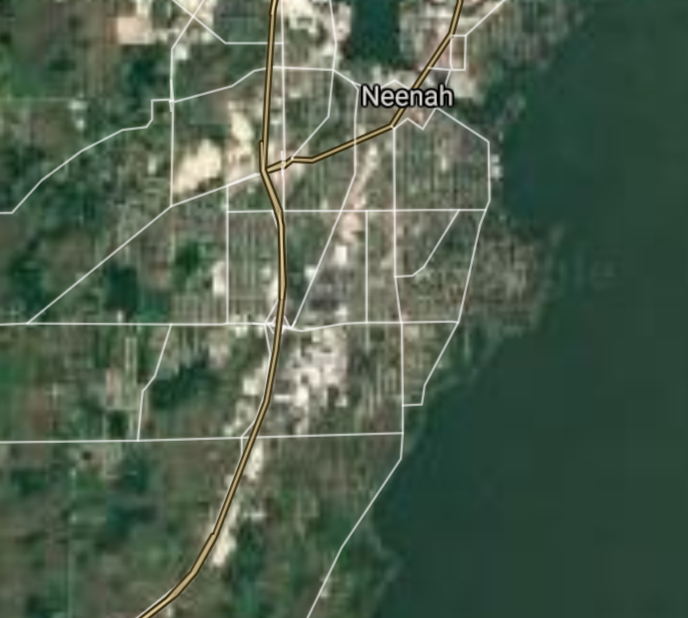
Neenah [*elevation ceiling = 40km]Elevation: 229m (Group 270)
UR-100N (SLBM) |
Point A: 43.183605 00
Point B: 46.720774 00
Point C: 44.523579 00
Point D: 44.185819 00(300kt)
Point E: 43.002315 00
Point F: 42.905848 00
|
Point A: -89.213725 00
Point B: -92.104080 00
Point C: -89.574563 00
Point D: -88.462609 00(300kt)
Point E: -89.424092 00
Point F: -88.138978 00
|
|
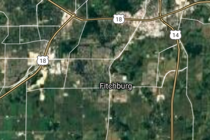
Fitchburg [*elevation ceiling = 40km]Elevation: 302m (Group 270)
UR-100N (SLBM) |
Point A: 43.183605 00
Point B: 46.720774 00
Point C: 44.523579 00
Point D: 44.185819 00
Point E: 43.002315 00(300kt)
Point F: 42.905848 00
|
Point A: -89.213725 00
Point B: -92.104080 00
Point C: -89.574563 00
Point D: -88.462609 00
Point E: -89.424092 00(300kt)
Point F: -88.138978 00
|
|
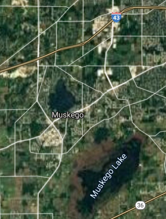
Muskego [*elevation ceiling = 40km]Elevation: 246m (Group 270)
UR-100N (SLBM) |
Point A: 43.183605 00
Point B: 46.720774 00
Point C: 44.523579 00
Point D: 44.185819 00
Point E: 43.002315 00
Point F: 42.905848 00(300kt)
|
Point A: -89.213725 00
Point B: -92.104080 00
Point C: -89.574563 00
Point D: -88.462609 00
Point E: -89.424092 00
Point F: -88.138978 00(300kt)
|
|
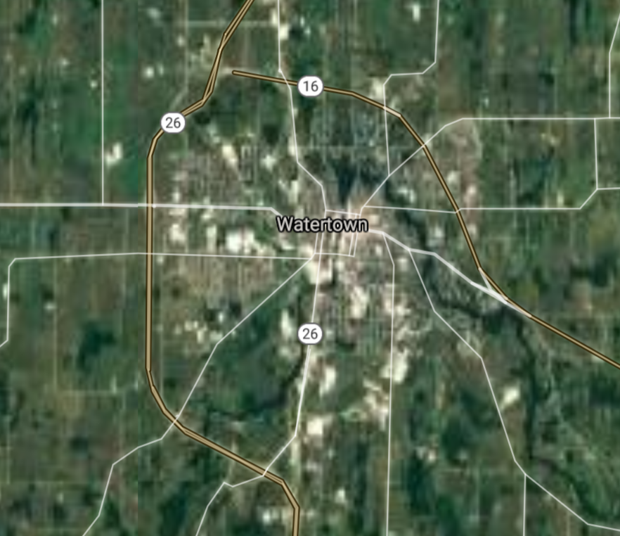
Watertown [*elevation ceiling = 40km]Elevation: 261m (Group 271)
UR-100N (SLBM) |
Point A: 43.194721 00(300kt)
Point B: 44.448881 00
Point C: 43.215923 00
Point D: 42.910572 00
Point E: 44.668852 00
Point F: 44.383576 00
|
Point A: -88.728992 00(300kt)
Point B: -88.060381 00
Point C: -88.031417 00
Point D: -87.860637 00
Point E: -90.171799 00
Point F: -89.817346 00
|
|
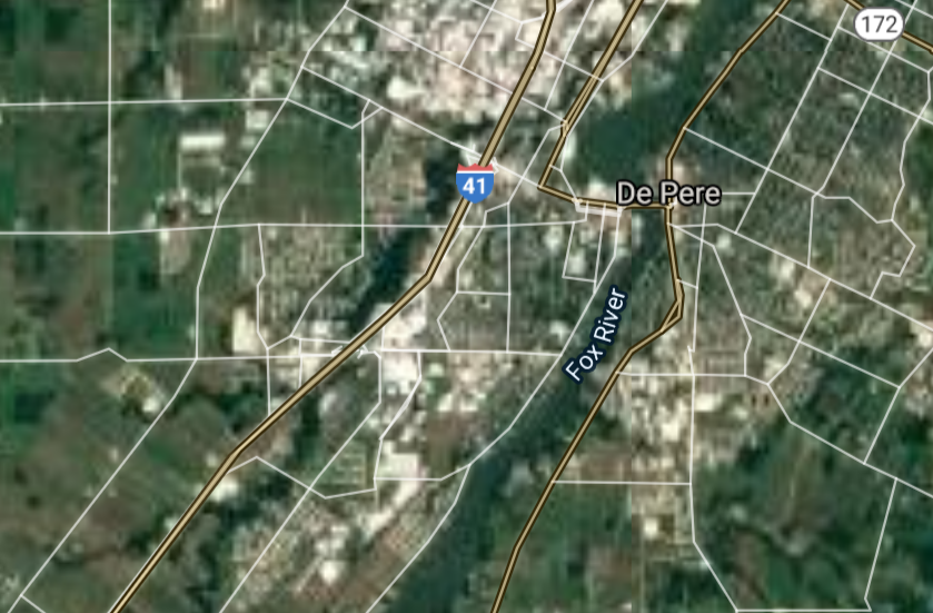
De Pere [*elevation ceiling = 40km]Elevation: 186m (Group 271)
UR-100N (SLBM) |
Point A: 43.194721 00
Point B: 44.448881 00(300kt)
Point C: 43.215923 00
Point D: 42.910572 00
Point E: 44.668852 00
Point F: 44.383576 00
|
Point A: -88.728992 00
Point B: -88.060381 00(300kt)
Point C: -88.031417 00
Point D: -87.860637 00
Point E: -90.171799 00
Point F: -89.817346 00
|
|
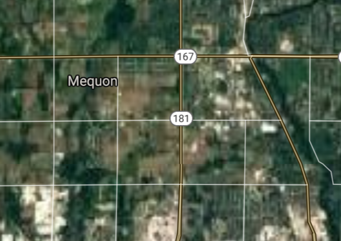
Mequon [*elevation ceiling = 40km]Elevation: 225m (Group 271)
UR-100N (SLBM) |
Point A: 43.194721 00
Point B: 44.448881 00
Point C: 43.215923 00(300kt)
Point D: 42.910572 00
Point E: 44.668852 00
Point F: 44.383576 00
|
Point A: -88.728992 00
Point B: -88.060381 00
Point C: -88.031417 00(300kt)
Point D: -87.860637 00
Point E: -90.171799 00
Point F: -89.817346 00
|
|
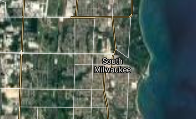
South Milwaukee [*elevation ceiling = 40km]Elevation: 203m (Group 271)
UR-100N (SLBM) |
Point A: 43.194721 00
Point B: 44.448881 00
Point C: 43.215923 00
Point D: 42.910572 00(300kt)
Point E: 44.668852 00
Point F: 44.383576 00
|
Point A: -88.728992 00
Point B: -88.060381 00
Point C: -88.031417 00
Point D: -87.860637 00(300kt)
Point E: -90.171799 00
Point F: -89.817346 00
|
|
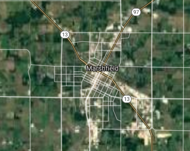
Marshfield [*elevation ceiling = 40km]Elevation: 393m (Group 271)
UR-100N (SLBM) |
Point A: 43.194721 00
Point B: 44.448881 00
Point C: 43.215923 00
Point D: 42.910572 00
Point E: 44.668852 00(300kt)
Point F: 44.383576 00
|
Point A: -88.728992 00
Point B: -88.060381 00
Point C: -88.031417 00
Point D: -87.860637 00
Point E: -90.171799 00(300kt)
Point F: -89.817346 00
|
|
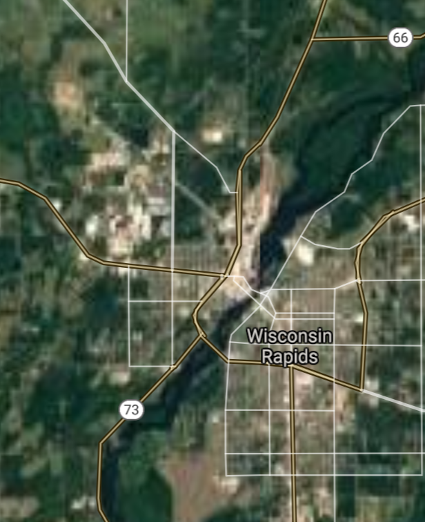
Wisconsin Rapids [*elevation ceiling = 40km]Elevation: 314m (Group 271)
UR-100N (SLBM) |
Point A: 43.194721 00
Point B: 44.448881 00
Point C: 43.215923 00
Point D: 42.910572 00
Point E: 44.668852 00
Point F: 44.383576 00(300kt)
|
Point A: -88.728992 00
Point B: -88.060381 00
Point C: -88.031417 00
Point D: -87.860637 00
Point E: -90.171799 00
Point F: -89.817346 00(300kt)
|
|
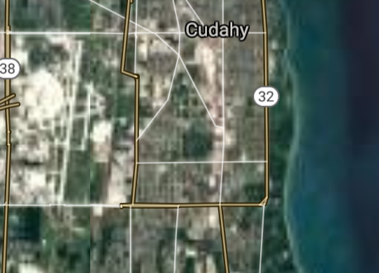
Cudahy [*elevation ceiling = 40km]Elevation: 221m (Group 272)
UR-100N (SLBM) |
Point A: 42.959738 00(300kt)
Point B: 43.884409 00
Point C: 43.097217 00
Point D: 44.202208 00
Point E: 44.875518 00
Point F: 43.457769 00
|
Point A: -87.861471 00(300kt)
Point B: -91.235139 00
Point C: -89.504288 00
Point D: -88.446497 00
Point E: -91.919342 00
Point F: -88.837329 00
|
|
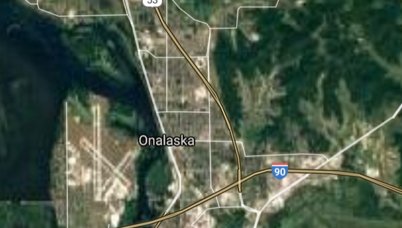
Onalaska [*elevation ceiling = 40km]Elevation: 218m (Group 272)
UR-100N (SLBM) |
Point A: 42.959738 00
Point B: 43.884409 00(300kt)
Point C: 43.097217 00
Point D: 44.202208 00
Point E: 44.875518 00
Point F: 43.457769 00
|
Point A: -87.861471 00
Point B: -91.235139 00(300kt)
Point C: -89.504288 00
Point D: -88.446497 00
Point E: -91.919342 00
Point F: -88.837329 00
|
|
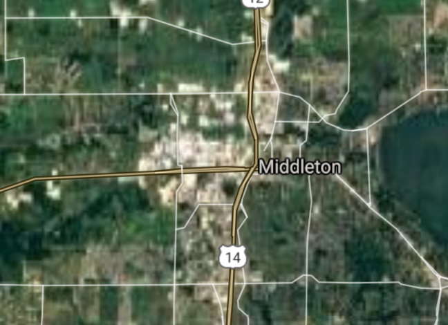
Middleton [*elevation ceiling = 40km]Elevation: 288m (Group 272)
UR-100N (SLBM) |
Point A: 42.959738 00
Point B: 43.884409 00
Point C: 43.097217 00(300kt)
Point D: 44.202208 00
Point E: 44.875518 00
Point F: 43.457769 00
|
Point A: -87.861471 00
Point B: -91.235139 00
Point C: -89.504288 00(300kt)
Point D: -88.446497 00
Point E: -91.919342 00
Point F: -88.837329 00
|
|
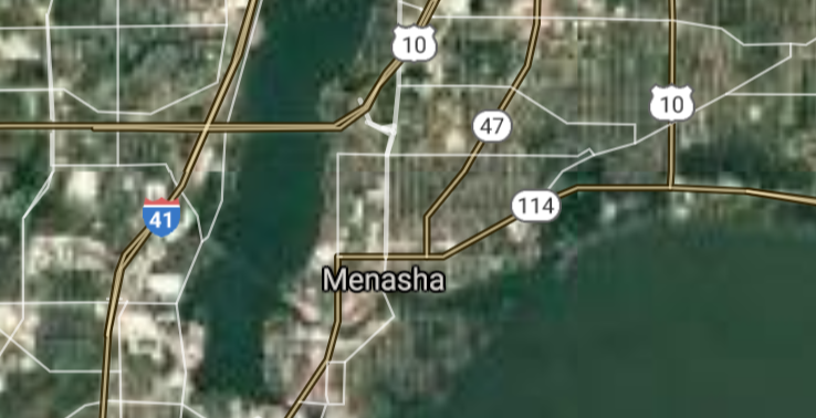
Menasha [*elevation ceiling = 40km]Elevation: 232m (Group 272)
UR-100N (SLBM) |
Point A: 42.959738 00
Point B: 43.884409 00
Point C: 43.097217 00
Point D: 44.202208 00(300kt)
Point E: 44.875518 00
Point F: 43.457769 00
|
Point A: -87.861471 00
Point B: -91.235139 00
Point C: -89.504288 00
Point D: -88.446497 00(300kt)
Point E: -91.919342 00
Point F: -88.837329 00
|
|
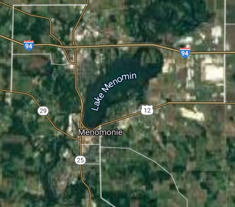
Menomonie [*elevation ceiling = 40km]Elevation: 269m (Group 272)
UR-100N (SLBM) |
Point A: 42.959738 00
Point B: 43.884409 00
Point C: 43.097217 00
Point D: 44.202208 00
Point E: 44.875518 00(300kt)
Point F: 43.457769 00
|
Point A: -87.861471 00
Point B: -91.235139 00
Point C: -89.504288 00
Point D: -88.446497 00
Point E: -91.919342 00(300kt)
Point F: -88.837329 00
|
|
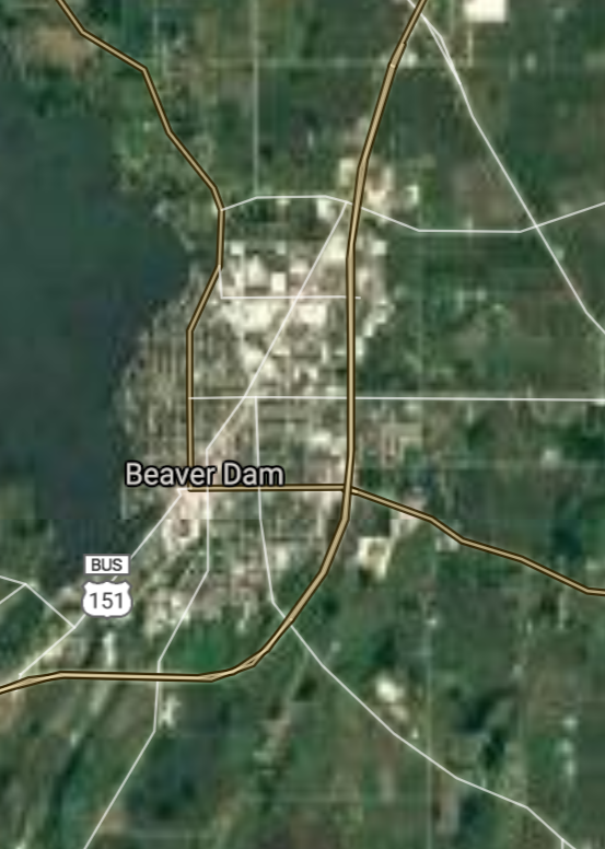
Beaver Dam [*elevation ceiling = 40km]Elevation: 268m (Group 272)
UR-100N (SLBM) |
Point A: 42.959738 00
Point B: 43.884409 00
Point C: 43.097217 00
Point D: 44.202208 00
Point E: 44.875518 00
Point F: 43.457769 00(300kt)
|
Point A: -87.861471 00
Point B: -91.235139 00
Point C: -89.504288 00
Point D: -88.446497 00
Point E: -91.919342 00
Point F: -88.837329 00(300kt)
|
|
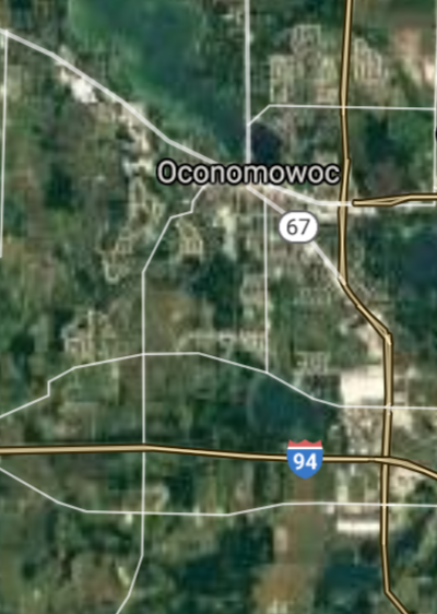
Oconomowoc [*elevation ceiling = 40km]Elevation: 265m (Group 273)
UR-100N (SLBM) |
Point A: 43.111673 00(300kt)
Point B: 44.278043 00
Point C: 44.861356 00
Point D: 42.833620 00
Point E: 43.317779 00
Point F: 44.936905 00
|
Point A: -88.499266 00(300kt)
Point B: -88.272050 00
Point C: -92.623808 00
Point D: -88.732327 00
Point E: -88.378986 00
Point F: -91.392935 00
|
|
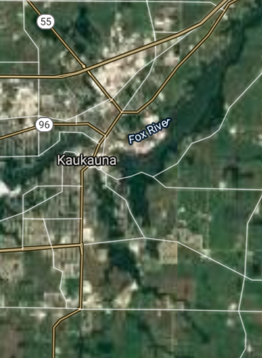
Kaukauna [*elevation ceiling = 40km]Elevation: 200m (Group 273)
UR-100N (SLBM) |
Point A: 43.111673 00
Point B: 44.278043 00(300kt)
Point C: 44.861356 00
Point D: 42.833620 00
Point E: 43.317779 00
Point F: 44.936905 00
|
Point A: -88.499266 00
Point B: -88.272050 00(300kt)
Point C: -92.623808 00
Point D: -88.732327 00
Point E: -88.378986 00
Point F: -91.392935 00
|
|
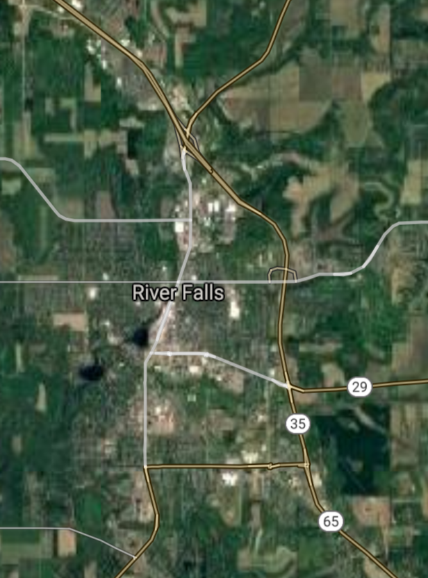
River Falls [*elevation ceiling = 40km]Elevation: 274m (Group 273)
UR-100N (SLBM) |
Point A: 43.111673 00
Point B: 44.278043 00
Point C: 44.861356 00(300kt)
Point D: 42.833620 00
Point E: 43.317779 00
Point F: 44.936905 00
|
Point A: -88.499266 00
Point B: -88.272050 00
Point C: -92.623808 00(300kt)
Point D: -88.732327 00
Point E: -88.378986 00
Point F: -91.392935 00
|
|
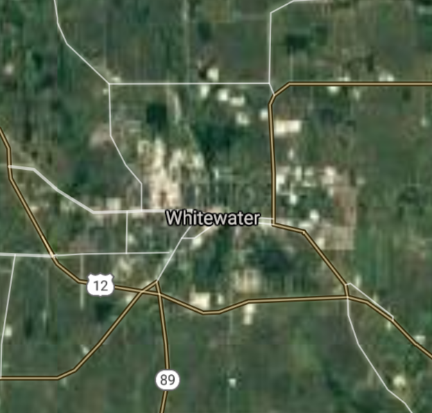
Whitewater [*elevation ceiling = 40km]Elevation: 251m (Group 273)
UR-100N (SLBM) |
Point A: 43.111673 00
Point B: 44.278043 00
Point C: 44.861356 00
Point D: 42.833620 00(300kt)
Point E: 43.317779 00
Point F: 44.936905 00
|
Point A: -88.499266 00
Point B: -88.272050 00
Point C: -92.623808 00
Point D: -88.732327 00(300kt)
Point E: -88.378986 00
Point F: -91.392935 00
|
|
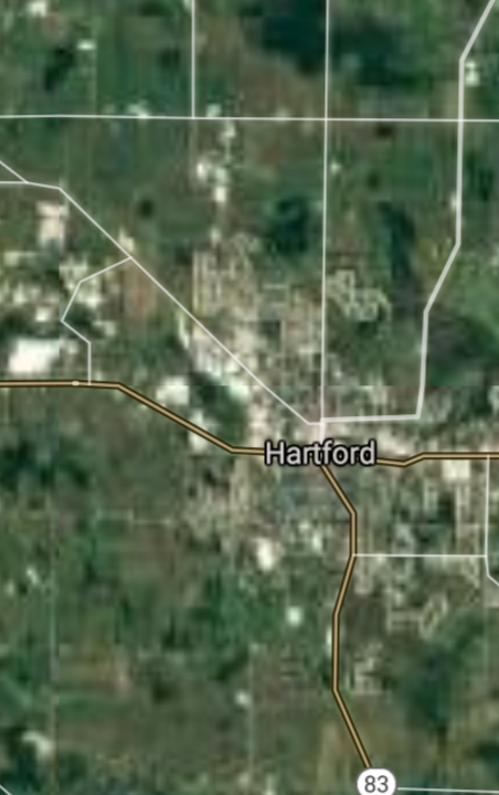
Hartford [*elevation ceiling = 40km]Elevation: 299m (Group 273)
UR-100N (SLBM) |
Point A: 43.111673 00
Point B: 44.278043 00
Point C: 44.861356 00
Point D: 42.833620 00
Point E: 43.317779 00(300kt)
Point F: 44.936905 00
|
Point A: -88.499266 00
Point B: -88.272050 00
Point C: -92.623808 00
Point D: -88.732327 00
Point E: -88.378986 00(300kt)
Point F: -91.392935 00
|
|
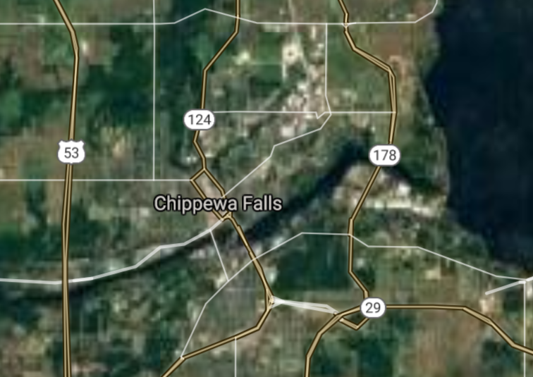
Chippewa Falls [*elevation ceiling = 40km]Elevation: 256m (Group 273)
UR-100N (SLBM) |
Point A: 43.111673 00
Point B: 44.278043 00
Point C: 44.861356 00
Point D: 42.833620 00
Point E: 43.317779 00
Point F: 44.936905 00(300kt)
|
Point A: -88.499266 00
Point B: -88.272050 00
Point C: -92.623808 00
Point D: -88.732327 00
Point E: -88.378986 00
Point F: -91.392935 00(300kt)
|
[Top]
Open START: Central Basin
"BRICS Security Council emerging from cross-currency evaluations"
OPEN Start: Central Basin - is an engineering vessel which is proven with climate security in evaluation of the USD/YEN currency pair. Annually, climate security is leading economic growth in key emerging markets surrounding the Four Asian Tigers. Affordably, the following industries extend opportunities for military cooperation: aerospace, telecommunications, finance and banking. OPEN Start: Central Basin strengthens the backbone for international security beyond the shadows of USD/YEN controversy. Traversely, OPEN Start: Central Basin offsets the cross-over gap between the USD/MXN and USD/RUB exchange rates. Notably, the Three Amigas form an economic alliance in the Far West through joint-cooperation projects from Venture 1, Venture LA and Venture SF which all extend with the Far North reach towards the Far South (as illustrated below).
![]()
![]()
![]()
![]()
![]()
![]()
![]()
![]()
![]()
JanuaryFebruaryMarchAprilJuneJulySeptemberOctoberDecember |
2026 Group Drills - Schedule
|
|

JanuaryFebruaryJuneJulyAugustOctoberNovemberDecember |
2026 Group Drills - Schedule
|
|

JanuaryFebruaryJuneJulySeptemberOctoberNovemberDecember |
2026 Group Drills - Schedule
|
|
