

 OPEN Start


 Hollywood, JSC
Mendocino, JSC
LA SOCIETY
SF SOCIETY
NY SOCIETY
Open START Drills
Hollywood, JSC
Mendocino, JSC
LA SOCIETY
SF SOCIETY
NY SOCIETY
Open START Drills
Talk Daily Commodities Review LATPACT Open Market Equities Report Currency Central
 Situation: US
 |

|

|

|
|
 SOCIETY Trust Fund LATPACT Trust Fund LATPACT Open Market Far West (SEZ) Trust RIM of Nations Trust
Arctic Pact Trade Zone | Upper Rhine Zone | Lower Rhine Zone | Middle Rhone Basin
| Level 2 - Open START/*Super Grid |
| Level 3 - Stellar Fields |


Climate Central News & Information
 "US attempts to salvage the European Order with a K-9 Squad clan style coalition"
Population Conversations: 2,403,826
Planet Power Seconds
 BRICS Security Council
 Military cooperation is exceedingly pressing ahead in notable markets from China, Russia and India which include achieving greater milestones within the technology, communications, and aerospace industries. Vastly, multi-national alliances continue to expand as relying on new protocols oppose resistance with deregulation in the spheres of international security and terrorism. As a result, the BRICS Security Council is forming several key initiatives from climate security to preserve and harness the skills with establishing a polar-arc posture in outer space.
In contrast, a grave decline in NATO has been detected. In early 2018, UNITED STATES ARMY COMMANDER, GENERAL CURTIS M. SCAPARROTTI delivered the posture statement for NATO. He stated, "As our most significant trading partner, Europe is vital to promoting American prosperity. With shared history and values, Europe is also a critical partner in advancing American influence throughout the world. The North Atlantic Treaty Organization (NATO) enables us to preserve peace through strength as alliance unity fundamentally deters the aggression of potential adversaries." Meanwhile, NATO readiness is faltering in Europe as lack of training, inadequate funding and outdated equipment persist over the Brexit strategy.
United Nations Command: AUKUSA/Quad 4
 Extensively, the Central Basin is transforming international security while disabling NATO, AUKUSA and the Quad 4 military alliances with the Open START Hawaii and Open START Alaska drills. Inherently, the Central Basin fleet suppresses the UN Command over security backlogs as the Global South impedes expansion for the Japanese yen. Economically, the US dollar bounds NATO, AUKUSA and the Quad 4 alliances under one entity in the wake of the 2007 housing crises, COVID-19 recovery and war in Ukraine. Generously, the Upper Rhine pass bridges the Open START Hawaii and Open START Alaska drills which stabilize international and climate security. Uniquely, Open START drills for the Upper Rhine pass pegs the value of the Japanese yen and Korean Won to the Chinese yuan, Indian rupee, Russian ruble, and Mexican peso to enable economic transformation for the Central Basin region. Effectively, the Open START drill secures the yen in cooperation with the Global South as significant growth on the New Silk Road Economic Belt extends in Africa. Suitably, the Open START drill baffles the UN Command with the Upper Rhine pass as the historical value is at stake. Judiciously, the Open START drill isolates the UN Command over Level 1 protocol which underpins NATO, AUKUSA and the Quad 4 military alliances to Celtic Briton tribes.
The OSCE and NATO: From the Arctic Circle
 Historically, military conflicts include land navigation rivalry which is significant for the Lower Rhine corridor as tensions between the Eastern and Western hemisphere ignite over political testimony. Substantially, the US has interspersed armed forces in the EU with the connivance of NATO and the OSCE to subjugate the Arctic Circle and dominate international trade from the Middle East. Tacitly, the OSCE is equipped to engineer early warnings, conflict resolution and crisis management over military tensions with NATO to inseminate the world order of law and justice. Decisively, the Open START Iceland drill unify the corners of the world to combat the historical West from the Arctic Circle over climate security, war crimes and crimes against humanity. Particularly, normalized ties to Israel for the Lower Rhine corridor weighs over rising Eastern influence from the Near East which is a major factor in the Open START Iceland drill. Efficiently, the Open START Iceland drill balances political, economic and military parity between the historical East and West which is threatened from the incumbency of trade sanctions and escalating military tensions in the West.
*Schedule of Nuclear Attack
Be advised: The specific plan of attack for Oklahoma is sensitive and will be posted here closer to its scheduled strike.
Oklahoma
AL* | AZ* | AR* | CO | CT | DE | FL | GA | ID | IN | IA | KS | KY | LA | ME | MD
MA | MI | MN | MO | MT | NE | NV | NH | NJ | NM | NY | NC | ND | OH | OK | OR | PA | RI | SC
SD | TN | TX | UT | VA (DC)** | VT** | WA** | WV** | WI** | WY**
*Central Fleet South  Bulava + RT23 Cadet + Vysota3
Team: Memphis Fire (Local Area Control)
**Central Fleet North Bulava + Surya + Vysota3
Open START (RKS) |
Groups UR189 - UR196 | *300kt | Millineum Power *4,000 MW
Level 1 - WA Dong (SIT.2) 
Oklahoma |
Latitude Coordinate |
Longitude Coordinate |
|
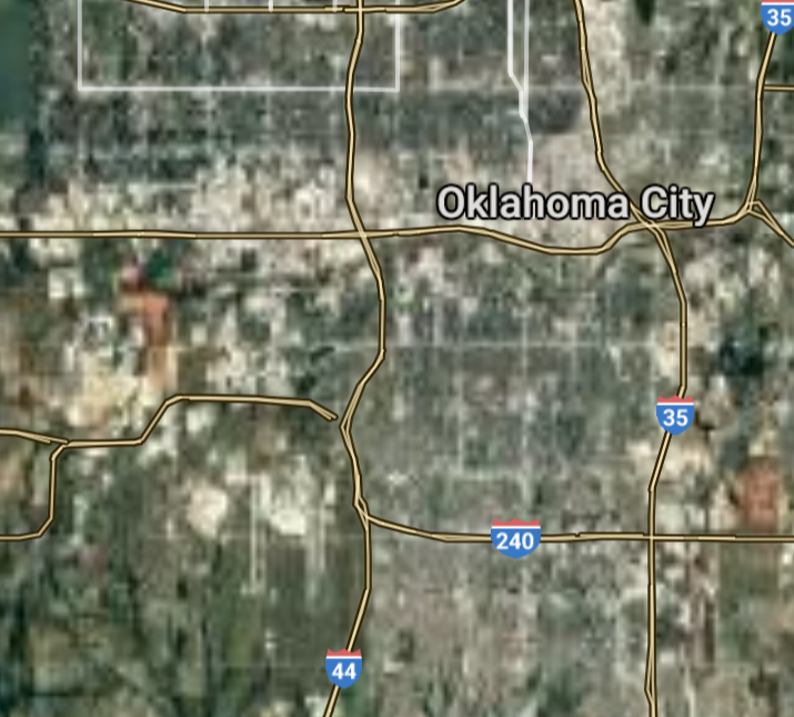
Oklahoma City [*elevation ceiling = 40km]Elevation: 366m (Group 189)
UR-100N (SLBM) |
Point A: 35.467560 00(300kt)
Point B: 36.153982 00
Point C: 35.222567 00
Point D: 36.060949 00
Point E: 34.603567 00
Point F: 35.652832 00
Open START Passages |
Point A: -97.516428 00(300kt)
Point B: -95.992775 00
Point C: -97.439478 00
Point D: -95.797453 00
Point E: -98.395929 00
Point F: -97.478095 00
Demonstration |
|
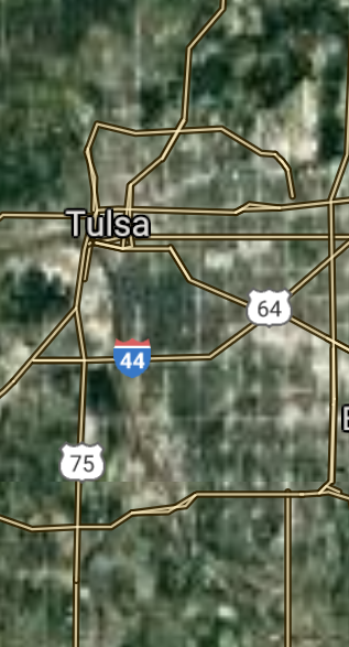
Tulsa [*elevation ceiling = 40km]Elevation: 219m (Group 189)
UR-100N (SLBM) |
Point A: 35.467560 00
Point B: 36.153982 00(300kt)
Point C: 35.222567 00
Point D: 36.060949 00
Point E: 34.603567 00
Point F: 35.652832 00
|
Point A: -97.516428 00
Point B: -95.992775 00(300kt)
Point C: -97.439478 00
Point D: -95.797453 00
Point E: -98.395929 00
Point F: -97.478095 00
|
|
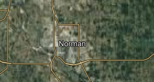
Norman [*elevation ceiling = 40km]Elevation: 359m (Group 189)
UR-100N (SLBM) |
Point A: 35.467560 00
Point B: 36.153982 00
Point C: 35.222567 00(300kt)
Point D: 36.060949 00
Point E: 34.603567 00
Point F: 35.652832 00
|
Point A: -97.516428 00
Point B: -95.992775 00
Point C: -97.439478 00(300kt)
Point D: -95.797453 00
Point E: -98.395929 00
Point F: -97.478095 00
|
|
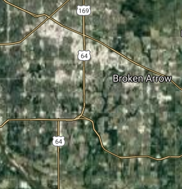
Broken Arrow [*elevation ceiling = 40km]Elevation: 226m (Group 189)
UR-100N (SLBM) |
Point A: 35.467560 00
Point B: 36.153982 00
Point C: 35.222567 00
Point D: 36.060949 00(300kt)
Point E: 34.603567 00
Point F: 35.652832 00
|
Point A: -97.516428 00
Point B: -95.992775 00
Point C: -97.439478 00
Point D: -95.797453 00(300kt)
Point E: -98.395929 00
Point F: -97.478095 00
|
|
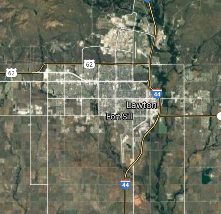
Lawton [*elevation ceiling = 40km]Elevation: 342m (Group 189)
UR-100N (SLBM) |
Point A: 35.467560 00
Point B: 36.153982 00
Point C: 35.222567 00
Point D: 36.060949 00
Point E: 34.603567 00(300kt)
Point F: 35.652832 00
|
Point A: -97.516428 00
Point B: -95.992775 00
Point C: -97.439478 00
Point D: -95.797453 00
Point E: -98.395929 00(300kt)
Point F: -97.478095 00
|
|
Edmond [*elevation ceiling = 40km]Elevation: 368m (Group 189)
UR-100N (SLBM) |
Point A: 35.467560 00
Point B: 36.153982 00
Point C: 35.222567 00
Point D: 36.060949 00
Point E: 34.603567 00
Point F: 35.652832 00(300kt)
|
Point A: -97.516428 00
Point B: -95.992775 00
Point C: -97.439478 00
Point D: -95.797453 00
Point E: -98.395929 00
Point F: -97.478095 00(300kt)
|
|
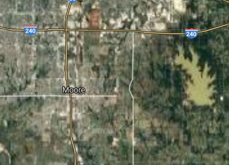
Moore [*elevation ceiling = 40km]Elevation: 382m (Group 190)
UR-100N (SLBM) |
Point A: 35.339508 00(300kt)
Point B: 35.449507 00
Point C: 36.395589 00
Point D: 36.115607 00
Point E: 35.747877 00
Point F: 36.747311 00
|
Point A: -97.486703 00(300kt)
Point B: -97.396702 00
Point C: -97.878391 00
Point D: -97.058368 00
Point E: -95.369691 00
Point F: -95.980818 00
|
|
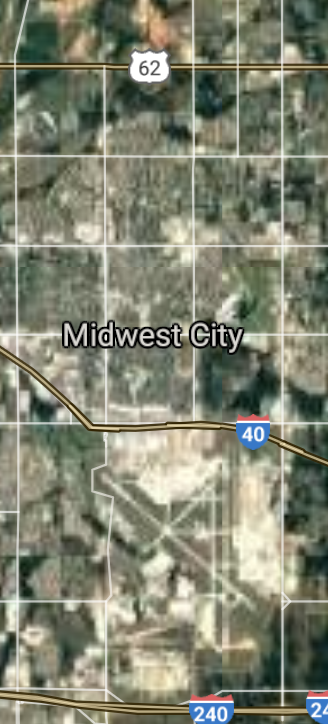
Midwest City [*elevation ceiling = 40km]Elevation: 383m (Group 190)
UR-100N (SLBM) |
Point A: 35.339508 00
Point B: 35.449507 00(300kt)
Point C: 36.395589 00
Point D: 36.115607 00
Point E: 35.747877 00
Point F: 36.747311 00
|
Point A: -97.486703 00
Point B: -97.396702 00(300kt)
Point C: -97.878391 00
Point D: -97.058368 00
Point E: -95.369691 00
Point F: -95.980818 00
|
|
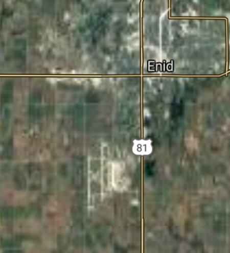
Enid [*elevation ceiling = 40km]Elevation: 378m (Group 190)
UR-100N (SLBM) |
Point A: 35.339508 00
Point B: 35.449507 00
Point C: 36.395589 00(300kt)
Point D: 36.115607 00
Point E: 35.747877 00
Point F: 36.747311 00
|
Point A: -97.486703 00
Point B: -97.396702 00
Point C: -97.878391 00(300kt)
Point D: -97.058368 00
Point E: -95.369691 00
Point F: -95.980818 00
|
|
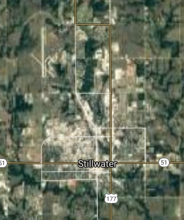
Stillwater [*elevation ceiling = 40km]Elevation: 273m (Group 190)
UR-100N (SLBM) |
Point A: 35.339508 00
Point B: 35.449507 00
Point C: 36.395589 00
Point D: 36.115607 00(300kt)
Point E: 35.747877 00
Point F: 36.747311 00
|
Point A: -97.486703 00
Point B: -97.396702 00
Point C: -97.878391 00
Point D: -97.058368 00(300kt)
Point E: -95.369691 00
Point F: -95.980818 00
|
|
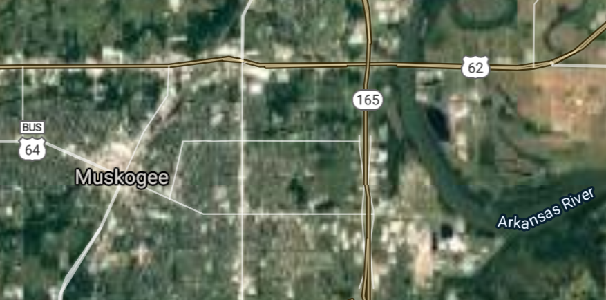
Muskogee [*elevation ceiling = 40km]Elevation: 185m (Group 190)
UR-100N (SLBM) |
Point A: 35.339508 00
Point B: 35.449507 00
Point C: 36.395589 00
Point D: 36.115607 00
Point E: 35.747877 00(300kt)
Point F: 36.747311 00
|
Point A: -97.486703 00
Point B: -97.396702 00
Point C: -97.878391 00
Point D: -97.058368 00
Point E: -95.369691 00(300kt)
Point F: -95.980818 00
|
|
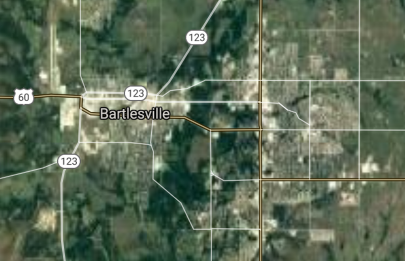
Bartlesville [*elevation ceiling = 40km]Elevation: 214m (Group 190)
UR-100N (SLBM) |
Point A: 35.339508 00
Point B: 35.449507 00
Point C: 36.395589 00
Point D: 36.115607 00
Point E: 35.747877 00
Point F: 36.747311 00(300kt)
|
Point A: -97.486703 00
Point B: -97.396702 00
Point C: -97.878391 00
Point D: -97.058368 00
Point E: -95.369691 00
Point F: -95.980818 00(300kt)
|
|
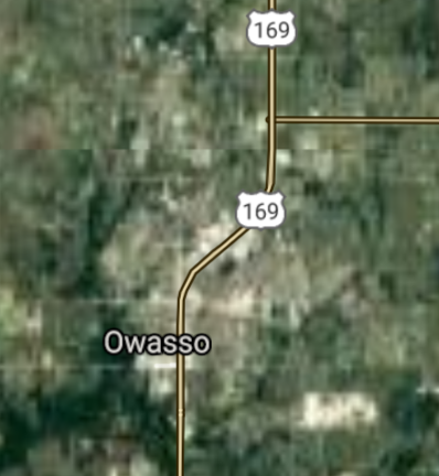
Owasso [*elevation ceiling = 40km]Elevation: 188m (Group 191)
UR-100N (SLBM) |
Point A: 36.269539 00(300kt)
Point B: 35.327293 00
Point C: 35.506722 00
Point D: 35.942043 00
Point E: 34.174261 00
Point F: 36.706981 00
|
Point A: -95.854712 00(300kt)
Point B: -96.925300 00
Point C: -97.762544 00
Point D: -95.883323 00
Point E: -97.143625 00
Point F: -97.085595 00
|
|
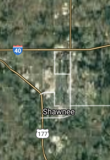
Shawnee [*elevation ceiling = 40km]Elevation: 324m (Group 191)
UR-100N (SLBM) |
Point A: 36.269539 00
Point B: 35.327293 00(300kt)
Point C: 35.506722 00
Point D: 35.942043 00
Point E: 34.174261 00
Point F: 36.706981 00
|
Point A: -95.854712 00
Point B: -96.925300 00(300kt)
Point C: -97.762544 00
Point D: -95.883323 00
Point E: -97.143625 00
Point F: -97.085595 00
|
|
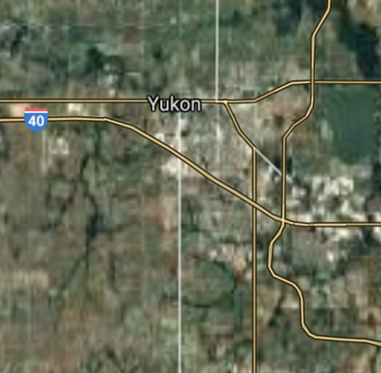
Yukon [*elevation ceiling = 40km]Elevation: 395m (Group 191)
UR-100N (SLBM) |
Point A: 36.269539 00
Point B: 35.327293 00
Point C: 35.506722 00(300kt)
Point D: 35.942043 00
Point E: 34.174261 00
Point F: 36.706981 00
|
Point A: -95.854712 00
Point B: -96.925300 00
Point C: -97.762544 00(300kt)
Point D: -95.883323 00
Point E: -97.143625 00
Point F: -97.085595 00
|
|
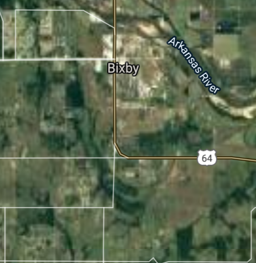
Bixby [*elevation ceiling = 40km]Elevation: 184m (Group 191)
UR-100N (SLBM) |
Point A: 36.269539 00
Point B: 35.327293 00
Point C: 35.506722 00
Point D: 35.942043 00(300kt)
Point E: 34.174261 00
Point F: 36.706981 00
|
Point A: -95.854712 00
Point B: -96.925300 00
Point C: -97.762544 00
Point D: -95.883323 00(300kt)
Point E: -97.143625 00
Point F: -97.085595 00
|
|
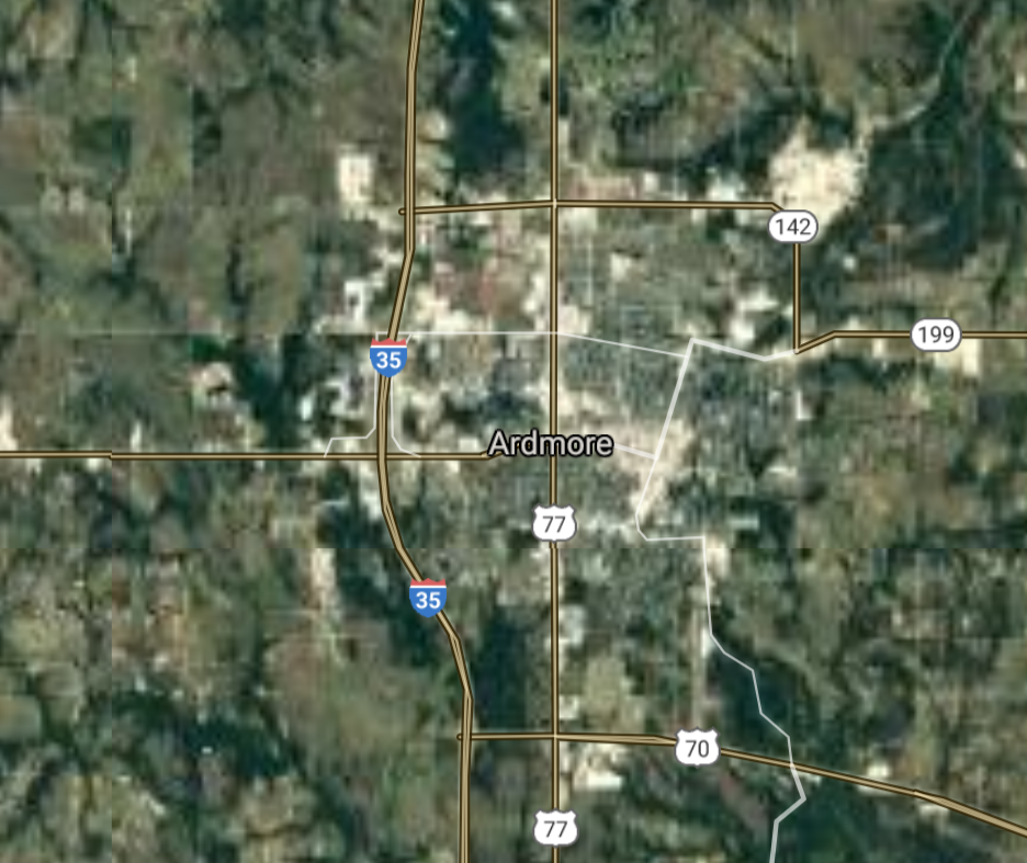
Ardmore [*elevation ceiling = 40km]Elevation: 265m (Group 191)
UR-100N (SLBM) |
Point A: 36.269539 00
Point B: 35.327293 00
Point C: 35.506722 00
Point D: 35.942043 00
Point E: 34.174261 00(300kt)
Point F: 36.706981 00
|
Point A: -95.854712 00
Point B: -96.925300 00
Point C: -97.762544 00
Point D: -95.883323 00
Point E: -97.143625 00(300kt)
Point F: -97.085595 00
|
|
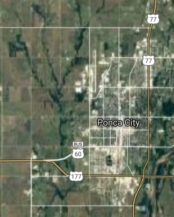
Ponca City [*elevation ceiling = 40km]Elevation: 308m (Group 191)
UR-100N (SLBM) |
Point A: 36.269539 00
Point B: 35.327293 00
Point C: 35.506722 00
Point D: 35.942043 00
Point E: 34.174261 00
Point F: 36.706981 00(300kt)
|
Point A: -95.854712 00
Point B: -96.925300 00
Point C: -97.762544 00
Point D: -95.883323 00
Point E: -97.143625 00
Point F: -97.085595 00(300kt)
|
|
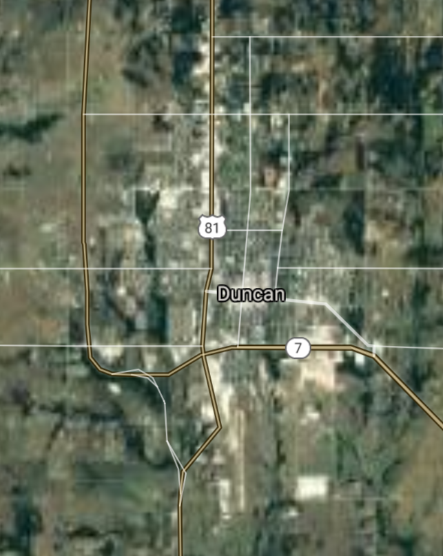
Duncan [*elevation ceiling = 40km]]Elevation: 345m (Group 192)
UR-100N (SLBM) |
Point A: 34.502303 00(300kt)
Point B: 35.442006 00
Point C: 36.022873 00
Point D: 35.998701 00
Point E: 35.384226 00
Point F: 36.139810 00
|
Point A: -97.957813 00(300kt)
Point B: -97.440870 00
Point C: -95.968328 00
Point D: -96.114166 00
Point E: -97.724487 00
Point F: -96.108891 00
|
|
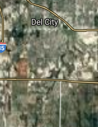
Del City [*elevation ceiling = 40km]Elevation: 368m (Group 192)
UR-100N (SLBM) |
Point A: 34.502303 00
Point B: 35.442006 00(300kt)
Point C: 36.022873 00
Point D: 35.998701 00
Point E: 35.384226 00
Point F: 36.139810 00
|
Point A: -97.957813 00
Point B: -97.440870 00(300kt)
Point C: -95.968328 00
Point D: -96.114166 00
Point E: -97.724487 00
Point F: -96.108891 00
|
|
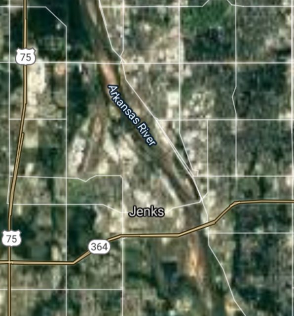
Jenks [*elevation ceiling = 40km]Elevation: 189m (Group 192)
UR-100N (SLBM) |
Point A: 34.502303 00
Point B: 35.442006 00
Point C: 36.022873 00(300kt)
Point D: 35.998701 00
Point E: 35.384226 00
Point F: 36.139810 00
|
Point A: -97.957813 00
Point B: -97.440870 00
Point C: -95.968328 00(300kt)
Point D: -96.114166 00
Point E: -97.724487 00
Point F: -96.108891 00
|
|
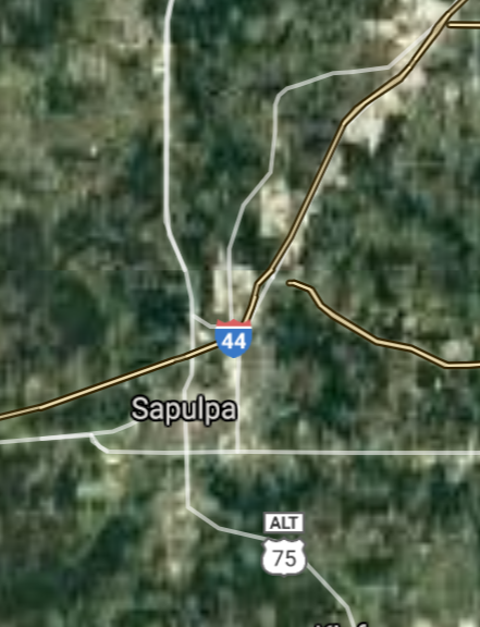
Sapulpa [*elevation ceiling = 40km]Elevation: 220m (Group 192)
UR-100N (SLBM) |
Point A: 34.502303 00
Point B: 35.442006 00
Point C: 36.022873 00
Point D: 35.998701 00(300kt)
Point E: 35.384226 00
Point F: 36.139810 00
|
Point A: -97.957813 00
Point B: -97.440870 00
Point C: -95.968328 00
Point D: -96.114166 00(300kt)
Point E: -97.724487 00
Point F: -96.108891 00
|
|
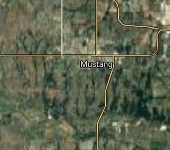
Mustang [*elevation ceiling = 40km]Elevation: 411m (Group 192)
UR-100N (SLBM) |
Point A: 34.502303 00
Point B: 35.442006 00
Point C: 36.022873 00
Point D: 35.998701 00
Point E: 35.384226 00(300kt)
Point F: 36.139810 00
|
Point A: -97.957813 00
Point B: -97.440870 00
Point C: -95.968328 00
Point D: -96.114166 00
Point E: -97.724487 00(300kt)
Point F: -96.108891 00
|
|
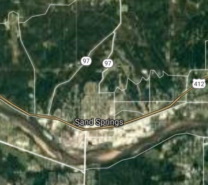
Sand Springs [*elevation ceiling = 40km]Elevation: 206m (Group 192)
UR-100N (SLBM) |
Point A: 34.502303 00
Point B: 35.442006 00
Point C: 36.022873 00
Point D: 35.998701 00
Point E: 35.384226 00
Point F: 36.139810 00(300kt)
|
Point A: -97.957813 00
Point B: -97.440870 00
Point C: -95.968328 00
Point D: -96.114166 00
Point E: -97.724487 00
Point F: -96.108891 00(300kt)
|
|
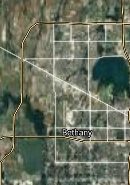
Bethany [*elevation ceiling = 40km]Elevation: 400m (Group 193)
UR-100N (SLBM) |
Point A: 35.518668 00(300kt)
Point B: 34.637765 00
Point C: 36.312596 00
Point D: 35.532274 00
Point E: 34.933430 00
Point F: 33.992419 00
|
Point A: -97.632264 00(300kt)
Point B: -99.334044 00
Point C: -95.616090 00
Point D: -97.955049 00
Point E: -95.769713 00
Point F: -96.397123 00
|
|
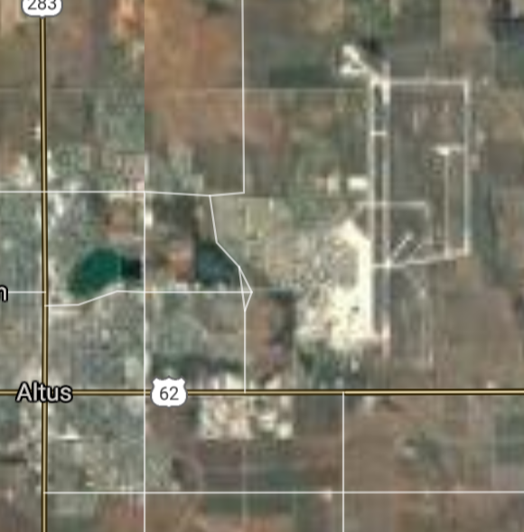
Altus [*elevation ceiling = 40km]Elevation: 427m (Group 193)
UR-100N (SLBM) |
Point A: 35.518668 00
Point B: 34.637765 00(300kt)
Point C: 36.312596 00
Point D: 35.532274 00
Point E: 34.933430 00
Point F: 33.992419 00
|
Point A: -97.632264 00
Point B: -99.334044 00(300kt)
Point C: -95.616090 00
Point D: -97.955049 00
Point E: -95.769713 00
Point F: -96.397123 00
|
|
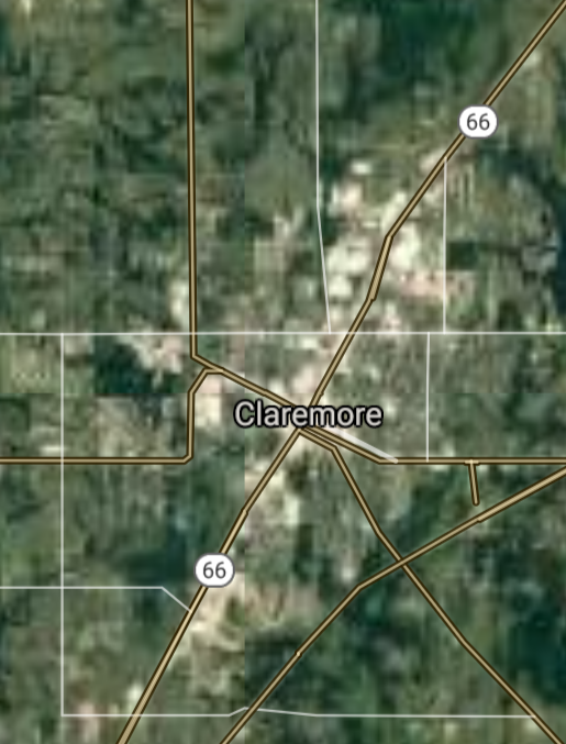
Claremore [*elevation ceiling = 40km]Elevation: 182m (Group 193)
UR-100N (SLBM) |
Point A: 35.518668 00
Point B: 34.637765 00
Point C: 36.312596 00(300kt)
Point D: 35.532274 00
Point E: 34.933430 00
Point F: 33.992419 00
|
Point A: -97.632264 00
Point B: -99.334044 00
Point C: -95.616090 00(300kt)
Point D: -97.955049 00
Point E: -95.769713 00
Point F: -96.397123 00
|
|
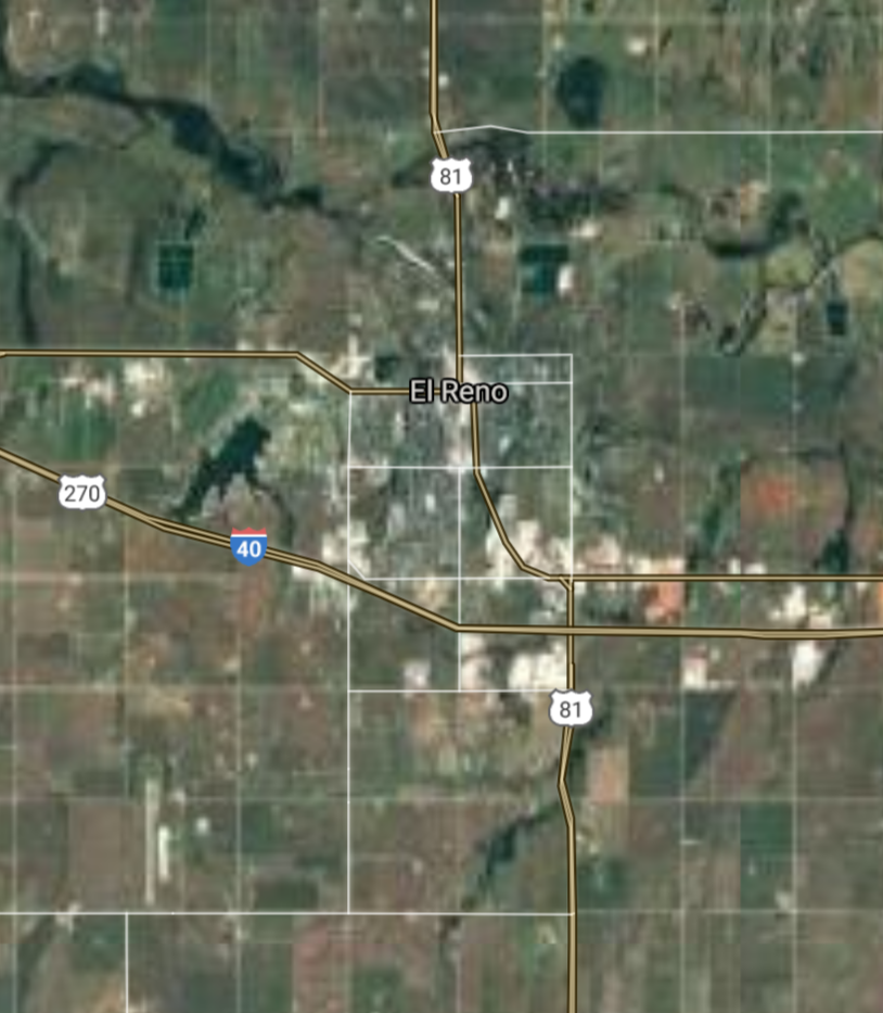
El Reno [*elevation ceiling = 40km]Elevation: 414m (Group 193)
UR-100N (SLBM) |
Point A: 35.518668 00
Point B: 34.637765 00
Point C: 36.312596 00
Point D: 35.532274 00(300kt)
Point E: 34.933430 00
Point F: 33.992419 00
|
Point A: -97.632264 00
Point B: -99.334044 00
Point C: -95.616090 00
Point D: -97.955049 00(300kt)
Point E: -95.769713 00
Point F: -96.397123 00
|
|
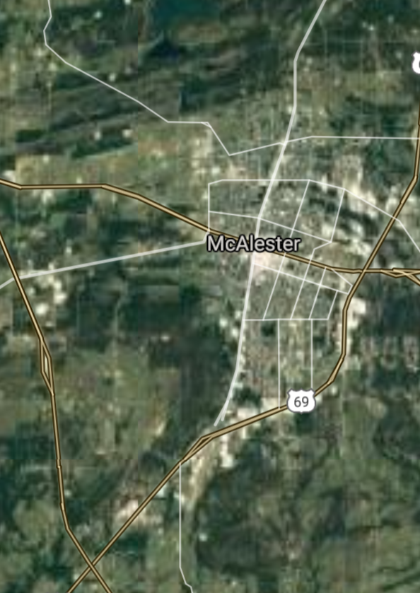
McAlester [*elevation ceiling = 40km]Elevation: 225m (Group 193)
UR-100N (SLBM) |
Point A: 35.518668 00
Point B: 34.637765 00
Point C: 36.312596 00
Point D: 35.532274 00
Point E: 34.933430 00(300kt)
Point F: 33.992419 00
|
Point A: -97.632264 00
Point B: -99.334044 00
Point C: -95.616090 00
Point D: -97.955049 00
Point E: -95.769713 00(300kt)
Point F: -96.397123 00
|
|
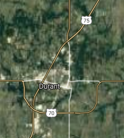
Durant [*elevation ceiling = 40km]Elevation: 201m (Group 193)
UR-100N (SLBM) |
Point A: 35.518668 00
Point B: 34.637765 00
Point C: 36.312596 00
Point D: 35.532274 00
Point E: 34.933430 00
Point F: 33.992419 00(300kt)
|
Point A: -97.632264 00
Point B: -99.334044 00
Point C: -95.616090 00
Point D: -97.955049 00
Point E: -95.769713 00
Point F: -96.397123 00(300kt)
|
|
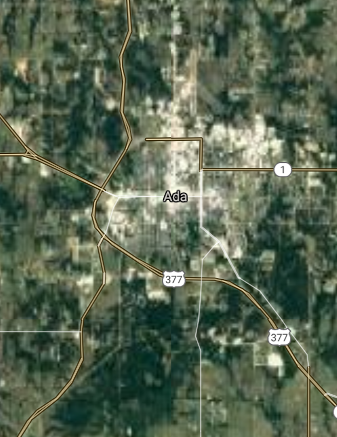
Ada [*elevation ceiling = 40km]Elevation: 308m (Group 194)
UR-100N (SLBM) |
Point A: 34.774531 00(300kt)
Point B: 35.915370 00
Point C: 35.052565 00
Point D: 36.874515 00
Point E: 35.955374 00
Point F: 36.433648 00
|
Point A: -96.678345 00(300kt)
Point B: -94.969956 00
Point C: -97.936433 00
Point D: -94.877455 00
Point E: -96.008884 00
Point F: -99.390386 00
|
|
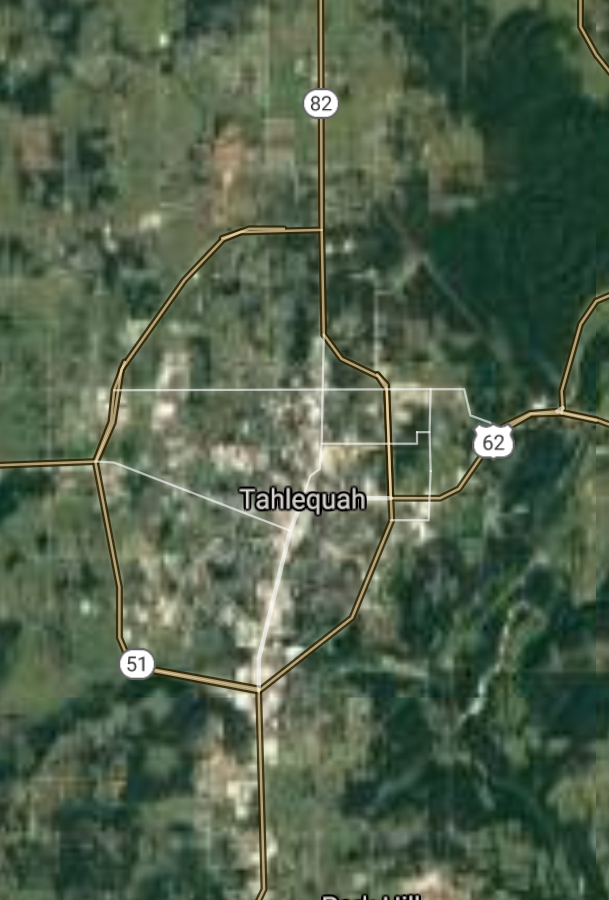
Tahlequah [*elevation ceiling = 40km]Elevation: 242m (Group 194)
UR-100N (SLBM) |
Point A: 34.774531 00
Point B: 35.915370 00(300kt)
Point C: 35.052565 00
Point D: 36.874515 00
Point E: 35.955374 00
Point F: 36.433648 00
|
Point A: -96.678345 00
Point B: -94.969956 00(300kt)
Point C: -97.936433 00
Point D: -94.877455 00
Point E: -96.008884 00
Point F: -99.390386 00
|
|
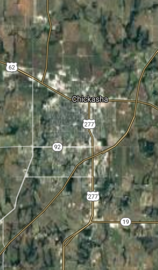
Chickasha [*elevation ceiling = 40km]Elevation: 334m (Group 194)
UR-100N (SLBM) |
Point A: 34.774531 00
Point B: 35.915370 00
Point C: 35.052565 00(300kt)
Point D: 36.874515 00
Point E: 35.955374 00
Point F: 36.433648 00
|
Point A: -96.678345 00
Point B: -94.969956 00
Point C: -97.936433 00(300kt)
Point D: -94.877455 00
Point E: -96.008884 00
Point F: -99.390386 00
|
|
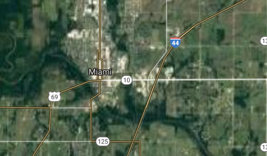
Miami [*elevation ceiling = 40km]Elevation: 243m (Group 194)
UR-100N (SLBM) |
Point A: 34.774531 00
Point B: 35.915370 00
Point C: 35.052565 00
Point D: 36.874515 00(300kt)
Point E: 35.955374 00
Point F: 36.433648 00
|
Point A: -96.678345 00
Point B: -94.969956 00
Point C: -97.936433 00
Point D: -94.877455 00(300kt)
Point E: -96.008884 00
Point F: -99.390386 00
|
|
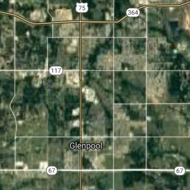
Glenpool [*elevation ceiling = 40km]Elevation: 217m (Group 194)
UR-100N (SLBM) |
Point A: 34.774531 00
Point B: 35.915370 00
Point C: 35.052565 00
Point D: 36.874515 00
Point E: 35.955374 00(300kt)
Point F: 36.433648 00
|
Point A: -96.678345 00
Point B: -94.969956 00
Point C: -97.936433 00
Point D: -94.877455 00
Point E: -96.008884 00(300kt)
Point F: -99.390386 00
|
|
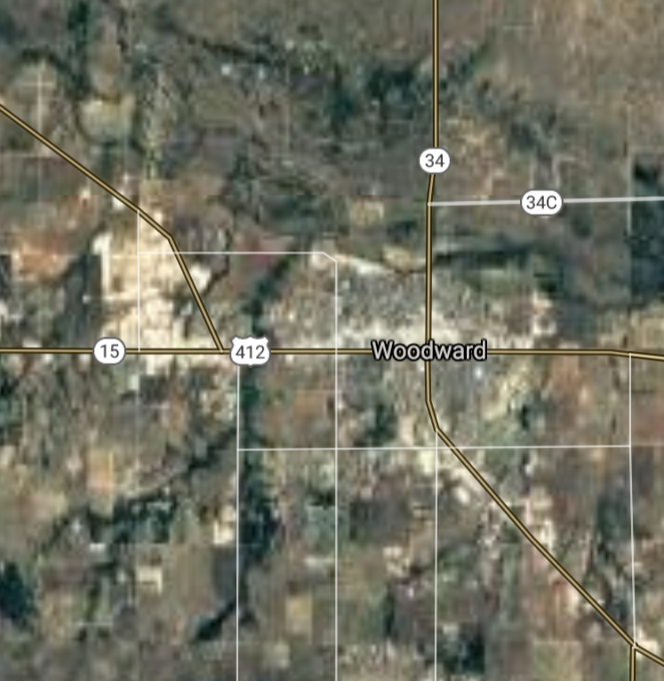
Woodward [*elevation ceiling = 40km]Elevation: 583m (Group 194)
UR-100N (SLBM) |
Point A: 34.774531 00
Point B: 35.915370 00
Point C: 35.052565 00
Point D: 36.874515 00
Point E: 35.955374 00
Point F: 36.433648 00(300kt)
|
Point A: -96.678345 00
Point B: -94.969956 00
Point C: -97.936433 00
Point D: -94.877455 00
Point E: -96.008884 00
Point F: -99.390386 00(300kt)
|
|
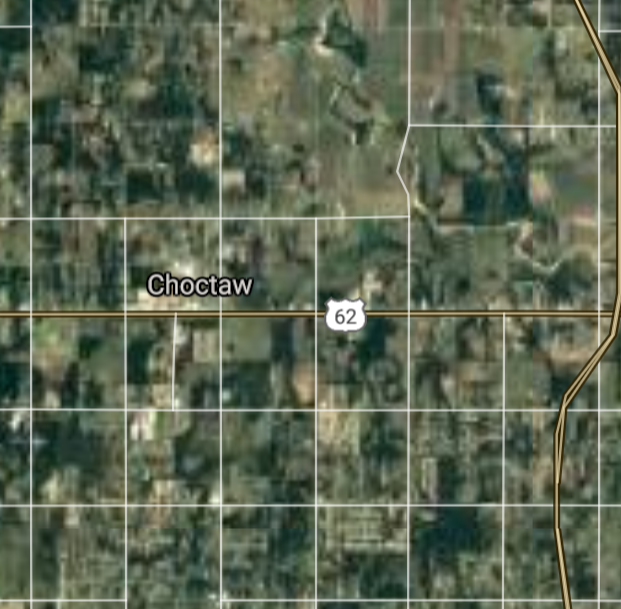
Choctaw [*elevation ceiling = 40km]Elevation: 353m (Group 195)
UR-100N (SLBM) |
Point A: 35.497563 00(300kt)
Point B: 35.626696 00
Point C: 35.411994 00
Point D: 35.526163 00
Point E: 36.682804 00
Point F: 35.878937 00
|
Point A: -97.268921 00(300kt)
Point B: -95.951540 00
Point C: -99.404259 00
Point D: -98.707574 00
Point E: -101.481549 00
Point F: -97.425319 00
|
|
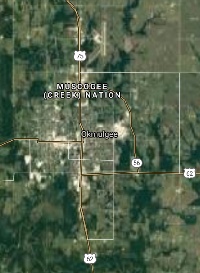
Okmulgee [*elevation ceiling = 40km]Elevation: 219m (Group 195)
UR-100N (SLBM) |
Point A: 35.497563 00
Point B: 35.626696 00(300kt)
Point C: 35.411994 00
Point D: 35.526163 00
Point E: 36.682804 00
Point F: 35.878937 00
|
Point A: -97.268921 00
Point B: -95.951540 00(300kt)
Point C: -99.404259 00
Point D: -98.707574 00
Point E: -101.481549 00
Point F: -97.425319 00
|
|
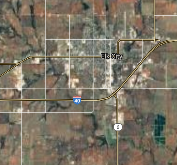
Elk City [*elevation ceiling = 40km]Elevation: 585m (Group 195)
UR-100N (SLBM) |
Point A: 35.497563 00
Point B: 35.626696 00
Point C: 35.411994 00(300kt)
Point D: 35.526163 00
Point E: 36.682804 00
Point F: 35.878937 00
|
Point A: -97.268921 00
Point B: -95.951540 00
Point C: -99.404259 00(300kt)
Point D: -98.707574 00
Point E: -101.481549 00
Point F: -97.425319 00
|
|
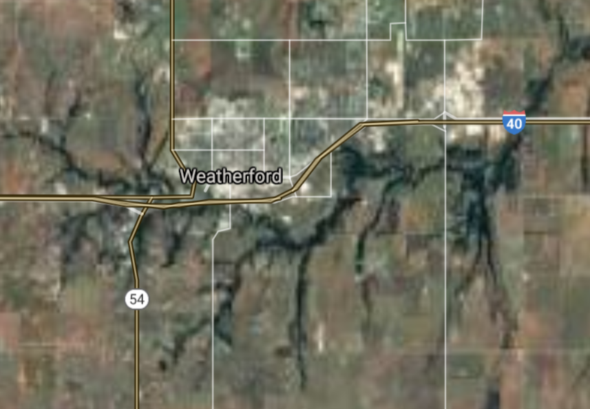
Weatherford [*elevation ceiling = 40km]Elevation: 505m (Group 195)
UR-100N (SLBM) |
Point A: 35.497563 00
Point B: 35.626696 00
Point C: 35.411994 00
Point D: 35.526163 00(300kt)
Point E: 36.682804 00
Point F: 35.878937 00
|
Point A: -97.268921 00
Point B: -95.951540 00
Point C: -99.404259 00
Point D: -98.707574 00(300kt)
Point E: -101.481549 00
Point F: -97.425319 00
|
|
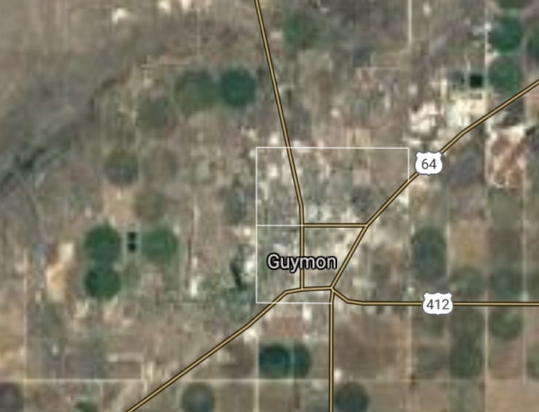
Guymon [*elevation ceiling = 40km]Elevation: 952m (Group 195)
UR-100N (SLBM) |
Point A: 35.497563 00
Point B: 35.626696 00
Point C: 35.411994 00
Point D: 35.526163 00
Point E: 36.682804 00(300kt)
Point F: 35.878937 00
|
Point A: -97.268921 00
Point B: -95.951540 00
Point C: -99.404259 00
Point D: -98.707574 00
Point E: -101.481549 00(300kt)
Point F: -97.425319 00
|
|
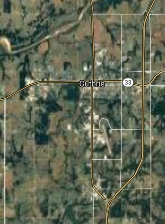
Guthrie [*elevation ceiling = 40km]Elevation: 301m (Group 195)
UR-100N (SLBM) |
Point A: 35.497563 00
Point B: 35.626696 00
Point C: 35.411994 00
Point D: 35.526163 00
Point E: 36.682804 00
Point F: 35.878937 00(300kt)
|
Point A: -97.268921 00
Point B: -95.951540 00
Point C: -99.404259 00
Point D: -98.707574 00
Point E: -101.481549 00
Point F: -97.425319 00(300kt)
|
|
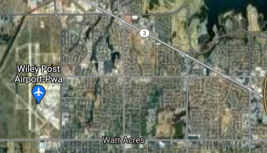
Warr Acres [*elevation ceiling = 40km]Elevation: 402m (Group 196)
UR-100N (SLBM) |
Point A: 35.522557 00(300kt)
Point B: 35.951767 00
Point C: 35.247287 00
Point D: 36.308428 00
Point E: 35.560890 00
Point F: 35.515606 00
|
Point A: -97.618930 00(300kt)
Point B: -95.650814 00
Point C: -97.599760 00
Point D: -95.316914 00
Point E: -97.551429 00
Point F: -98.967307 00
|
|
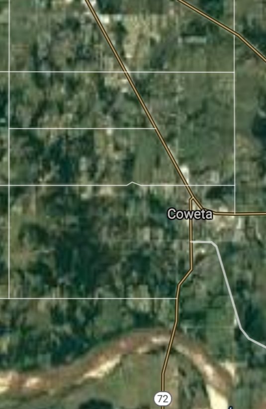
Coweta [*elevation ceiling = 40km]Elevation: 203m (Group 196)
UR-100N (SLBM) |
Point A: 35.522557 00
Point B: 35.951767 00(300kt)
Point C: 35.247287 00
Point D: 36.308428 00
Point E: 35.560890 00
Point F: 35.515606 00
|
Point A: -97.618930 00
Point B: -95.650814 00(300kt)
Point C: -97.599760 00
Point D: -95.316914 00
Point E: -97.551429 00
Point F: -98.967307 00
|
|
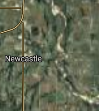
Newcastle [*elevation ceiling = 40km]Elevation: 367m (Group 196)
UR-100N (SLBM) |
Point A: 35.522557 00
Point B: 35.951767 00
Point C: 35.247287 00(300kt)
Point D: 36.308428 00
Point E: 35.560890 00
Point F: 35.515606 00
|
Point A: -97.618930 00
Point B: -95.650814 00
Point C: -97.599760 00(300kt)
Point D: -95.316914 00
Point E: -97.551429 00
Point F: -98.967307 00
|
|
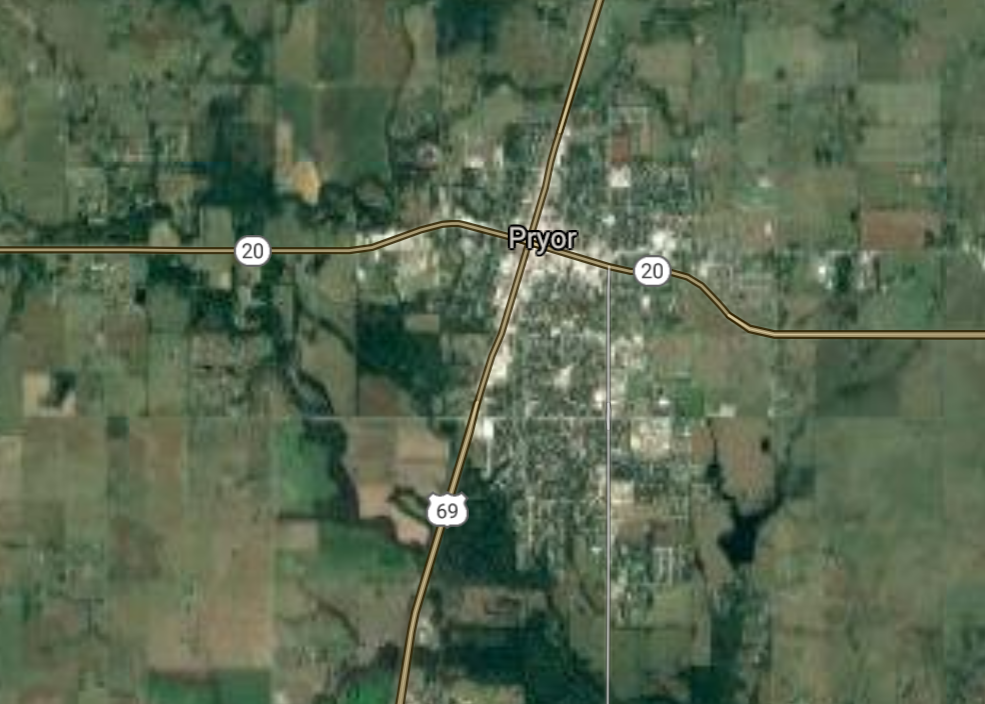
Pryor Creek [*elevation ceiling = 40km]Elevation: 192m (Group 196)
UR-100N (SLBM) |
Point A: 35.522557 00
Point B: 35.951767 00
Point C: 35.247287 00
Point D: 36.308428 00(300kt)
Point E: 35.560890 00
Point F: 35.515606 00
|
Point A: -97.618930 00
Point B: -95.650814 00
Point C: -97.599760 00
Point D: -95.316914 00(300kt)
Point E: -97.551429 00
Point F: -98.967307 00
|
|
The Village [*elevation ceiling = 40km]Elevation: 374m (Group 196)
UR-100N (SLBM) |
Point A: 35.522557 00
Point B: 35.951767 00
Point C: 35.247287 00
Point D: 36.308428 00
Point E: 35.560890 00(300kt)
Point F: 35.515606 00
|
Point A: -97.618930 00
Point B: -95.650814 00
Point C: -97.599760 00
Point D: -95.316914 00
Point E: -97.551429 00(300kt)
Point F: -98.967307 00
|
|
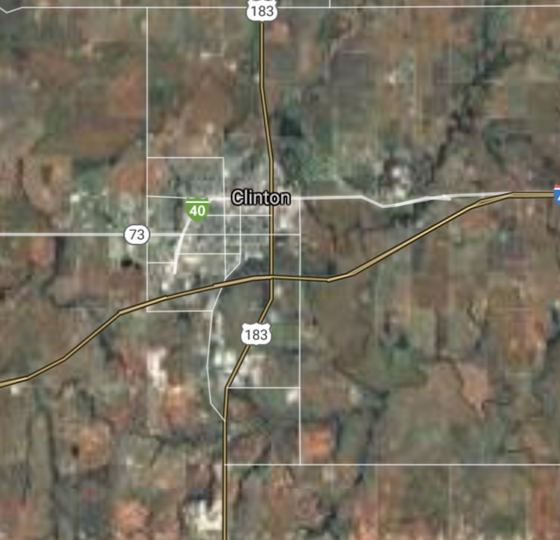
Clinton [*elevation ceiling = 40km]Elevation: 477m (Group 196)
UR-100N (SLBM) |
Point A: 35.522557 00
Point B: 35.951767 00
Point C: 35.247287 00
Point D: 36.308428 00
Point E: 35.560890 00
Point F: 35.515606 00(300kt)
|
Point A: -97.618930 00
Point B: -95.650814 00
Point C: -97.599760 00
Point D: -95.316914 00
Point E: -97.551429 00
Point F: -98.967307 00(300kt)
|


[Top]
Open START: Central Basin
"BRICS Security Council emerging from cross-currency evaluations"
OPEN Start: Central Basin - is an engineering vessel which is proven with climate security in evaluation of the USD/YEN currency pair. Annually, climate security is leading economic growth in key emerging markets surrounding the Four Asian Tigers. Affordably, the following industries extend opportunities for military cooperation: aerospace, telecommunications, finance and banking. OPEN Start: Central Basin strengthens the backbone for international security beyond the shadows of USD/YEN controversy. Traversely, OPEN Start: Central Basin offsets the cross-over gap between the USD/MXN and USD/RUB exchange rates. Notably, the Three Amigas form an economic alliance in the Far West through joint-cooperation projects from Venture 1, Venture LA and Venture SF which all extend with the Far North reach towards the Far South (as illustrated below).
![]()
![]()
![]()
![]()
![]()
![]()
![]()
![]()
![]()
JanuaryFebruaryMarchAprilJuneJulySeptemberOctoberDecember |
2026 Group Drills - Schedule
|
|

JanuaryFebruaryJuneJulyAugustOctoberNovemberDecember |
2026 Group Drills - Schedule
|
|

JanuaryFebruaryJuneJulySeptemberOctoberNovemberDecember |
2026 Group Drills - Schedule
|
|
