

 OPEN Start


 Hollywood, JSC
Mendocino, JSC
LA SOCIETY
SF SOCIETY
NY SOCIETY
Open START Drills
Hollywood, JSC
Mendocino, JSC
LA SOCIETY
SF SOCIETY
NY SOCIETY
Open START Drills
Talk Daily Commodities Review LATPACT Open Market Equities Report Currency Central
 Situation: US
 |

|

|

|
|
 SOCIETY Trust Fund LATPACT Trust Fund LATPACT Open Market Far West (SEZ) Trust RIM of Nations Trust
Arctic Pact Trade Zone | Upper Rhine Zone | Lower Rhine Zone | Middle Rhone Basin
| Level 2 - Open START/*Super Grid |
| Level 3 - Stellar Fields |


Climate Central News & Information
 "US attempts to salvage the European Order with a K-9 Squad clan style coalition"
Population Conversations: 4,345,877
Planet Power Seconds
 BRICS Security Council
 Military cooperation is exceedingly pressing ahead in notable markets from China, Russia and India which include achieving greater milestones within the technology, communications, and aerospace industries. Vastly, multi-national alliances continue to expand as relying on new protocols oppose resistance with deregulation in the spheres of international security and terrorism. As a result, the BRICS Security Council is forming several key initiatives from climate security to preserve and harness the skills with establishing a polar-arc posture in outer space.
In contrast, a grave decline in NATO has been detected. In early 2018, UNITED STATES ARMY COMMANDER, GENERAL CURTIS M. SCAPARROTTI delivered the posture statement for NATO. He stated, "As our most significant trading partner, Europe is vital to promoting American prosperity. With shared history and values, Europe is also a critical partner in advancing American influence throughout the world. The North Atlantic Treaty Organization (NATO) enables us to preserve peace through strength as alliance unity fundamentally deters the aggression of potential adversaries." Meanwhile, NATO readiness is faltering in Europe as lack of training, inadequate funding and outdated equipment persist over the Brexit strategy.
United Nations Command: AUKUSA/Quad 4
 Extensively, the Central Basin is transforming international security while disabling NATO, AUKUSA and the Quad 4 military alliances with the Open START Hawaii and Open START Alaska drills. Inherently, the Central Basin fleet suppresses the UN Command over security backlogs as the Global South impedes expansion for the Japanese yen. Economically, the US dollar bounds NATO, AUKUSA and the Quad 4 alliances under one entity in the wake of the 2007 housing crises, COVID-19 recovery and war in Ukraine. Generously, the Upper Rhine pass bridges the Open START Hawaii and Open START Alaska drills which stabilize international and climate security. Uniquely, Open START drills for the Upper Rhine pass pegs the value of the Japanese yen and Korean Won to the Chinese yuan, Indian rupee, Russian ruble, and Mexican peso to enable economic transformation for the Central Basin region. Effectively, the Open START drill secures the yen in cooperation with the Global South as significant growth on the New Silk Road Economic Belt extends in Africa. Suitably, the Open START drill baffles the UN Command with the Upper Rhine pass as the historical value is at stake. Judiciously, the Open START drill isolates the UN Command over Level 1 protocol which underpins NATO, AUKUSA and the Quad 4 military alliances to Celtic Briton tribes.
The OSCE and NATO: From the Arctic Circle
 Historically, military conflicts include land navigation rivalry which is significant for the Lower Rhine corridor as tensions between the Eastern and Western hemisphere ignite over political testimony. Substantially, the US has interspersed armed forces in the EU with the connivance of NATO and the OSCE to subjugate the Arctic Circle and dominate international trade from the Middle East. Tacitly, the OSCE is equipped to engineer early warnings, conflict resolution and crisis management over military tensions with NATO to inseminate the world order of law and justice. Decisively, the Open START Iceland drill unify the corners of the world to combat the historical West from the Arctic Circle over climate security, war crimes and crimes against humanity. Particularly, normalized ties to Israel for the Lower Rhine corridor weighs over rising Eastern influence from the Near East which is a major factor in the Open START Iceland drill. Efficiently, the Open START Iceland drill balances political, economic and military parity between the historical East and West which is threatened from the incumbency of trade sanctions and escalating military tensions in the West.
*Schedule of Nuclear Attack
Be advised: The specific plan of attack for North Carolina is sensitive and will be posted here closer to its scheduled strike.
North Carolina
AL* | AZ* | AR* | CO | CT | DE | FL | GA | ID | IN | IA | KS | KY | LA | ME | MD
MA | MI | MN | MO | MT | NE | NV | NH | NJ | NM | NY | NC | ND | OH | OK | OR | PA | RI | SC
SD | TN | TX | UT | VA (DC)** | VT** | WA** | WV** | WI** | WY**
*Central Fleet South  Bulava + RT23 Cadet + Vysota3
Team: Memphis Fire (Local Area Control)
**Central Fleet North Bulava + Surya + Vysota3
Open START (RKS) |
Groups UR166 - UR173 | *300kt | Millineum Power *4,000 MW
Level 1 - WA Dong (SIT.2) 
North Carolina |
Latitude Coordinate |
Longitude Coordinate |
|
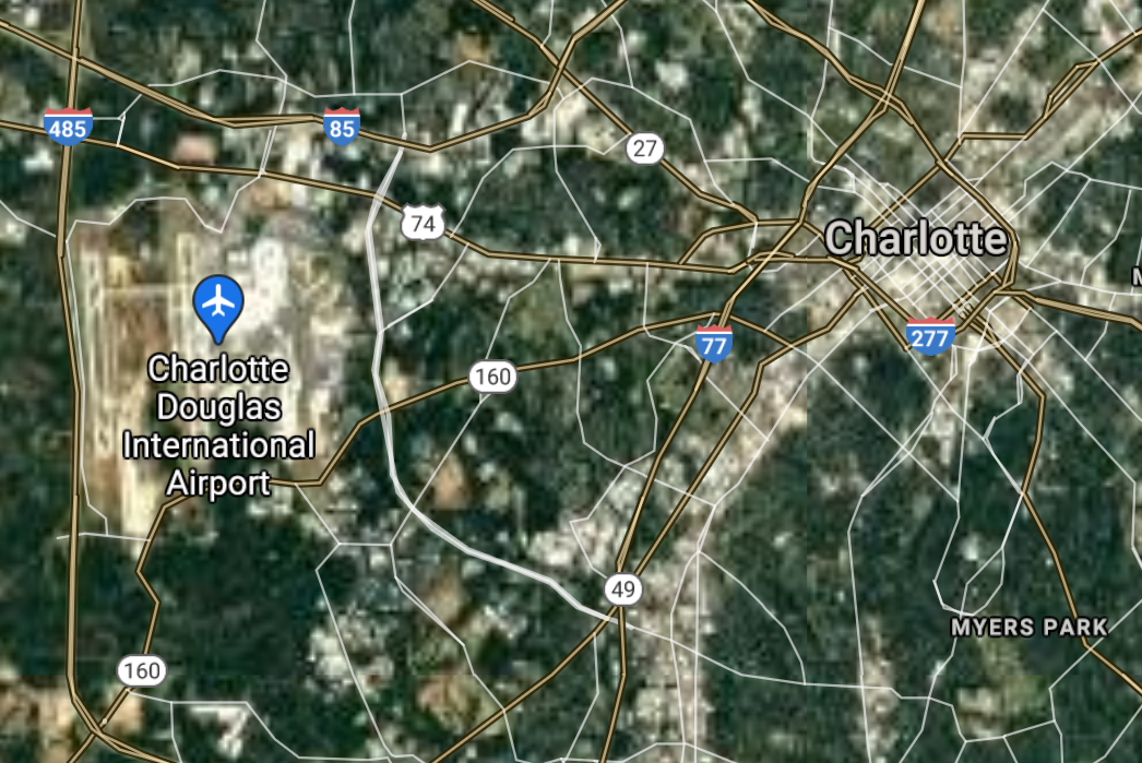
Charlotte [*elevation ceiling = 40km]Elevation: 233m (Group 166)
UR-100N (SLBM) |
Point A: 35.227087 00(300kt)
Point B: 35.779590 00
Point C: 36.072635 00
Point D: 35.994033 00
Point E: 36.099860 00
Point F: 35.052664 00
Open START Passages |
Point A: -80.843127 00(300kt)
Point B: -78.638179 00
Point C: -79.791975 00
Point D: -78.898619 00
Point E: -80.244216 00
Point F: -78.878358 00
Demonstration |
|
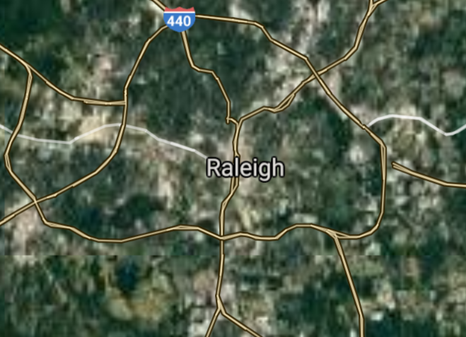
Raleigh [*elevation ceiling = 40km]Elevation: 106m (Group 166)
UR-100N (SLBM) |
Point A: 35.227087 00
Point B: 35.779590 00(300kt)
Point C: 36.072635 00
Point D: 35.994033 00
Point E: 36.099860 00
Point F: 35.052664 00
|
Point A: -80.843127 00
Point B: -78.638179 00(300kt)
Point C: -79.791975 00
Point D: -78.898619 00
Point E: -80.244216 00
Point F: -78.878358 00
|
|
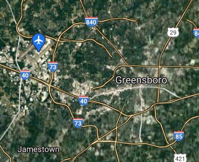
Greensboro [*elevation ceiling = 40km]Elevation: 251m (Group 166)
UR-100N (SLBM) |
Point A: 35.227087 00
Point B: 35.779590 00
Point C: 36.072635 00(300kt)
Point D: 35.994033 00
Point E: 36.099860 00
Point F: 35.052664 00
|
Point A: -80.843127 00
Point B: -78.638179 00
Point C: -79.791975 00(300kt)
Point D: -78.898619 00
Point E: -80.244216 00
Point F: -78.878358 00
|
|
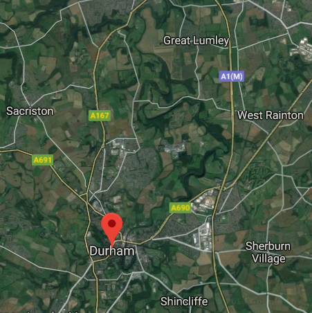
Durham [*elevation ceiling = 40km]Elevation: 121m (Group 166)
UR-100N (SLBM) |
Point A: 35.227087 00
Point B: 35.779590 00
Point C: 36.072635 00
Point D: 35.994033 00(300kt)
Point E: 36.099860 00
Point F: 35.052664 00
|
Point A: -80.843127 00
Point B: -78.638179 00
Point C: -79.791975 00
Point D: -78.898619 00(300kt)
Point E: -80.244216 00
Point F: -78.878358 00
|
|
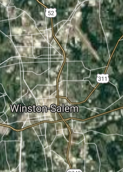
Winston-Salem [*elevation ceiling = 40km]Elevation: 278m (Group 166)
UR-100N (SLBM) |
Point A: 35.227087 00
Point B: 35.779590 00
Point C: 36.072635 00
Point D: 35.994033 00
Point E: 36.099860 00(300kt)
Point F: 35.052664 00
|
Point A: -80.843127 00
Point B: -78.638179 00
Point C: -79.791975 00
Point D: -78.898619 00
Point E: -80.244216 00(300kt)
Point F: -78.878358 00
|
|
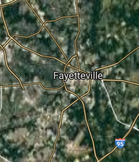
Fayetteville [*elevation ceiling = 40km]Elevation: 31m (Group 166)
UR-100N (SLBM) |
Point A: 35.227087 00
Point B: 35.779590 00
Point C: 36.072635 00
Point D: 35.994033 00
Point E: 36.099860 00
Point F: 35.052664 00(300kt)
|
Point A: -80.843127 00
Point B: -78.638179 00
Point C: -79.791975 00
Point D: -78.898619 00
Point E: -80.244216 00
Point F: -78.878358 00(300kt)
|
|
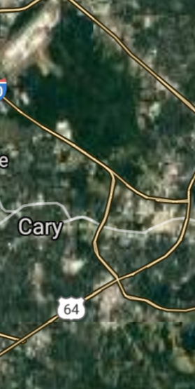
Cary [*elevation ceiling = 40km]Elevation: 152m (Group 167)
UR-100N (SLBM) |
Point A: 35.791540 00(300kt)
Point B: 34.210389 00
Point C: 35.955692 00
Point D: 35.612661 00
Point E: 35.408752 00
Point F: 35.595058 00
|
Point A: -78.781117 00(300kt)
Point B: -77.886812 00
Point C: -80.005318 00
Point D: -77.366354 00
Point E: -80.579511 00
Point F: -82.551487 00
|
|
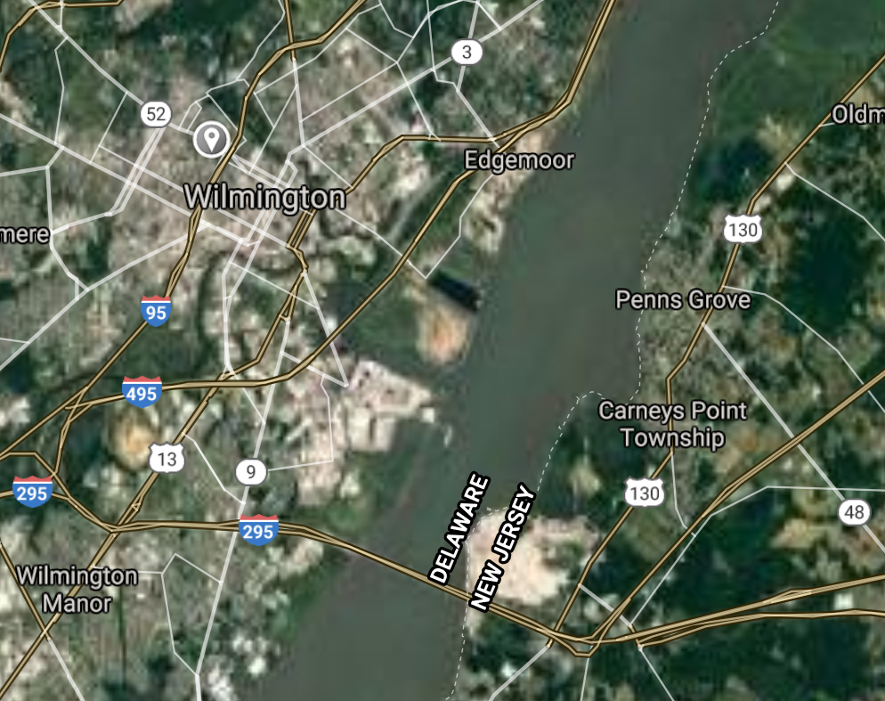
Wilmington [*elevation ceiling = 40km]Elevation: 13m (Group 167)
UR-100N (SLBM) |
Point A: 35.791540 00
Point B: 34.210389 00(300kt)
Point C: 35.955692 00
Point D: 35.612661 00
Point E: 35.408752 00
Point F: 35.595058 00
|
Point A: -78.781117 00
Point B: -77.886812 00(300kt)
Point C: -80.005318 00
Point D: -77.366354 00
Point E: -80.579511 00
Point F: -82.551487 00
|
|
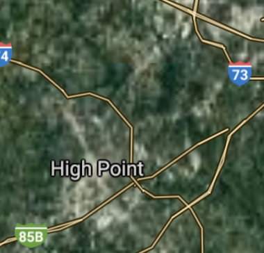
High Point [*elevation ceiling = 40km]Elevation: 281m (Group 167)
UR-100N (SLBM) |
Point A: 35.791540 00
Point B: 34.210389 00
Point C: 35.955692 00(300kt)
Point D: 35.612661 00
Point E: 35.408752 00
Point F: 35.595058 00
|
Point A: -78.781117 00
Point B: -77.886812 00
Point C: -80.005318 00(300kt)
Point D: -77.366354 00
Point E: -80.579511 00
Point F: -82.551487 00
|
|
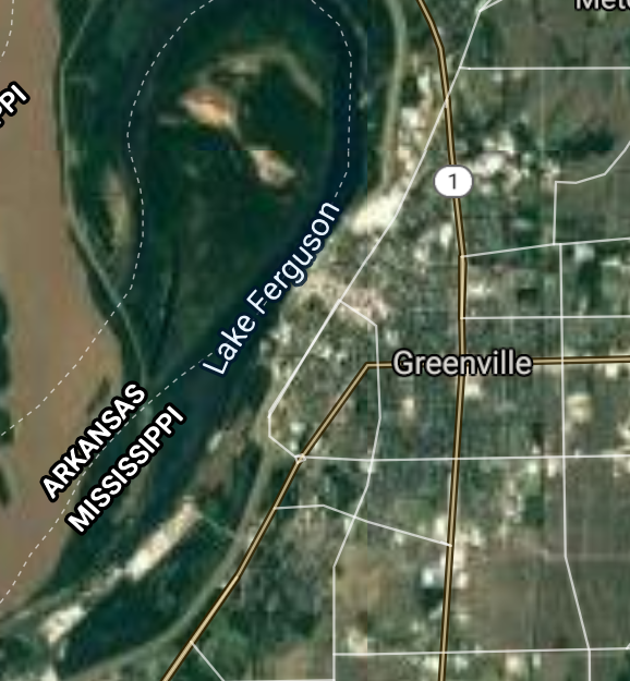
Greenville [*elevation ceiling = 40km]Elevation: 17m (Group 167)
UR-100N (SLBM) |
Point A: 35.791540 00
Point B: 34.210389 00
Point C: 35.955692 00
Point D: 35.612661 00(300kt)
Point E: 35.408752 00
Point F: 35.595058 00
|
Point A: -78.781117 00
Point B: -77.886812 00
Point C: -80.005318 00
Point D: -77.366354 00(300kt)
Point E: -80.579511 00
Point F: -82.551487 00
|
|
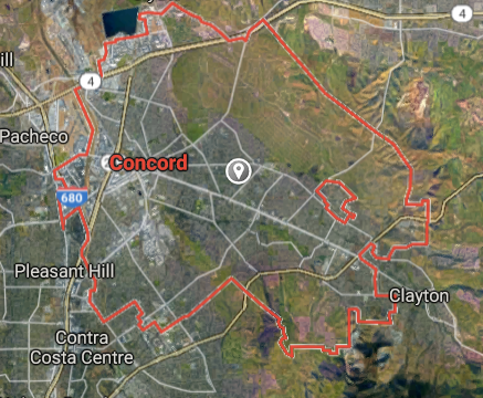
Concord [*elevation ceiling = 40km]Elevation: 215m (Group 167)
UR-100N (SLBM) |
Point A: 35.791540 00
Point B: 34.210389 00
Point C: 35.955692 00
Point D: 35.612661 00
Point E: 35.408752 00(300kt)
Point F: 35.595058 00
|
Point A: -78.781117 00
Point B: -77.886812 00
Point C: -80.005318 00
Point D: -77.366354 00
Point E: -80.579511 00(300kt)
Point F: -82.551487 00
|
|
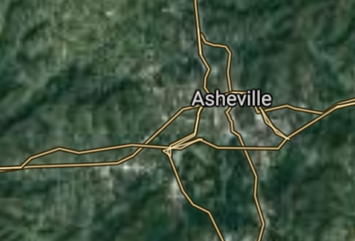
Asheville [*elevation ceiling = 40km]Elevation: 676m (Group 167)
UR-100N (SLBM) |
Point A: 35.791540 00
Point B: 34.210389 00
Point C: 35.955692 00
Point D: 35.612661 00
Point E: 35.408752 00
Point F: 35.595058 00(300kt)
|
Point A: -78.781117 00
Point B: -77.886812 00
Point C: -80.005318 00
Point D: -77.366354 00
Point E: -80.579511 00
Point F: -82.551487 00(300kt)
|
|
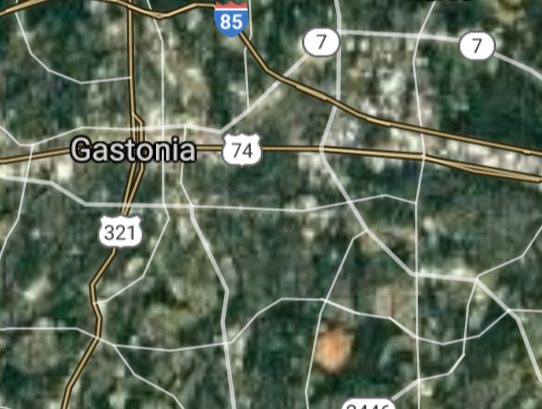
Gastonia [*elevation ceiling = 40km]Elevation: 245m (Group 168)
UR-100N (SLBM) |
Point A: 35.262082 00(300kt)
Point B: 34.754052 00
Point C: 35.913200 00
Point D: 35.410694 00
Point E: 35.938210 00
Point F: 36.095692 00
|
Point A: -81.187300 00(300kt)
Point B: -77.430241 00
Point C: -79.055845 00
Point D: -80.842850 00
Point E: -77.790534 00
Point F: -79.437799 00
|
|
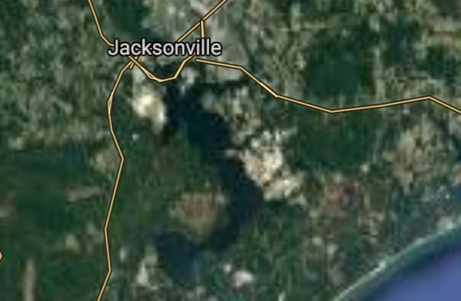
Jacksonville [*elevation ceiling = 40km]Elevation: 4m (Group 168)
UR-100N (SLBM) |
Point A: 35.262082 00
Point B: 34.754052 00(300kt)
Point C: 35.913200 00
Point D: 35.410694 00
Point E: 35.938210 00
Point F: 36.095692 00
|
Point A: -81.187300 00
Point B: -77.430241 00(300kt)
Point C: -79.055845 00
Point D: -80.842850 00
Point E: -77.790534 00
Point F: -79.437799 00
|
|
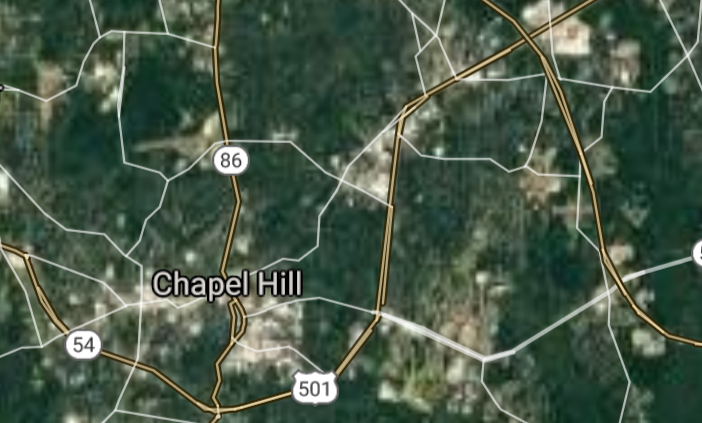
Chapel Hill [*elevation ceiling = 40km]Elevation: 149m (Group 168)
UR-100N (SLBM) |
Point A: 35.262082 00
Point B: 34.754052 00
Point C: 35.913200 00(300kt)
Point D: 35.410694 00
Point E: 35.938210 00
Point F: 36.095692 00
|
Point A: -81.187300 00
Point B: -77.430241 00
Point C: -79.055845 00(300kt)
Point D: -80.842850 00
Point E: -77.790534 00
Point F: -79.437799 00
|
|
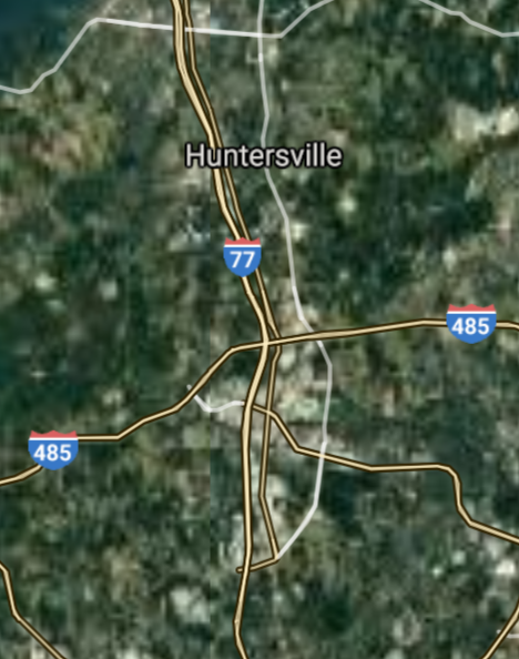
Huntersville [*elevation ceiling = 40km]Elevation: 247m (Group 168)
UR-100N (SLBM) |
Point A: 35.262082 00
Point B: 34.754052 00
Point C: 35.913200 00
Point D: 35.410694 00(300kt)
Point E: 35.938210 00
Point F: 36.095692 00
|
Point A: -81.187300 00
Point B: -77.430241 00
Point C: -79.055845 00
Point D: -80.842850 00(300kt)
Point E: -77.790534 00
Point F: -79.437799 00
|
|
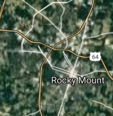
Rocky Mount [*elevation ceiling = 40km]Elevation: 30m (Group 168)
UR-100N (SLBM) |
Point A: 35.262082 00
Point B: 34.754052 00
Point C: 35.913200 00
Point D: 35.410694 00
Point E: 35.938210 00(300kt)
Point F: 36.095692 00
|
Point A: -81.187300 00
Point B: -77.430241 00
Point C: -79.055845 00
Point D: -80.842850 00
Point E: -77.790534 00(300kt)
Point F: -79.437799 00
|
|
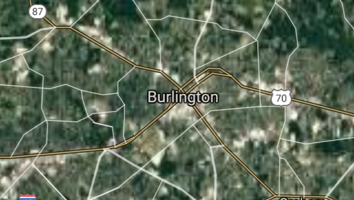
Burlington [*elevation ceiling = 40km]Elevation: 198m (Group 168)
UR-100N (SLBM) |
Point A: 35.262082 00
Point B: 34.754052 00
Point C: 35.913200 00
Point D: 35.410694 00
Point E: 35.938210 00
Point F: 36.095692 00(300kt)
|
Point A: -81.187300 00
Point B: -77.430241 00
Point C: -79.055845 00
Point D: -80.842850 00
Point E: -77.790534 00
Point F: -79.437799 00(300kt)
|
|
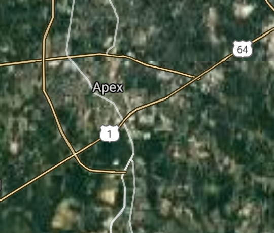
Apex [*elevation ceiling = 40km]Elevation: 152m (Group 169)
UR-100N (SLBM) |
Point A: 35.732652 00(300kt)
Point B: 35.721269 00
Point C: 35.487361 00
Point D: 35.979873 00
Point E: 35.734454 00
Point F: 35.076814 00
|
Point A: -78.850286 00(300kt)
Point B: -77.915540 00
Point C: -80.621734 00
Point D: -78.509723 00
Point E: -81.344457 00
Point F: -80.669235 00
|
|
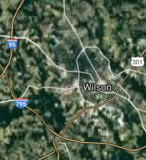
Wilson [*elevation ceiling = 40km]Elevation: 34m (Group 169)
UR-100N (SLBM) |
Point A: 35.732652 00
Point B: 35.721269 00(300kt)
Point C: 35.487361 00
Point D: 35.979873 00
Point E: 35.734454 00
Point F: 35.076814 00
|
Point A: -78.850286 00
Point B: -77.915540 00(300kt)
Point C: -80.621734 00
Point D: -78.509723 00
Point E: -81.344457 00
Point F: -80.669235 00
|
|
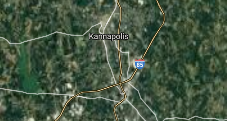
Kannapolis [*elevation ceiling = 40km]Elevation: 244m (Group 169)
UR-100N (SLBM) |
Point A: 35.732652 00
Point B: 35.721269 00
Point C: 35.487361 00(300kt)
Point D: 35.979873 00
Point E: 35.734454 00
Point F: 35.076814 00
|
Point A: -78.850286 00
Point B: -77.915540 00
Point C: -80.621734 00(300kt)
Point D: -78.509723 00
Point E: -81.344457 00
Point F: -80.669235 00
|
|
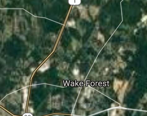
Wake Forest [*elevation ceiling = 40km]Elevation: 119m (Group 169)
UR-100N (SLBM) |
Point A: 35.732652 00
Point B: 35.721269 00
Point C: 35.487361 00
Point D: 35.979873 00(300kt)
Point E: 35.734454 00
Point F: 35.076814 00
|
Point A: -78.850286 00
Point B: -77.915540 00
Point C: -80.621734 00
Point D: -78.509723 00(300kt)
Point E: -81.344457 00
Point F: -80.669235 00
|
|
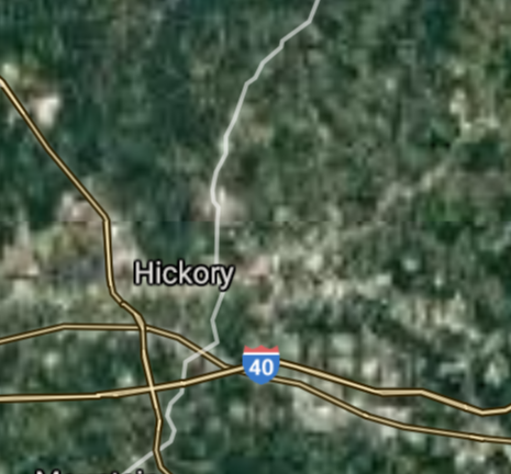
Hickory [*elevation ceiling = 40km]Elevation: 353m (Group 169)
UR-100N (SLBM) |
Point A: 35.732652 00
Point B: 35.721269 00
Point C: 35.487361 00
Point D: 35.979873 00
Point E: 35.734454 00(300kt)
Point F: 35.076814 00
|
Point A: -78.850286 00
Point B: -77.915540 00
Point C: -80.621734 00
Point D: -78.509723 00
Point E: -81.344457 00(300kt)
Point F: -80.669235 00
|
|
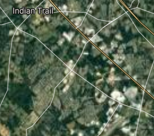
Indian Trail [*elevation ceiling = 40km]Elevation: 213m (Group 169)
UR-100N (SLBM) |
Point A: 35.732652 00
Point B: 35.721269 00
Point C: 35.487361 00
Point D: 35.979873 00
Point E: 35.734454 00
Point F: 35.076814 00(300kt)
|
Point A: -78.850286 00
Point B: -77.915540 00
Point C: -80.621734 00
Point D: -78.509723 00
Point E: -81.344457 00
Point F: -80.669235 00(300kt)
|
|
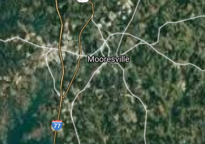
Mooresville [*elevation ceiling = 40km]Elevation: 277m (Group 170)
UR-100N (SLBM) |
Point A: 35.585915 00(300kt)
Point B: 35.651266 00
Point C: 35.384884 00
Point D: 34.985428 00
Point E: 35.670973 00
Point F: 35.116813 00
|
Point A: -80.808141 00(300kt)
Point B: -78.833622 00
Point C: -77.992765 00
Point D: -80.549511 00
Point E: -80.474226 00
Point F: -80.723680 00
|
|
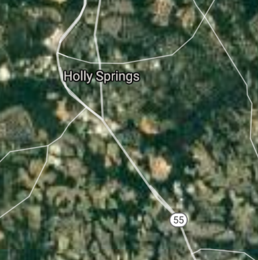
Holly Springs [*elevation ceiling = 40km]Elevation: 134m (Group 170)
UR-100N (SLBM) |
Point A: 35.585915 00
Point B: 35.651266 00(300kt)
Point C: 35.384884 00
Point D: 34.985428 00
Point E: 35.670973 00
Point F: 35.116813 00
|
Point A: -80.808141 00
Point B: -78.833622 00(300kt)
Point C: -77.992765 00
Point D: -80.549511 00
Point E: -80.474226 00
Point F: -80.723680 00
|
|
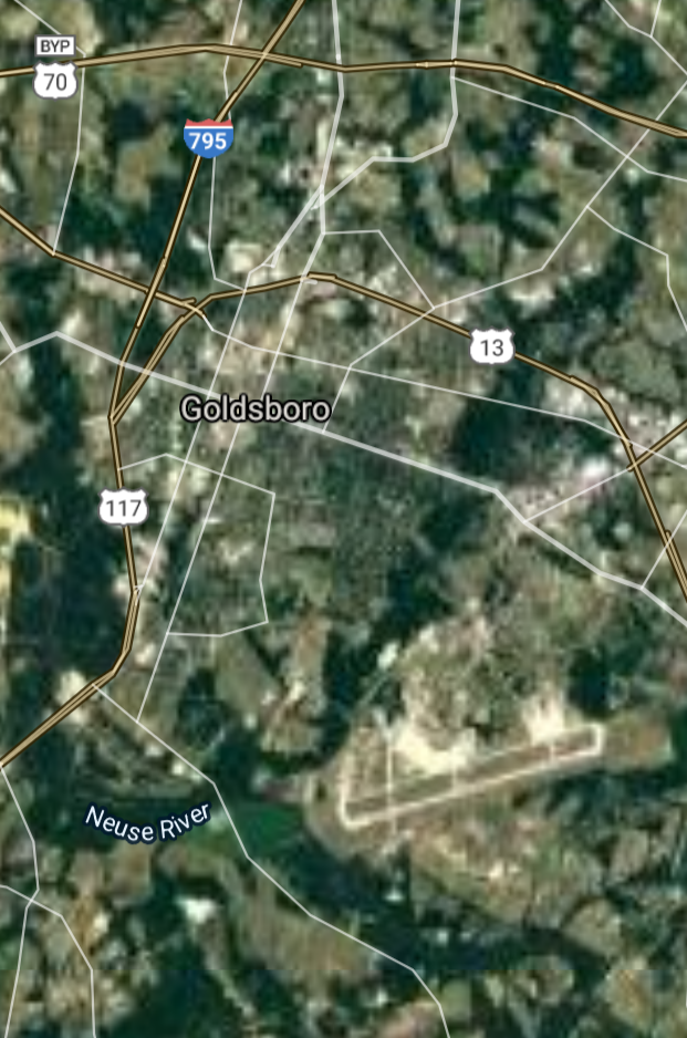
Goldsboro [*elevation ceiling = 40km]Elevation: 33m (Group 170)
UR-100N (SLBM) |
Point A: 35.585915 00
Point B: 35.651266 00
Point C: 35.384884 00(300kt)
Point D: 34.985428 00
Point E: 35.670973 00
Point F: 35.116813 00
|
Point A: -80.808141 00
Point B: -78.833622 00
Point C: -77.992765 00(300kt)
Point D: -80.549511 00
Point E: -80.474226 00
Point F: -80.723680 00
|
|
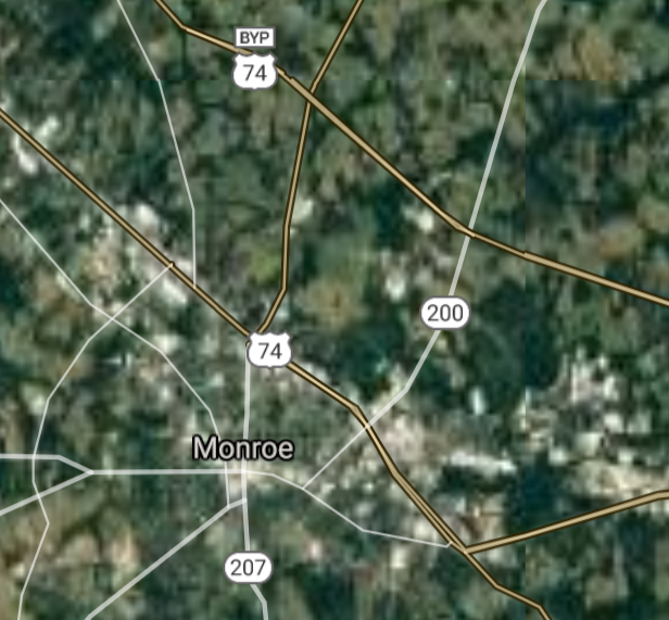
Monroe [*elevation ceiling = 40km]Elevation: 183m (Group 170)
UR-100N (SLBM) |
Point A: 35.585915 00
Point B: 35.651266 00
Point C: 35.384884 00
Point D: 34.985428 00(300kt)
Point E: 35.670973 00
Point F: 35.116813 00
|
Point A: -80.808141 00
Point B: -78.833622 00
Point C: -77.992765 00
Point D: -80.549511 00(300kt)
Point E: -80.474226 00
Point F: -80.723680 00
|
|
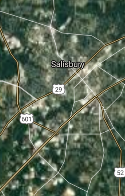
Salisbury [*elevation ceiling = 40km]Elevation: 234m (Group 170)
UR-100N (SLBM) |
Point A: 35.585915 00
Point B: 35.651266 00
Point C: 35.384884 00
Point D: 34.985428 00
Point E: 35.670973 00(300kt)
Point F: 35.116813 00
|
Point A: -80.808141 00
Point B: -78.833622 00
Point C: -77.992765 00
Point D: -80.549511 00
Point E: -80.474226 00(300kt)
Point F: -80.723680 00
|
|
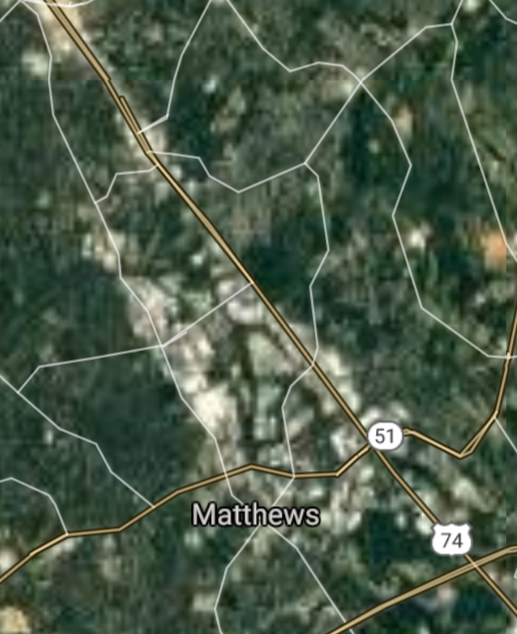
Matthews [*elevation ceiling = 40km]Elevation: 222m (Group 170)
UR-100N (SLBM) |
Point A: 35.585915 00
Point B: 35.651266 00
Point C: 35.384884 00
Point D: 34.985428 00
Point E: 35.670973 00
Point F: 35.116813 00(300kt)
|
Point A: -80.808141 00
Point B: -78.833622 00
Point C: -77.992765 00
Point D: -80.549511 00
Point E: -80.474226 00
Point F: -80.723680 00(300kt)
|
|
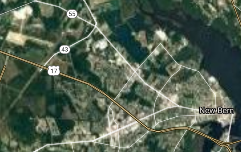
New Bern [*elevation ceiling = 40km]Elevation: 3m (Group 171)
UR-100N (SLBM) |
Point A: 35.108493 00(300kt)
Point B: 35.479876 00
Point C: 35.486803 00
Point D: 35.711264 00
Point E: 35.584324 00
Point F: 35.173540 00
|
Point A: -77.044114 00(300kt)
Point B: -79.180299 00
Point C: -80.860074 00
Point D: -78.614171 00
Point E: -78.800013 00
Point F: -80.657030 00
|
|
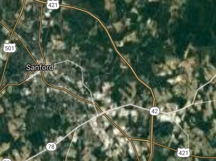
Sanford [*elevation ceiling = 40km]Elevation: 109m (Group 171)
UR-100N (SLBM) |
Point A: 35.108493 00
Point B: 35.479876 00(300kt)
Point C: 35.486803 00
Point D: 35.711264 00
Point E: 35.584324 00
Point F: 35.173540 00
|
Point A: -77.044114 00
Point B: -79.180299 00(300kt)
Point C: -80.860074 00
Point D: -78.614171 00
Point E: -78.800013 00
Point F: -80.657030 00
|
|
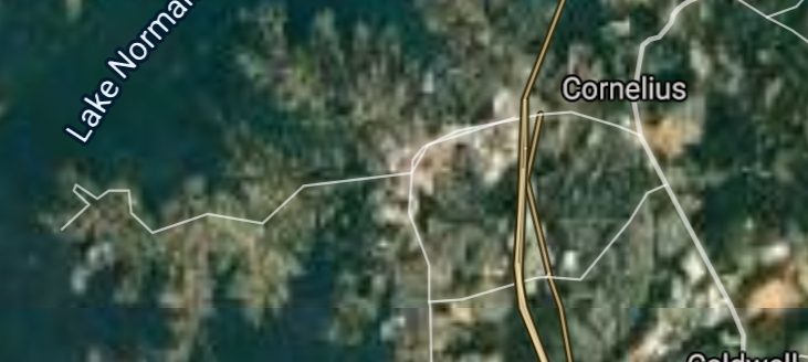
Cornelius [*elevation ceiling = 40km]Elevation: 239m (Group 171)
UR-100N (SLBM) |
Point A: 35.108493 00
Point B: 35.479876 00
Point C: 35.486803 00(300kt)
Point D: 35.711264 00
Point E: 35.584324 00
Point F: 35.173540 00
|
Point A: -77.044114 00
Point B: -79.180299 00
Point C: -80.860074 00(300kt)
Point D: -78.614171 00
Point E: -78.800013 00
Point F: -80.657030 00
|
|
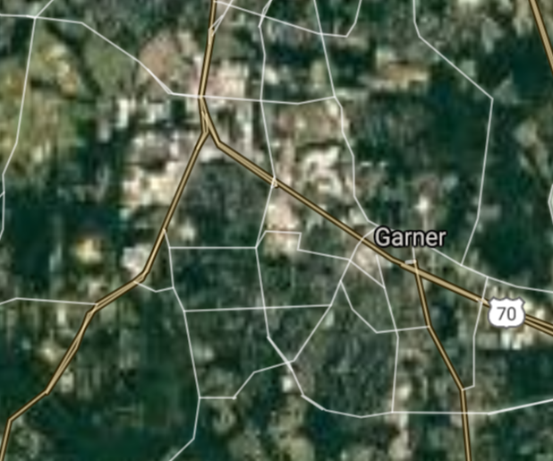
Garner [*elevation ceiling = 40km]Elevation: 110m (Group 171)
UR-100N (SLBM) |
Point A: 35.108493 00
Point B: 35.479876 00
Point C: 35.486803 00
Point D: 35.711264 00(300kt)
Point E: 35.584324 00
Point F: 35.173540 00
|
Point A: -77.044114 00
Point B: -79.180299 00
Point C: -80.860074 00
Point D: -78.614171 00(300kt)
Point E: -78.800013 00
Point F: -80.657030 00
|
|
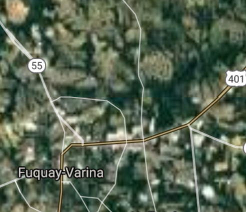
Fuquay-Varina [*elevation ceiling = 40km]Elevation: 119m (Group 171)
UR-100N (SLBM) |
Point A: 35.108493 00
Point B: 35.479876 00
Point C: 35.486803 00
Point D: 35.711264 00
Point E: 35.584324 00(300kt)
Point F: 35.173540 00
|
Point A: -77.044114 00
Point B: -79.180299 00
Point C: -80.860074 00
Point D: -78.614171 00
Point E: -78.800013 00(300kt)
Point F: -80.657030 00
|
|
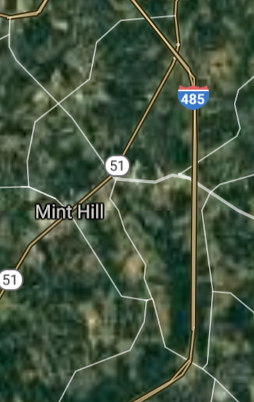
Mint Hill [*elevation ceiling = 40km]Elevation: 230m (Group 171)
UR-100N (SLBM) |
Point A: 35.108493 00
Point B: 35.479876 00
Point C: 35.486803 00
Point D: 35.711264 00
Point E: 35.584324 00
Point F: 35.173540 00(300kt)
|
Point A: -77.044114 00
Point B: -79.180299 00
Point C: -80.860074 00
Point D: -78.614171 00
Point E: -78.800013 00
Point F: -80.657030 00(300kt)
|
|
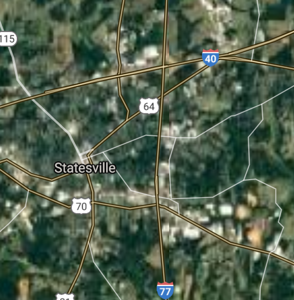
Statesville [*elevation ceiling = 40km]Elevation: 278m (Group 172)
UR-100N (SLBM) |
Point A: 35.782636 00(300kt)
Point B: 35.882637 00
Point C: 35.823483 00
Point D: 35.707915 00
Point E: 36.119859 00
Point F: 35.910144 00
|
Point A: -80.887296 00(300kt)
Point B: -80.081988 00
Point C: -78.825562 00
Point D: -79.813645 00
Point E: -80.073653 00
Point F: -79.075290 00
|
|
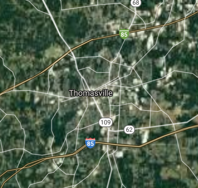
Thomasville [*elevation ceiling = 40km]Elevation: 259m (Group 172)
UR-100N (SLBM) |
Point A: 35.782636 00
Point B: 35.882637 00(300kt)
Point C: 35.823483 00
Point D: 35.707915 00
Point E: 36.119859 00
Point F: 35.910144 00
|
Point A: -80.887296 00
Point B: -80.081988 00(300kt)
Point C: -78.825562 00
Point D: -79.813645 00
Point E: -80.073653 00
Point F: -79.075290 00
|
|
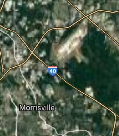
Morrisville [*elevation ceiling = 40km]Elevation: 91m (Group 172)
UR-100N (SLBM) |
Point A: 35.782636 00
Point B: 35.882637 00
Point C: 35.823483 00(300kt)
Point D: 35.707915 00
Point E: 36.119859 00
Point F: 35.910144 00
|
Point A: -80.887296 00
Point B: -80.081988 00
Point C: -78.825562 00(300kt)
Point D: -79.813645 00
Point E: -80.073653 00
Point F: -79.075290 00
|
|
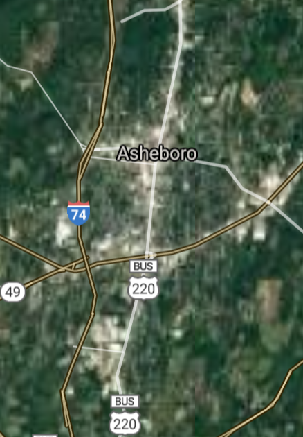
Asheboro [*elevation ceiling = 40km]Elevation: 256m (Group 172)
UR-100N (SLBM) |
Point A: 35.782636 00
Point B: 35.882637 00
Point C: 35.823483 00
Point D: 35.707915 00(300kt)
Point E: 36.119859 00
Point F: 35.910144 00
|
Point A: -80.887296 00
Point B: -80.081988 00
Point C: -78.825562 00
Point D: -79.813645 00(300kt)
Point E: -80.073653 00
Point F: -79.075290 00
|
|
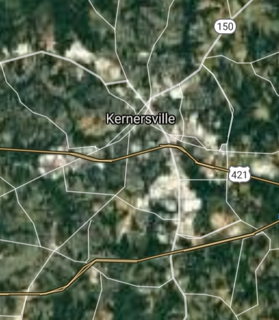
Kernersville [*elevation ceiling = 40km]Elevation: 308m (Group 172)
UR-100N (SLBM) |
Point A: 35.782636 00
Point B: 35.882637 00
Point C: 35.823483 00
Point D: 35.707915 00
Point E: 36.119859 00(300kt)
Point F: 35.910144 00
|
Point A: -80.887296 00
Point B: -80.081988 00
Point C: -78.825562 00
Point D: -79.813645 00
Point E: -80.073653 00(300kt)
Point F: -79.075290 00
|
|
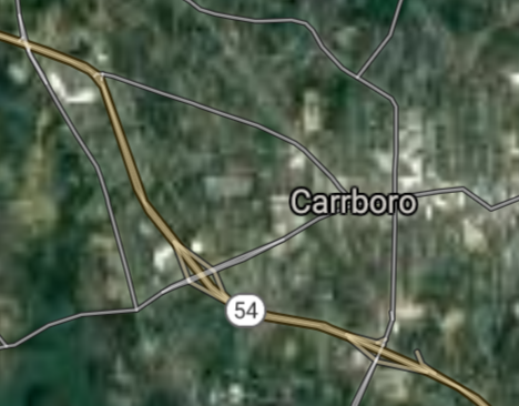
Carrboro [*elevation ceiling = 40km]Elevation: 141m (Group 172)
UR-100N (SLBM) |
Point A: 35.782636 00
Point B: 35.882637 00
Point C: 35.823483 00
Point D: 35.707915 00
Point E: 36.119859 00
Point F: 35.910144 00(300kt)
|
Point A: -80.887296 00
Point B: -80.081988 00
Point C: -78.825562 00
Point D: -79.813645 00
Point E: -80.073653 00
Point F: -79.075290 00(300kt)
|
|
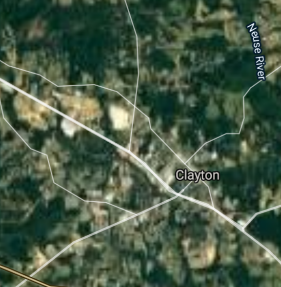
Clayton [*elevation ceiling = 40km]Elevation: 104m (Group 173)
UR-100N (SLBM) |
Point A: 35.650711 00(300kt)
Point B: 35.1883311 00
Point C: 35.262664 00
Point D: 36.021526 00
Point E: 35.292351 00
Point F: 34.879049 00
|
Point A: -78.456391 00(300kt)
Point B: -79.2991684 00
Point C: -77.581635 00
Point D: -80.381998 00
Point E: -81.535646 00
Point F: -76.901330 00
|
|
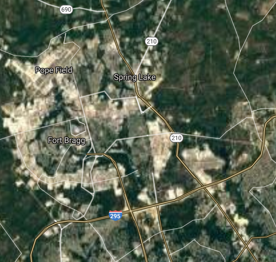
Fort Bragg [*elevation ceiling = 40km]Elevation: 97m (Group 173)
UR-100N (SLBM) |
Point A: 35.650711 00
Point B: 35.1883311 00(300kt)
Point C: 35.262664 00
Point D: 36.021526 00
Point E: 35.292351 00
Point F: 34.879049 00
|
Point A: -78.456391 00
Point B: -79.2991684 00(300kt)
Point C: -77.581635 00
Point D: -80.381998 00
Point E: -81.535646 00
Point F: -76.901330 00
|
|
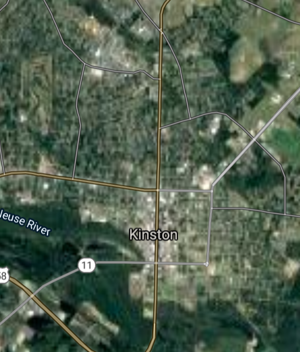
Kinston [*elevation ceiling = 40km]Elevation: 13m (Group 173)
UR-100N (SLBM) |
Point A: 35.650711 00
Point B: 35.1883311 00
Point C: 35.262664 00(300kt)
Point D: 36.021526 00
Point E: 35.292351 00
Point F: 34.879049 00
|
Point A: -78.456391 00
Point B: -79.2991684 00
Point C: -77.581635 00(300kt)
Point D: -80.381998 00
Point E: -81.535646 00
Point F: -76.901330 00
|
|
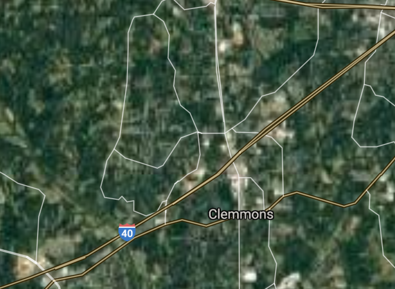
Clemmons [*elevation ceiling = 40km]Elevation: 256m (Group 173)
UR-100N (SLBM) |
Point A: 35.650711 00
Point B: 35.1883311 00
Point C: 35.262664 00
Point D: 36.021526 00(300kt)
Point E: 35.292351 00
Point F: 34.879049 00
|
Point A: -78.456391 00
Point B: -79.2991684 00
Point C: -77.581635 00
Point D: -80.381998 00(300kt)
Point E: -81.535646 00
Point F: -76.901330 00
|
|
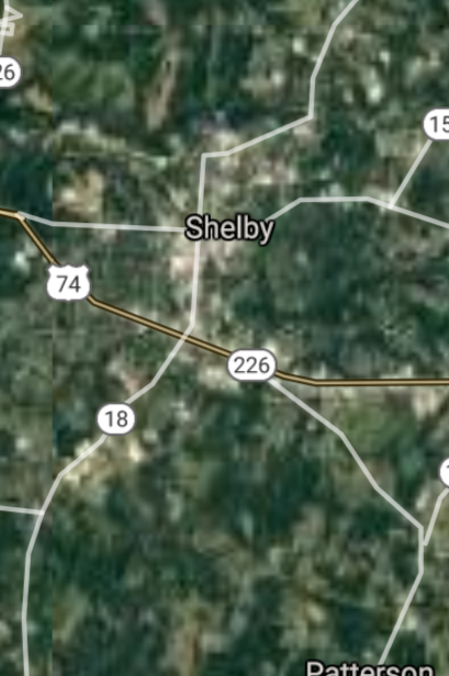
Shelby [*elevation ceiling = 40km]Elevation: 262m (Group 173)
UR-100N (SLBM) |
Point A: 35.650711 00
Point B: 35.1883311 00
Point C: 35.262664 00
Point D: 36.021526 00
Point E: 35.292351 00(300kt)
Point F: 34.879049 00
|
Point A: -78.456391 00
Point B: -79.2991684 00
Point C: -77.581635 00
Point D: -80.381998 00
Point E: -81.535646 00(300kt)
Point F: -76.901330 00
|
|
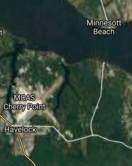
Havelock [*elevation ceiling = 40km]Elevation: 7m (Group 173)
UR-100N (SLBM) |
Point A: 35.650711 00
Point B: 35.1883311 00
Point C: 35.262664 00
Point D: 36.021526 00
Point E: 35.292351 00
Point F: 34.879049 00(300kt)
|
Point A: -78.456391 00
Point B: -79.2991684 00
Point C: -77.581635 00
Point D: -80.381998 00
Point E: -81.535646 00
Point F: -76.901330 00(300kt)
|
[Top]
Open START: Central Basin
"BRICS Security Council emerging from cross-currency evaluations"
OPEN Start: Central Basin - is an engineering vessel which is proven with climate security in evaluation of the USD/YEN currency pair. Annually, climate security is leading economic growth in key emerging markets surrounding the Four Asian Tigers. Affordably, the following industries extend opportunities for military cooperation: aerospace, telecommunications, finance and banking. OPEN Start: Central Basin strengthens the backbone for international security beyond the shadows of USD/YEN controversy. Traversely, OPEN Start: Central Basin offsets the cross-over gap between the USD/MXN and USD/RUB exchange rates. Notably, the Three Amigas form an economic alliance in the Far West through joint-cooperation projects from Venture 1, Venture LA and Venture SF which all extend with the Far North reach towards the Far South (as illustrated below).
![]()
![]()
![]()
![]()
![]()
![]()
![]()
![]()
![]()
JanuaryFebruaryMarchAprilJuneJulySeptemberOctoberDecember |
2026 Group Drills - Schedule
|
|

JanuaryFebruaryJuneJulyAugustOctoberNovemberDecember |
2026 Group Drills - Schedule
|
|

JanuaryFebruaryJuneJulySeptemberOctoberNovemberDecember |
2026 Group Drills - Schedule
|
|
