

 OPEN Start


 Hollywood, JSC
Mendocino, JSC
LA SOCIETY
SF SOCIETY
NY SOCIETY
Open START Drills
Hollywood, JSC
Mendocino, JSC
LA SOCIETY
SF SOCIETY
NY SOCIETY
Open START Drills
Talk Daily Commodities Review LATPACT Open Market Equities Report Currency Central
 Situation: US
 |

|

|

|
|
 SOCIETY Trust Fund LATPACT Trust Fund LATPACT Open Market Far West (SEZ) Trust RIM of Nations Trust
Arctic Pact Trade Zone | Upper Rhine Zone | Lower Rhine Zone | Middle Rhone Basin
| Level 2 - Open START/*Super Grid |
| Level 3 - Stellar Fields |


Climate Central News & Information
 "US attempts to salvage the European Order with a K-9 Squad clan style coalition"
Population Conversations: 1,413,376
Planet Power Seconds
 BRICS Security Council
 Military cooperation is exceedingly pressing ahead in notable markets from China, Russia and India which include achieving greater milestones within the technology, communications, and aerospace industries. Vastly, multi-national alliances continue to expand as relying on new protocols oppose resistance with deregulation in the spheres of international security and terrorism. As a result, the BRICS Security Council is forming several key initiatives from climate security to preserve and harness the skills with establishing a polar-arc posture in outer space.
In contrast, a grave decline in NATO has been detected. In early 2018, UNITED STATES ARMY COMMANDER, GENERAL CURTIS M. SCAPARROTTI delivered the posture statement for NATO. He stated, "As our most significant trading partner, Europe is vital to promoting American prosperity. With shared history and values, Europe is also a critical partner in advancing American influence throughout the world. The North Atlantic Treaty Organization (NATO) enables us to preserve peace through strength as alliance unity fundamentally deters the aggression of potential adversaries." Meanwhile, NATO readiness is faltering in Europe as lack of training, inadequate funding and outdated equipment persist over the Brexit strategy.
United Nations Command: AUKUSA/Quad 4
 Extensively, the Central Basin is transforming international security while disabling NATO, AUKUSA and the Quad 4 military alliances with the Open START Hawaii and Open START Alaska drills. Inherently, the Central Basin fleet suppresses the UN Command over security backlogs as the Global South impedes expansion for the Japanese yen. Economically, the US dollar bounds NATO, AUKUSA and the Quad 4 alliances under one entity in the wake of the 2007 housing crises, COVID-19 recovery and war in Ukraine. Generously, the Upper Rhine pass bridges the Open START Hawaii and Open START Alaska drills which stabilize international and climate security. Uniquely, Open START drills for the Upper Rhine pass pegs the value of the Japanese yen and Korean Won to the Chinese yuan, Indian rupee, Russian ruble, and Mexican peso to enable economic transformation for the Central Basin region. Effectively, the Open START drill secures the yen in cooperation with the Global South as significant growth on the New Silk Road Economic Belt extends in Africa. Suitably, the Open START drill baffles the UN Command with the Upper Rhine pass as the historical value is at stake. Judiciously, the Open START drill isolates the UN Command over Level 1 protocol which underpins NATO, AUKUSA and the Quad 4 military alliances to Celtic Briton tribes.
The OSCE and NATO: From the Arctic Circle
 Historically, military conflicts include land navigation rivalry which is significant for the Lower Rhine corridor as tensions between the Eastern and Western hemisphere ignite over political testimony. Substantially, the US has interspersed armed forces in the EU with the connivance of NATO and the OSCE to subjugate the Arctic Circle and dominate international trade from the Middle East. Tacitly, the OSCE is equipped to engineer early warnings, conflict resolution and crisis management over military tensions with NATO to inseminate the world order of law and justice. Decisively, the Open START Iceland drill unify the corners of the world to combat the historical West from the Arctic Circle over climate security, war crimes and crimes against humanity. Particularly, normalized ties to Israel for the Lower Rhine corridor weighs over rising Eastern influence from the Near East which is a major factor in the Open START Iceland drill. Efficiently, the Open START Iceland drill balances political, economic and military parity between the historical East and West which is threatened from the incumbency of trade sanctions and escalating military tensions in the West.
*Schedule of Nuclear Attack
Be advised: The specific plan of attack for Arkansas is sensitive and will be posted here closer to its scheduled strike.
Arkansas
AL* | AZ* | AR* | CO | CT | DE | FL | GA | ID | IN | IA | KS | KY | LA | ME | MD
MA | MI | MN | MO | MT | NE | NV | NH | NJ | NM | NY | NC | ND | OH | OK | OR | PA | RI | SC
SD | TN | TX | UT | VA (DC)** | VT** | WA** | WV** | WI** | WY**
*Central Fleet South  Bulava + RT23 Cadet + Vysota3
Team: Memphis Fire (Local Area Control)
**Central Fleet North Bulava + Surya + Vysota3
Open START (RKS) |
Groups UR9 - UR16 | *300kt | Millineum Power *4,000 MW
Level 1 - WA Dong (SIT.2) 
Arkansas |
Latitude Coordinate |
Longitude Coordinate |
|
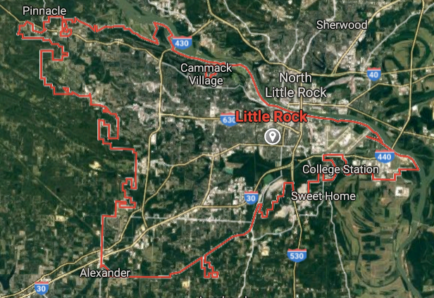
Little Rock [*elevation ceiling = 40km]Elevation: 102m (Group 9)
UR-100N (SLBM) |
Point A: 34.746481 00 (300kt)
Point B: 35.385924 00
Point C: 36.082156 00
Point D: 36.186744 00
Point E: 35.842297 00
Point F: 34.769536 00
Open START Passages |
Point A: -92.289595 00 (300kt)
Point B: -94.398548 00
Point C: -94.171854 00
Point D: -94.128814 00
Point E: -90.704279 00
Point F: -92.267094 00
Demonstration |
|
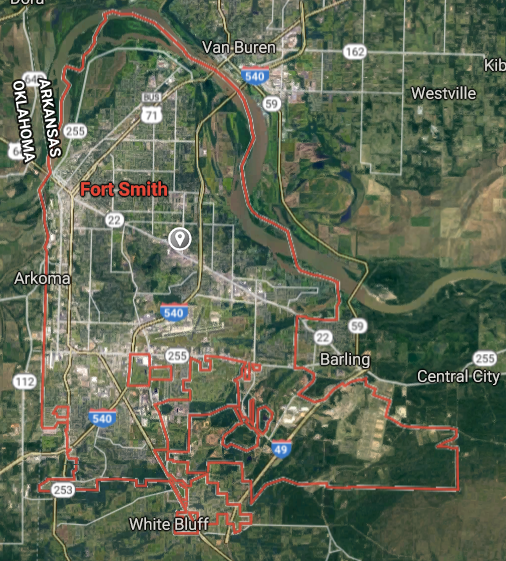
Fort Smith [*elevation ceiling = 40km]Elevation: 131m (Group 9)
UR-100N (SLBM) |
Point A: 34.746481 00
Point B: 35.385924 00 (300kt)
Point C: 36.082156 00
Point D: 36.186744 00
Point E: 35.842297 00
Point F: 34.769536 00
|
Point A: -92.289595 00
Point B: -94.398548 00 (300kt)
Point C: -94.171854 00
Point D: -94.128814 00
Point E: -90.704279 00
Point F: -92.267094 00
|
|
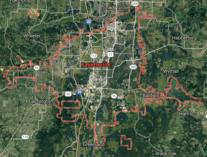
Fayetteville [*elevation ceiling = 40km]Elevation: 392m (Group 9)
UR-100N (SLBM) |
Point A: 34.746481 00
Point B: 35.385924 00
Point C: 36.082156 00 (300kt)
Point D: 36.186744 00
Point E: 35.842297 00
Point F: 34.769536 00
|
Point A: -92.289595 00
Point B: -94.398548 00
Point C: -94.171854 00 (300kt)
Point D: -94.128814 00
Point E: -90.704279 00
Point F: -92.267094 00
|
|
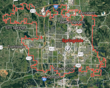
Springdale [*elevation ceiling = 40km]Elevation: 400m (Group 9)
UR-100N (SLBM) |
Point A: 34.746481 00
Point B: 35.385924 00
Point C: 36.082156 00
Point D: 36.186744 00 (300kt)
Point E: 35.842297 00
Point F: 34.769536 00
|
Point A: -92.289595 00
Point B: -94.398548 00
Point C: -94.171854 00
Point D: -94.128814 00 (300kt)
Point E: -90.704279 00
Point F: -92.267094 00
|
|
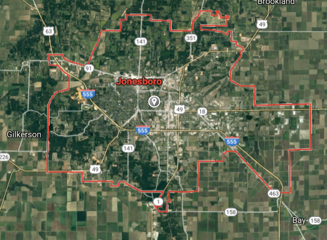
Jonesboro [*elevation ceiling = 40km]Elevation: 98m (Group 9)
UR-100N (SLBM) |
Point A: 34.746481 00
Point B: 35.385924 00
Point C: 36.082156 00
Point D: 36.186744 00
Point E: 35.842297 00 (300kt)
Point F: 34.769536 00
|
Point A: -92.289595 00
Point B: -94.398548 00
Point C: -94.171854 00
Point D: -94.128814 00
Point E: -90.704279 00 (300kt)
Point F: -92.267094 00
|
|
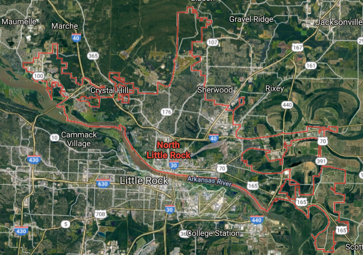
North Little Rock [*elevation ceiling = 40km]Elevation: 83m (Group 9)
UR-100N (SLBM) |
Point A: 34.746481 00
Point B: 35.385924 00
Point C: 36.082156 00
Point D: 36.186744 00
Point E: 35.842297 00
Point F: 34.769536 00 (300kt)
|
Point A: -92.289595 00
Point B: -94.398548 00
Point C: -94.171854 00
Point D: -94.128814 00
Point E: -90.704279 00
Point F: -92.267094 00 (300kt)
|
|
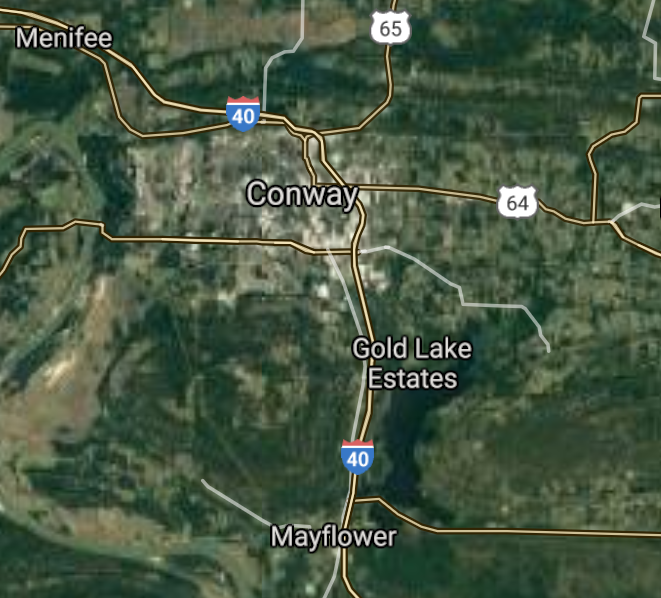
Conway [*elevation ceiling = 40km]Elevation: 94m (Group 10)
UR-100N (SLBM) |
Point A: 35.088696 00 (300kt)
Point B: 36.332020 00
Point C: 34.228431 00
Point D: 36.372854 00
Point E: 34.503700 00
Point F: 34.564537 00
|
Point A: -92.442101 00 (300kt)
Point B: -94.118537 00
Point C: -92.003196 00
Point D: -94.208817 00
Point E: -93.055180 00
Point F: -92.586828 00
|
|
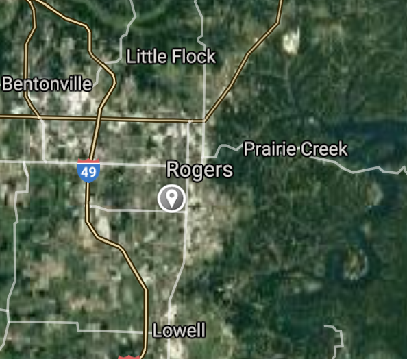
Rogers [*elevation ceiling = 40km]Elevation: 414m (Group 10)
UR-100N (SLBM) |
Point A: 35.088696 00
Point B: 36.332020 00 (300kt)
Point C: 34.228431 00
Point D: 36.372854 00
Point E: 34.503700 00
Point F: 34.564537 00
|
Point A: -92.442101 00
Point B: -94.118537 00 (300kt)
Point C: -92.003196 00
Point D: -94.208817 00
Point E: -93.055180 00
Point F: -92.586828 00
|
|
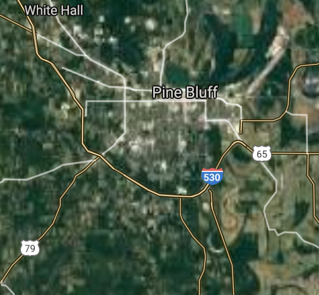
Pine Bluff [*elevation ceiling = 40km]Elevation: 69m (Group 10)
UR-100N (SLBM) |
Point A: 35.088696 00
Point B: 36.332020 00
Point C: 34.228431 00 (300kt)
Point D: 36.372854 00
Point E: 34.503700 00
Point F: 34.564537 00
|
Point A: -92.442101 00
Point B: -94.118537 00
Point C: -92.003196 00 (300kt)
Point D: -94.208817 00
Point E: -93.055180 00
Point F: -92.586828 00
|
|
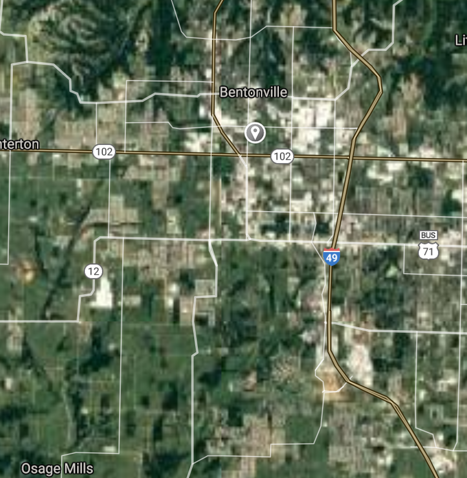
Bentonville [*elevation ceiling = 40km]Elevation: 393m (Group 10)
UR-100N (SLBM) |
Point A: 35.088696 00
Point B: 36.332020 00
Point C: 34.228431 00
Point D: 36.372854 00 (300kt)
Point E: 34.503700 00
Point F: 34.564537 00
|
Point A: -92.442101 00
Point B: -94.118537 00
Point C: -92.003196 00
Point D: -94.208817 00 (300kt)
Point E: -93.055180 00
Point F: -92.586828 00
|
|
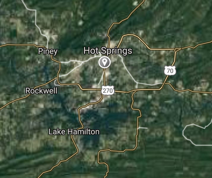
Hot Springs [*elevation ceiling = 40km]Elevation: 178m (Group 10)
UR-100N (SLBM) |
Point A: 35.088696 00
Point B: 36.332020 00
Point C: 34.228431 00
Point D: 36.372854 00
Point E: 34.503700 00 (300kt)
Point F: 34.564537 00
|
Point A: -92.442101 00
Point B: -94.118537 00
Point C: -92.003196 00
Point D: -94.208817 00
Point E: -93.055180 00 (300kt)
Point F: -92.586828 00
|
|
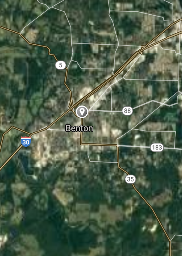
Benton [*elevation ceiling = 40km]Elevation: 126m (Group 10)
UR-100N (SLBM) |
Point A: 35.088696 00
Point B: 36.332020 00
Point C: 34.228431 00
Point D: 36.372854 00
Point E: 34.503700 00
Point F: 34.564537 00 (300kt)
|
Point A: -92.442101 00
Point B: -94.118537 00
Point C: -92.003196 00
Point D: -94.208817 00
Point E: -93.055180 00
Point F: -92.586828 00 (300kt)
|
|
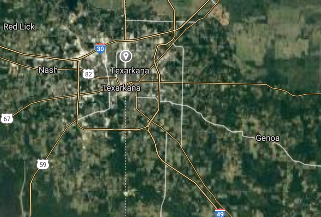
Texarkana [*elevation ceiling = 40km]Elevation: 111m (Group 11)
UR-100N (SLBM) |
Point A: 33.441792 00 (300kt)
Point B: 34.815091 00
Point C: 34.866201 00
Point D: 35.278417 00
Point E: 36.481464 00
Point F: 35.146480 00
|
Point A: -94.037688 00 (300kt)
Point B: -92.224315 00
Point C: -92.110146 00
Point D: -93.133786 00
Point E: -94.273264 00
Point F: -90.184539 00
|
|
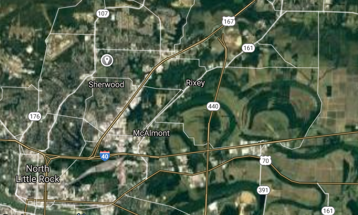
Sherwood [*elevation ceiling = 40km]Elevation: 99m (Group 11)
UR-100N (SLBM) |
Point A: 33.441792 00
Point B: 34.815091 00 (300kt)
Point C: 34.866201 00
Point D: 35.278417 00
Point E: 36.481464 00
Point F: 35.146480 00
|
Point A: -94.037688 00
Point B: -92.224315 00 (300kt)
Point C: -92.110146 00
Point D: -93.133786 00
Point E: -94.273264 00
Point F: -90.184539 00
|
|
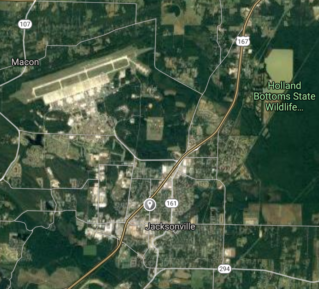
Jacksonville [*elevation ceiling = 40km]Elevation: 86m (Group 11)
UR-100N (SLBM) |
Point A: 33.441792 00
Point B: 34.815091 00
Point C: 34.866201 00 (300kt)
Point D: 35.278417 00
Point E: 36.481464 00
Point F: 35.146480 00
|
Point A: -94.037688 00
Point B: -92.224315 00
Point C: -92.110146 00 (300kt)
Point D: -93.133786 00
Point E: -94.273264 00
Point F: -90.184539 00
|
|
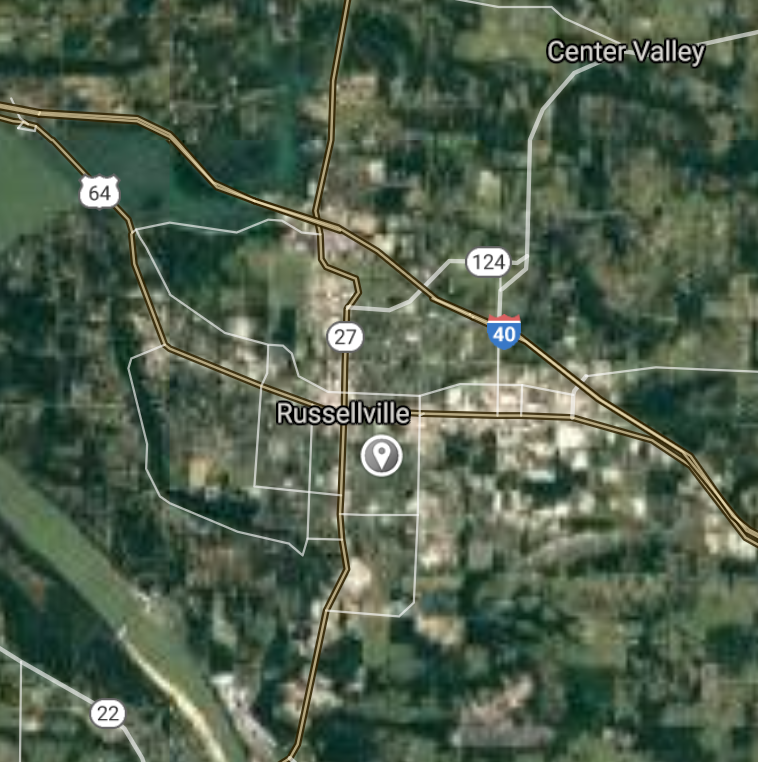
Russellville [*elevation ceiling = 40km]Elevation: 104m (Group 11)
UR-100N (SLBM) |
Point A: 33.441792 00
Point B: 34.815091 00
Point C: 34.866201 00
Point D: 35.278417 00 (300kt)
Point E: 36.481464 00
Point F: 35.146480 00
|
Point A: -94.037688 00
Point B: -92.224315 00
Point C: -92.110146 00
Point D: -93.133786 00 (300kt)
Point E: -94.273264 00
Point F: -90.184539 00
|
|
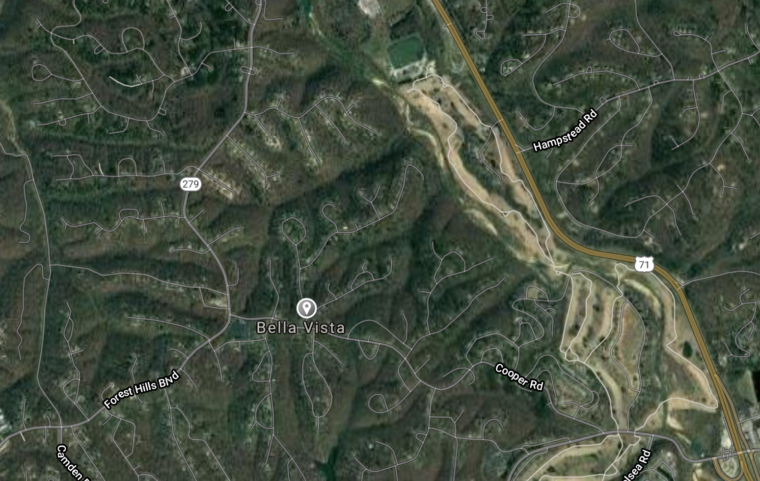
Bella Vista [*elevation ceiling = 40km]Elevation: 374m (Group 11)
UR-100N (SLBM) |
Point A: 33.441792 00
Point B: 34.815091 00
Point C: 34.866201 00
Point D: 35.278417 00
Point E: 36.481464 00 (300kt)
Point F: 35.146480 00
|
Point A: -94.037688 00
Point B: -92.224315 00
Point C: -92.110146 00
Point D: -93.133786 00
Point E: -94.273264 00 (300kt)
Point F: -90.184539 00
|
|
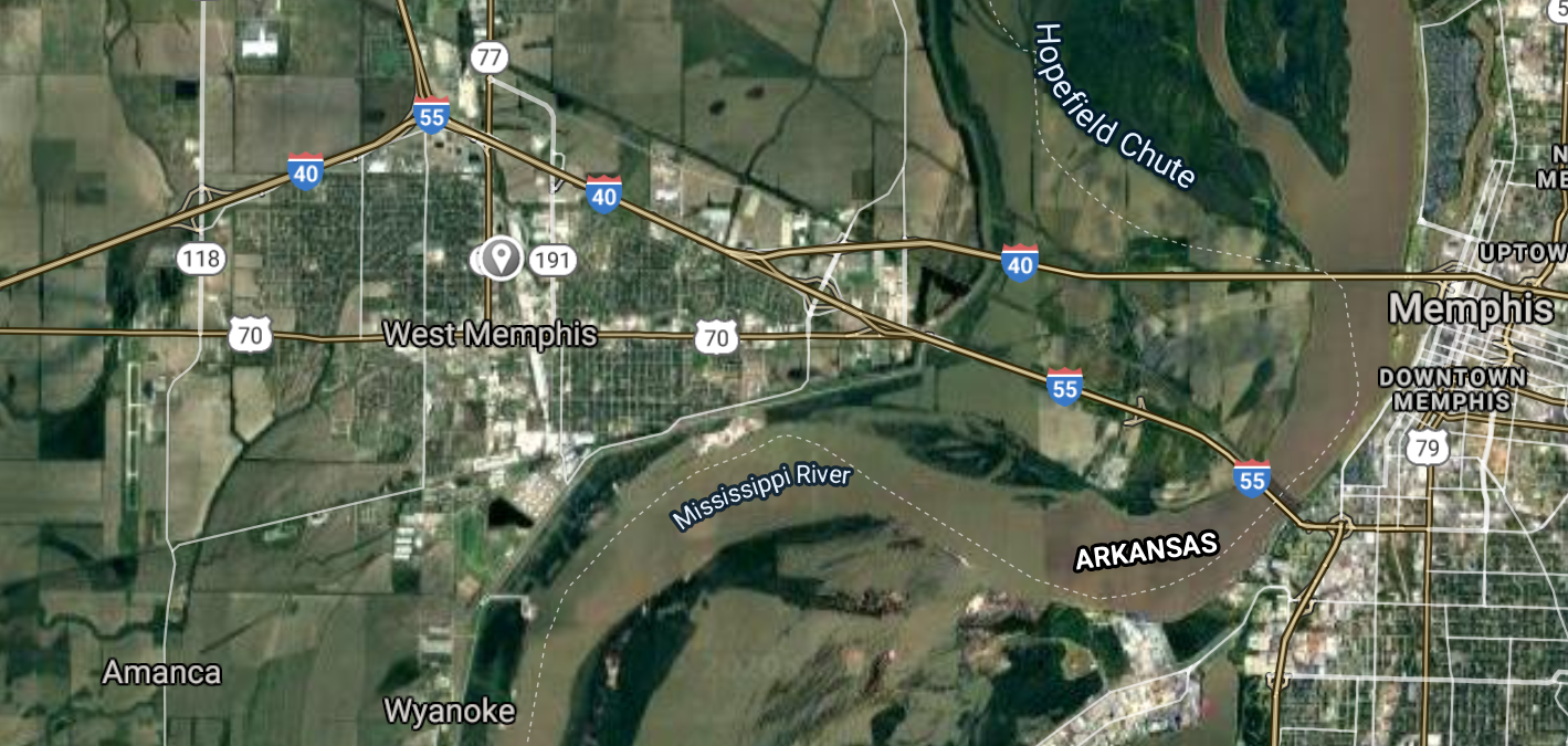
West Memphis [*elevation ceiling = 40km]Elevation: 64m (Group 11)
UR-100N (SLBM) |
Point A: 33.441792 00
Point B: 34.815091 00
Point C: 34.866201 00
Point D: 35.278417 00
Point E: 36.481464 00
Point F: 35.146480 00 (300kt)
|
Point A: -94.037688 00
Point B: -92.224315 00
Point C: -92.110146 00
Point D: -93.133786 00
Point E: -94.273264 00
Point F: -90.184539 00 (300kt)
|
|
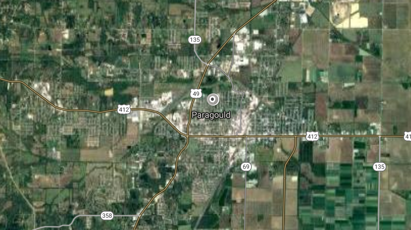
Paragould [*elevation ceiling = 40km]Elevation: 93m (Group 12)
UR-100N (SLBM) |
Point A: 36.058402 00 (300kt)
Point B: 34.974532 00
Point C: 35.246820 00
Point D: 35.436756 00
Point E: 33.207630 00
Point F: 34.866757 00
|
Point A: -90.497329 00 (300kt)
Point B: -92.016534 00
Point C: -91.733685 00
Point D: -94.348268 00
Point E: -92.666267 00
Point F: -92.404322 00
|
|
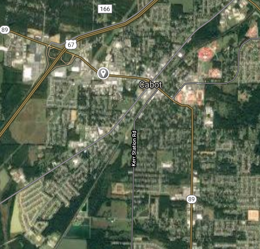
Cabot [*elevation ceiling = 40km]Elevation: 90m (Group 12)
UR-100N (SLBM) |
Point A: 36.058402 00
Point B: 34.974532 00 (300kt)
Point C: 35.246820 00
Point D: 35.436756 00
Point E: 33.207630 00
Point F: 34.866757 00
|
Point A: -90.497329 00
Point B: -92.016534 00 (300kt)
Point C: -91.733685 00
Point D: -94.348268 00
Point E: -92.666267 00
Point F: -92.404322 00
|
|
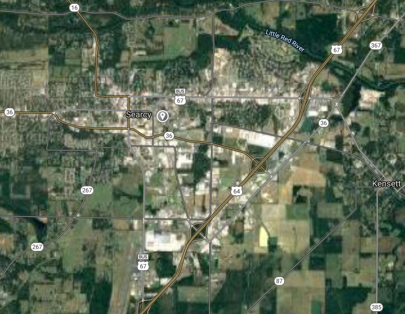
Searcy [*elevation ceiling = 40km]Elevation: 76m (Group 12)
UR-100N (SLBM) |
Point A: 36.058402 00
Point B: 34.974532 00
Point C: 35.246820 00 (300kt)
Point D: 35.436756 00
Point E: 33.207630 00
Point F: 34.866757 00
|
Point A: -90.497329 00
Point B: -92.016534 00
Point C: -91.733685 00 (300kt)
Point D: -94.348268 00
Point E: -92.666267 00
Point F: -92.404322 00
|
|
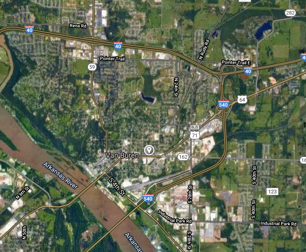
Van Buren [*elevation ceiling = 40km]Elevation: 126m (Group 12)
UR-100N (SLBM) |
Point A: 36.058402 00
Point B: 34.974532 00
Point C: 35.246820 00
Point D: 35.436756 00 (300kt)
Point E: 33.207630 00
Point F: 34.866757 00
|
Point A: -90.497329 00
Point B: -92.016534 00
Point C: -91.733685 00
Point D: -94.348268 00 (300kt)
Point E: -92.666267 00
Point F: -92.404322 00
|
|
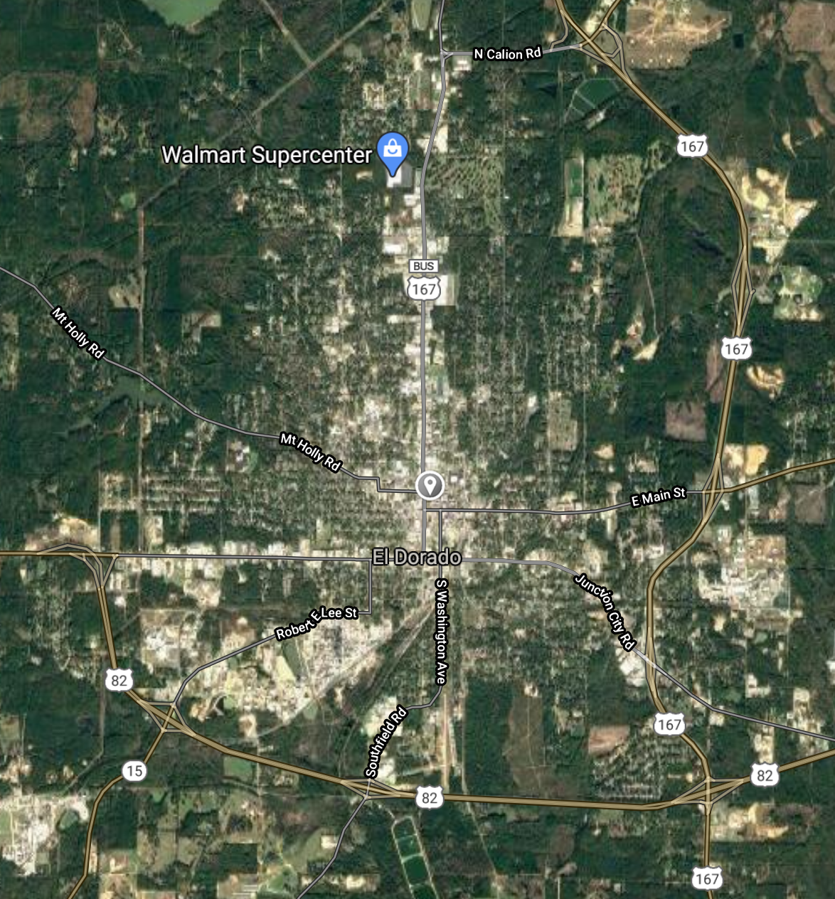
El Dorado [*elevation ceiling = 40km]Elevation: 81m (Group 12)
UR-100N (SLBM) |
Point A: 36.058402 00
Point B: 34.974532 00
Point C: 35.246820 00
Point D: 35.436756 00
Point E: 33.207630 00 (300kt)
Point F: 34.866757 00
|
Point A: -90.497329 00
Point B: -92.016534 00
Point C: -91.733685 00
Point D: -94.348268 00
Point E: -92.666267 00 (300kt)
Point F: -92.404322 00
|
|
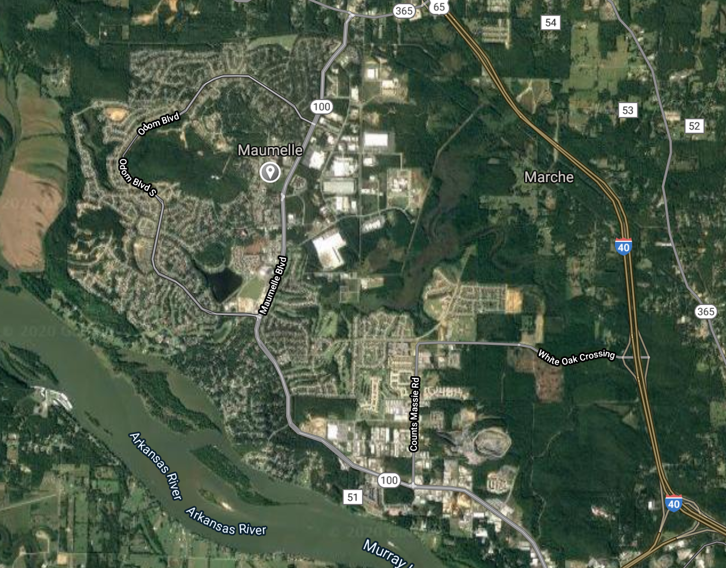
Maumelle [*elevation ceiling = 40km]Elevation: 107m (Group 12)
UR-100N (SLBM) |
Point A: 36.058402 00
Point B: 34.974532 00
Point C: 35.246820 00
Point D: 35.436756 00
Point E: 33.207630 00
Point F: 34.866757 00 (300kt)
|
Point A: -90.497329 00
Point B: -92.016534 00
Point C: -91.733685 00
Point D: -94.348268 00
Point E: -92.666267 00
Point F: -92.404322 00 (300kt)
|
|
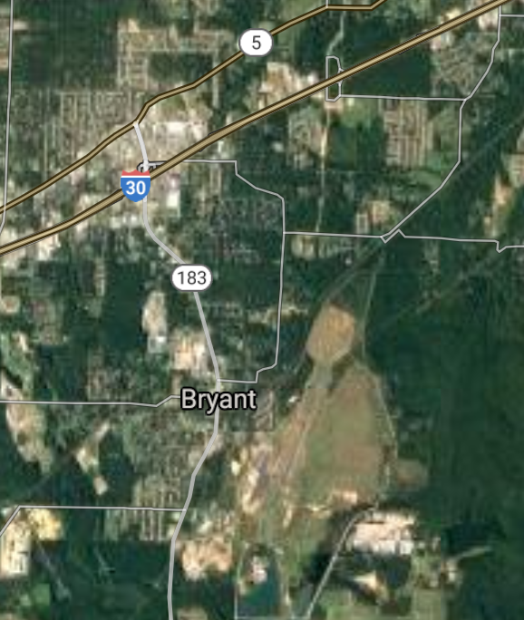
Bryant [*elevation ceiling = 40km]Elevation: 125m (Group 13)
UR-100N (SLBM) |
Point A: 34.595927 00 (300kt)
Point B: 35.927295 00
Point C: 35.008147 00
Point D: 36.188137 00
Point E: 36.229794 00
Point F: 34.672036 00
|
Point A: -92.489047 00 (300kt)
Point B: -89.918975 00
Point C: -90.789834 00
Point D: -94.540496 00
Point E: -93.107677 00
Point F: -92.998789 00
|
|
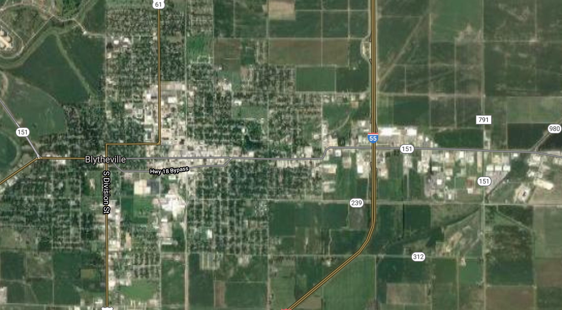
Blytheville [*elevation ceiling = 40km]Elevation: 78m (Group 13)
UR-100N (SLBM) |
Point A: 34.595927 00
Point B: 35.927295 00 (300kt)
Point C: 35.008147 00
Point D: 36.188137 00
Point E: 36.229794 00
Point F: 34.672036 00
|
Point A: -92.489047 00
Point B: -89.918975 00 (300kt)
Point C: -90.789834 00
Point D: -94.540496 00
Point E: -93.107677 00
Point F: -92.998789 00
|
|
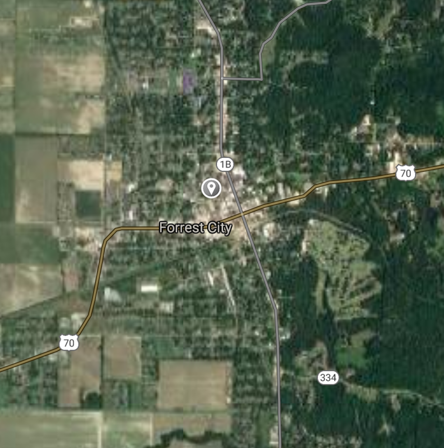
Forrest City [*elevation ceiling = 40km]Elevation: 79m (Group 13)
UR-100N (SLBM) |
Point A: 34.595927 00
Point B: 35.927295 00
Point C: 35.008147 00 (300kt)
Point D: 36.188137 00
Point E: 36.229794 00
Point F: 34.672036 00
|
Point A: -92.489047 00
Point B: -89.918975 00
Point C: -90.789834 00 (300kt)
Point D: -94.540496 00
Point E: -93.107677 00
Point F: -92.998789 00
|
|
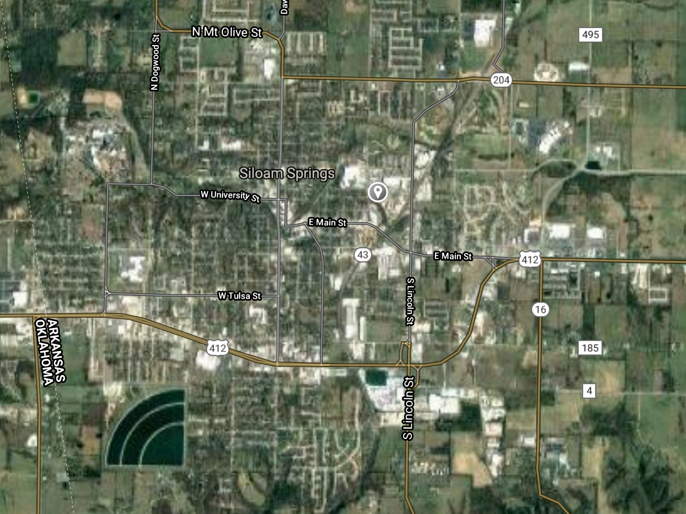
Siloam Springs [*elevation ceiling = 40km]Elevation: 343m (Group 13)
UR-100N (SLBM) |
Point A: 34.595927 00
Point B: 35.927295 00
Point C: 35.008147 00
Point D: 36.188137 00 (300kt)
Point E: 36.229794 00
Point F: 34.672036 00
|
Point A: -92.489047 00
Point B: -89.918975 00
Point C: -90.789834 00
Point D: -94.540496 00 (300kt)
Point E: -93.107677 00
Point F: -92.998789 00
|
|
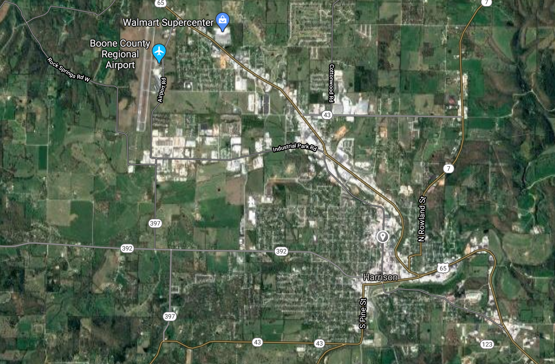
Harrison [*elevation ceiling = 40km]Elevation: 317m (Group 13)
UR-100N (SLBM) |
Point A: 34.595927 00
Point B: 35.927295 00
Point C: 35.008147 00
Point D: 36.188137 00
Point E: 36.229794 00 (300kt)
Point F: 34.672036 00
|
Point A: -92.489047 00
Point B: -89.918975 00
Point C: -90.789834 00
Point D: -94.540496 00
Point E: -93.107677 00 (300kt)
Point F: -92.998789 00
|
|
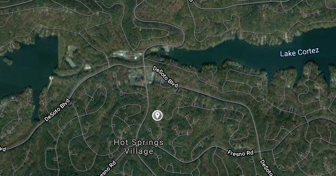
Hot Springs Village [*elevation ceiling = 40km]Elevation: 240m (Group 13)
UR-100N (SLBM) |
Point A: 34.595927 00
Point B: 35.927295 00
Point C: 35.008147 00
Point D: 36.188137 00
Point E: 36.229794 00
Point F: 34.672036 00 (300kt)
|
Point A: -92.489047 00
Point B: -89.918975 00
Point C: -90.789834 00
Point D: -94.540496 00
Point E: -93.107677 00
Point F: -92.998789 00 (300kt)
|
|
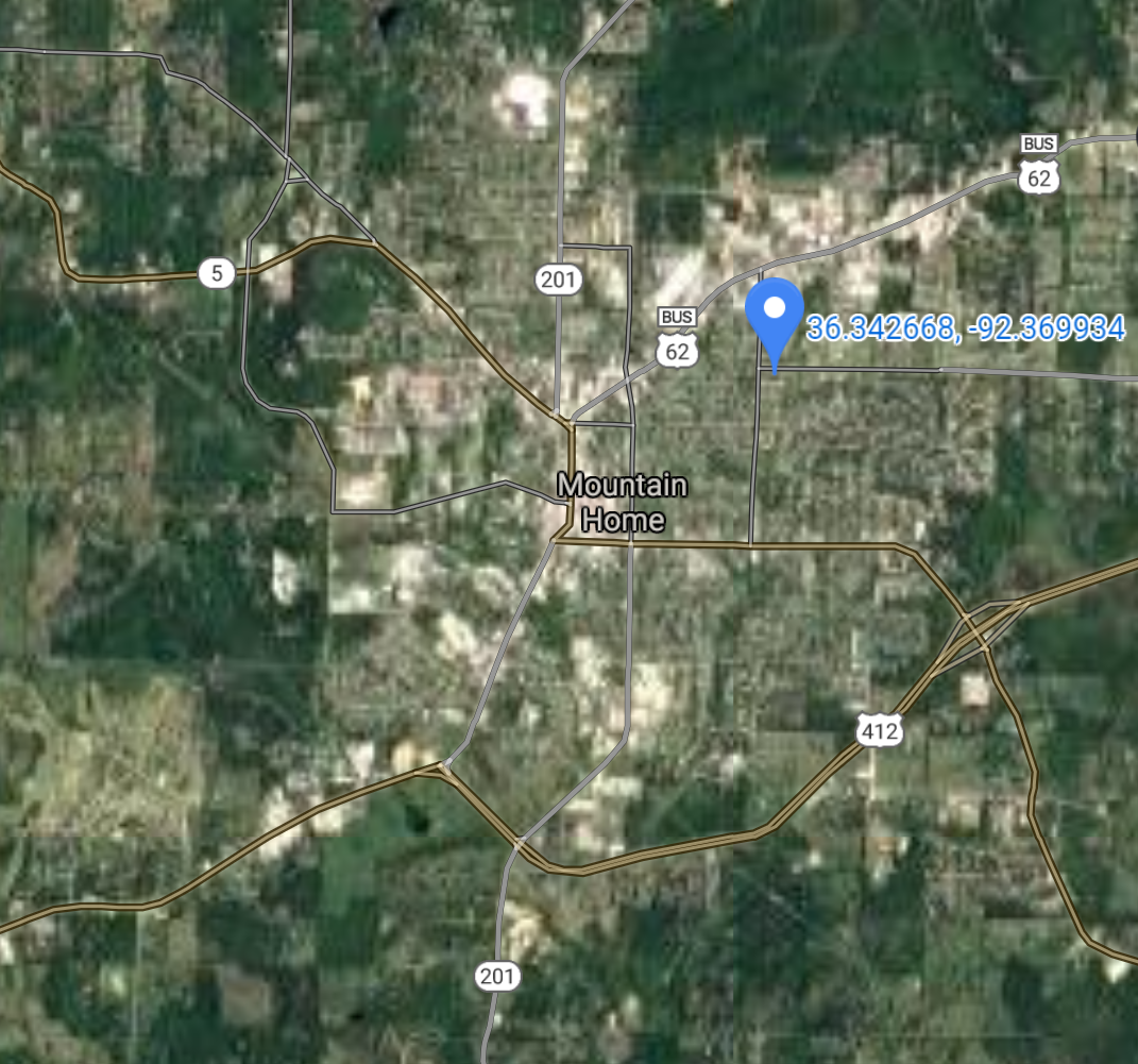
Mountain Home [*elevation ceiling = 40km]Elevation: 240m (Group 14)
UR-100N (SLBM) |
Point A: 36.335395 00 (300kt)
Point B: 35.214534 00
Point C: 34.529100 00
Point D: 33.584558 00
Point E: 33.267073 00
Point F: 34.120929 00
|
Point A: -92.381346 00 (300kt)
Point B: -90.196484 00
Point C: -90.590000 00
Point D: -92.834329 00
Point E: -93.239334 00
Point F: -93.053784 00
|
|
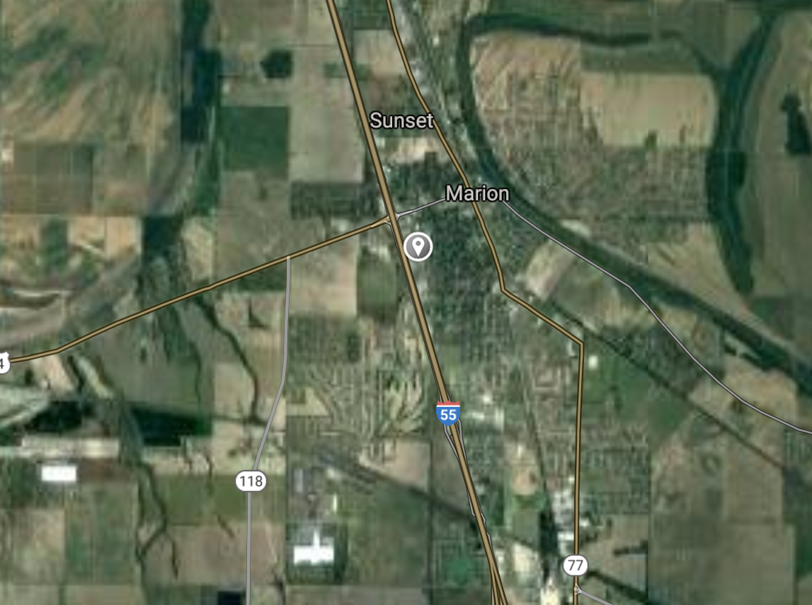
Marion [*elevation ceiling = 40km]Elevation: 69m (Group 14)
UR-100N (SLBM) |
Point A: 36.335395 00
Point B: 35.214534 00 (300kt)
Point C: 34.529100 00
Point D: 33.584558 00
Point E: 33.267073 00
Point F: 34.120929 00
|
Point A: -92.381346 00
Point B: -90.196484 00 (300kt)
Point C: -90.590000 00
Point D: -92.834329 00
Point E: -93.239334 00
Point F: -93.053784 00
|
|
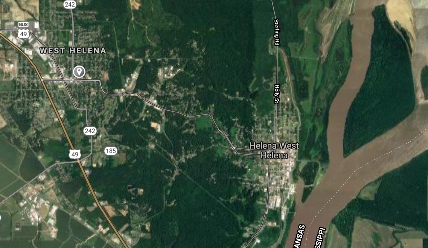
Helena-West Helena [*elevation ceiling = 40km]Elevation: 59m (Group 14)
UR-100N (SLBM) |
Point A: 36.335395 00
Point B: 35.214534 00
Point C: 34.529100 00 (300kt)
Point D: 33.584558 00
Point E: 33.267073 00
Point F: 34.120929 00
|
Point A: -92.381346 00
Point B: -90.196484 00
Point C: -90.590000 00 (300kt)
Point D: -92.834329 00
Point E: -93.239334 00
Point F: -93.053784 00
|
|
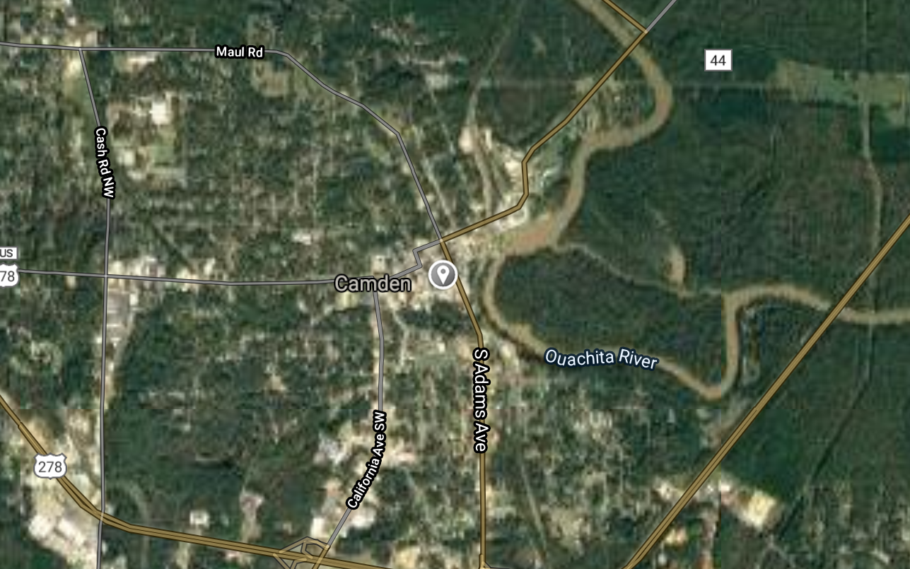
Camden [*elevation ceiling = 40km]Elevation: 61m (Group 14)
UR-100N (SLBM) |
Point A: 36.335395 00
Point B: 35.214534 00
Point C: 34.529100 00
Point D: 33.584558 00 (300kt)
Point E: 33.267073 00
Point F: 34.120929 00
|
Point A: -92.381346 00
Point B: -90.196484 00
Point C: -90.590000 00
Point D: -92.834329 00 (300kt)
Point E: -93.239334 00
Point F: -93.053784 00
|
|
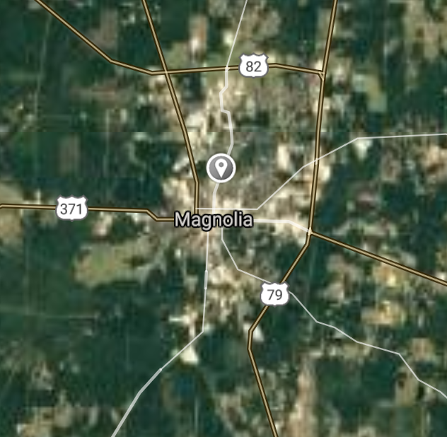
Magnolia [*elevation ceiling = 40km]Elevation: 104m (Group 14)
UR-100N (SLBM) |
Point A: 36.335395 00
Point B: 35.214534 00
Point C: 34.529100 00
Point D: 33.584558 00
Point E: 33.267073 00 (300kt)
Point F: 34.120929 00
|
Point A: -92.381346 00
Point B: -90.196484 00
Point C: -90.590000 00
Point D: -92.834329 00
Point E: -93.239334 00 (300kt)
Point F: -93.053784 00
|
|
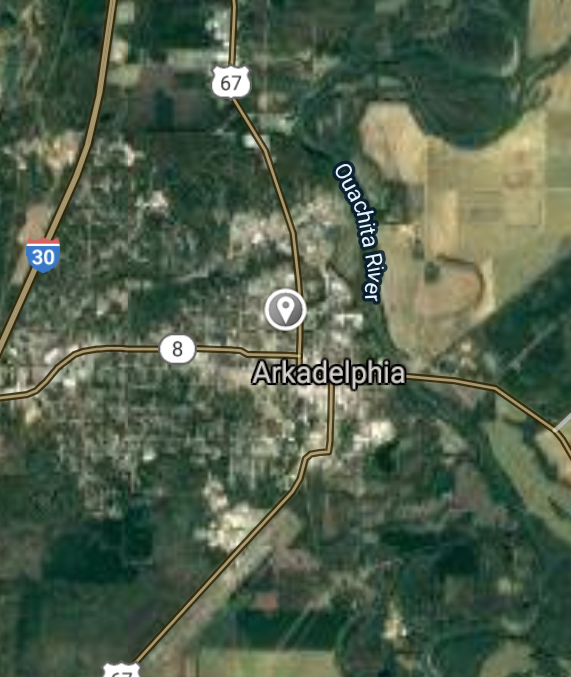
Arkadelphia [*elevation ceiling = 40km]Elevation: 73m (Group 14)
UR-100N (SLBM) |
Point A: 36.335395 00
Point B: 35.214534 00
Point C: 34.529100 00
Point D: 33.584558 00
Point E: 33.267073 00
Point F: 34.120929 00 (300kt)
|
Point A: -92.381346 00
Point B: -90.196484 00
Point C: -90.590000 00
Point D: -92.834329 00
Point E: -93.239334 00
Point F: -93.053784 00 (300kt)
|
|
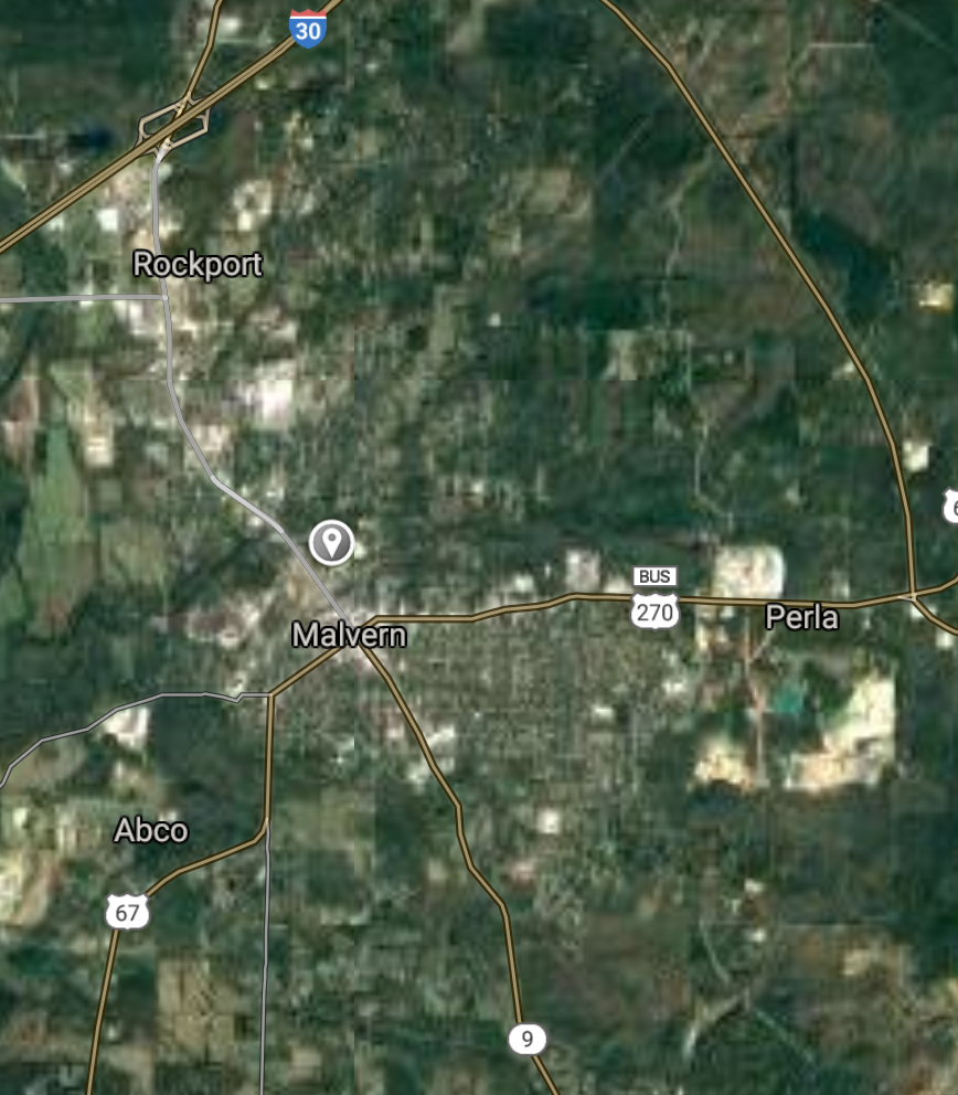
Malvern [*elevation ceiling = 40km]Elevation: 95m (Group 15)
UR-100N (SLBM) |
Point A: 34.362315 00 (300kt)
Point B: 35.769799 00
Point C: 33.667062 00
Point D: 36.359799 00
Point E: 33.628997 00
Point F: 34.500375 00
|
Point A: -92.812946 00 (300kt)
Point B: -91.640972 00
Point C: -93.591567 00
Point D: -94.285209 00
Point E: -91.790964 00
Point F: -91.552628 00
|
|
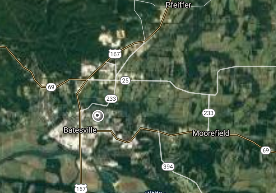
Batesville [*elevation ceiling = 40km]Elevation: 102m (Group 15)
UR-100N (SLBM) |
Point A: 34.362315 00
Point B: 35.769799 00 (300kt)
Point C: 33.667062 00
Point D: 36.359799 00
Point E: 33.628997 00
Point F: 34.500375 00
|
Point A: -92.812946 00
Point B: -91.640972 00 (300kt)
Point C: -93.591567 00
Point D: -94.285209 00
Point E: -91.790964 00
Point F: -91.552628 00
|
|
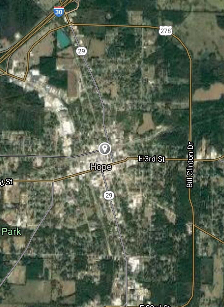
Hope [*elevation ceiling = 40km]Elevation: 108m (Group 15)
UR-100N (SLBM) |
Point A: 34.362315 00
Point B: 35.769799 00
Point C: 33.667062 00 (300kt)
Point D: 36.359799 00
Point E: 33.628997 00
Point F: 34.500375 00
|
Point A: -92.812946 00
Point B: -91.640972 00
Point C: -93.591567 00 (300kt)
Point D: -94.285209 00
Point E: -91.790964 00
Point F: -91.552628 00
|
|
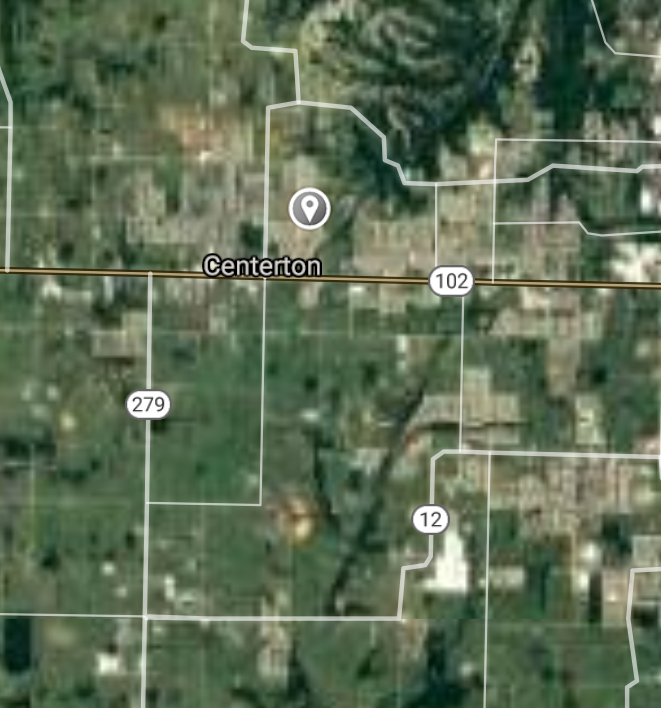
Centerton [*elevation ceiling = 40km]Elevation: 380m (Group 15)
UR-100N (SLBM) |
Point A: 34.362315 00
Point B: 35.769799 00
Point C: 33.667062 00
Point D: 36.359799 00 (300kt)
Point E: 33.628997 00
Point F: 34.500375 00
|
Point A: -92.812946 00
Point B: -91.640972 00
Point C: -93.591567 00
Point D: -94.285209 00 (300kt)
Point E: -91.790964 00
Point F: -91.552628 00
|
|
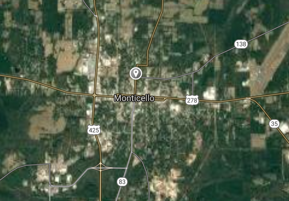
Monticello [*elevation ceiling = 40km]Elevation: 90m (Group 15)
UR-100N (SLBM) |
Point A: 34.362315 00
Point B: 35.769799 00
Point C: 33.667062 00
Point D: 36.359799 00
Point E: 33.628997 00 (300kt)
Point F: 34.500375 00
|
Point A: -92.812946 00
Point B: -91.640972 00
Point C: -93.591567 00
Point D: -94.285209 00
Point E: -91.790964 00 (300kt)
Point F: -91.552628 00
|
|
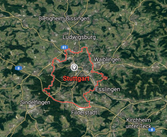
Stuttgart [*elevation ceiling = 40km]Elevation: 64m (Group 15)
UR-100N (SLBM) |
Point A: 34.362315 00
Point B: 35.769799 00
Point C: 33.667062 00
Point D: 36.359799 00
Point E: 33.628997 00
Point F: 34.500375 00 (300kt)
|
Point A: -92.812946 00
Point B: -91.640972 00
Point C: -93.591567 00
Point D: -94.285209 00
Point E: -91.790964 00
Point F: -91.552628 00 (300kt)
|
|
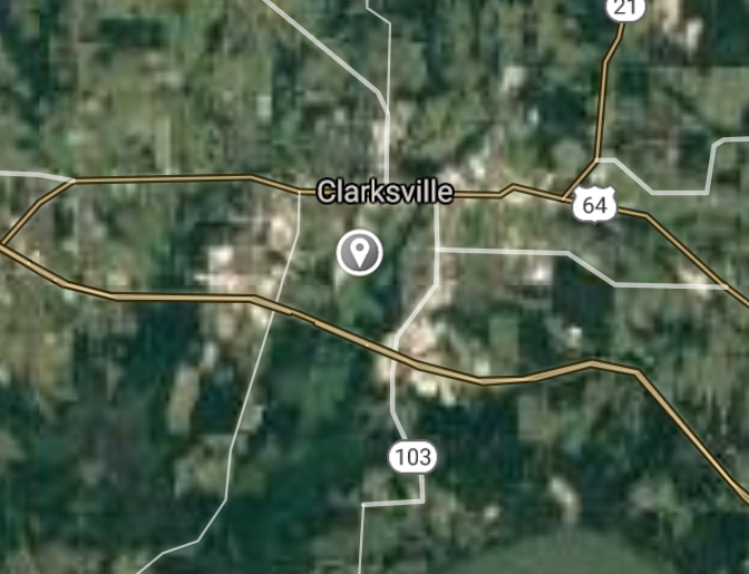
Clarksville [*elevation ceiling = 40km]Elevation: 111m (Group 16)
UR-100N (SLBM) |
Point A: 35.471472 00 (300kt)
Point B: 35.215649 00
Point C: 35.224533 00
Point D: 35.604802 00
Point E: 35.705078 00
Point F: 36.255354 00
|
Point A: -93.466573 00 (300kt)
Point B: -94.255766 00
Point C: -90.786780 00
Point D: -91.281795 00
Point E: -89.969532 00
Point F: -94.130759 00
|
|
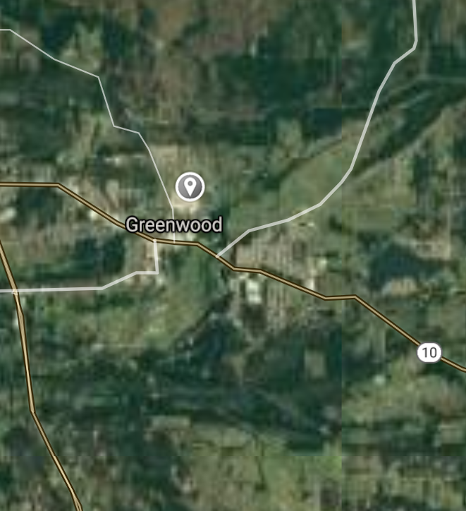
Greenwood [*elevation ceiling = 40km]Elevation: 159m (Group 16)
UR-100N (SLBM) |
Point A: 35.471472 00
Point B: 35.215649 00 (300kt)
Point C: 35.224533 00
Point D: 35.604802 00
Point E: 35.705078 00
Point F: 36.255354 00
|
Point A: -93.466573 00
Point B: -94.255766 00 (300kt)
Point C: -90.786780 00
Point D: -91.281795 00
Point E: -89.969532 00
Point F: -94.130759 00
|
|
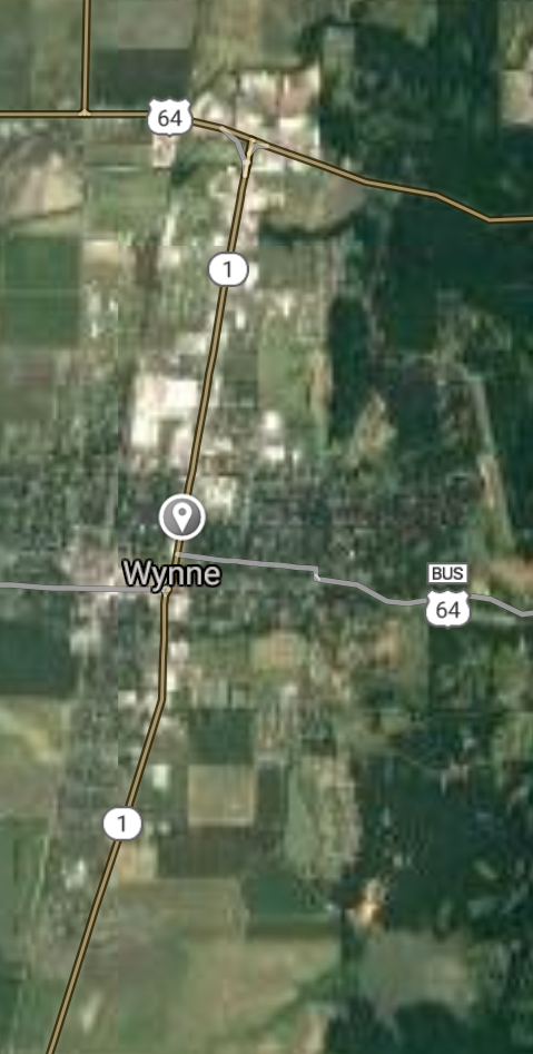
Wynne [*elevation ceiling = 40km]Elevation: 79m (Group 16)
UR-100N (SLBM) |
Point A: 35.471472 00
Point B: 35.215649 00
Point C: 35.224533 00 (300kt)
Point D: 35.604802 00
Point E: 35.705078 00
Point F: 36.255354 00
|
Point A: -93.466573 00
Point B: -94.255766 00
Point C: -90.786780 00 (300kt)
Point D: -91.281795 00
Point E: -89.969532 00
Point F: -94.130759 00
|
|
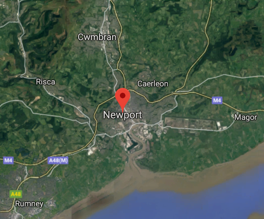
Newport [*elevation ceiling = 40km]Elevation: 67m (Group 16)
UR-100N (SLBM) |
Point A: 35.471472 00
Point B: 35.215649 00
Point C: 35.224533 00
Point D: 35.604802 00 (300kt)
Point E: 35.705078 00
Point F: 36.255354 00
|
Point A: -93.466573 00
Point B: -94.255766 00
Point C: -90.786780 00
Point D: -91.281795 00 (300kt)
Point E: -89.969532 00
Point F: -94.130759 00
|
|
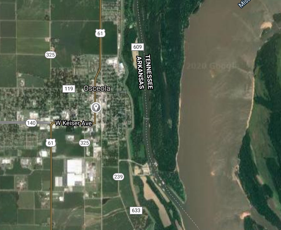
Osceola [*elevation ceiling = 40km]Elevation: 75m (Group 16)
UR-100N (SLBM) |
Point A: 35.471472 00
Point B: 35.215649 00
Point C: 35.224533 00
Point D: 35.604802 00
Point E: 35.705078 00 (300kt)
Point F: 36.255354 00
|
Point A: -93.466573 00
Point B: -94.255766 00
Point C: -90.786780 00
Point D: -91.281795 00
Point E: -89.969532 00 (300kt)
Point F: -94.130759 00
|
|
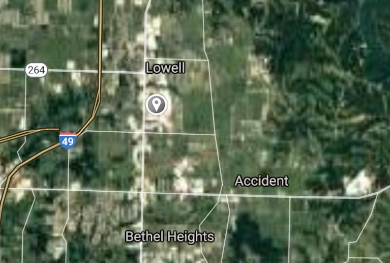
Lowell [*elevation ceiling = 40km]Elevation: 408m (Group 16)
UR-100N (SLBM) |
Point A: 35.471472 00
Point B: 35.215649 00
Point C: 35.224533 00
Point D: 35.604802 00
Point E: 35.705078 00
Point F: 36.255354 00 (300kt)
|
Point A: -93.466573 00
Point B: -94.255766 00
Point C: -90.786780 00
Point D: -91.281795 00
Point E: -89.969532 00
Point F: -94.130759 00 (300kt)
|
[Top]
Open START: Central Basin
"BRICS Security Council emerging from cross-currency evaluations"
OPEN Start: Central Basin - is an engineering vessel which is proven with climate security in evaluation of the USD/YEN currency pair. Annually, climate security is leading economic growth in key emerging markets surrounding the Four Asian Tigers. Affordably, the following industries extend opportunities for military cooperation: aerospace, telecommunications, finance and banking. OPEN Start: Central Basin strengthens the backbone for international security beyond the shadows of USD/YEN controversy. Traversely, OPEN Start: Central Basin offsets the cross-over gap between the USD/MXN and USD/RUB exchange rates. Notably, the Three Amigas form an economic alliance in the Far West through joint-cooperation projects from Venture 1, Venture LA and Venture SF which all extend with the Far North reach towards the Far South (as illustrated below).
![]()
![]()
![]()
![]()
![]()
![]()
![]()
![]()
![]()
JanuaryFebruaryMarchAprilJuneJulySeptemberOctoberDecember |
2026 Group Drills - Schedule
|
|

JanuaryFebruaryJuneJulyAugustOctoberNovemberDecember |
2026 Group Drills - Schedule
|
|

JanuaryFebruaryJuneJulySeptemberOctoberNovemberDecember |
2026 Group Drills - Schedule
|
|
