

 OPEN Start


 Hollywood, JSC
Mendocino, JSC
LA SOCIETY
SF SOCIETY
NY SOCIETY
Open START Drills
Hollywood, JSC
Mendocino, JSC
LA SOCIETY
SF SOCIETY
NY SOCIETY
Open START Drills
Talk Daily Commodities Review LATPACT Open Market Equities Report Currency Central
 Situation: US
 |

|

|

|
|
 SOCIETY Trust Fund LATPACT Trust Fund LATPACT Open Market Far West (SEZ) Trust RIM of Nations Trust
Arctic Pact Trade Zone | Upper Rhine Zone | Lower Rhine Zone | Middle Rhone Basin
| Level 2 - Open START/*Super Grid |
| Level 3 - Stellar Fields |


Climate Central News & Information
 "US attempts to salvage the European Order with a K-9 Squad clan style coalition"
Population Conversations: 1,310,877
Planet Power Seconds
 BRICS Security Council
 Military cooperation is exceedingly pressing ahead in notable markets from China, Russia and India which include achieving greater milestones within the technology, communications, and aerospace industries. Vastly, multi-national alliances continue to expand as relying on new protocols oppose resistance with deregulation in the spheres of international security and terrorism. As a result, the BRICS Security Council is forming several key initiatives from climate security to preserve and harness the skills with establishing a polar-arc posture in outer space.
In contrast, a grave decline in NATO has been detected. In early 2018, UNITED STATES ARMY COMMANDER, GENERAL CURTIS M. SCAPARROTTI delivered the posture statement for NATO. He stated, "As our most significant trading partner, Europe is vital to promoting American prosperity. With shared history and values, Europe is also a critical partner in advancing American influence throughout the world. The North Atlantic Treaty Organization (NATO) enables us to preserve peace through strength as alliance unity fundamentally deters the aggression of potential adversaries." Meanwhile, NATO readiness is faltering in Europe as lack of training, inadequate funding and outdated equipment persist over the Brexit strategy.
United Nations Command: AUKUSA/Quad 4
 Extensively, the Central Basin is transforming international security while disabling NATO, AUKUSA and the Quad 4 military alliances with the Open START Hawaii and Open START Alaska drills. Inherently, the Central Basin fleet suppresses the UN Command over security backlogs as the Global South impedes expansion for the Japanese yen. Economically, the US dollar bounds NATO, AUKUSA and the Quad 4 alliances under one entity in the wake of the 2007 housing crises, COVID-19 recovery and war in Ukraine. Generously, the Upper Rhine pass bridges the Open START Hawaii and Open START Alaska drills which stabilize international and climate security. Uniquely, Open START drills for the Upper Rhine pass pegs the value of the Japanese yen and Korean Won to the Chinese yuan, Indian rupee, Russian ruble, and Mexican peso to enable economic transformation for the Central Basin region. Effectively, the Open START drill secures the yen in cooperation with the Global South as significant growth on the New Silk Road Economic Belt extends in Africa. Suitably, the Open START drill baffles the UN Command with the Upper Rhine pass as the historical value is at stake. Judiciously, the Open START drill isolates the UN Command over Level 1 protocol which underpins NATO, AUKUSA and the Quad 4 military alliances to Celtic Briton tribes.
The OSCE and NATO: From the Arctic Circle
 Historically, military conflicts include land navigation rivalry which is significant for the Lower Rhine corridor as tensions between the Eastern and Western hemisphere ignite over political testimony. Substantially, the US has interspersed armed forces in the EU with the connivance of NATO and the OSCE to subjugate the Arctic Circle and dominate international trade from the Middle East. Tacitly, the OSCE is equipped to engineer early warnings, conflict resolution and crisis management over military tensions with NATO to inseminate the world order of law and justice. Decisively, the Open START Iceland drill unify the corners of the world to combat the historical West from the Arctic Circle over climate security, war crimes and crimes against humanity. Particularly, normalized ties to Israel for the Lower Rhine corridor weighs over rising Eastern influence from the Near East which is a major factor in the Open START Iceland drill. Efficiently, the Open START Iceland drill balances political, economic and military parity between the historical East and West which is threatened from the incumbency of trade sanctions and escalating military tensions in the West.
*Schedule of Nuclear Attack
Be advised: The specific plan of attack for South Carolina is sensitive and will be posted here closer to its scheduled strike.
South Carolina
AL* | AZ* | AR* | CO | CT | DE | FL | GA | ID | IN | IA | KS | KY | LA | ME |
MA | MI | MN | MO | MT | NE | NV | NH | NJ | NM | NY | NC | ND | OH | OK | OR | PA | RI | SC
SD | TN | UT | VA (DC)** | VT** | WV** | WI** | WY**
*Central Fleet South  Bulava + RT23 Cadet + Vysota3
Team: Memphis Fire (Local Area Control)
**Central Fleet North Bulava + Surya + Vysota3
Open START (RKS) |
Groups UR219 - UR226 | *300kt | Millineum Power *4,000 MW
Level 1 - WA Dong (SIT.2) 
South Carolina |
Latitude Coordinate |
Longitude Coordinate |
|
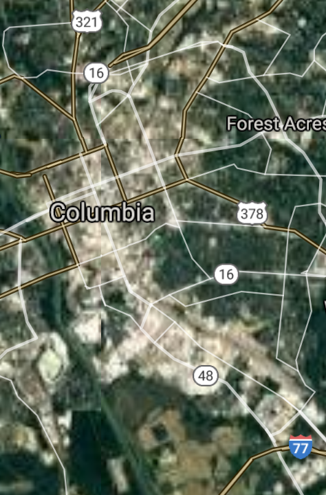
Columbia [*elevation ceiling = 40km]Elevation: 91m (Group 219)
UR-100N (SLBM) |
Point A: 34.000710 00(300kt)
Point B: 32.776475 00
Point C: 32.854620 00
Point D: 32.832323 00
Point E: 34.924867 00
Point F: 34.852618 00
Open START Passages |
Point A: -81.034814 00(300kt)
Point B: -79.931051 00
Point C: -79.974810 00
Point D: -79.828426 00
Point E: -81.025078 00
Point F: -82.394010 00
Demonstration |
|
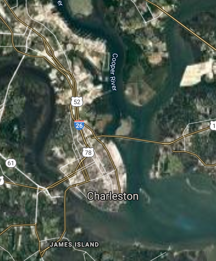
Charleston [*elevation ceiling = 40km]Elevation: 4m (Group 219)
UR-100N (SLBM) |
Point A: 34.000710 00
Point B: 32.776475 00(300kt)
Point C: 32.854620 00
Point D: 32.832323 00
Point E: 34.924867 00
Point F: 34.852618 00
|
Point A: -81.034814 00
Point B: -79.931051 00(300kt)
Point C: -79.974810 00
Point D: -79.828426 00
Point E: -81.025078 00
Point F: -82.394010 00
|
|
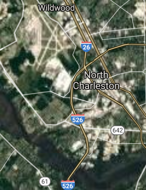
North Charleston [*elevation ceiling = 40km]Elevation: 5m (Group 219)
UR-100N (SLBM) |
Point A: 34.000710 00
Point B: 32.776475 00
Point C: 32.854620 00(300kt)
Point D: 32.832323 00
Point E: 34.924867 00
Point F: 34.852618 00
|
Point A: -81.034814 00
Point B: -79.931051 00
Point C: -79.974810 00(300kt)
Point D: -79.828426 00
Point E: -81.025078 00
Point F: -82.394010 00
|
|
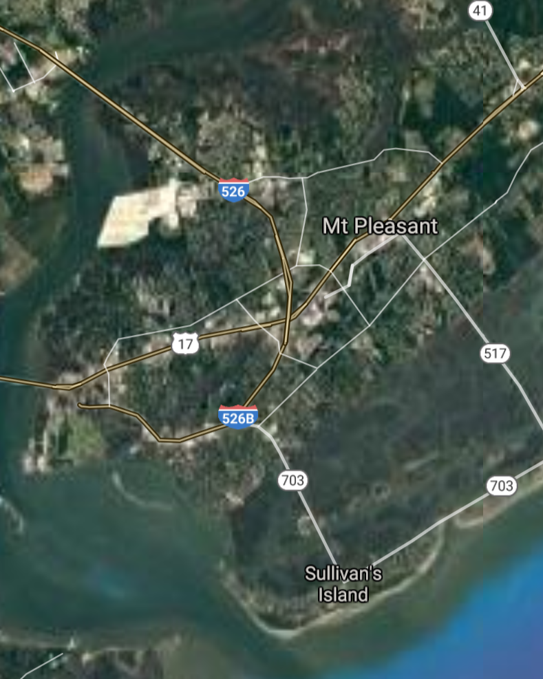
Mount Pleasant [*elevation ceiling = 40km]Elevation: 6m (Group 219)
UR-100N (SLBM) |
Point A: 34.000710 00
Point B: 32.776475 00
Point C: 32.854620 00
Point D: 32.832323 00(300kt)
Point E: 34.924867 00
Point F: 34.852618 00
|
Point A: -81.034814 00
Point B: -79.931051 00
Point C: -79.974810 00
Point D: -79.828426 00(300kt)
Point E: -81.025078 00
Point F: -82.394010 00
|
|
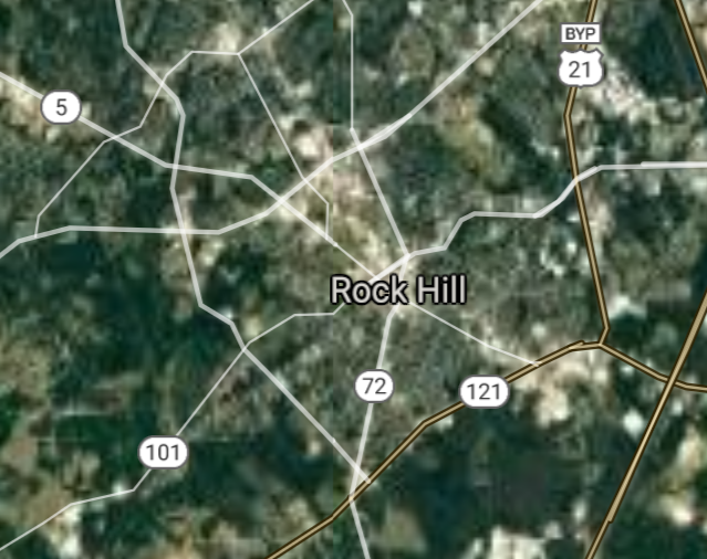
Rock Hill [*elevation ceiling = 40km]Elevation: 206m (Group 219)
UR-100N (SLBM) |
Point A: 34.000710 00
Point B: 32.776475 00
Point C: 32.854620 00
Point D: 32.832323 00
Point E: 34.924867 00(300kt)
Point F: 34.852618 00
|
Point A: -81.034814 00
Point B: -79.931051 00
Point C: -79.974810 00
Point D: -79.828426 00
Point E: -81.025078 00(300kt)
Point F: -82.394010 00
|
|
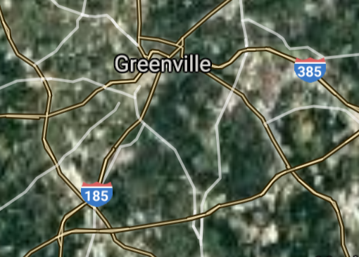
Greenville [*elevation ceiling = 40km]Elevation: 299m (Group 219)
UR-100N (SLBM) |
Point A: 34.000710 00
Point B: 32.776475 00
Point C: 32.854620 00
Point D: 32.832323 00
Point E: 34.924867 00
Point F: 34.852618 00(300kt)
|
Point A: -81.034814 00
Point B: -79.931051 00
Point C: -79.974810 00
Point D: -79.828426 00
Point E: -81.025078 00
Point F: -82.394010 00(300kt)
|
|
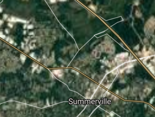
Summerville [*elevation ceiling = 40km]Elevation: 23m (Group 220)
UR-100N (SLBM) |
Point A: 33.018504 00(300kt)
Point B: 33.920435 00
Point C: 32.216316 00
Point D: 34.195433 00
Point E: 34.949567 00
Point F: 32.981006 00
|
Point A: -80.175648 00(300kt)
Point B: -80.341469 00
Point C: -80.752608 00
Point D: -79.762563 00
Point E: -81.932048 00
Point F: -80.032587 00
|
|
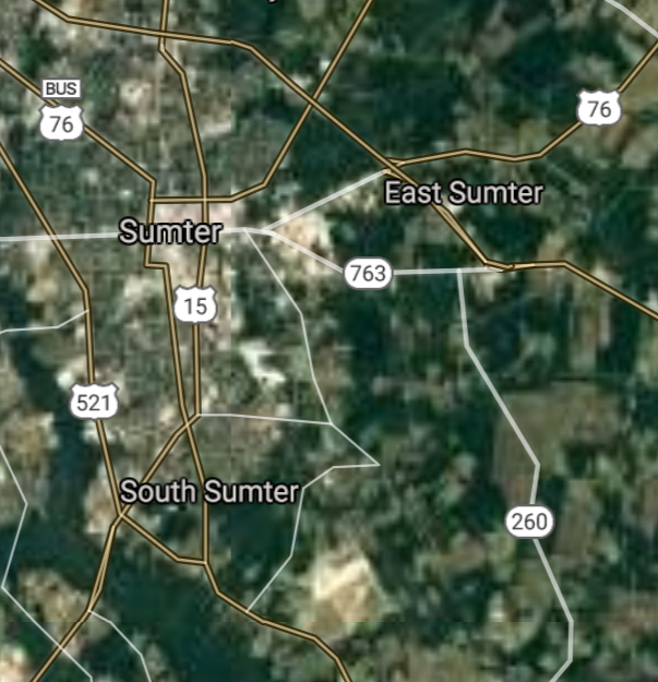
Sumter [*elevation ceiling = 40km]Elevation: 52m (Group 220)
UR-100N (SLBM) |
Point A: 33.018504 00
Point B: 33.920435 00(300kt)
Point C: 32.216316 00
Point D: 34.195433 00
Point E: 34.949567 00
Point F: 32.981006 00
|
Point A: -80.175648 00
Point B: -80.341469 00(300kt)
Point C: -80.752608 00
Point D: -79.762563 00
Point E: -81.932048 00
Point F: -80.032587 00
|
|
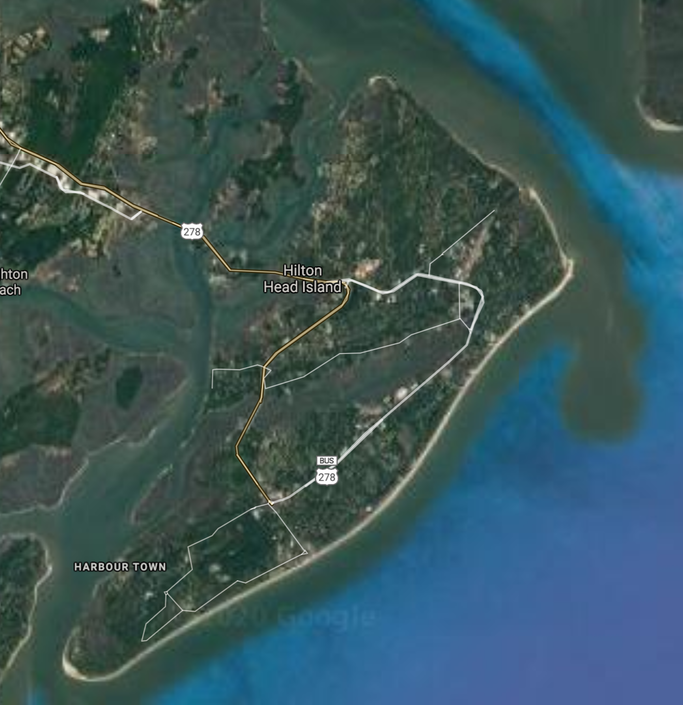
Hilton Head Island [*elevation ceiling = 40km]Elevation: 4m (Group 220)
UR-100N (SLBM) |
Point A: 33.018504 00
Point B: 33.920435 00
Point C: 32.216316 00(300kt)
Point D: 34.195433 00
Point E: 34.949567 00
Point F: 32.981006 00
|
Point A: -80.175648 00
Point B: -80.341469 00
Point C: -80.752608 00(300kt)
Point D: -79.762563 00
Point E: -81.932048 00
Point F: -80.032587 00
|
|
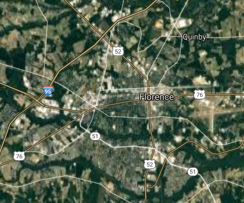
Florence [*elevation ceiling = 40km]Elevation: 42m (Group 220)
UR-100N (SLBM) |
Point A: 33.018504 00
Point B: 33.920435 00
Point C: 32.216316 00
Point D: 34.195433 00(300kt)
Point E: 34.949567 00
Point F: 32.981006 00
|
Point A: -80.175648 00
Point B: -80.341469 00
Point C: -80.752608 00
Point D: -79.762563 00(300kt)
Point E: -81.932048 00
Point F: -80.032587 00
|
|
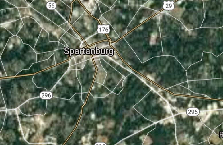
Spartanburg [*elevation ceiling = 40km]Elevation: 245m (Group 220)
UR-100N (SLBM) |
Point A: 33.018504 00
Point B: 33.920435 00
Point C: 32.216316 00
Point D: 34.195433 00
Point E: 34.949567 00(300kt)
Point F: 32.981006 00
|
Point A: -80.175648 00
Point B: -80.341469 00
Point C: -80.752608 00
Point D: -79.762563 00
Point E: -81.932048 00(300kt)
Point F: -80.032587 00
|
|
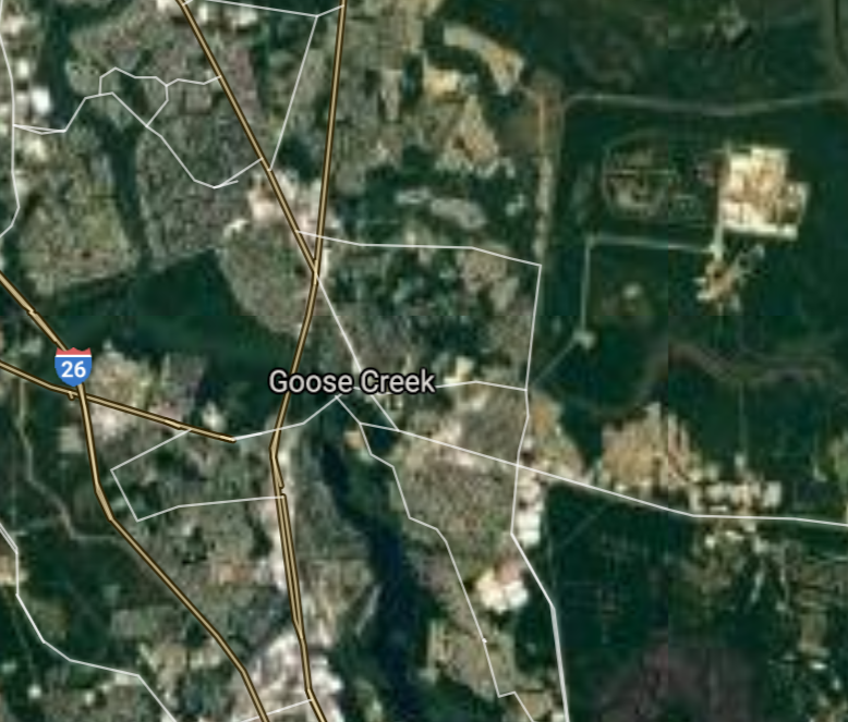
Goose Creek [*elevation ceiling = 40km]Elevation: 10m (Group 220)
UR-100N (SLBM) |
Point A: 33.018504 00
Point B: 33.920435 00
Point C: 32.216316 00
Point D: 34.195433 00
Point E: 34.949567 00
Point F: 32.981006 00(300kt)
|
Point A: -80.175648 00
Point B: -80.341469 00
Point C: -80.752608 00
Point D: -79.762563 00
Point E: -81.932048 00
Point F: -80.032587 00(300kt)
|
|
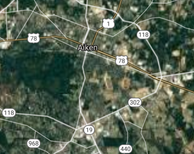
Aiken [*elevation ceiling = 40km]Elevation: 156m (Group 221)
UR-100N (SLBM) |
Point A: 33.560417 00(300kt)
Point B: 33.689060 00
Point C: 34.503439 00
Point D: 34.938728 00
Point E: 34.195400 00
Point F: 34.778730 00
|
Point A: -81.719553 00(300kt)
Point B: -78.886694 00
Point C: -82.650133 00
Point D: -82.227057 00
Point E: -82.161788 00
Point F: -82.310119 00
|
|
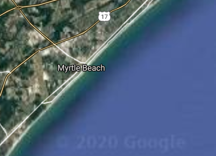
Myrtle Beach [*elevation ceiling = 40km]Elevation: 8m (Group 221)
UR-100N (SLBM) |
Point A: 33.560417 00
Point B: 33.689060 00(300kt)
Point C: 34.503439 00
Point D: 34.938728 00
Point E: 34.195400 00
Point F: 34.778730 00
|
Point A: -81.719553 00
Point B: -78.886694 00(300kt)
Point C: -82.650133 00
Point D: -82.227057 00
Point E: -82.161788 00
Point F: -82.310119 00
|
|
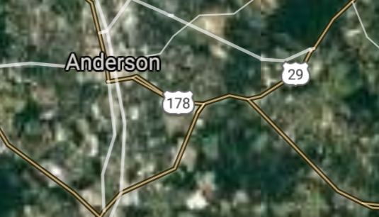
Anderson [*elevation ceiling = 40km]Elevation: 240m (Group 221)
UR-100N (SLBM) |
Point A: 33.560417 00
Point B: 33.689060 00
Point C: 34.503439 00(300kt)
Point D: 34.938728 00
Point E: 34.195400 00
Point F: 34.778730 00
|
Point A: -81.719553 00
Point B: -78.886694 00
Point C: -82.650133 00(300kt)
Point D: -82.227057 00
Point E: -82.161788 00
Point F: -82.310119 00
|
|
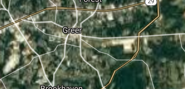
Greer [*elevation ceiling = 40km]Elevation: 309m (Group 221)
UR-100N (SLBM) |
Point A: 33.560417 00
Point B: 33.689060 00
Point C: 34.503439 00
Point D: 34.938728 00(300kt)
Point E: 34.195400 00
Point F: 34.778730 00
|
Point A: -81.719553 00
Point B: -78.886694 00
Point C: -82.650133 00
Point D: -82.227057 00(300kt)
Point E: -82.161788 00
Point F: -82.310119 00
|
|
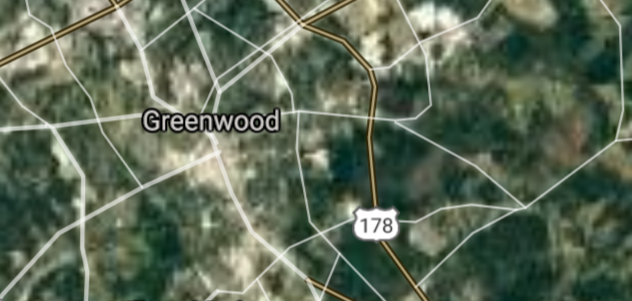
Greenwood [*elevation ceiling = 40km]Elevation: 202m (Group 221)
UR-100N (SLBM) |
Point A: 33.560417 00
Point B: 33.689060 00
Point C: 34.503439 00
Point D: 34.938728 00
Point E: 34.195400 00(300kt)
Point F: 34.778730 00
|
Point A: -81.719553 00
Point B: -78.886694 00
Point C: -82.650133 00
Point D: -82.227057 00
Point E: -82.161788 00(300kt)
Point F: -82.310119 00
|
|
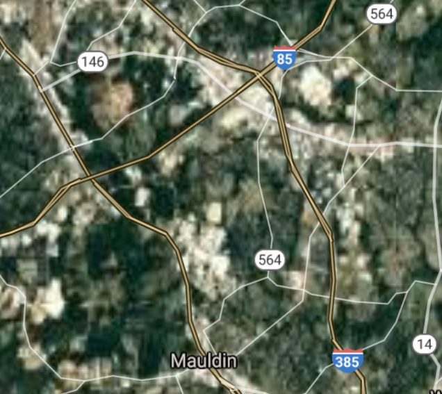
Mauldin [*elevation ceiling = 40km]Elevation: 284m (Group 221)
UR-100N (SLBM) |
Point A: 33.560417 00
Point B: 33.689060 00
Point C: 34.503439 00
Point D: 34.938728 00
Point E: 34.195400 00
Point F: 34.778730 00(300kt)
|
Point A: -81.719553 00
Point B: -78.886694 00
Point C: -82.650133 00
Point D: -82.227057 00
Point E: -82.161788 00
Point F: -82.310119 00(300kt)
|
|
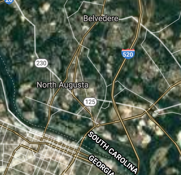
North Augusta [*elevation ceiling = 40km]Elevation: 118m (Group 222)
UR-100N (SLBM) |
Point A: 33.501803 00(300kt)
Point B: 34.829838 00
Point C: 34.737064 00
Point D: 32.930579 00
Point E: 33.981537 00
Point F: 33.836003 00
|
Point A: -81.965115 00(300kt)
Point B: -82.601521 00
Point C: -82.254283 00
Point D: -80.003183 00
Point E: -81.236211 00
Point F: -79.047814 00
|
|
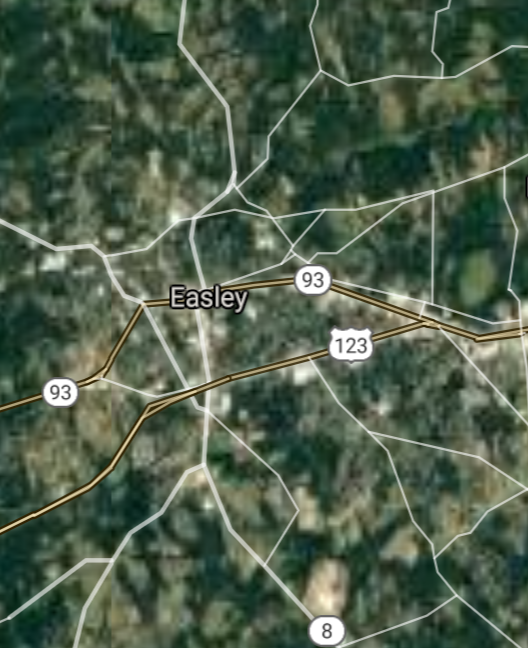
Easley [*elevation ceiling = 40km]Elevation: 321m (Group 222)
UR-100N (SLBM) |
Point A: 33.501803 00
Point B: 34.829838 00(300kt)
Point C: 34.737064 00
Point D: 32.930579 00
Point E: 33.981537 00
Point F: 33.836003 00
|
Point A: -81.965115 00
Point B: -82.601521 00(300kt)
Point C: -82.254283 00
Point D: -80.003183 00
Point E: -81.236211 00
Point F: -79.047814 00
|
|
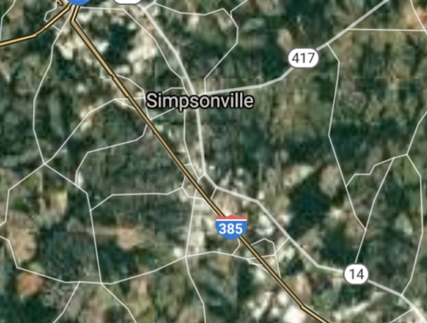
Simpsonville [*elevation ceiling = 40km]Elevation: 263m (Group 222)
UR-100N (SLBM) |
Point A: 33.501803 00
Point B: 34.829838 00
Point C: 34.737064 00(300kt)
Point D: 32.930579 00
Point E: 33.981537 00
Point F: 33.836003 00
|
Point A: -81.965115 00
Point B: -82.601521 00
Point C: -82.254283 00(300kt)
Point D: -80.003183 00
Point E: -81.236211 00
Point F: -79.047814 00
|
|
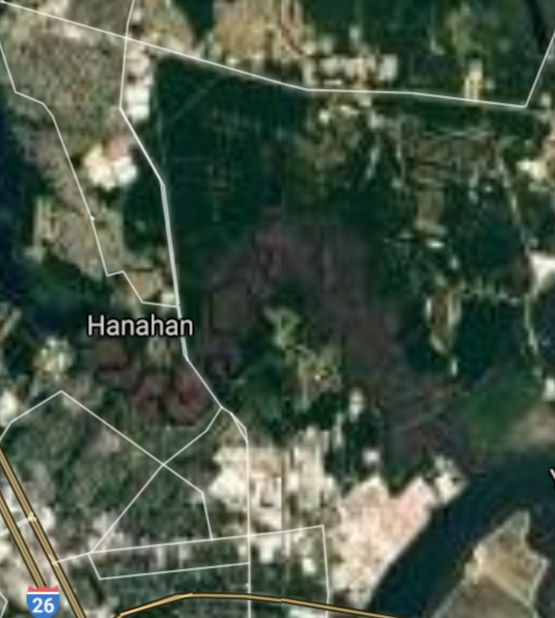
Hanahan [*elevation ceiling = 40km]Elevation: 15m (Group 222)
UR-100N (SLBM) |
Point A: 33.501803 00
Point B: 34.829838 00
Point C: 34.737064 00
Point D: 32.930579 00(300kt)
Point E: 33.981537 00
Point F: 33.836003 00
|
Point A: -81.965115 00
Point B: -82.601521 00
Point C: -82.254283 00
Point D: -80.003183 00(300kt)
Point E: -81.236211 00
Point F: -79.047814 00
|
|
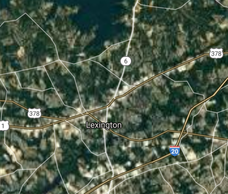
Lexington [*elevation ceiling = 40km]Elevation: 121m (Group 222)
UR-100N (SLBM) |
Point A: 33.501803 00
Point B: 34.829838 00
Point C: 34.737064 00
Point D: 32.930579 00
Point E: 33.981537 00(300kt)
Point F: 33.836003 00
|
Point A: -81.965115 00
Point B: -82.601521 00
Point C: -82.254283 00
Point D: -80.003183 00
Point E: -81.236211 00(300kt)
Point F: -79.047814 00
|
|
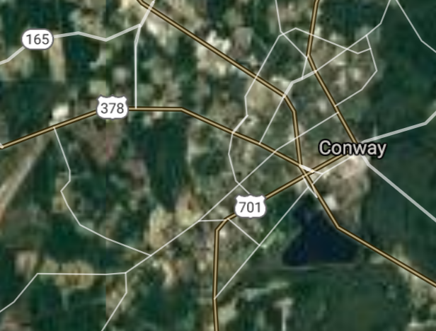
Conway [*elevation ceiling = 40km]Elevation: 10m (Group 222)
UR-100N (SLBM) |
Point A: 33.501803 00
Point B: 34.829838 00
Point C: 34.737064 00
Point D: 32.930579 00
Point E: 33.981537 00
Point F: 33.836003 00(300kt)
|
Point A: -81.965115 00
Point B: -82.601521 00
Point C: -82.254283 00
Point D: -80.003183 00
Point E: -81.236211 00
Point F: -79.047814 00(300kt)
|
|
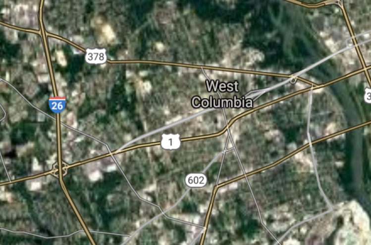
West Columbia [*elevation ceiling = 40km]Elevation: 87m (Group 223)
UR-100N (SLBM) |
Point A: 33.993487 00(300kt)
Point B: 33.491820 00
Point C: 34.683438 00
Point D: 33.816006 00
Point E: 32.237147 00
Point F: 33.965709 00
|
Point A: -81.073983 00(300kt)
Point B: -80.855648 00
Point C: -82.837365 00
Point D: -78.680016 00
Point E: -80.860387 00
Point F: -81.073983 00
|
|
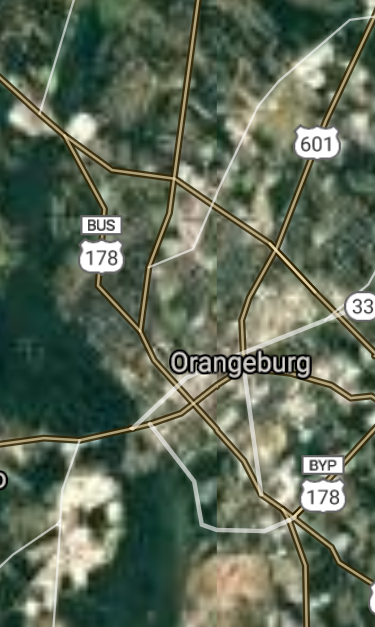
Orangeburg [*elevation ceiling = 40km]Elevation: 74m (Group 223)
UR-100N (SLBM) |
Point A: 33.993487 00
Point B: 33.491820 00(300kt)
Point C: 34.683438 00
Point D: 33.816006 00
Point E: 32.237147 00
Point F: 33.965709 00
|
Point A: -81.073983 00
Point B: -80.855648 00(300kt)
Point C: -82.837365 00
Point D: -78.680016 00
Point E: -80.860387 00
Point F: -81.073983 00
|
|
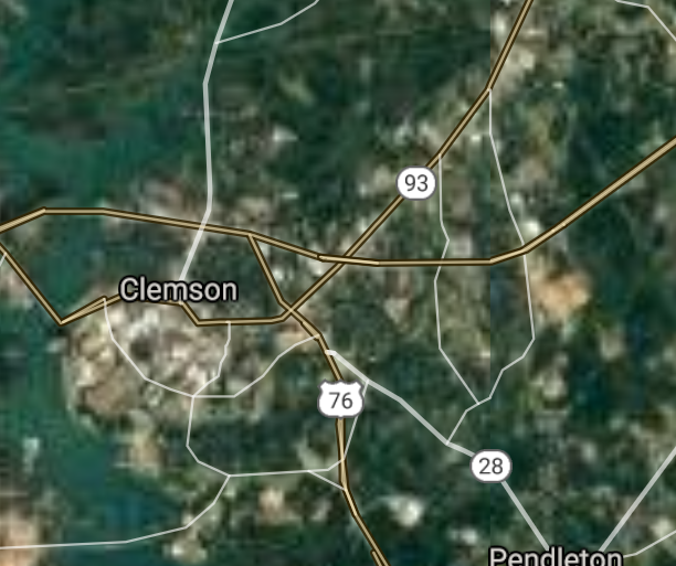
Clemson [*elevation ceiling = 40km]Elevation: 222m (Group 223)
UR-100N (SLBM) |
Point A: 33.993487 00
Point B: 33.491820 00
Point C: 34.683438 00(300kt)
Point D: 33.816006 00
Point E: 32.237147 00
Point F: 33.965709 00
|
Point A: -81.073983 00
Point B: -80.855648 00
Point C: -82.837365 00(300kt)
Point D: -78.680016 00
Point E: -80.860387 00
Point F: -81.073983 00
|
|
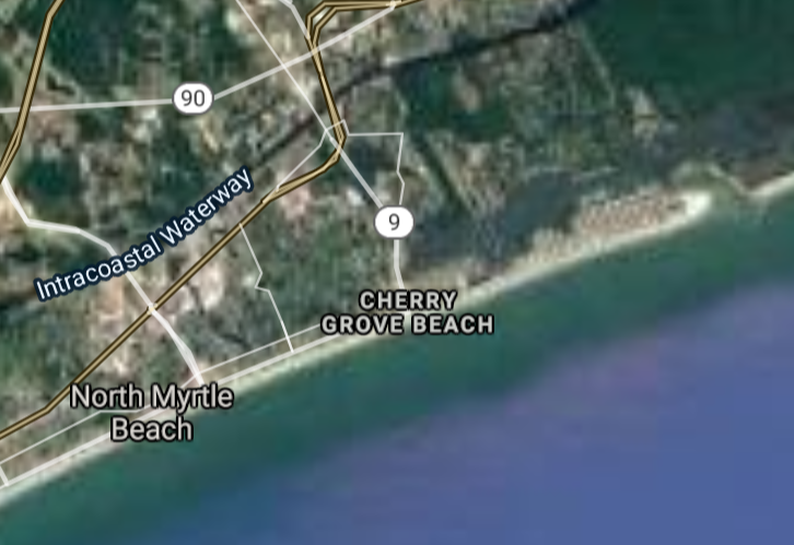
North Myrtle Beach [*elevation ceiling = 40km]Elevation: 3m (Group 223)
UR-100N (SLBM) |
Point A: 33.993487 00
Point B: 33.491820 00
Point C: 34.683438 00
Point D: 33.816006 00(300kt)
Point E: 32.237147 00
Point F: 33.965709 00
|
Point A: -81.073983 00
Point B: -80.855648 00
Point C: -82.837365 00
Point D: -78.680016 00(300kt)
Point E: -80.860387 00
Point F: -81.073983 00
|
|
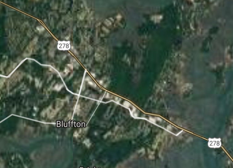
Bluffton [*elevation ceiling = 40km]Elevation: 9m (Group 223)
UR-100N (SLBM) |
Point A: 33.993487 00
Point B: 33.491820 00
Point C: 34.683438 00
Point D: 33.816006 00
Point E: 32.237147 00(300kt)
Point F: 33.965709 00
|
Point A: -81.073983 00
Point B: -80.855648 00
Point C: -82.837365 00
Point D: -78.680016 00
Point E: -80.860387 00(300kt)
Point F: -81.073983 00
|
|
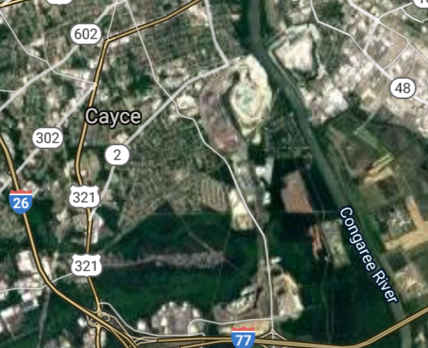
Cayce [*elevation ceiling = 40km]Elevation: 73m (Group 223)
UR-100N (SLBM) |
Point A: 33.993487 00
Point B: 33.491820 00
Point C: 34.683438 00
Point D: 33.816006 00
Point E: 32.237147 00
Point F: 33.965709 00(300kt)
|
Point A: -81.073983 00
Point B: -80.855648 00
Point C: -82.837365 00
Point D: -78.680016 00
Point E: -80.860387 00
Point F: -81.073983 00(300kt)
|
|
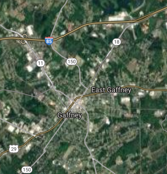
Gaffney [*elevation ceiling = 40km]Elevation: 239m (Group 224)
UR-100N (SLBM) |
Point A: 35.071795 00(300kt)
Point B: 32.431581 00
Point C: 34.085983 00
Point D: 35.007370 00
Point E: 32.379084 00
Point F: 34.019322 00
|
Point A: -81.649819 00(300kt)
Point B: -80.669829 00
Point C: -81.183151 00
Point D: -80.945076 00
Point E: -80.692607 00
Point F: -80.989813 00
|
|
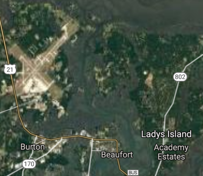
Beaufort [*elevation ceiling = 40km]Elevation: 4m (Group 224)
UR-100N (SLBM) |
Point A: 35.071795 00
Point B: 32.431581 00(300kt)
Point C: 34.085983 00
Point D: 35.007370 00
Point E: 32.379084 00
Point F: 34.019322 00
|
Point A: -81.649819 00
Point B: -80.669829 00(300kt)
Point C: -81.183151 00
Point D: -80.945076 00
Point E: -80.692607 00
Point F: -80.989813 00
|
|
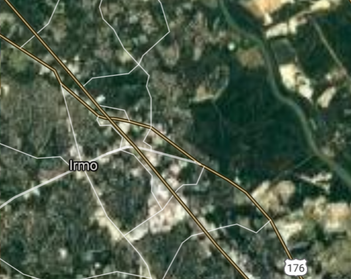
Irmo [*elevation ceiling = 40km]Elevation: 109m (Group 224)
UR-100N (SLBM) |
Point A: 35.071795 00
Point B: 32.431581 00
Point C: 34.085983 00(300kt)
Point D: 35.007370 00
Point E: 32.379084 00
Point F: 34.019322 00
|
Point A: -81.649819 00
Point B: -80.669829 00
Point C: -81.183151 00(300kt)
Point D: -80.945076 00
Point E: -80.692607 00
Point F: -80.989813 00
|
|
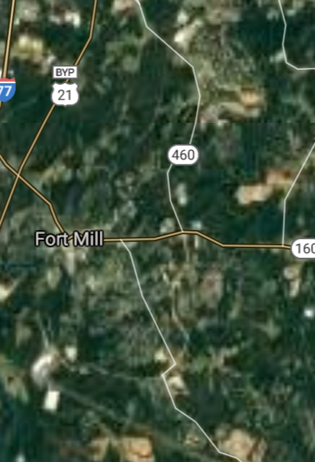
Fort Mill [*elevation ceiling = 40km]Elevation: 190m (Group 224)
UR-100N (SLBM) |
Point A: 35.071795 00
Point B: 32.431581 00
Point C: 34.085983 00
Point D: 35.007370 00(300kt)
Point E: 32.379084 00
Point F: 34.019322 00
|
Point A: -81.649819 00
Point B: -80.669829 00
Point C: -81.183151 00
Point D: -80.945076 00(300kt)
Point E: -80.692607 00
Point F: -80.989813 00
|
|
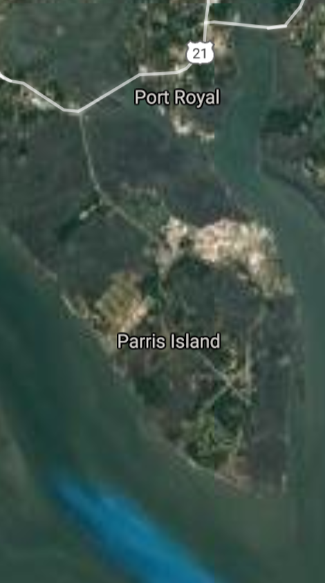
Port Royal [*elevation ceiling = 40km]Elevation: 8m (Group 224)
UR-100N (SLBM) |
Point A: 35.071795 00
Point B: 32.431581 00
Point C: 34.085983 00
Point D: 35.007370 00
Point E: 32.379084 00(300kt)
Point F: 34.019322 00
|
Point A: -81.649819 00
Point B: -80.669829 00
Point C: -81.183151 00
Point D: -80.945076 00
Point E: -80.692607 00(300kt)
Point F: -80.989813 00
|
|
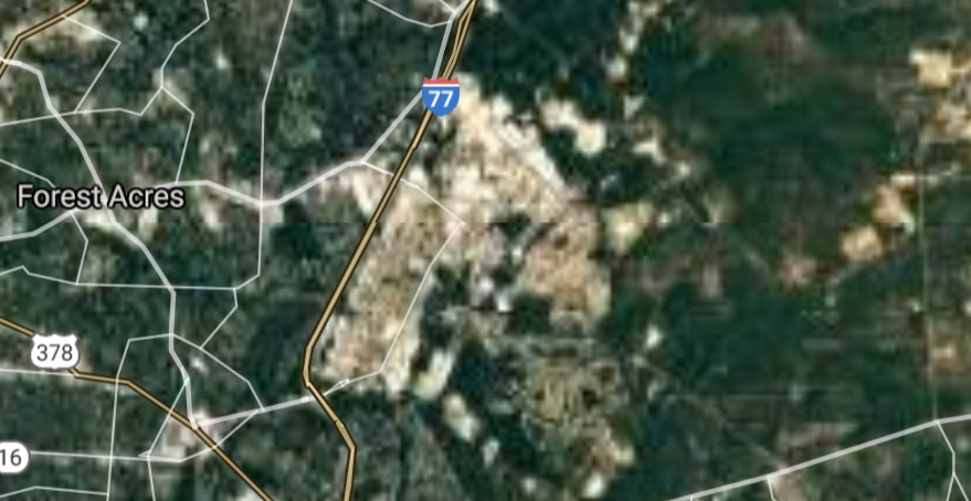
Forest Acres [*elevation ceiling = 40km]Elevation: 78m (Group 224)
UR-100N (SLBM) |
Point A: 35.071795 00
Point B: 32.431581 00
Point C: 34.085983 00
Point D: 35.007370 00
Point E: 32.379084 00
Point F: 34.019322 00(300kt)
|
Point A: -81.649819 00
Point B: -80.669829 00
Point C: -81.183151 00
Point D: -80.945076 00
Point E: -80.692607 00
Point F: -80.989813 00(300kt)
|
|
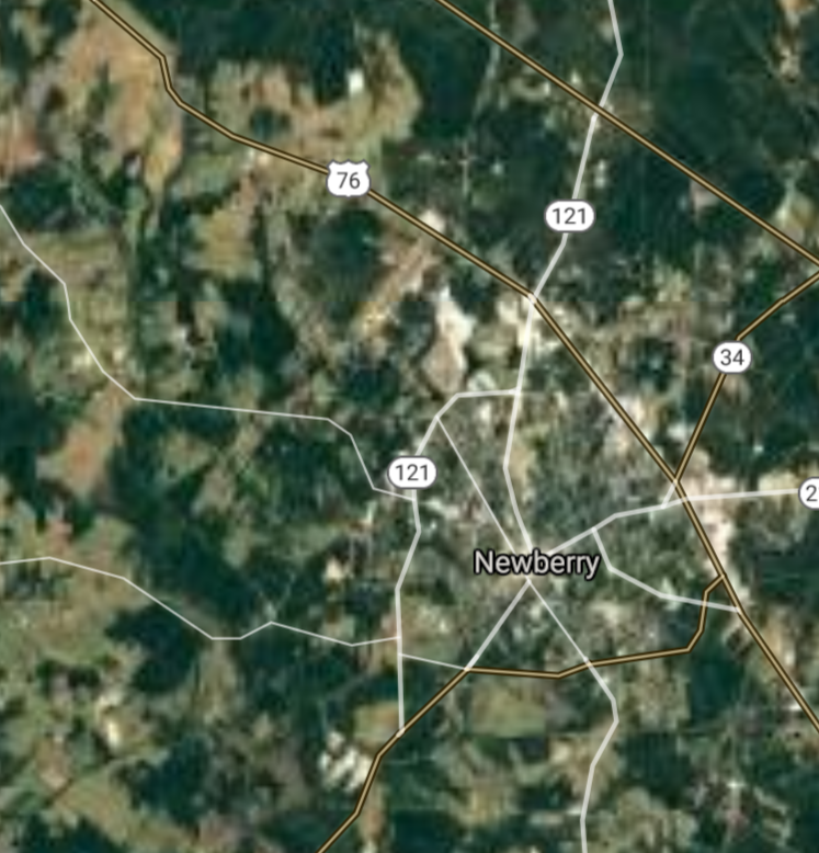
Newberry [*elevation ceiling = 40km]Elevation: 150m (Group 225)
UR-100N (SLBM) |
Point A: 34.274583 00(300kt)
Point B: 33.376834 00
Point C: 34.499012 00
Point D: 34.617380 00
Point E: 34.720426 00
Point F: 34.472628 00
|
Point A: -81.618718 00(300kt)
Point B: -79.294496 00
Point C: -82.014260 00
Point D: -79.684781 00
Point E: -80.770901 00
Point F: -81.880656 00
|
|
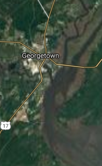
Georgetown [*elevation ceiling = 40km]Elevation: 5m (Group 225)
UR-100N (SLBM) |
Point A: 34.274583 00
Point B: 33.376834 00(300kt)
Point C: 34.499012 00
Point D: 34.617380 00
Point E: 34.720426 00
Point F: 34.472628 00
|
Point A: -81.618718 00
Point B: -79.294496 00(300kt)
Point C: -82.014260 00
Point D: -79.684781 00
Point E: -80.770901 00
Point F: -81.880656 00
|
|
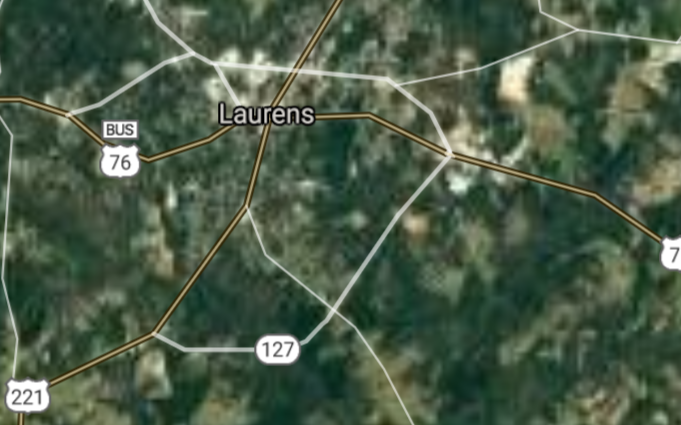
Laurens [*elevation ceiling = 40km]Elevation: 187m (Group 225)
UR-100N (SLBM) |
Point A: 34.274583 00
Point B: 33.376834 00
Point C: 34.499012 00(300kt)
Point D: 34.617380 00
Point E: 34.720426 00
Point F: 34.472628 00
|
Point A: -81.618718 00
Point B: -79.294496 00
Point C: -82.014260 00(300kt)
Point D: -79.684781 00
Point E: -80.770901 00
Point F: -81.880656 00
|
|
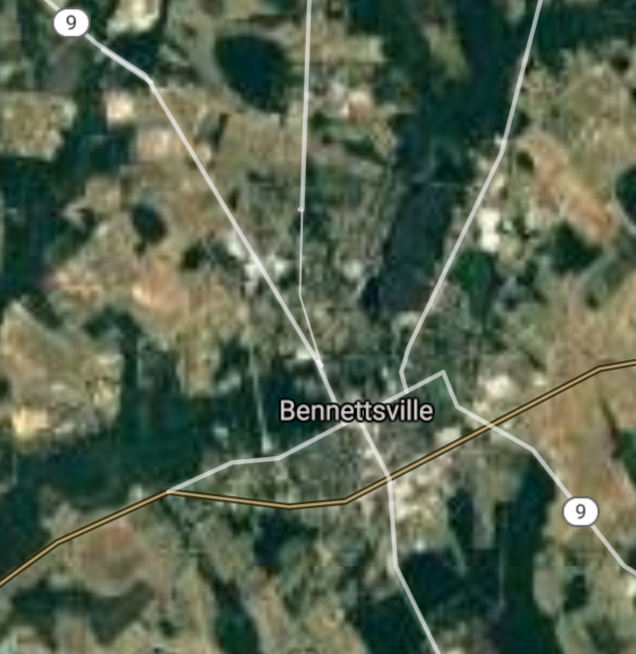
Bennettsville [*elevation ceiling = 40km]Elevation: 47m (Group 225)
UR-100N (SLBM) |
Point A: 34.274583 00
Point B: 33.376834 00
Point C: 34.499012 00
Point D: 34.617380 00(300kt)
Point E: 34.720426 00
Point F: 34.472628 00
|
Point A: -81.618718 00
Point B: -79.294496 00
Point C: -82.014260 00
Point D: -79.684781 00(300kt)
Point E: -80.770901 00
Point F: -81.880656 00
|
|
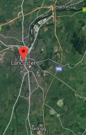
Lancaster [*elevation ceiling = 40km]Elevation: 166m (Group 225)
UR-100N (SLBM) |
Point A: 34.274583 00
Point B: 33.376834 00
Point C: 34.499012 00
Point D: 34.617380 00
Point E: 34.720426 00(300kt)
Point F: 34.472628 00
|
Point A: -81.618718 00
Point B: -79.294496 00
Point C: -82.014260 00
Point D: -79.684781 00
Point E: -80.770901 00(300kt)
Point F: -81.880656 00
|
|
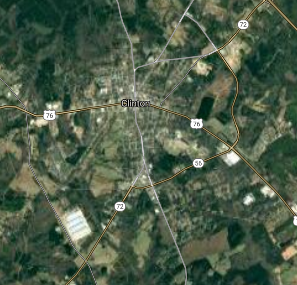
Clinton [*elevation ceiling = 40km]Elevation: 206m (Group 225)
UR-100N (SLBM) |
Point A: 34.274583 00
Point B: 33.376834 00
Point C: 34.499012 00
Point D: 34.617380 00
Point E: 34.720426 00
Point F: 34.472628 00(300kt)
|
Point A: -81.618718 00
Point B: -79.294496 00
Point C: -82.014260 00
Point D: -79.684781 00
Point E: -80.770901 00
Point F: -81.880656 00(300kt)
|
|
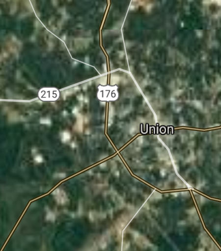
Union [*elevation ceiling = 40km]Elevation: 195m (Group 226)
UR-100N (SLBM) |
Point A: 34.715412 00(300kt)
Point B: 34.685656 00
Point C: 33.196003 00
Point D: 34.689010 00
Point E: 34.374043 00
Point F: 34.994302 00
|
Point A: -81.623711 00(300kt)
Point B: -82.953204 00
Point C: -80.013137 00
Point D: -82.195668 00
Point E: -80.073400 00
Point F: -81.242018 00
|
|
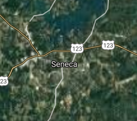
Seneca [*elevation ceiling = 40km]Elevation: 292m (Group 226)
UR-100N (SLBM) |
Point A: 34.715412 00
Point B: 34.685656 00(300kt)
Point C: 33.196003 00
Point D: 34.689010 00
Point E: 34.374043 00
Point F: 34.994302 00
|
Point A: -81.623711 00
Point B: -82.953204 00(300kt)
Point C: -80.013137 00
Point D: -82.195668 00
Point E: -80.073400 00
Point F: -81.242018 00
|
|
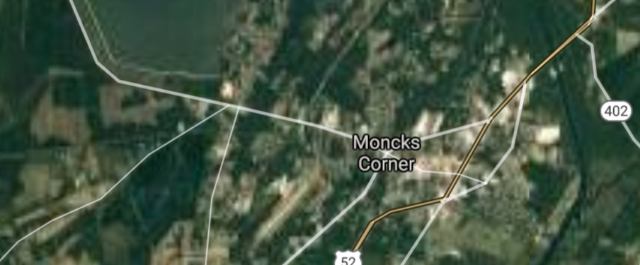
Moncks Corner [*elevation ceiling = 40km]Elevation: 17m (Group 226)
UR-100N (SLBM) |
Point A: 34.715412 00
Point B: 34.685656 00
Point C: 33.196003 00(300kt)
Point D: 34.689010 00
Point E: 34.374043 00
Point F: 34.994302 00
|
Point A: -81.623711 00
Point B: -82.953204 00
Point C: -80.013137 00(300kt)
Point D: -82.195668 00
Point E: -80.073400 00
Point F: -81.242018 00
|
|
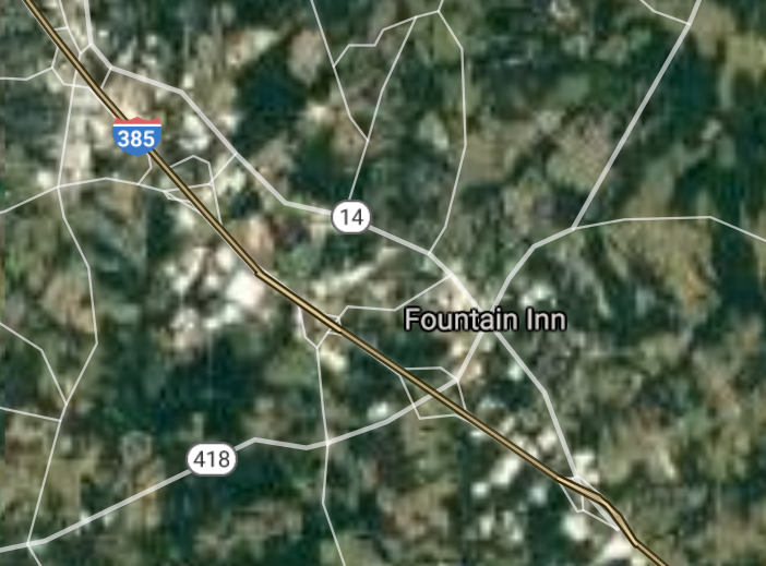
Fountain Inn [*elevation ceiling = 40km]Elevation: 264m (Group 226)
UR-100N (SLBM) |
Point A: 34.715412 00
Point B: 34.685656 00
Point C: 33.196003 00
Point D: 34.689010 00(300kt)
Point E: 34.374043 00
Point F: 34.994302 00
|
Point A: -81.623711 00
Point B: -82.953204 00
Point C: -80.013137 00
Point D: -82.195668 00(300kt)
Point E: -80.073400 00
Point F: -81.242018 00
|
|
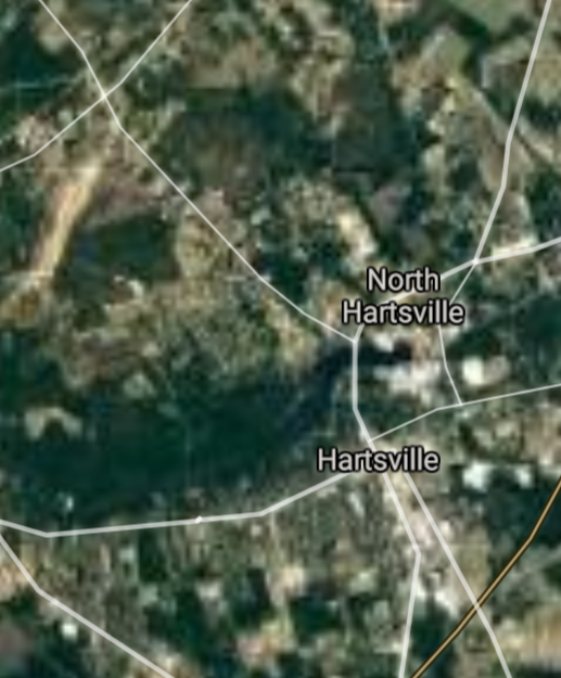
Hartsville [*elevation ceiling = 40km]Elevation: 66m (Group 226)
UR-100N (SLBM) |
Point A: 34.715412 00
Point B: 34.685656 00
Point C: 33.196003 00
Point D: 34.689010 00
Point E: 34.374043 00(300kt)
Point F: 34.994302 00
|
Point A: -81.623711 00
Point B: -82.953204 00
Point C: -80.013137 00
Point D: -82.195668 00
Point E: -80.073400 00(300kt)
Point F: -81.242018 00
|
|
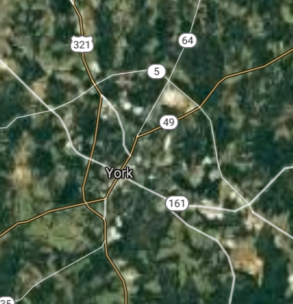
York [*elevation ceiling = 40km]Elevation: 232m (Group 226)
UR-100N (SLBM) |
Point A: 34.715412 00
Point B: 34.685656 00
Point C: 33.196003 00
Point D: 34.689010 00
Point E: 34.374043 00
Point F: 34.994302 00(300kt)
|
Point A: -81.623711 00
Point B: -82.953204 00
Point C: -80.013137 00
Point D: -82.195668 00
Point E: -80.073400 00
Point F: -81.242018 00(300kt)
|
[Top]
Situation: Central Basin
"BRICS Security Council emerging from cross-currency evaluations"
OPEN Start: Central Basin - is an engineering vessel which is proven with climate security in evaluation of the USD/YEN currency pair. Annually, climate security is leading economic growth in key emerging markets surrounding the Four Asian Tigers. Affordably, the following industries extend opportunities for military cooperation: aerospace, telecommunications, finance and banking. OPEN Start: Central Basin strengthens the backbone for international security beyond the shadows of USD/YEN controversy. Traversely, OPEN Start: Central Basin offsets the cross-over gap between the USD/MXN and USD/RUB exchange rates. Notably, the Three Amigas form an economic alliance in the Far West through joint-cooperation projects from Venture 1, Venture LA and Venture SF which all extend with the Far North reach towards the Far South (as illustrated below).
![]()
![]()
![]()
![]()
![]()
![]()
![]()
![]()
![]()
JanuaryFebruaryMarchAprilJuneJulySeptemberOctoberDecember |
2026 Group Drills - Schedule
|
|

JanuaryFebruaryJuneJulyAugustOctoberNovemberDecember |
2026 Group Drills - Schedule
|
|

JanuaryFebruaryJuneJulySeptemberOctoberNovemberDecember |
2026 Group Drills - Schedule
|
|
